Ticker for March 25, 2026
MESONET TICKER ... MESONET TICKER ... MESONET TICKER ... MESONET TICKER ...
March 25, 2026 March 25, 2026 March 25, 2026 March 25, 2026
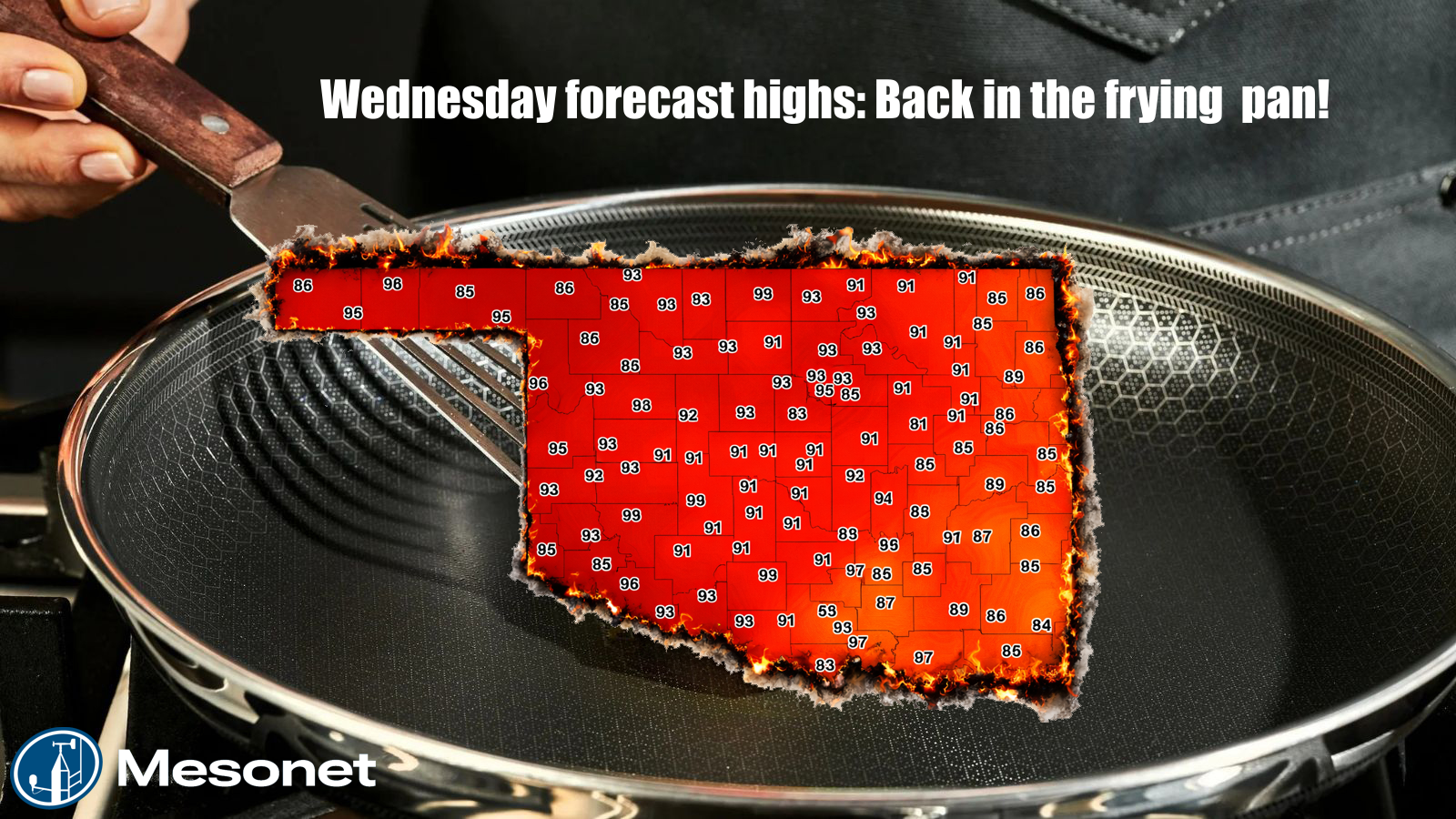
More records shall fall today, and I don't mean the most Cherry Pop-Tarts consumed
in a 24-hour period by a single person (although I am willing to try).
The crazy part is, as hot as today looks, it's not even the hottest day this
month so far...that was last Saturday!
And it's not even gonna be the hottest day this week...that's tomorrow!
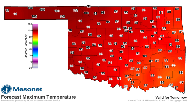
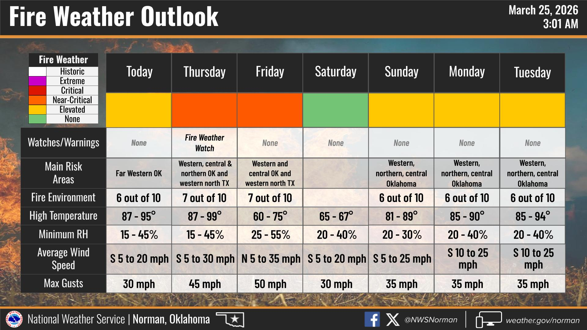
Now there will be a cold front coming through Thursday evening and we'll get
back to maybe even being a bit cool for late March, but before that we'll see
those winds kick back up close to 50 mph with lots of fire danger in store for
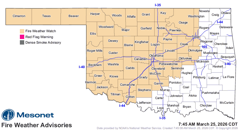
those areas, enough so that we already see a Fire Weather Watch issued for much
of the state (sure to be upgraded to a Red Flag Warning for tomorrow).
As detailed by the fire experts over at the Oklahoma Forestry Services:
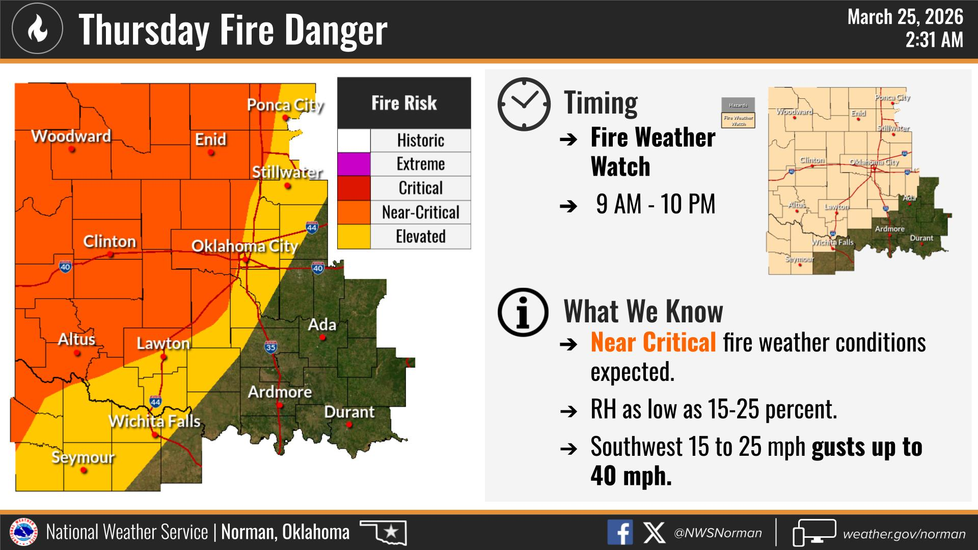
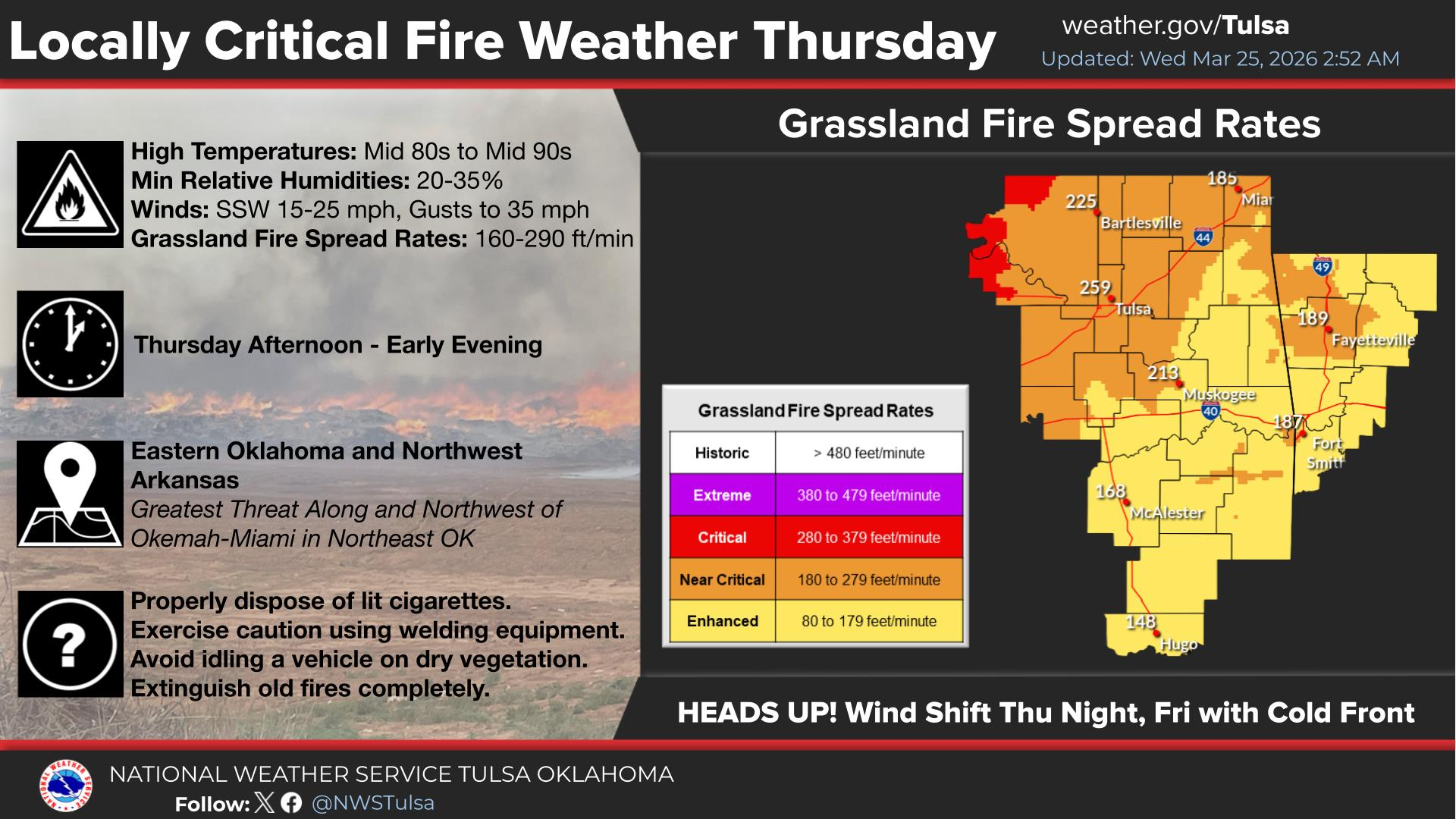
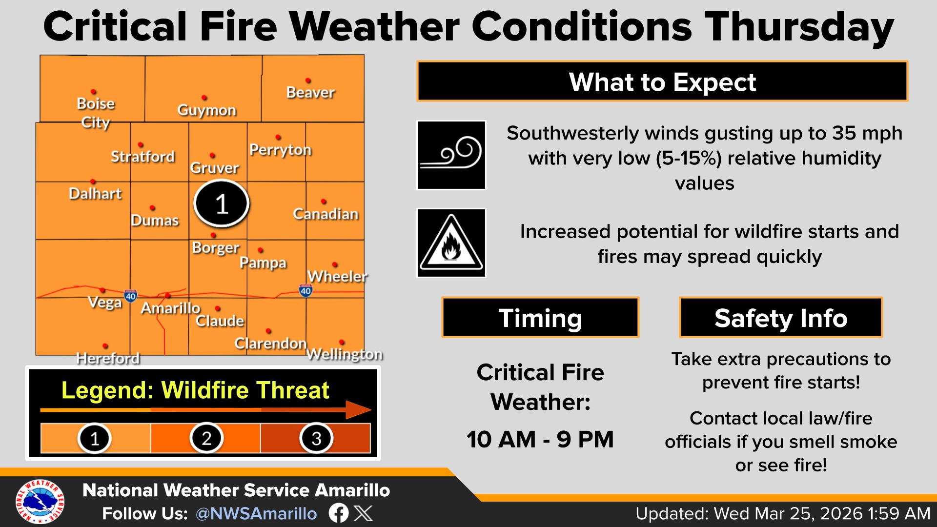
"Statewide Discussion: A Fire Weather Watch is in effect for tomorrow
(Thursday) with hit temperatures (20-25° above normal) as southwest
winds increase ahead of another cold front arriving Thursday evening.
While most of the state remains dry with this frontal boundary, a few
isolated storms may form in Northern Oklahoma overnight. Given the
state of the fuels and increasing fire weather again, large fire
probabilities are increasing evidenced in the statistics above.
Significant fire potential returns noting that less-tan-critical fire weather
is required to produce problematic to extreme fire behavior given the
state of fuels."
Here's more on (no, YOU'RE a more on!) tomorrow's not-so-fun time from our local
NWS folks.
And, of course, given the drought and lack of green up, the fire danger will
continue beyond that.
Surely it will rain soon (first you call me a more on, now Shirley??)? Well,
maybe a few showers/storms here and there, but supposedly...SUPPOSEDLY...we'll
get into more of a stormy pattern later next week. But for the next 7 days, meh.
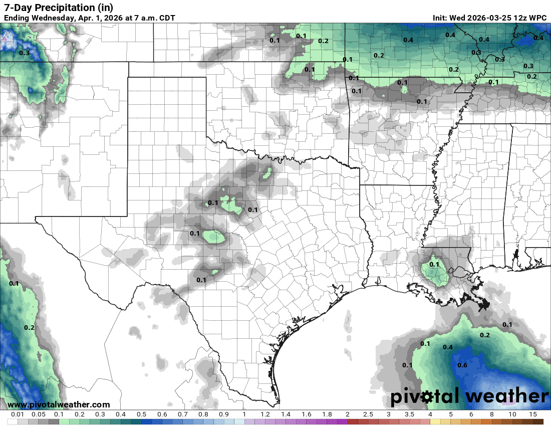
About those chances next week, I'll keep saying this until I'm green in the
face (sorry, I look bad when I turn blue)...that's how droughts work. The rain
chances are always better NEXT week. And then when it does rain, it doesn't
rain where it counts the most. However, we can always hope for some semblance
of last April's rainfall.
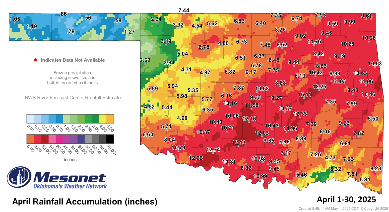
How about half?
Gary McManus
State Climatologist
Oklahoma Mesonet
Oklahoma Climate Survey
gmcmanus@ou.edu
March 25 in Mesonet History
| Record | Value | Station | Year |
|---|---|---|---|
| Maximum Temperature | 93°F | WOOD | 1998 |
| Minimum Temperature | 15°F | BOIS | 2013 |
| Maximum Rainfall | 2.92 inches | VALL | 2024 |
Mesonet records begin in 1994.
Search by Date
If you're a bit off, don't worry, because just like horseshoes, “almost” counts on the Ticker website!