Ticker for March 10, 2026
MESONET TICKER ... MESONET TICKER ... MESONET TICKER ... MESONET TICKER ...
March 10, 2026 March 10, 2026 March 10, 2026 March 10, 2026
Severe risk again
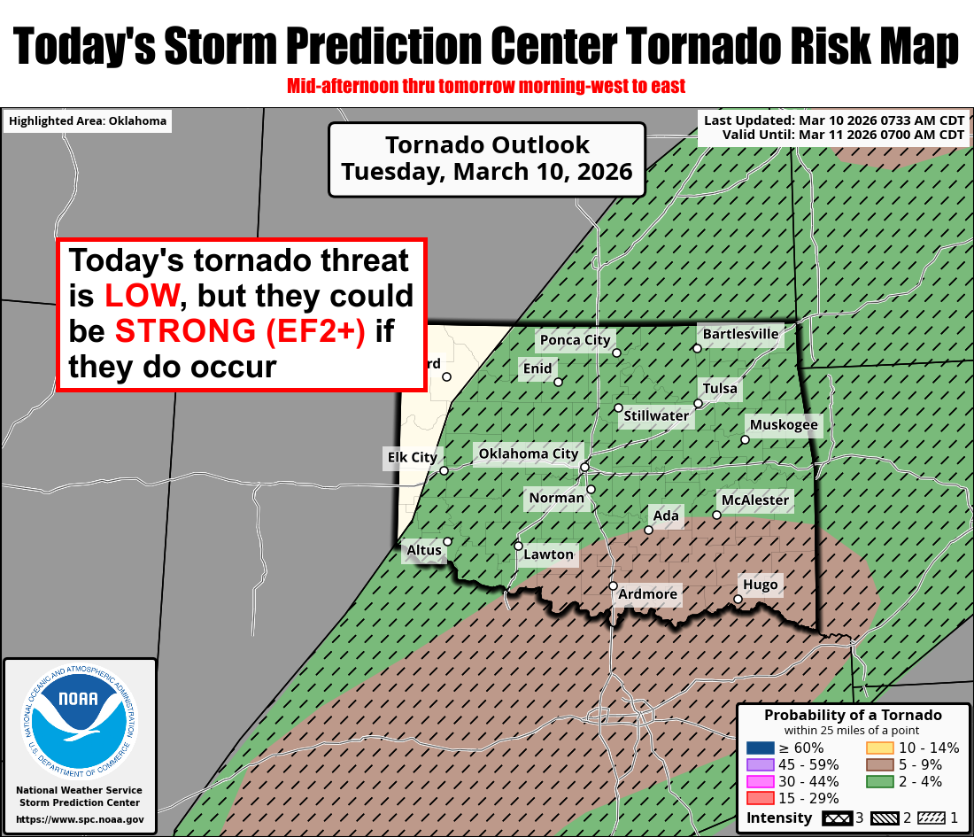
Tornadoes. Tornadoes?? Heck, the hail will probably get ya, for crying out loud!
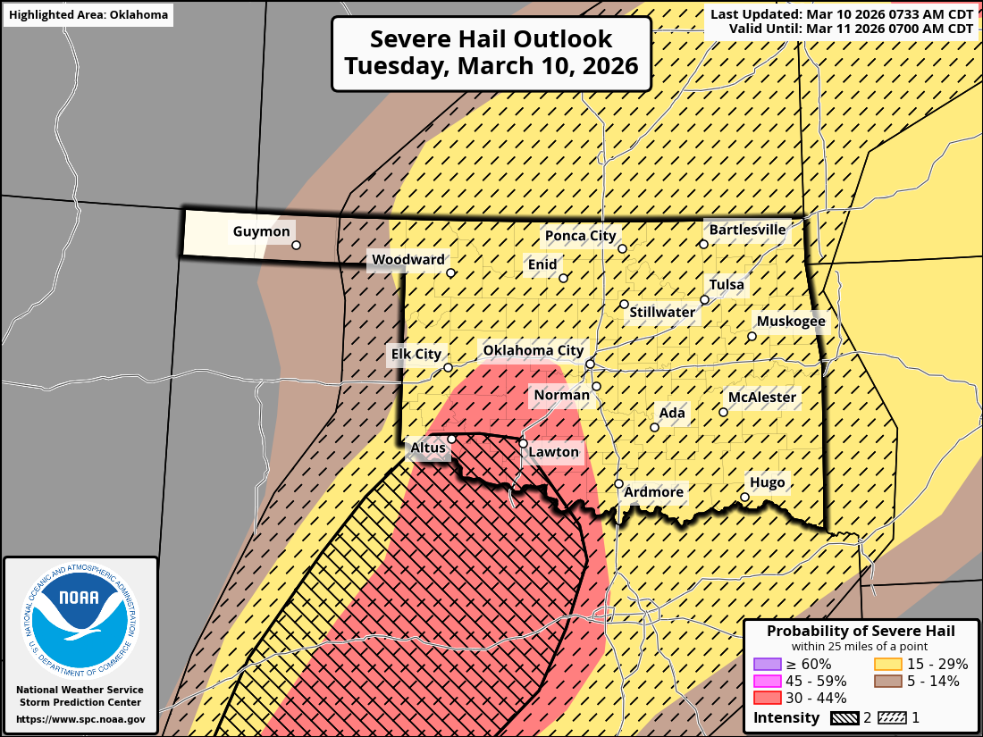
That's an enhanced threat of baseball size hail, friends (and the large majority
of you that are enemies...I know you're all plotting against me!). Windshield
eaters! That'll put knots on your noggin faster'n you can rub 'em. And don't
forget the wind, with a risk of 70+ mph blowing up your bloomers.
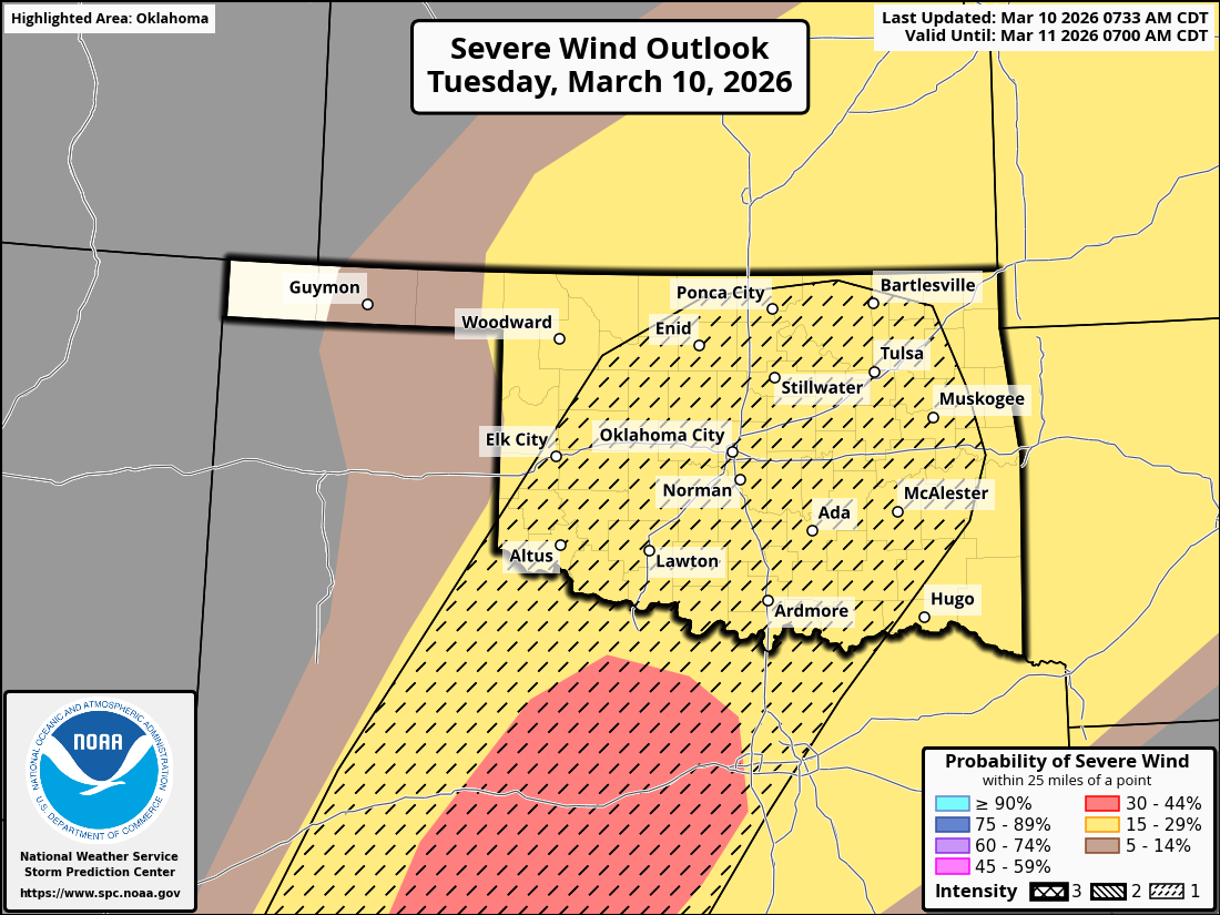
The overall coverage is expected to be scattered, with a bit more coverage down
across soutwest OK.
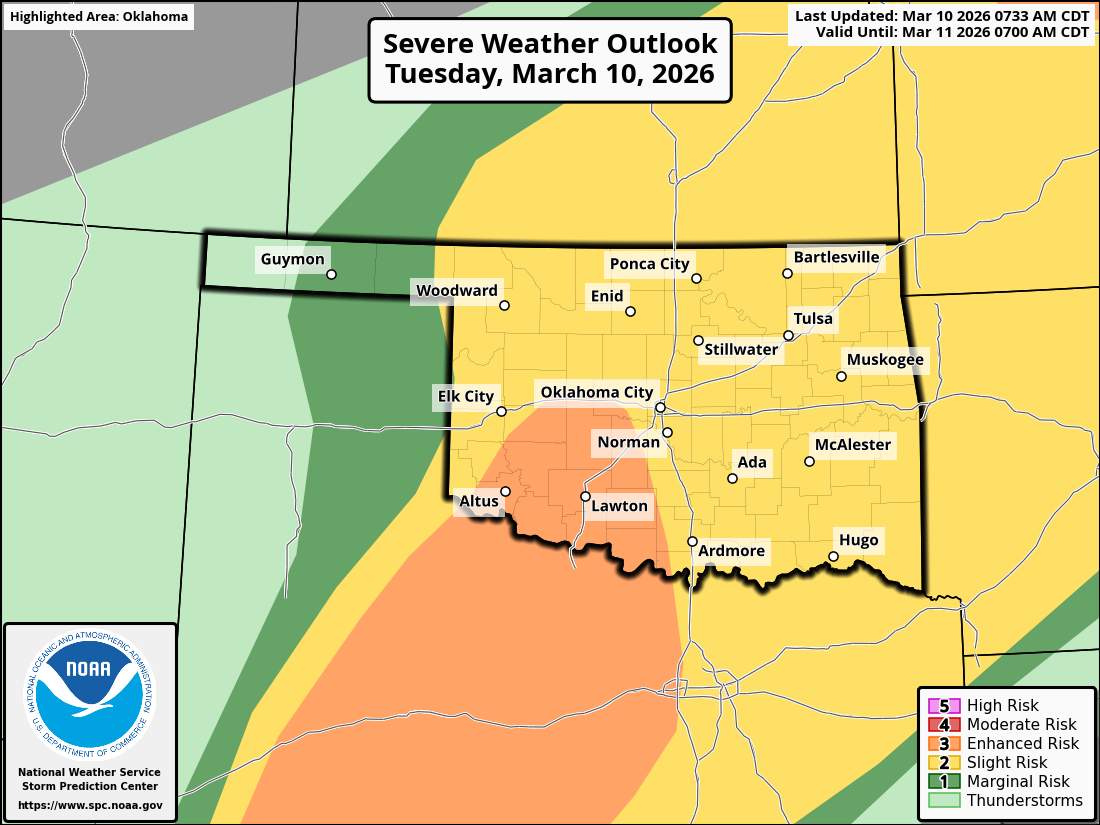
As always, one threat implies another, but some area enhanced (like the hail
across SW OK).
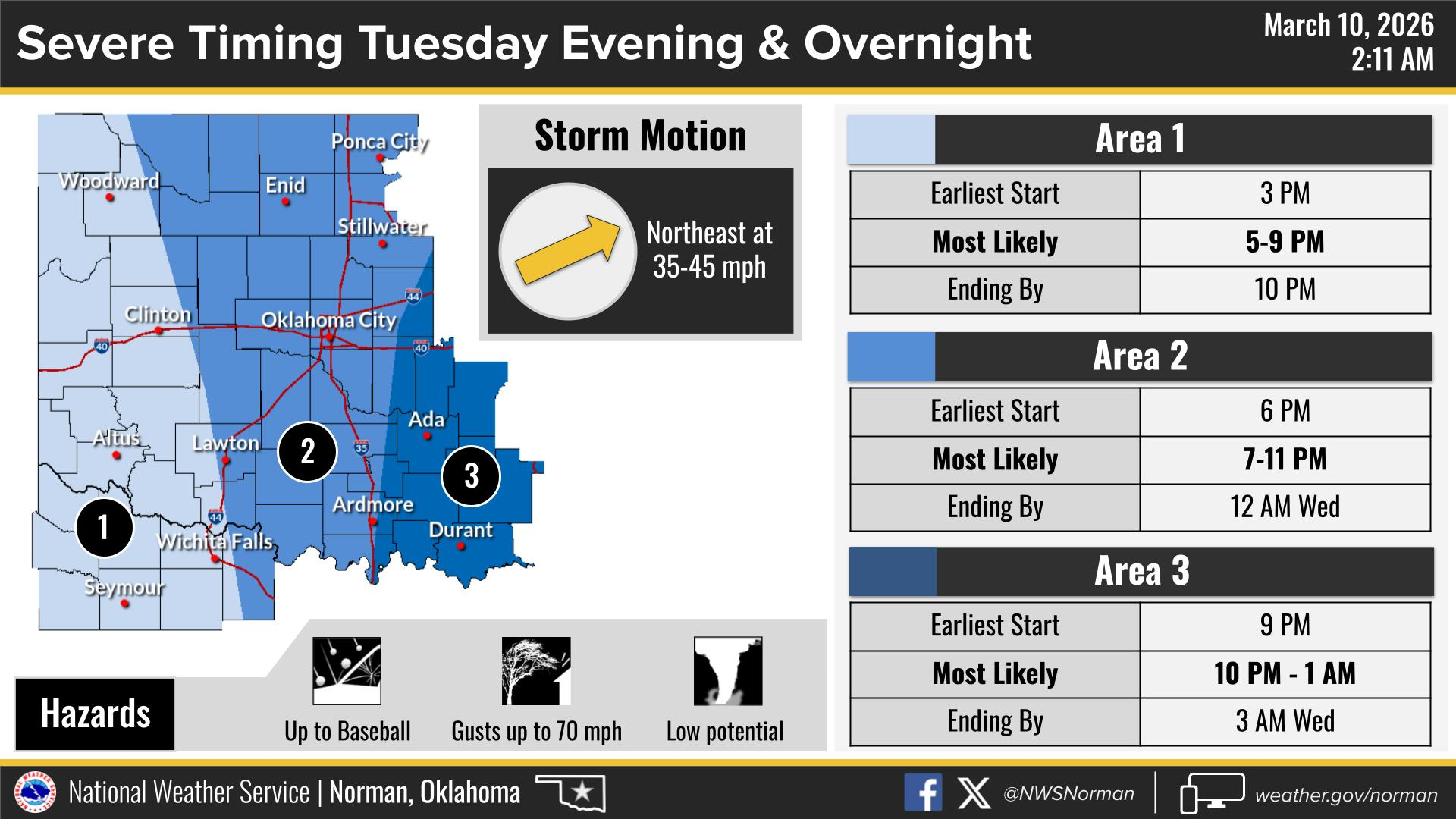
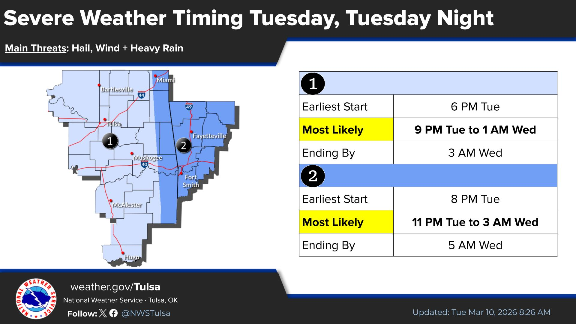
Here's a bit more on the timing from our NWS friends.
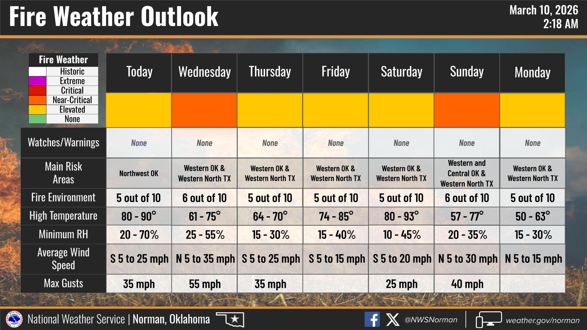
And NWS Norman reminds us that with drought going on, combined with the winds
and low humidity following these storm systems, and lack of green up at this
point in the season...fire danger is still a thing.
All these hazards need to be taken seriously. Seriously. The atmosphere
continues to over-perform (as noted many times). We're already up to 12
tornadoes for the month, and that number could still increase as the storm
damage continues to be investigated. Tonight, we could see more. Our record
March total of 17 from 1991 is definitely at risk, and we're not even to the
Ides of March yet!
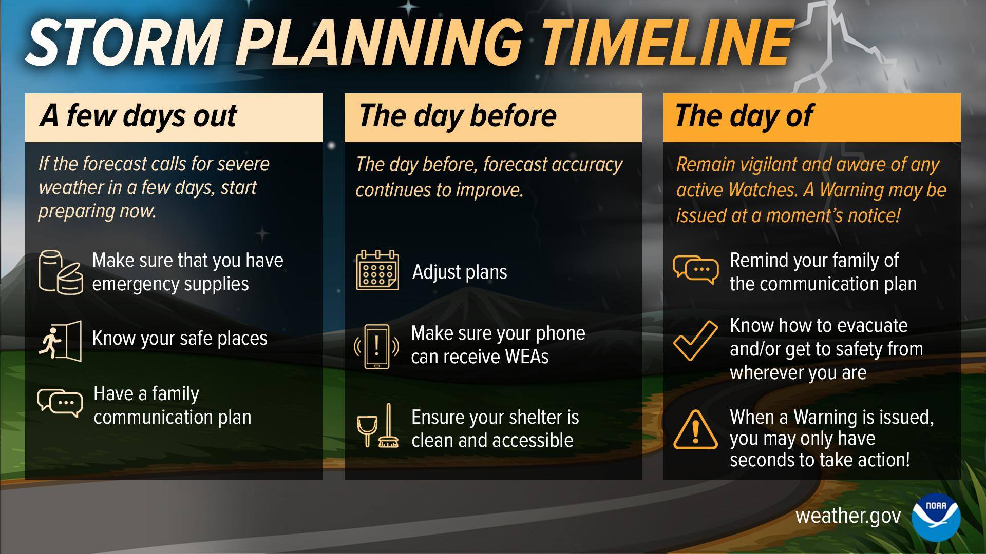
Your severe weather safety plan should already be fine-tuned by this point,
so be prepared!
Gary McManus
State Climatologist
Oklahoma Mesonet
Oklahoma Climate Survey
gmcmanus@ou.edu
March 10 in Mesonet History
| Record | Value | Station | Year |
|---|---|---|---|
| Maximum Temperature | 87°F | MANG | 2021 |
| Minimum Temperature | 6°F | BEAV | 1998 |
| Maximum Rainfall | 1.93 inches | RING | 2012 |
Mesonet records begin in 1994.
Search by Date
If you're a bit off, don't worry, because just like horseshoes, “almost” counts on the Ticker website!