Ticker for February 12, 2026
MESONET TICKER ... MESONET TICKER ... MESONET TICKER ... MESONET TICKER ...
February 12, 2026 February 12, 2026 February 12, 2026 February 12, 2026
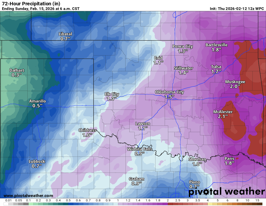
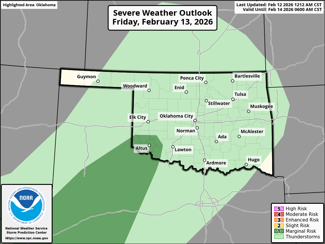
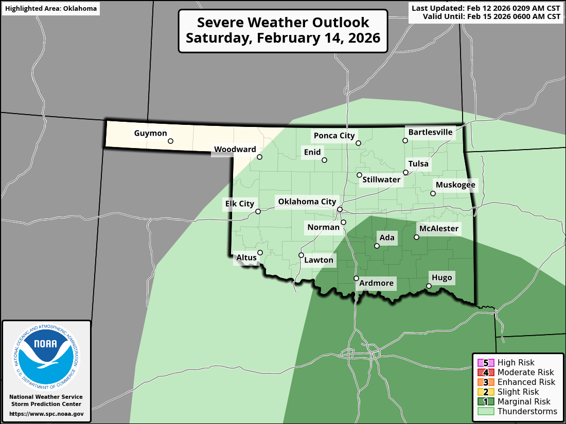
The tables need turned
You know what it takes to come up with something to write about in a Ticker post,
200 times a year? Brains. Brains and brawn. Brains and brawn and excitement. And
burritos. Well brains is out, and so is brawn. And even though a burrito sounds
really good rn, ngl, I have none. But what we do have, is excitement. Excitement
to break up a long, dry winter. Our last excitement was two weeks or so ago at
the end of January when that winter storm hit and gave us a good glazing for a
week. The only other bit of "excitement" this winter was in early January with
that OTHER storm system that brought us the January record-tying five tornadoes.
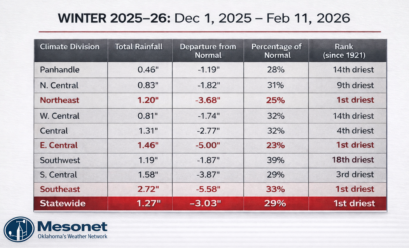
December was just blah, in a record dry and near-record warm kind of way that
excites climatologists and other scofflaws and ne'er-do-wells. Maybe ne'er'laws
and scoff-do-wells, too. So this weekends storms system is pretty darned
exciting.
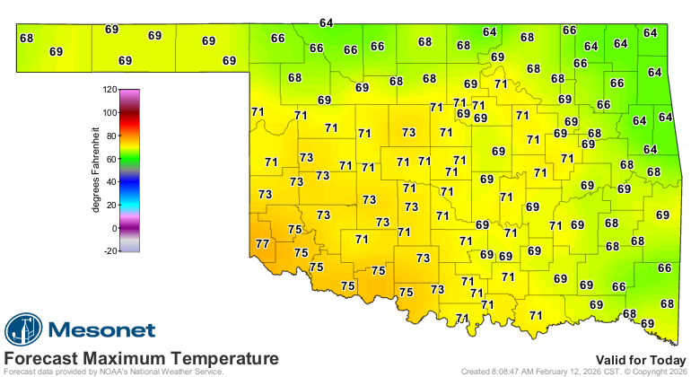
Today is kinda exciting too, in a "it's not gonna be 18 degrees" kinda way.
Finally, our last bit of excitement, we're still in La Nina according to the
NOAA's Climate Prediction Center. With the ENSO Alert System Status still firmly
in La Nina Advisory, uhhhhh, status. So there remains the possibility of it
still impacting our weather patterns in a not-so-good way (dry and warm) for
awhile longer. The good news is CPC expects it to transition to ENSO-neutral
conditions in the next few months and remain that way through the summer.
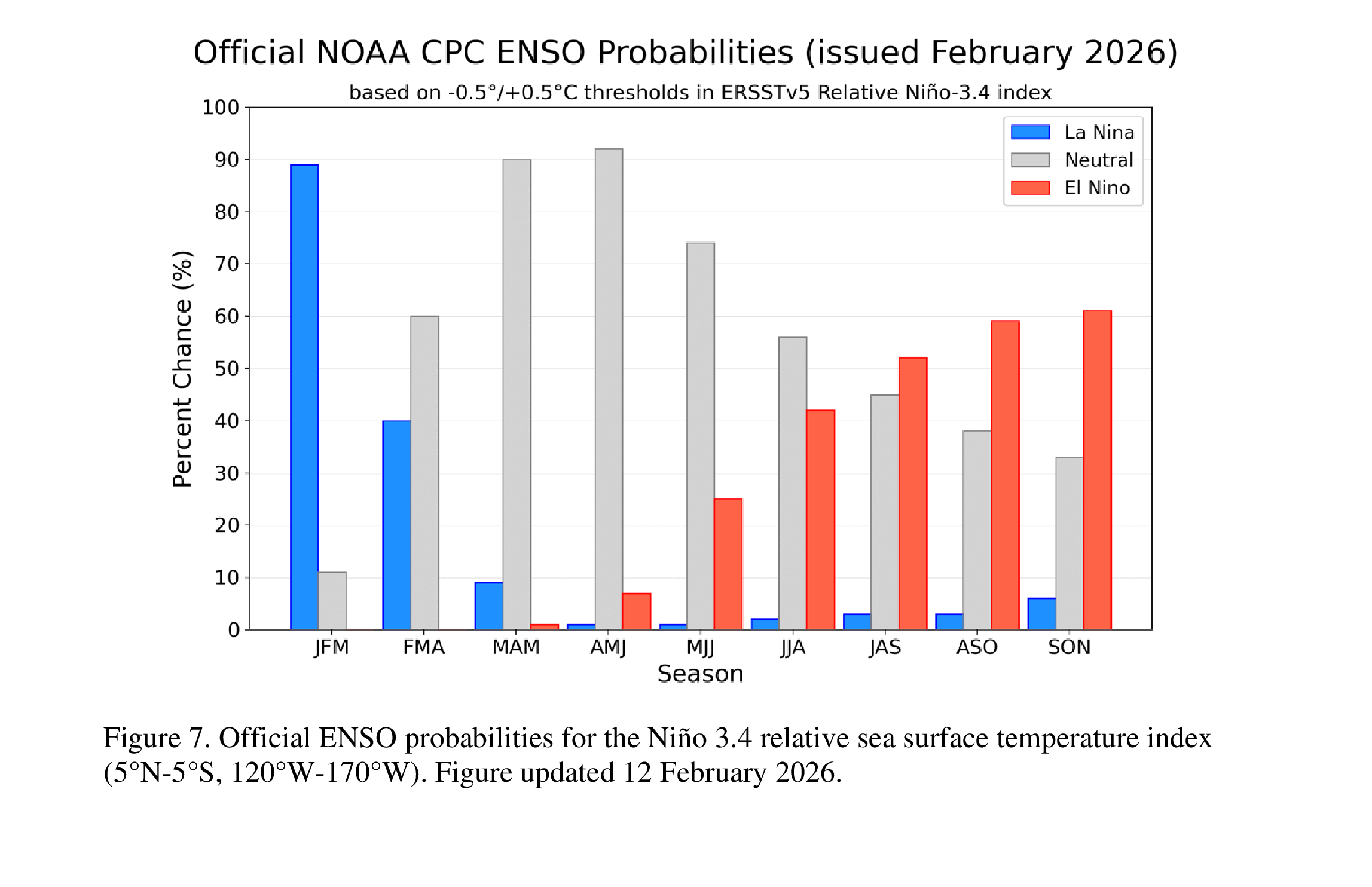
Notice in the table that as the blue (La Nina) goes down, the gray (Neutral)
dominates through the summer, then the red (El Nino) starts to win as we get
into the fall. Don't get too excited (see what I did there?) about that El Nino
prediction. There's still the "spring predictability barrier" to break through
before much confidence is placed in the fall predictions. That barrier is a well
known problem when it comes to accuracy of predictions with increased uncertainty
until we get past April/May or so. Don't be shocked if in a few months, after
lots and lots of exciting weather I'm sure will occur, we don't see El Nino
in the ENSO forecasts any longer and La Nina starts to take over that bar graph
again.
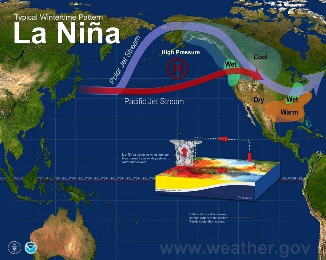
Quick primer on ENSO again: La Nina is usually bad for us because it brings the
Southern Plains warmer and drier than normal weather during the cool season
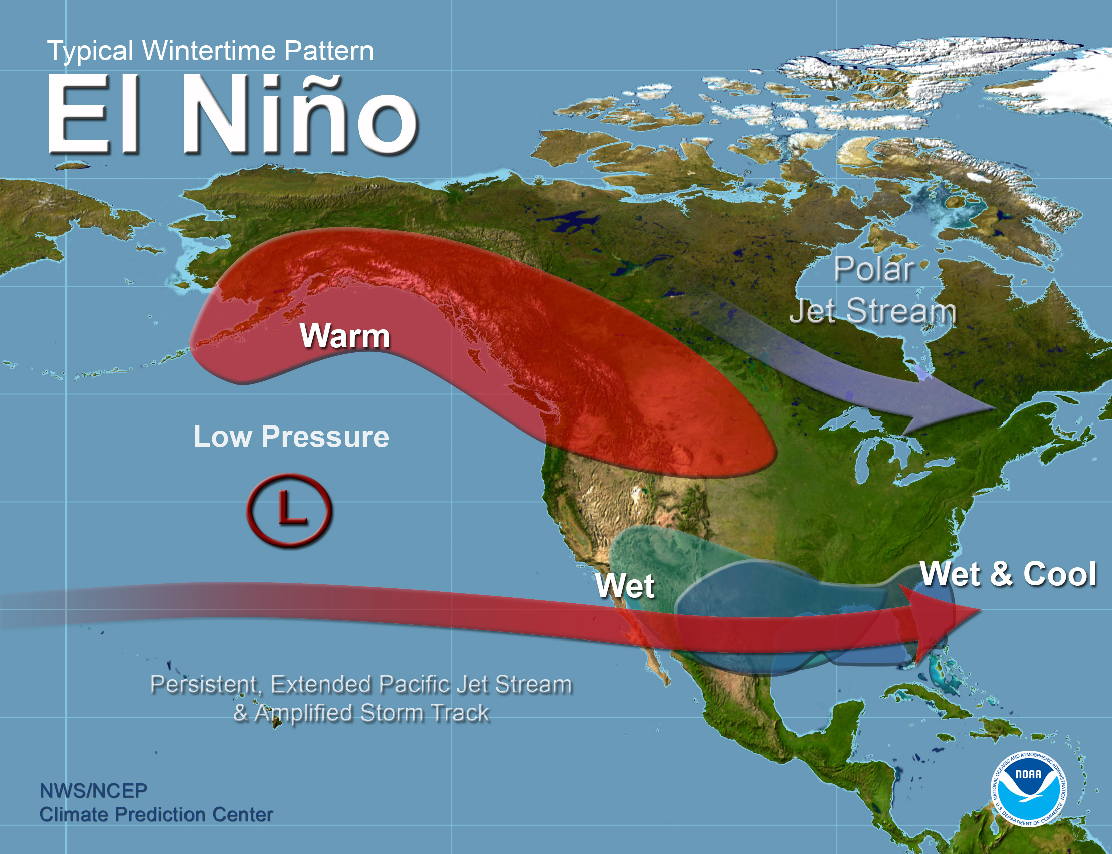
(think November-April'ish). El Nino CAN BE good because it tends to be cooler
and wetter during the cool season when it's present, but the strength of the
El Nino can also matter because weak El Ninos tend to give us dry weather. And
don't bother with El Nino in the summer talk because there's no jet stream
hanging around during the summer to be impacted by El Nino anyway.
Okay, now for the non-exciting nail-in-the-Ticker (I guess ENSO is exciting in
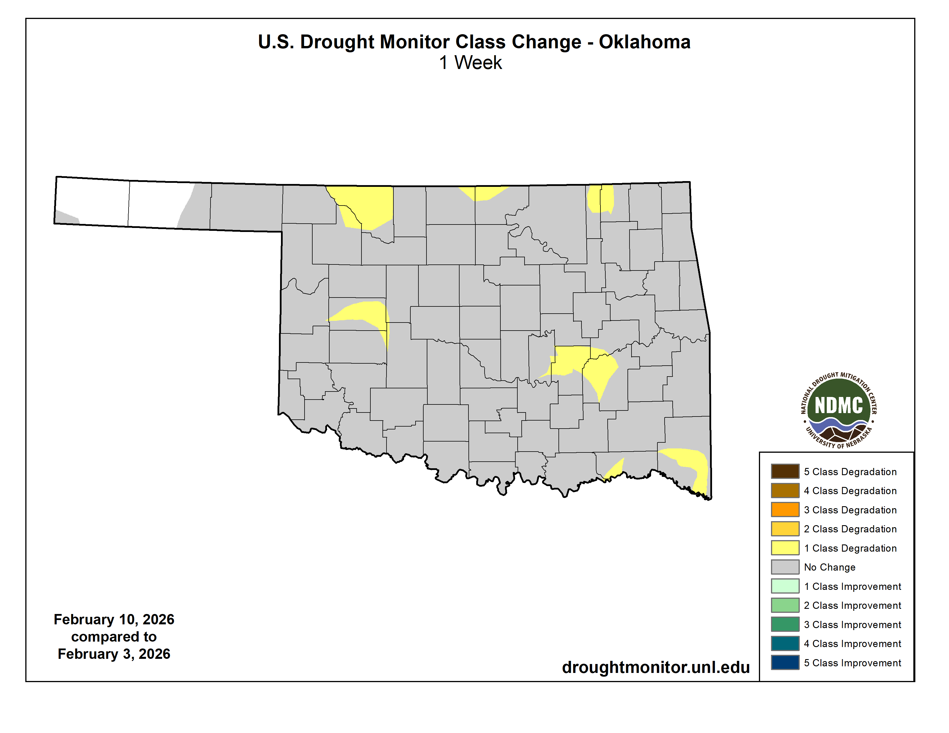
a gruesome kind of way), the Drought Monitor. For the ninth week out of the last
10, we've seen drought increase or intensify in the state on the map, now leaving
us with 74% of Oklahoma in at least moderate (D1) drought, with 28% in severe-
to-extreme (D2-D3) drought.
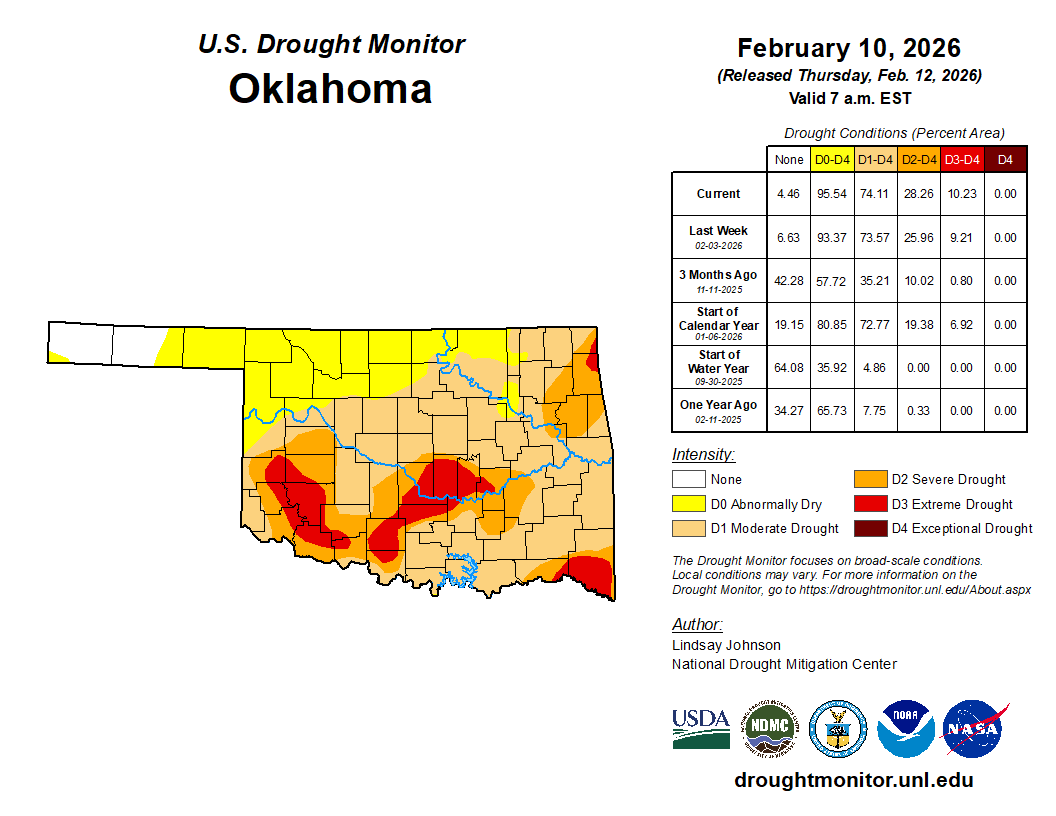
Another 21% of the state is in abnormally dry conditions (D0), signifying areas
in danger of going INTO drought soon if adequate moisture isn't received.
So, we're very excited that it appears adequate moisture is imminent. Now, about
that burrito...
Gary McManus
State Climatologist
Oklahoma Mesonet
Oklahoma Climate Survey
gmcmanus@ou.edu
February 12 in Mesonet History
| Record | Value | Station | Year |
|---|---|---|---|
| Maximum Temperature | 76°F | CAMA | 2023 |
| Minimum Temperature | -3°F | EVAX | 2025 |
| Maximum Rainfall | 1.81 inches | BROK | 2020 |
Mesonet records begin in 1994.
Search by Date
If you're a bit off, don't worry, because just like horseshoes, “almost” counts on the Ticker website!