Ticker for February 2, 2026
MESONET TICKER ... MESONET TICKER ... MESONET TICKER ... MESONET TICKER ...
February 2, 2026 February 2, 2026 February 2, 2026 February 2, 2026
Acclimation
January's but a memory now (scroll to the bottom to rekindle...or just kindle
if you've never kindled before), but its impacts remain. Folks are still
cleaning up from the Jan. 8 tornadoes, and there's still lots of drought in
the state. Heck, we still have snow on the ground, for crying out loud!
But nothing's better in Oklahoma than that first day back into the 60s after an
arctic blast. Well, maybe Cherry Pop-Tarts, but that's well-covered territory.
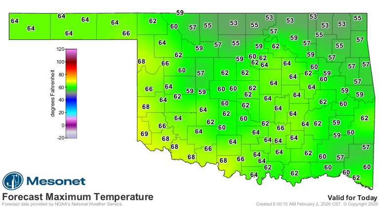
Some folks out west got that yesterday, and most of us will get it today.
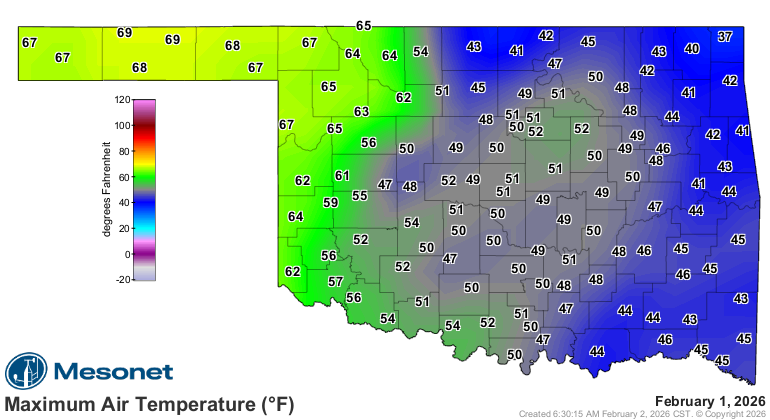
It won't take much getting used to. Shoot, I was hot yesterday in the upper-40s!
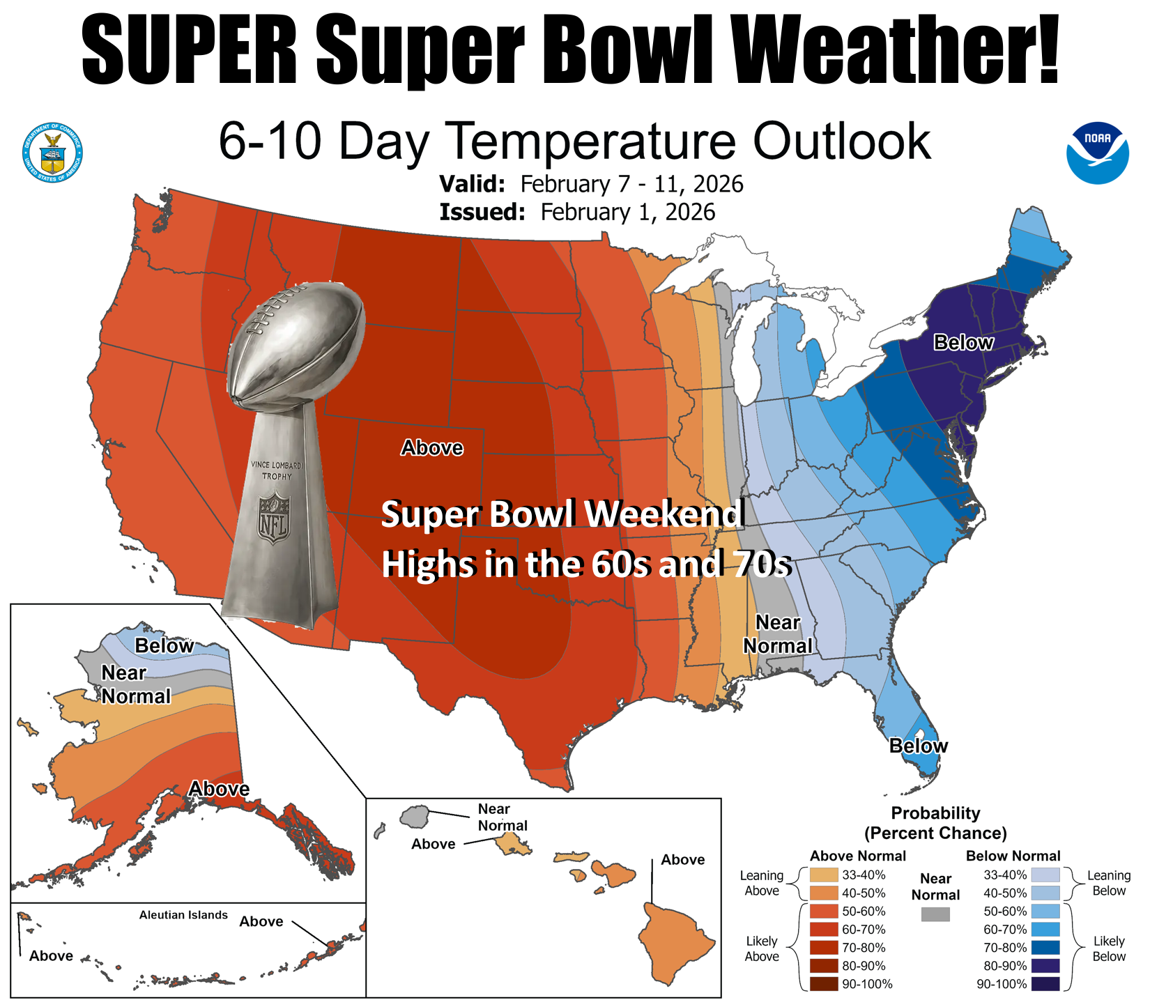
The weather will calm down a lot this week. We'll go back to above normal temps
a lot of the time, with occasional cold fronts. Like tomorrow.
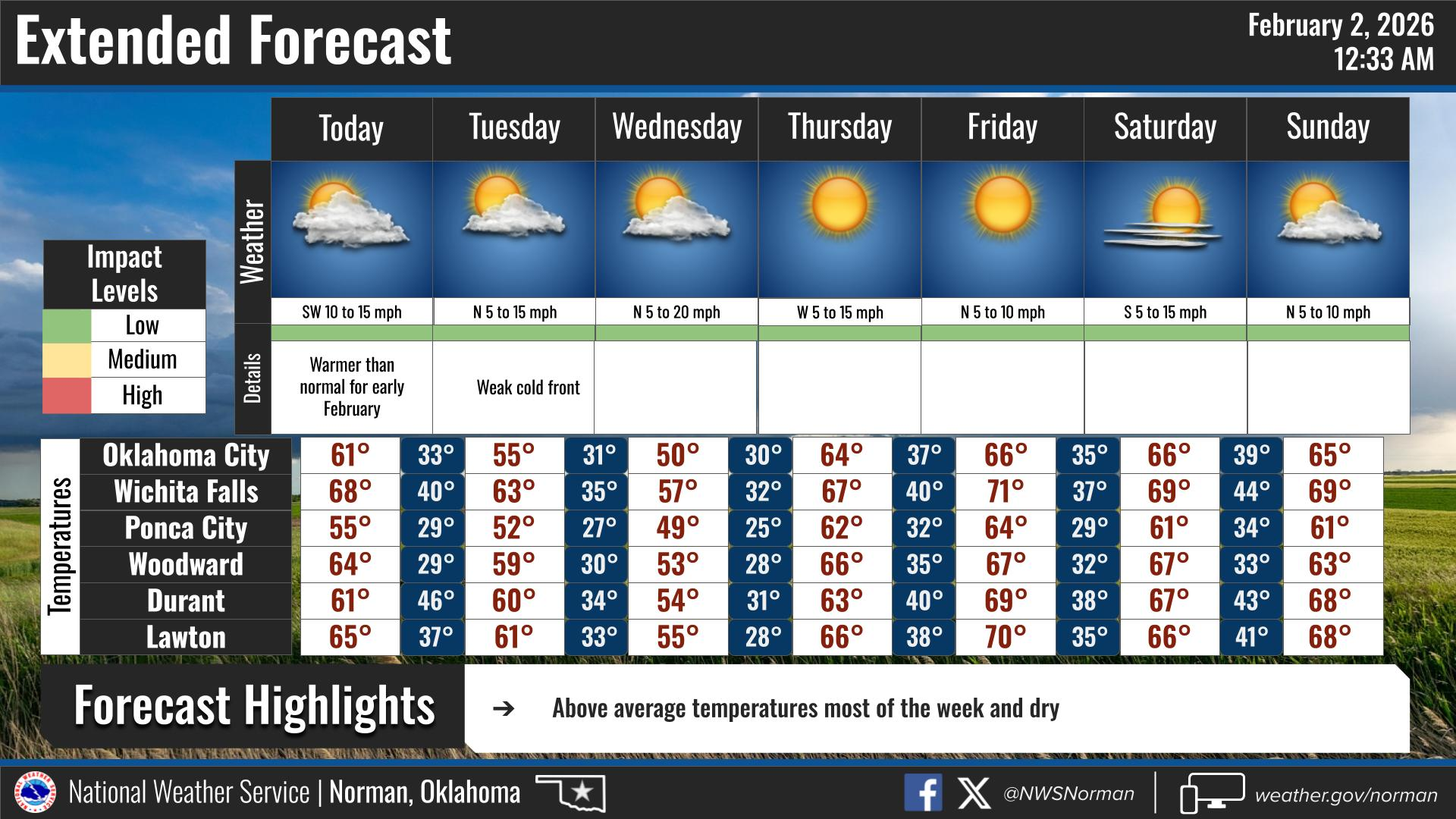
But for the most part, just really nice weather as we come out of the frigid and
into the fridge for those Super Bowl snacks.
And now, a look back at the "excitement!"
---------------------------------------------------------------------------------
January brings tornadoes, snow and arctic cold
Feb. 2, 2026
January 2026 delivered a little bit of everything Oklahoma weather is known
for — a rare January tornado outbreak, a major winter storm accompanied by
arctic cold, and continued drought across much of the state. The month featured
both destructive severe weather and prolonged freezing conditions, including
one of the most impactful snow and ice events in recent memory. By month’s end,
more than two-thirds of Oklahoma was in drought, even as snow cover lingered
across the northern half of the state. It was a month defined by sharp
contrasts and high-impact weather from start to finish.
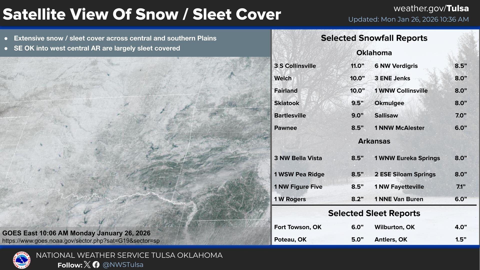
Late-month winter blast impacts state
After several near-misses with wintry weather earlier in the season, Oklahoma
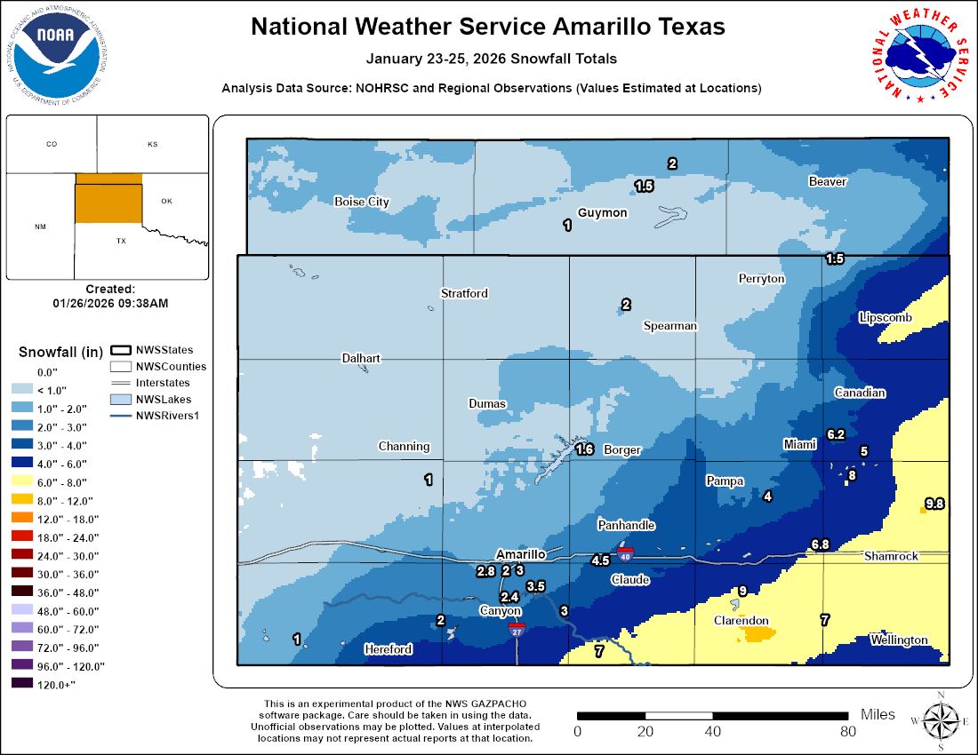
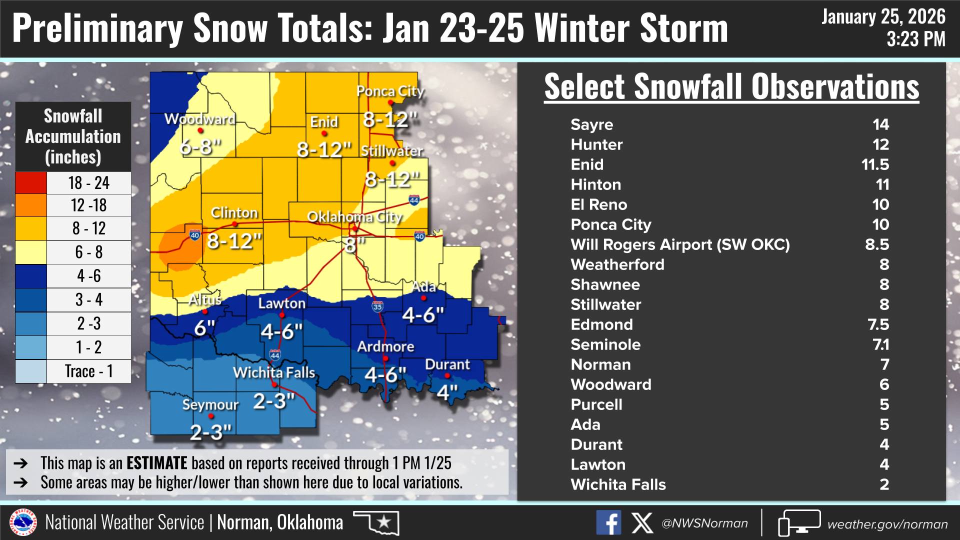
snow lovers finally struck gold with a major winter storm during Jan. 23–25. A
powerful upper-level low combined with the coldest air of the season to produce
a broad swath of 6 to 12 inches of snow across the northwestern half of the
state and 2 to 4 inches of sleet across southeastern Oklahoma. Snowfall totals
were led by Sayre with 14 inches, while a corridor of 8 to 12 inches stretched
from west-central through northeast Oklahoma. Fort Towson led the sleet totals
with 6 inches. The frigid air that accompanied the storm proved just as
impactful as the snow and ice. Many sites reported record low maximum and
minimum temperatures. Highs remained in the single digits to teens on Jan. 24,
and lows dropped below zero at numerous locations on Jan. 25. Wind chills fell
to between 10 and 20 degrees below zero. Some areas remained below freezing for
more than 130 consecutive hours, and snow cover persisted through the end of
the month. By Jan. 28, all areas of the state had finally risen above freezing.
The storm caused widespread travel problems, hundreds of motor vehicle
accidents, and power outages affecting more than 1,300 customers statewide. The
Oklahoma State Department of Health reported as many as 250 injuries associated
with the storm, most related to falls and vehicle accidents.
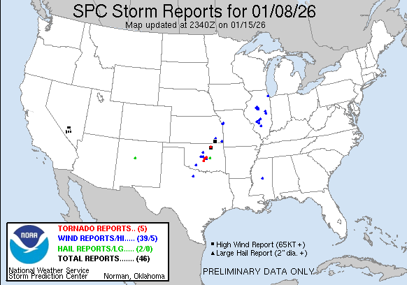
January tornadoes match state record
At least five tornadoes were reported in Oklahoma on Jan. 8, according to
preliminary data from the National Weather Service, tying the previous January
record set in 2023. January is typically the least active month for tornadoes
in Oklahoma, averaging just 0.4 tornadoes since 1950. The storms developed
shortly after sunrise on Jan. 8. The strongest tornado of the day, rated EF2,
touched down southwest of Purcell and tracked northeast, injuring one person
and damaging homes and businesses before dissipating northeast of Lexington.
Additional tornadoes were reported near Lake Thunderbird, in and around
Shawnee, and near Wynona. The tornado near Wynona produced an 88 mph wind gust
at the Wynona Mesonet site. All of the tornadoes caused damage to structures,
power lines and trees. Scattered severe wind gusts and some large hail were
also reported with the storms.
January by the numbers
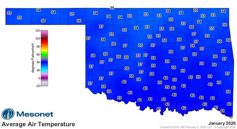
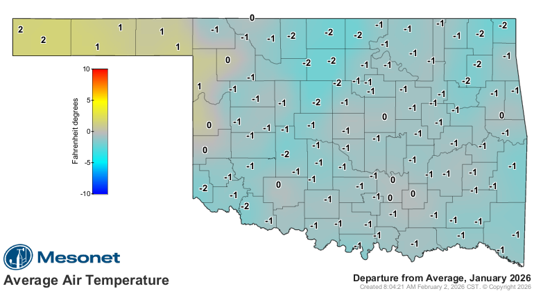
• Statewide average temperature: 37°F, 1.3°F below normal — the 61st-
coolest January since records began in 1895
• Temperature extremes: High of 83°F at Hollis on Jan. 5; low of 12°F
at Kenton on Jan. 26; lowest wind chill, –24°F at Kenton on Jan. 26
• Temperatures of 10 degrees or below: 633 instances recorded at the 120
Oklahoma Mesonet sites, including 103 below zero
• Wind chills of zero degrees or below: 728 instances, including 21
below –20°F
• Warmest and coolest locations: Highest monthly average, 41.6°F at Hugo;
lowest, 33°F at Vinita
• Hours below freezing: High of 360 hours at Beaver and Hooker; low of
188 hours at Durant
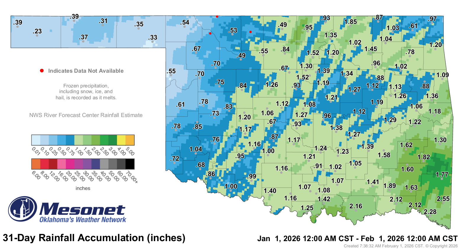
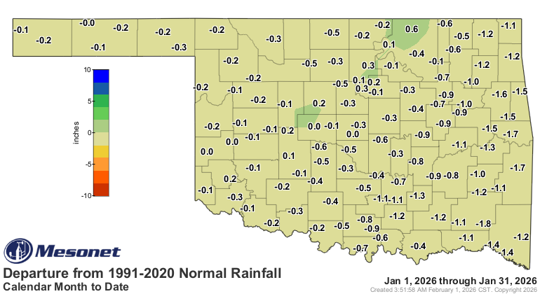
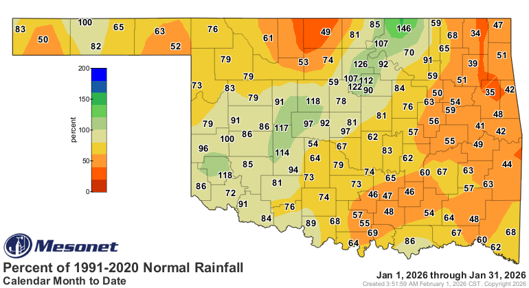
• Statewide average precipitation: 1.04 inches, 0.53 inches below
normal — the 51st-driest January on record
• Rainfall extremes: High of 2.55 inches at Broken Bow; low of 0.23
inches at Boise City
• Highest wind gusts: Wynona, Jan. 8: 88 mph; Oklahoma City East, Jan. 8:
60 mph; Yukon, Jan. 8: 60 mph; Shawnee, Jan. 8: 59 mph
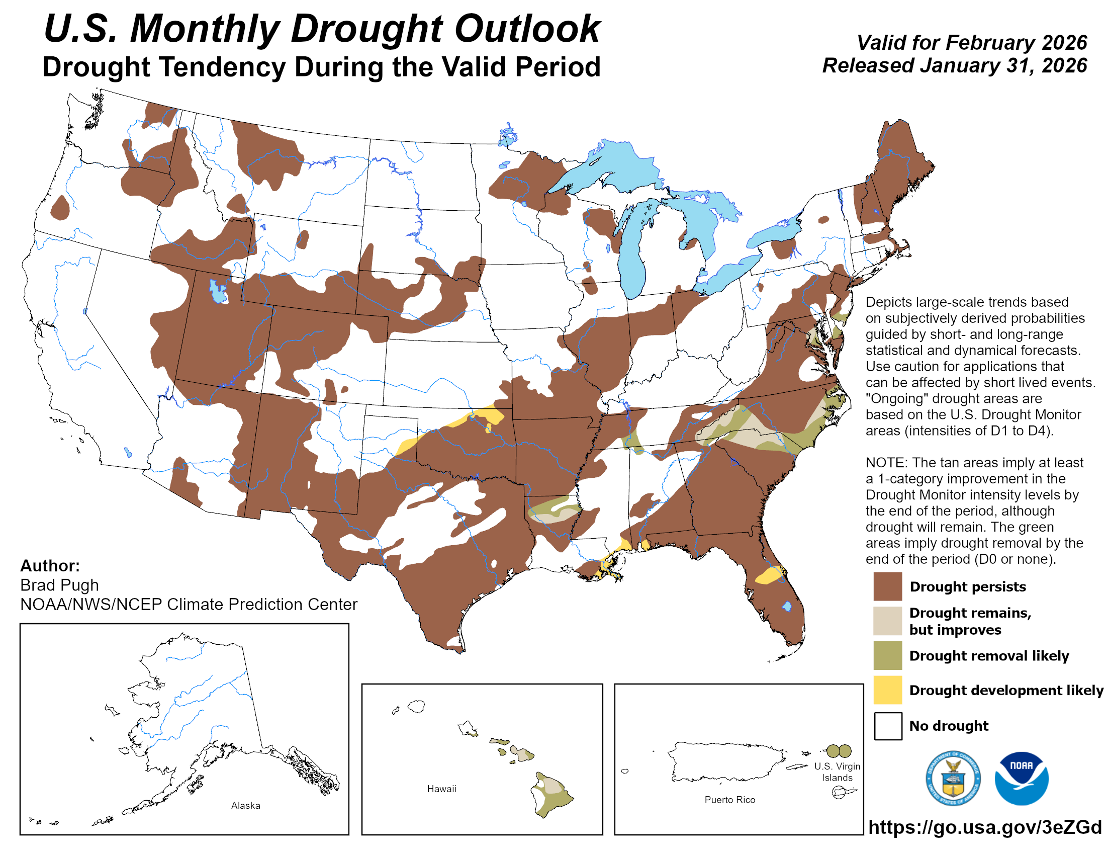
Drought likely to persist through February
Drought expanded across Oklahoma for the fourth consecutive month, increasing
from 54% of the state at the end of December to 72% by the end of January.
Higher-intensity drought categories also grew, rising from 14% to 23% during
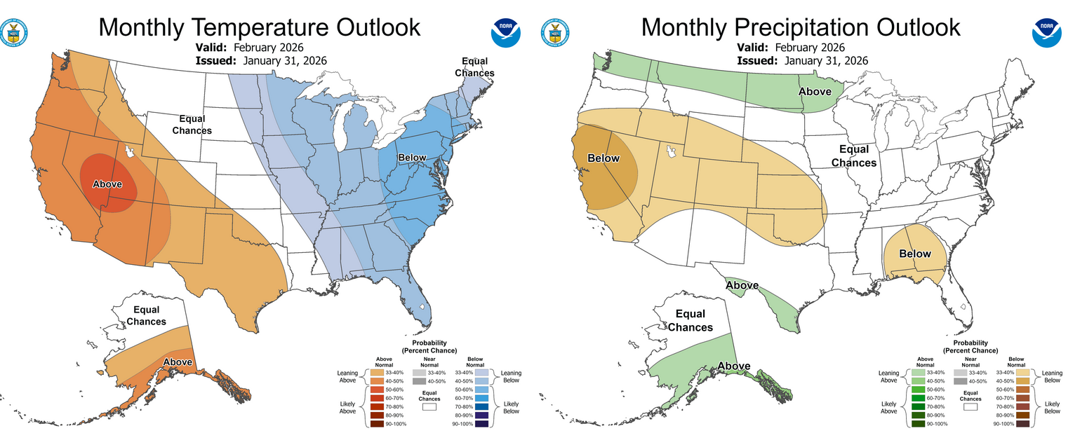
the month. The Climate Prediction Center’s (CPC) February outlook indicates
slightly increased odds of below-normal precipitation across Oklahoma, along
with increased odds of above-normal temperatures across the Panhandle and
southwestern third of the state. The CPC’s February drought outlook calls for
drought to persist where it existed at the end of January, with some additional
expansion possible to the northwest.
###
Gary McManus
State Climatologist
Oklahoma Mesonet
Oklahoma Climate Survey
gmcmanus@ou.edu
February 2 in Mesonet History
| Record | Value | Station | Year |
|---|---|---|---|
| Maximum Temperature | 87°F | ALTU | 2003 |
| Minimum Temperature | -19°F | KENT | 2011 |
| Maximum Rainfall | 2.35 inches | FREE | 2012 |
Mesonet records begin in 1994.
Search by Date
If you're a bit off, don't worry, because just like horseshoes, “almost” counts on the Ticker website!