Ticker for December 15, 2025
MESONET TICKER ... MESONET TICKER ... MESONET TICKER ... MESONET TICKER ...
December 15, 2025 December 15, 2025 December 15, 2025 December 15, 2025
The Extremely Extreme Extremes of 2025
Normally (come on, you know there ain't nothing normal about normal pertaining to
Oklahoma weather!), we'd wait for another week or so to release the much-
anticipated annual extremes map from the Mesonet, but frankly, there just ain't
much else to talk about, AND there isn't anything exciting coming down the road
either, at least not through the end of the year, and if we keep adding to this
sentence we're gonna break the internet.
Whew, free at last!
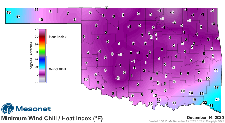
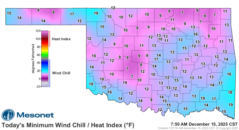
We could talk about the coldest air of the season that we just saw over the
weekend, including the wind chills hovering around zero yesterday (and not so
great this morning either!).
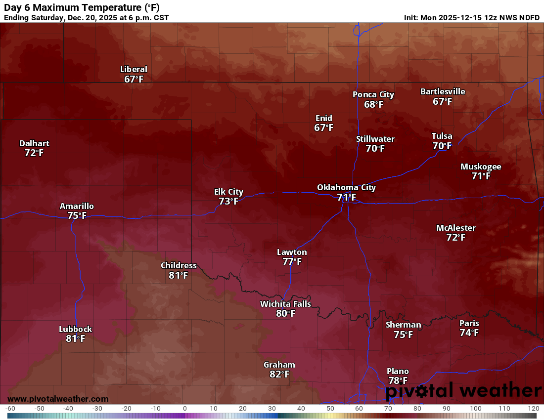
Or how we're now gonna warm up, WAYYYYY up, as we go through the week. Highs in
the 70s on Saturday? Go home Mother Nature, you're drunk!
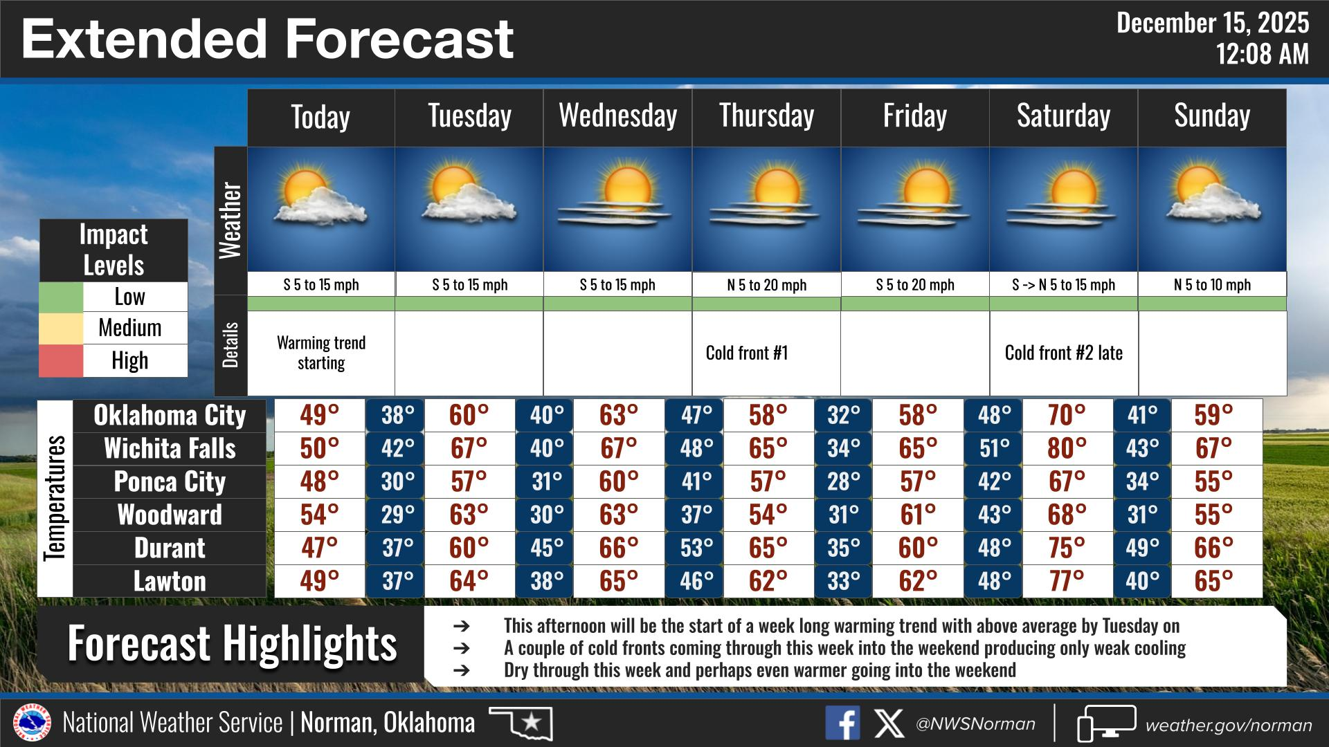
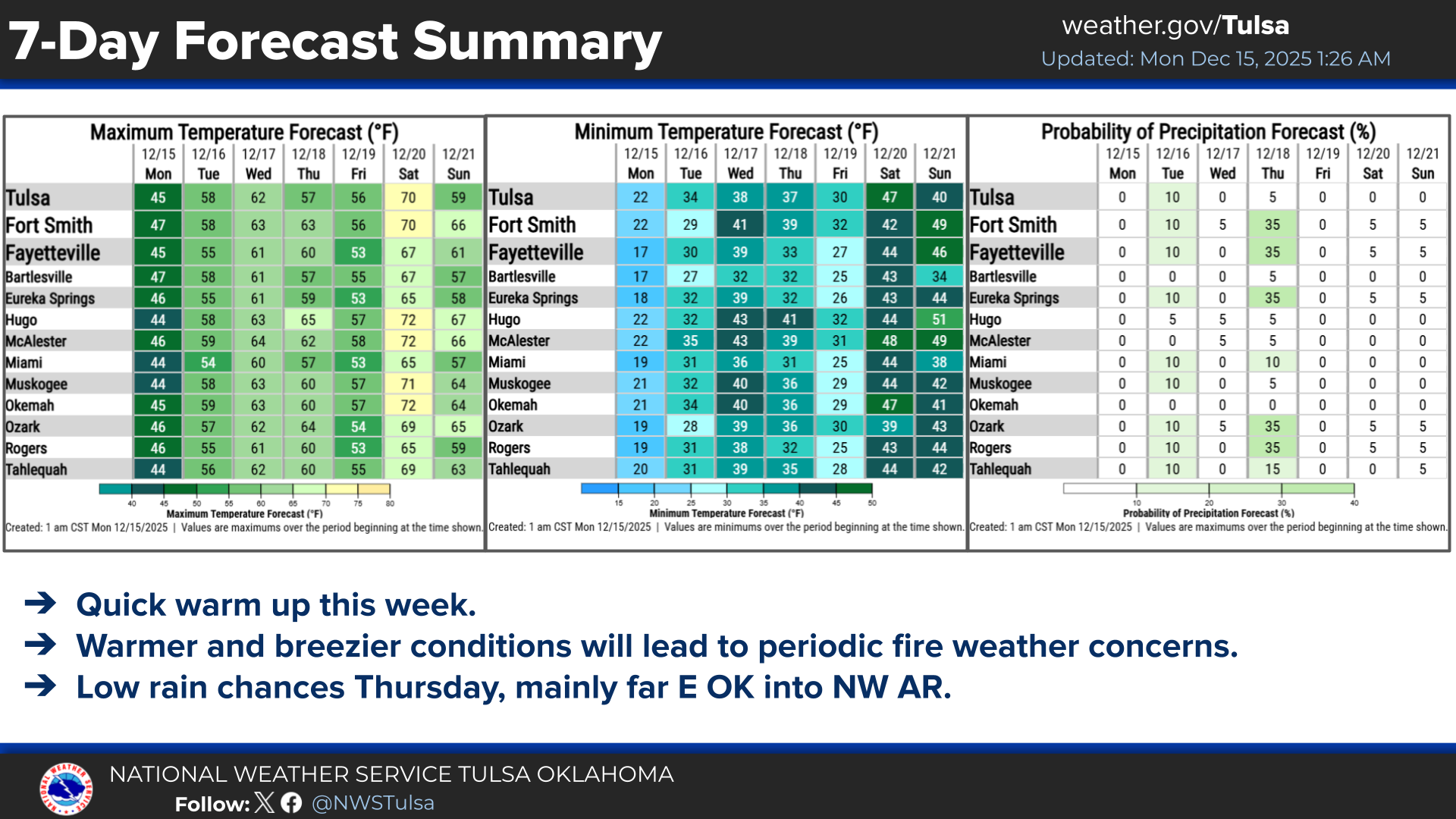
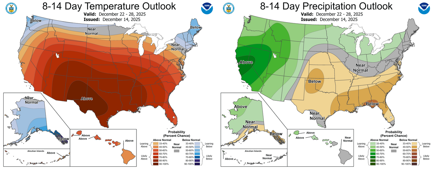
How about more of the same through Christmas? Bah humbug indeed.
No, we're not gonna talk about that stuff. Too boring. How about those 2025
extremes, though?
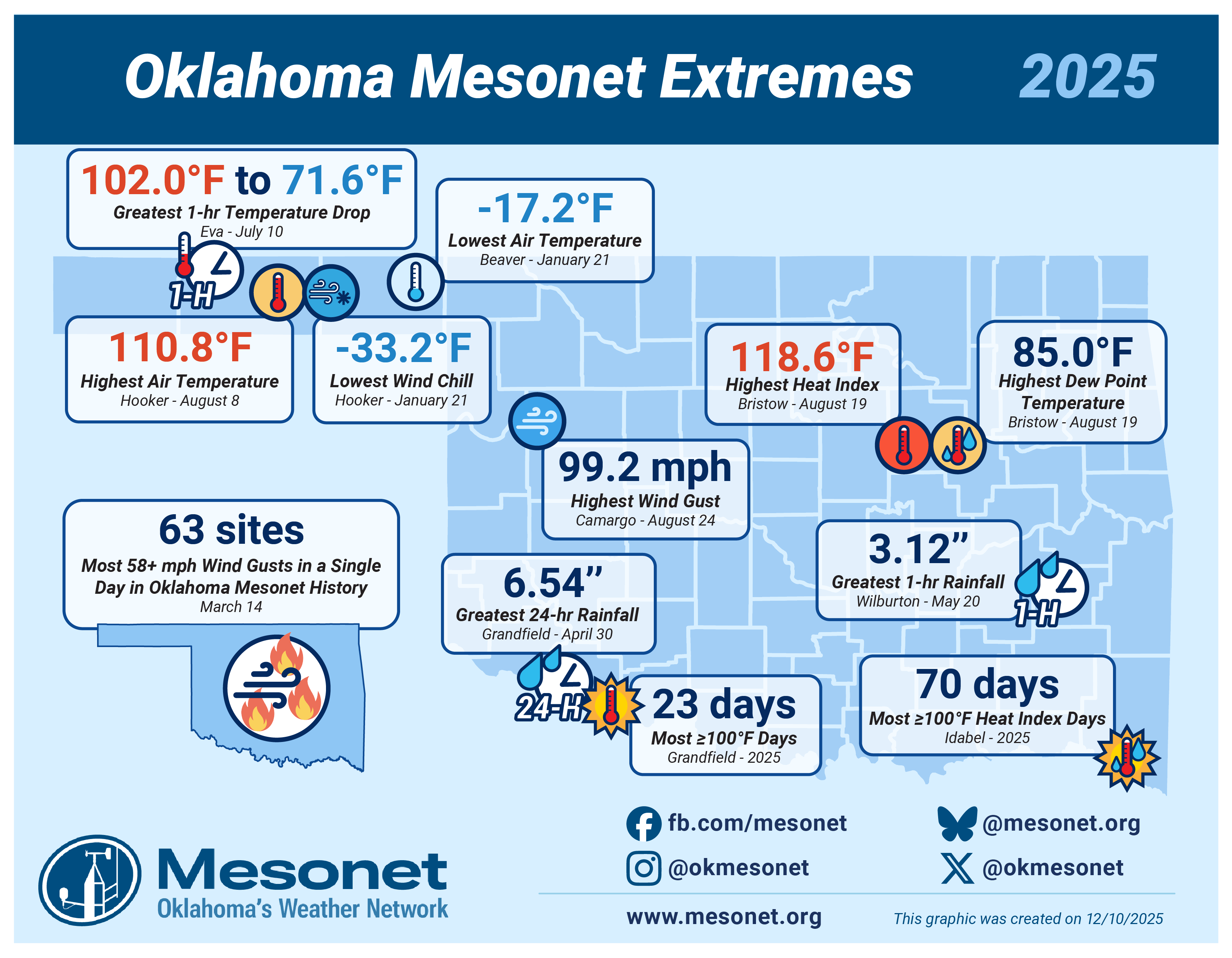
**The most extreme of those extremely extreme extremes is undoubtedly the March
14 observance of 63 sites with wind gusts of at least 58 mph, an Oklahoma
Mesonet record (dating back to Jan. 1, 1994), as well as 99 sites that hit at
least 50 mph. That was also the day we saw arguably the worst firestorm in
Oklahoma's recorded history, burning over 170,000 acres with at least
400 homes damaged or destroyed by the fires, 4 lives lost, and over 200
injuries.
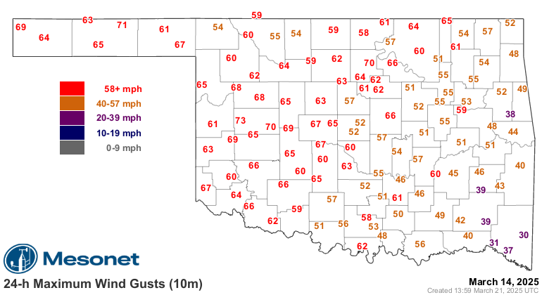
Simply put, one of the most devastating non-severe storm related weather days
in Oklahoma history.
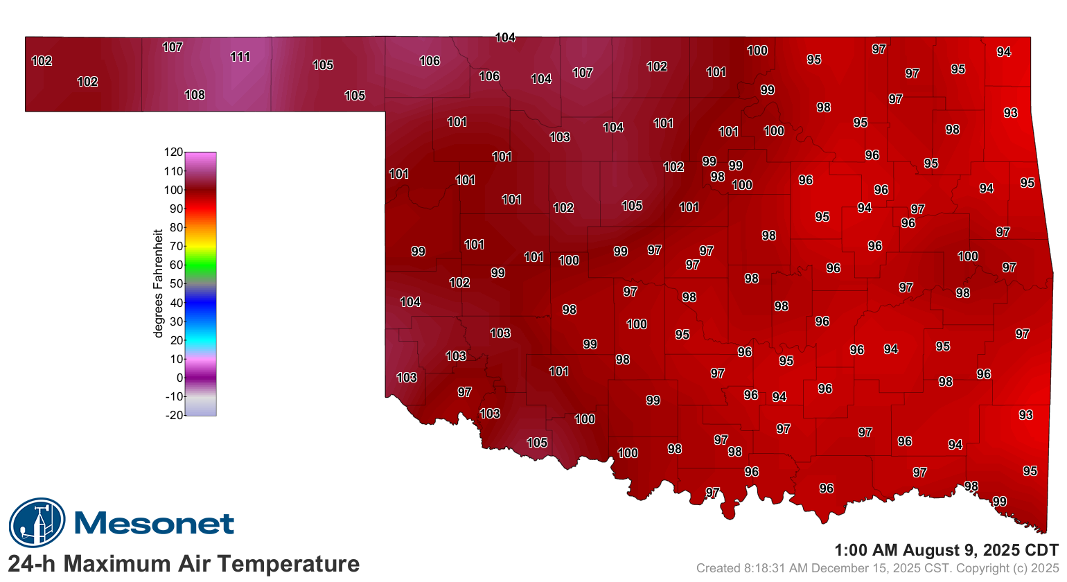
**Admittedly, our temperature extremes were kind of "meh" this year, at least
compared to recent memory. 111F was our highest temperature, set at Hooker on
Augugst 8. I mean, nothing to sneeze at, but folks in western OK call that a
summer Tuesday.
**Admittedly again (lots of admitting today...here's one: I am pretty darned
cool, I must admit!), not a great year if you love those triple-digits. See
Grandfield down there in the southwest corner, hitting our most days at or
above 100 with only 23.
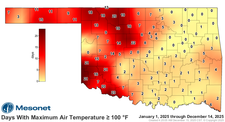
That's pretty puny if you ask me. You didn't? Well too bad because I've got the
pen!
**Add more moisture to that heat and we see the heat index was acting up a bit,
but once again, not as crazy as recent years (we see you, 2023!). Bristow
hit the highest heat index this year at 119F, and Idabel led the state with
most days at or above 100 on the heat index scale at 70.
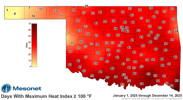
Obviously that 85F dew point temperature that same day at Bristow made all that
glorious sweat possible.
**What we did have is a lot of rain, including some extremely extreme downpours.
Check out that 6.54 inches down in Grandfield, of all places, which set our
standard in 2025 for greatest 24-hour rainfall total.
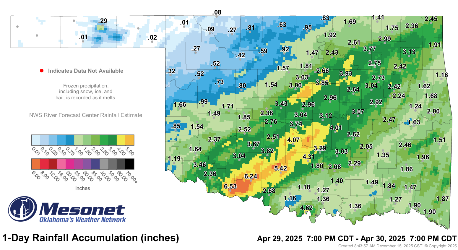
This tremendous rainfall at the end of the month helped break the all-time April
rainfall record with a statewide average of 8.74 inches, 5.15 inches above
normal.
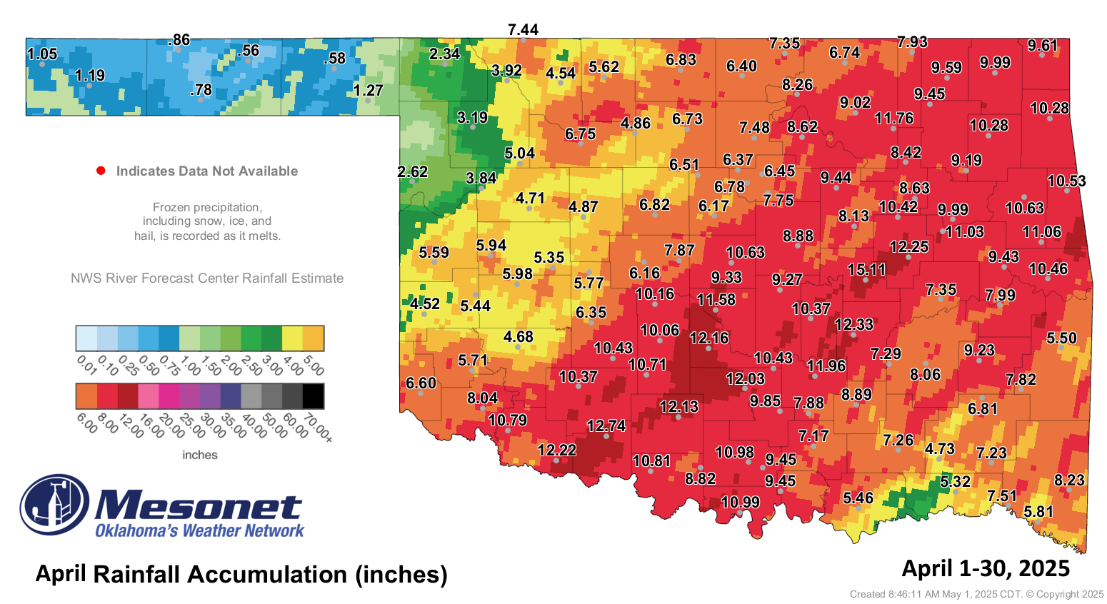
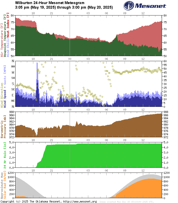
Wilburton's 3.12 inches was our greatest 1-hour rainfall total of 2025, a
toad-strangler for sure!
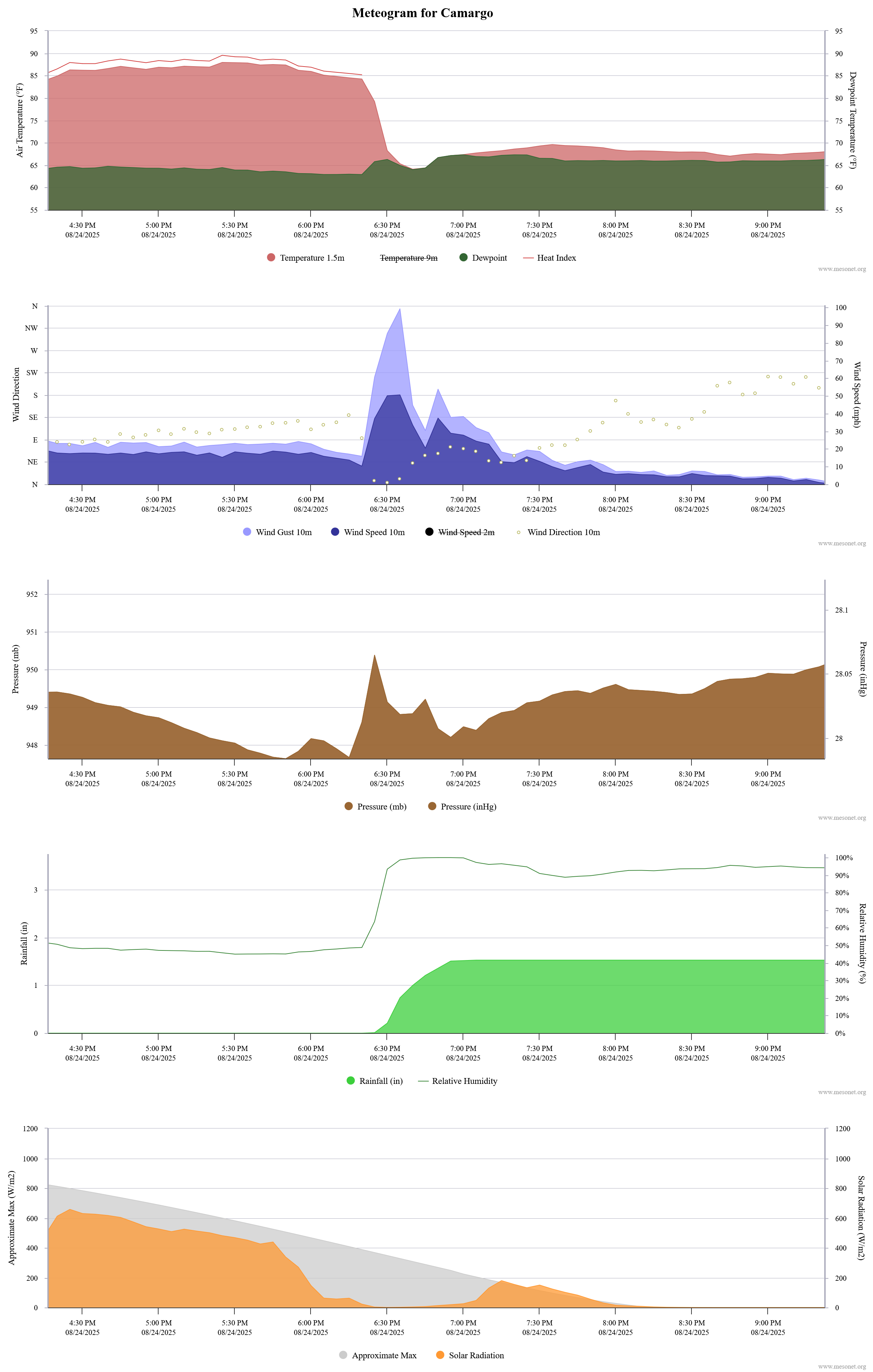
**That 99.2 mph wind gust at Camargo on Aug. 24 came from a bigtime supercell
that also gave them an 85 mph gust as well.
**Oh yeah, almost forgot the cold stuff, because that's what's outside my door
right now. Beaver set the 2025 standard for low temps at -17F on January 21,
and the neighboring site at Hooker grabbed the wind chill mark at -33F.


Brrrr...makes yesterday and today look tropical in comparison. Some more facts
about that day's cold weather:
-------------------------------------------------------------------------------
* Lowest temperature ever recorded on a Jan. 21: -17 degrees, Beaver
* Lowest temperature recorded in OK since Feb. 16, 2021: -17 degrees, Beaver
* Lowest wind chill since Dec. 22, 2022: -33 degrees at Beaver and Hooker
* Lowest statewide average low temperature: -6.7 degrees
-------------------------------------------------------------------------------
Well there you have it. Like I said (well...typed), if anything changes in the
next couple of weeks, we'll adjust the graphic. SHOULD be good to go, but
you know...it IS Oklahoma.
Gary McManus
State Climatologist
Oklahoma Mesonet
Oklahoma Climatological Survey
gmcmanus@ou.edu
December 15 in Mesonet History
| Record | Value | Station | Year |
|---|---|---|---|
| Maximum Temperature | 83°F | SEIL | 2021 |
| Minimum Temperature | 2°F | KENT | 2008 |
| Maximum Rainfall | 1.99 inches | BBOW | 2001 |
Mesonet records begin in 1994.
Search by Date
If you're a bit off, don't worry, because just like horseshoes, “almost” counts on the Ticker website!