Ticker for December 1, 2025
MESONET TICKER ... MESONET TICKER ... MESONET TICKER ... MESONET TICKER ...
December 1, 2025 December 1, 2025 December 1, 2025 December 1, 2025
I'm calling it!
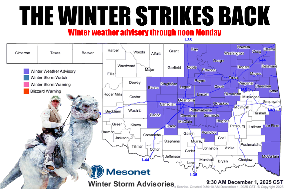
Well that about covers winter, amirite??
Yeah, I know...long time no Tick. I had to work on my music, you know. Plus I
had to get a hair cut (the one on top of my head). But here we are again with
an underestimated icy situation across central and eastern Oklahoma. I know I've
told you many times, DON'T UNDERESTIMATE THE AMOUNT OF HAVOC SOME LIGHT
FREEZING DRIZZLE AND RAIN CAN CAUSE. Wait, don't underestimate an underestimate?
And why are those underestimates pronounced differently?
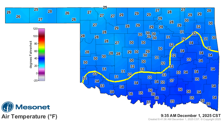
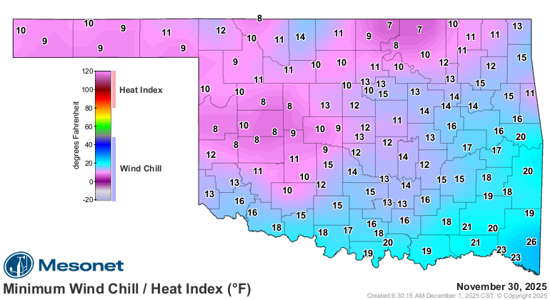
Temperatures fell into the upper-20s and low-30s to produce prime icing
conditions on those elevated surfaces (think bridges, overpasses, and my
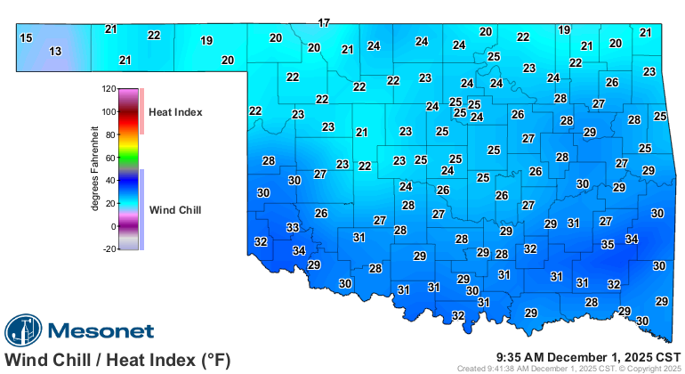
hairline). And they haven't warmed up that much yet either. And those wind
chills!

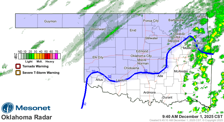
And that's not even mentioning the light snow to the north. Heck, it's snowing
up there right now, for crying out loud!
That's okay, could be worse. Or Sunday.
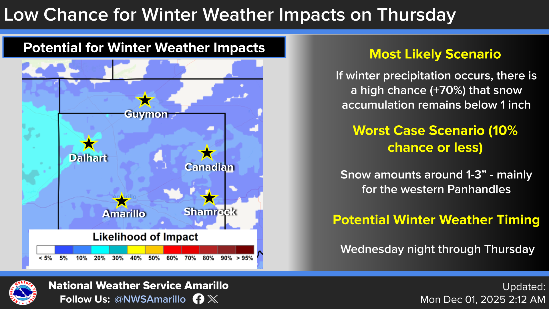
At least we will get a warm up the next couple of days, then another cold front
and we try this all over again on Thursday.
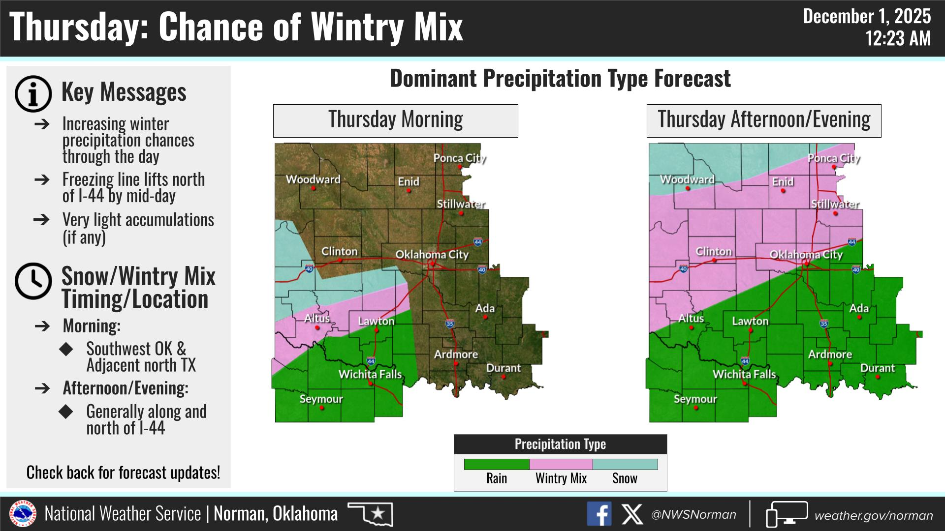
My suggestion? Don't underestimate it, and you can pronounce that however you
wish as you scroll down and read of a warmer, friendlier climate from fall 2025.
Seacrest out!
--------------------------------------------------------------------------------
Warm and dry November drives drought expansion
Dec. 1, 2025
November 2025 was a warm and mostly dry month across Oklahoma, much like the
climatological fall season as a whole (Sept. 1–Nov. 30). Those conditions
allowed drought to flourish across the southern half of the state, only a few
months after Oklahoma had enjoyed a mostly drought-free summer. The dryness is
expected to persist through the end of the year and may even expand. Some rain
and bouts of severe weather did occur, including a weak tornado near Broken
Arrow on Nov. 20. The preliminary tornado count for the year rose to 105,
according to the National Weather Service — nearly double the 1951–2024 annual
average of 58.8 for Oklahoma. An arctic blast during the month’s final weekend
then brought a sharp jolt of winter, driving wind chills into the single digits
and teens and giving the state its first true taste of the coming season.
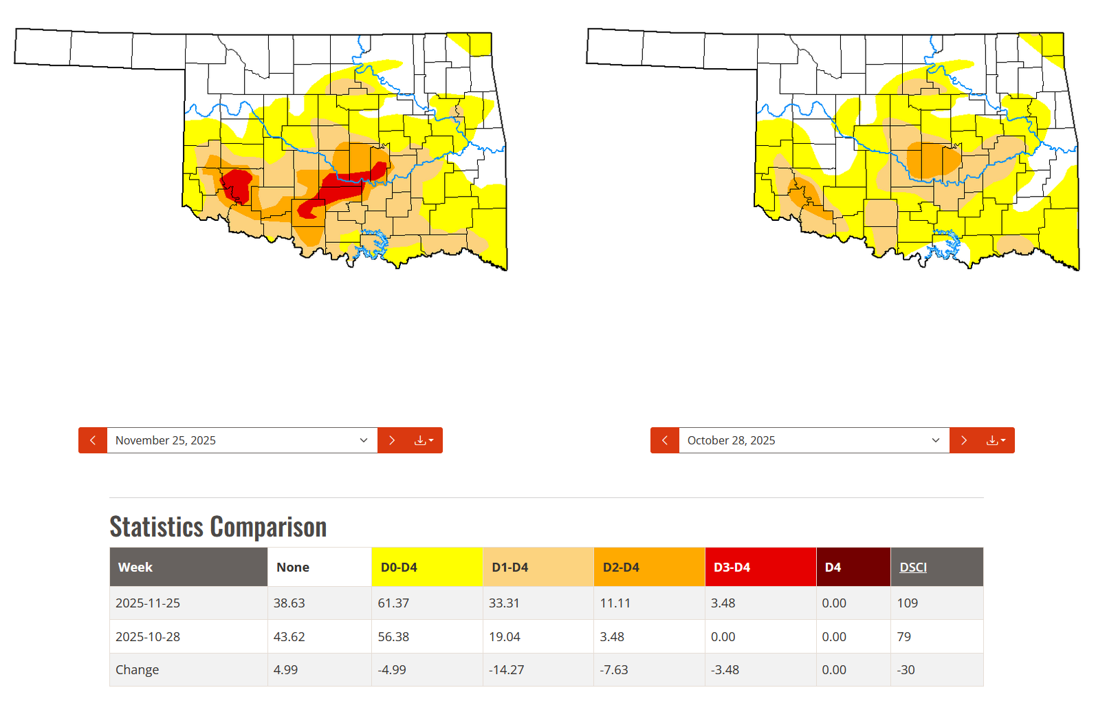
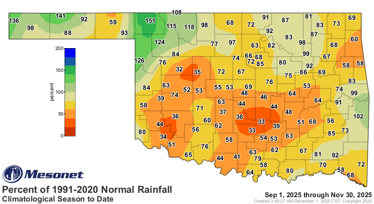
Drought spreads across southern Oklahoma.
Drought coverage nearly doubled from the end of October through November,
increasing from 19% on Oct. 28 to 33% by month’s end, according to the U.S.
Drought Monitor. Severe to extreme drought (D2 to D3) also expanded, rising
from 3.5% to more than 11% over the same period. The state saw its first
extreme drought designation since Oct. 29, 2024, with D3 conditions introduced
in southwest Oklahoma on the Nov. 11 report. The extreme areas on the Drought
Monitor map were centered on Kiowa County and stretched from Stephens County to
Seminole County. The Oklahoma Mesonet continued to receive reports of dry farm
ponds, stressed or dying winter wheat, and other agricultural impacts
associated with the worsening drought conditions.
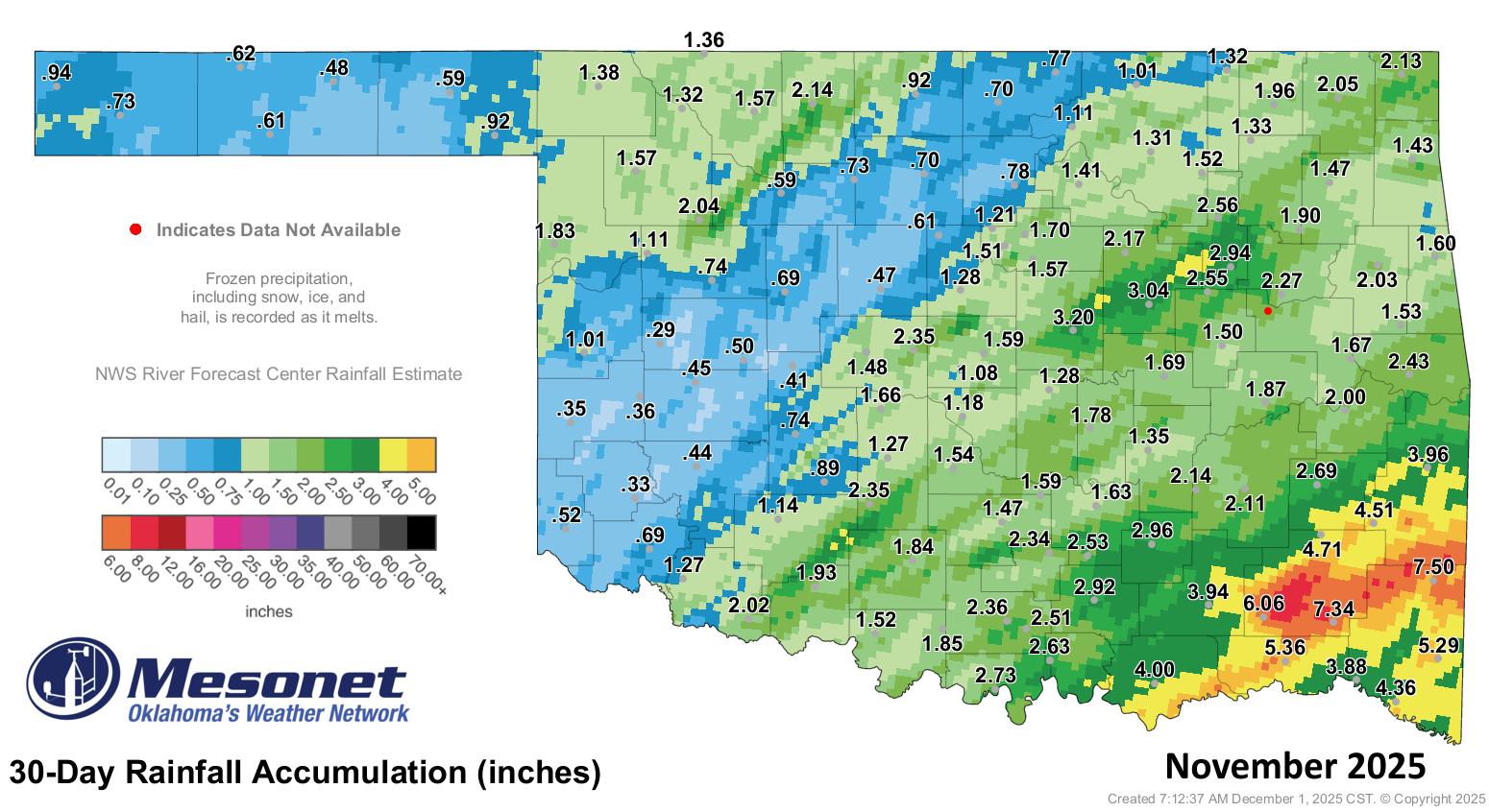
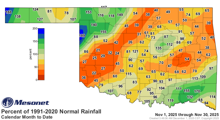
November deficits compound a dry fall
November’s statewide average rainfall of 1.78 inches fell 0.54 inches below
normal — a dry finish to an already dry fall. Deficits of 1 to 2 inches were
common during the month, which is normally the fourth-driest calendar month in
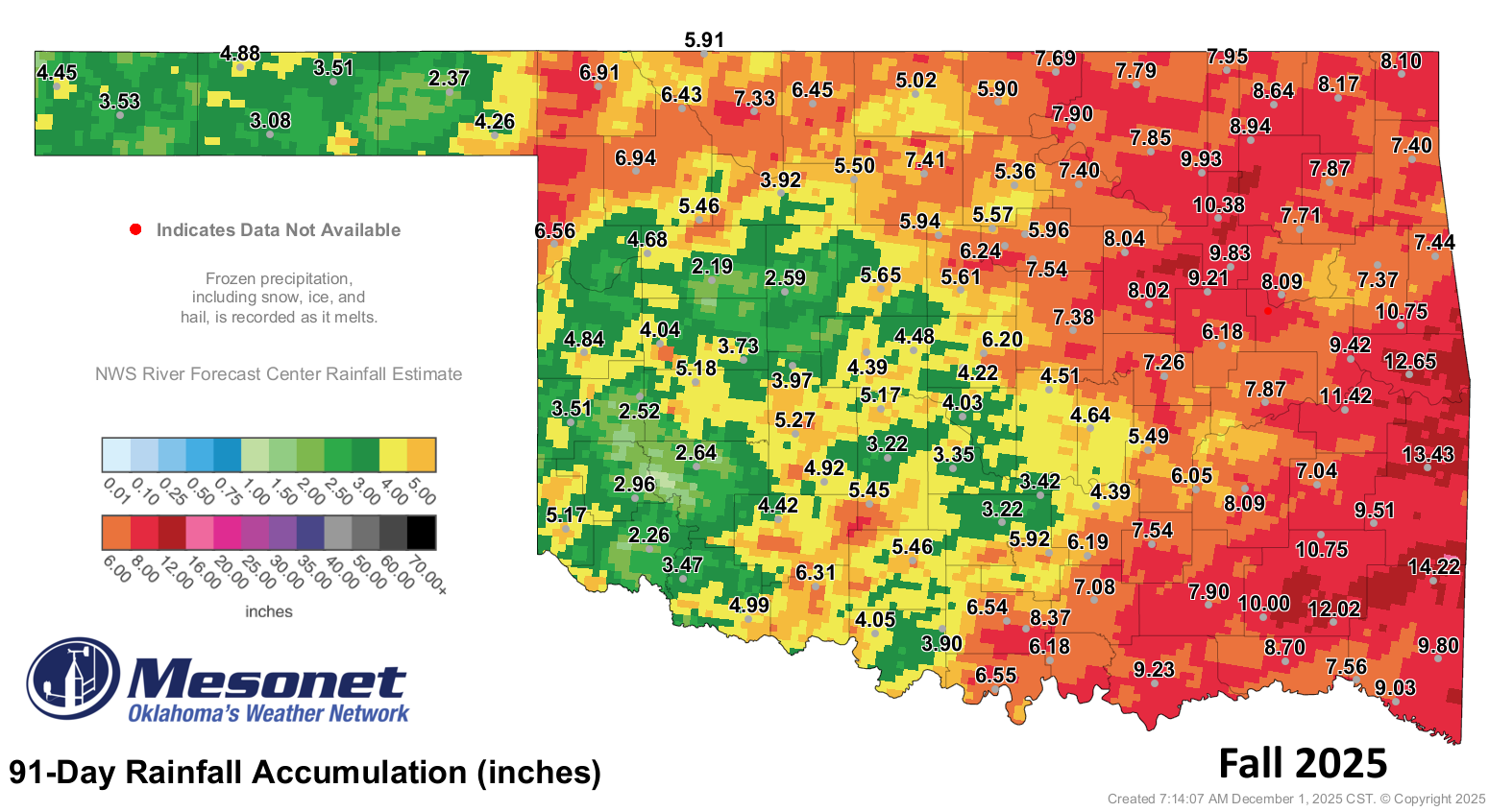
Oklahoma. Fall deficits of 5 to 7 inches were centered southeast of the
Oklahoma City metro, with broader deficits of 3 to 5 inches across surrounding
areas. Jackson and Tillman counties had gone nearly 60 days without at least a
quarter-inch of daily rainfall by Nov. 17 before light rains finally ended the
streak. Climatological fall — September through November — finished as the
39th-driest on record statewide at nearly 2.5 inches below normal. Some parts
of Oklahoma were more fortunate, however, with far northwestern and
southeastern areas enjoying November surpluses of 1 to 3 inches. Northwestern
Oklahoma also recorded fall surpluses of similar amounts.


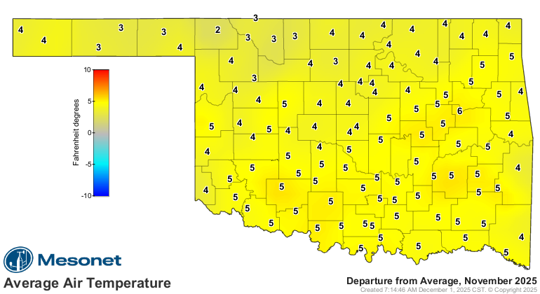
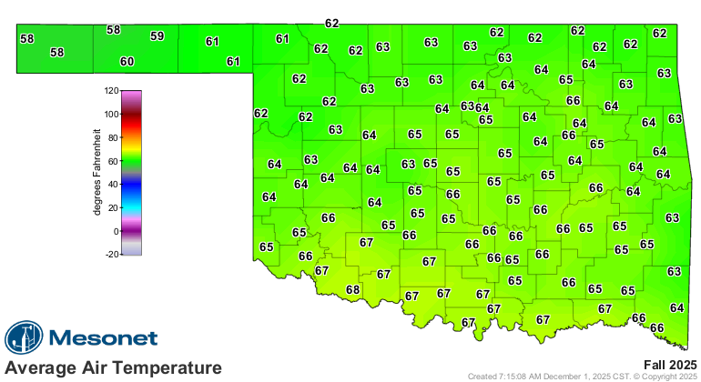
Unusual fall warmth continues into November
Statewide temperatures during November were notably warm, ranking seventh-
warmest at 4.5 degrees above normal. That warmth helped push climatological
fall to the sixth-warmest on record at 3.6 degrees above normal. The fall
season’s highest temperatures reached 99°F at Grandfield on Sept. 11–12, and
November itself climbed as high as 94°F at Tipton on Nov. 15. The month also
saw 13 days reach at least 90°F statewide. Despite this persistent warmth,
Oklahoma did not record a single triple-digit temperature during fall, a
relatively uncommon outcome.
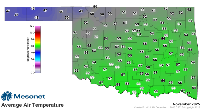

November by the numbers
• Statewide average temperature: 54°F, 4.6°F above normal — the seventh-warmest
November since records began in 1895
• Temperature extremes: High of 94°F at Tipton on Nov. 15; low of 17°F at Eva
and Goodwell on Nov. 29 and again at Goodwell on Nov. 30; lowest wind chill,
6°F at Eva on Nov. 29
• Warmest and coolest locations: Highest monthly average, 58.4°F at Durant;
lowest, 46.8°F at Kenton
• Statewide average precipitation: 1.79 inches, 0.53 inches below normal — the
63rd-driest November on record
• Rainfall extremes: High of 7.5 inches at Smithville; low of 0.29 inches at
Butler; highest daily total, 4.05 inches at Smithville on Nov. 20
• Rainfall totals under 2 inches: 79 instances recorded at the 120 Oklahoma
Mesonet sites
• Highest wind gusts: Medicine Park, Nov. 29: 60 mph; Yukon, Nov. 20: 55 mph;
Arnett and Okemah, Nov. 8: 51 mph
Climatological fall (September–November) by the numbers
• Statewide average temperature: 64.8°F, 3.6°F above normal — the sixth-warmest
fall since 1895
• Temperature extremes: High of 99°F at Grandfield on Sept. 11–12; low of 17°F
at Eva and Goodwell on Nov. 29 and again at Goodwell on Nov. 30
• Statewide average precipitation: 6.53 inches, 2.47 inches below normal — the
39th-driest fall on record
• Rainfall extremes: High of 14.22 inches at Smithville; low of 2.19 inches at
Putnam
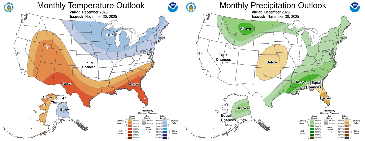
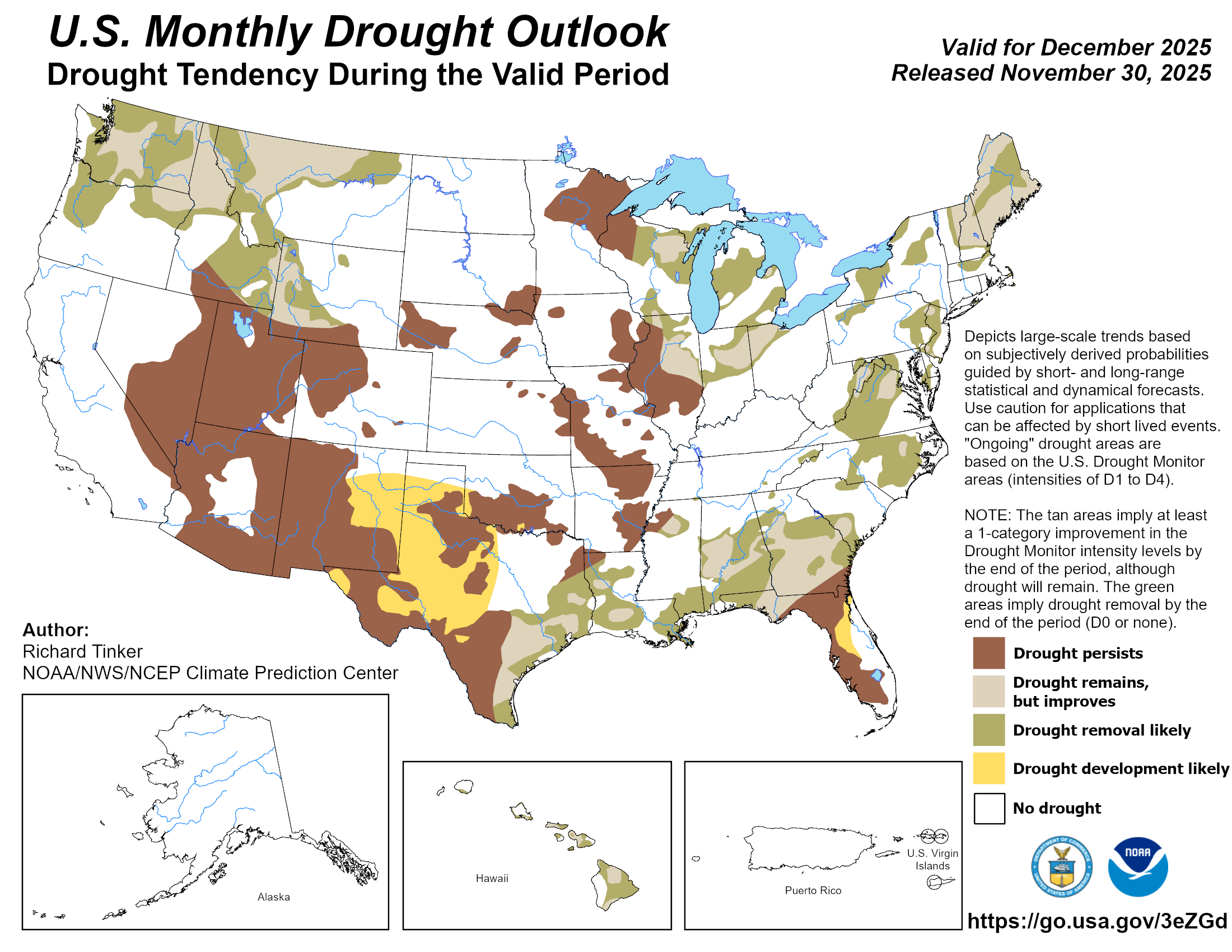
Drought likely to persist through December
The Climate Prediction Center’s (CPC) December outlook indicates equal chances
of above-, below- or near-normal temperatures across most of Oklahoma, along
with increased odds of below-normal precipitation across all but the far
southeast corner of the state. The CPC’s December drought outlook calls for
drought to persist in areas where it existed at the end of November and for
additional development in far southwestern and south-central Oklahoma.
###
Gary McManus
State Climatologist
Oklahoma Mesonet
Oklahoma Climate Survey
gmcmanus@ou.edu
December 1 in Mesonet History
| Record | Value | Station | Year |
|---|---|---|---|
| Maximum Temperature | 86°F | HOLL | 2012 |
| Minimum Temperature | 0°F | SEIL | 2006 |
| Maximum Rainfall | 0.75 inches | WATO | 2015 |
Mesonet records begin in 1994.
Search by Date
If you're a bit off, don't worry, because just like horseshoes, “almost” counts on the Ticker website!