Ticker for October 28, 2025
MESONET TICKER ... MESONET TICKER ... MESONET TICKER ... MESONET TICKER ...
October 28, 2025 October 28, 2025 October 28, 2025 October 28, 2025
North now south
There once was a man from Nantucket...NO NO NO, wait, let's try that again and
keep our job.
A front from the northwest is nigh,
And shorts season’s ready to die.
Out come the heaters,
And sock-wearing cheaters—
’Til next week when temps rebound high!
STOP ME BEFORE I LIMERICK AGAIN (oddly enough, it FEELS like Limerick right now,
where it's also in the 50s).
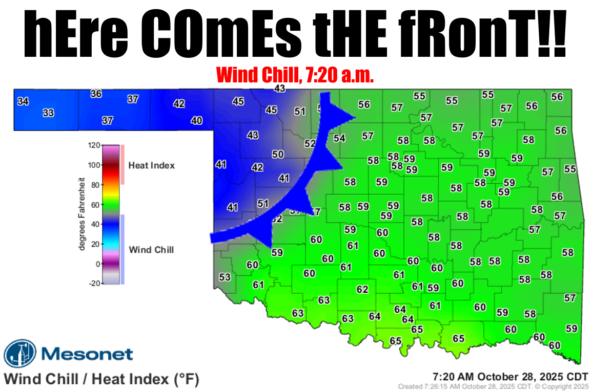
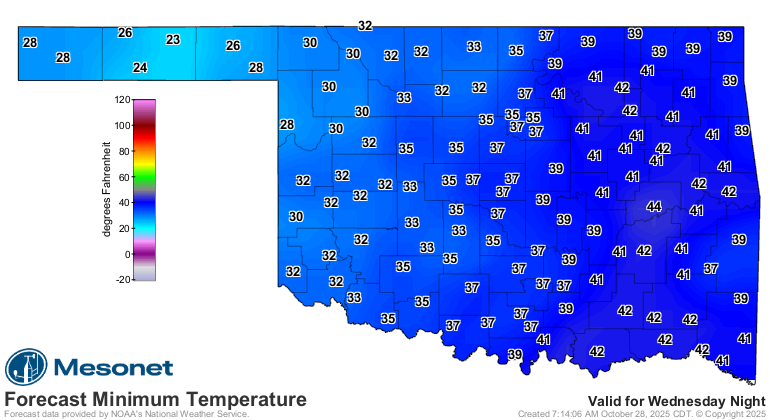
That front moving through the state as I type (maybe not as you read, it might
already be through, so work with me here) is gonna bring us our first true taste
of late-fall/early-winter. Temperatures will hold steady or drop a bit through
the day today, but they're gonna plummet in the dry air tomorrow morning. And with
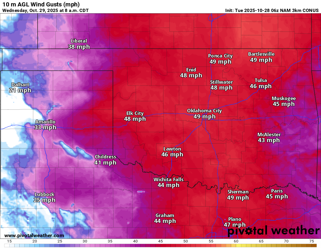
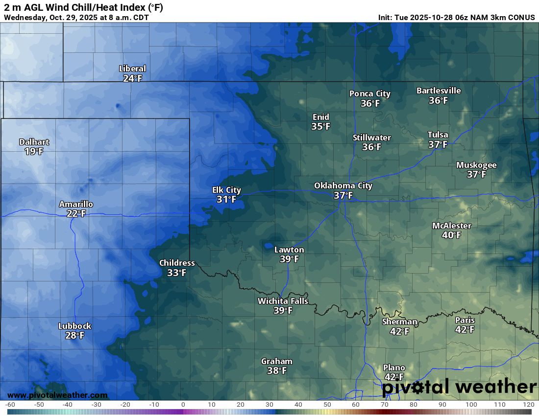
the winds kicking up to 40-50 mph, we're gonna see those wind chills give us a
taste of November.
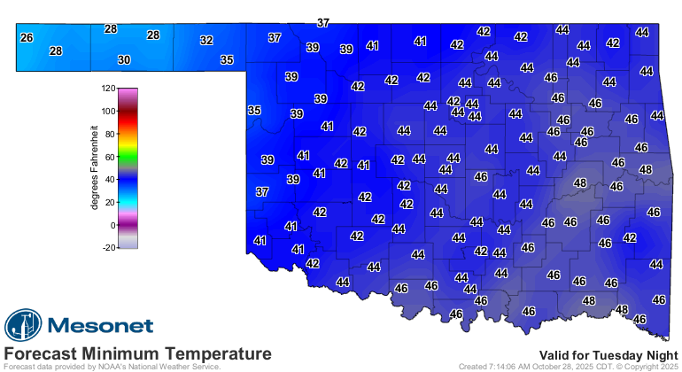
And we're still looking at more freezes over the next couple of mornings.
I can't begin to tell you how miserable tomorrow morning is going to be with
those high winds (watch for a high wind watch or something similar later today
from our NWS friends) and frigid-feeling temps. So I won't try.
How about this?
The wind’s doing laps through the state,
At fifty—it’s downright irate.
We’ll shiver and cuss,
As tumbleweeds fuss—
Fall’s charm took the next exit gate.
Yeah, stick to the day job.
Gary McManus
State Climatologist
Oklahoma Mesonet
Oklahoma Climate Survey
gmcmanus@ou.edu
October 28 in Mesonet History
| Record | Value | Station | Year |
|---|---|---|---|
| Maximum Temperature | 97°F | FREE | 2024 |
| Minimum Temperature | 18°F | BUFF | 2019 |
| Maximum Rainfall | 3.63 inches | STIG | 2025 |
Mesonet records begin in 1994.
Search by Date
If you're a bit off, don't worry, because just like horseshoes, “almost” counts on the Ticker website!