Ticker for October 22, 2025
MESONET TICKER ... MESONET TICKER ... MESONET TICKER ... MESONET TICKER ...
October 22, 2025 October 22, 2025 October 22, 2025 October 22, 2025
Private Rain, Reporting for duty
Hey, that one is a reach (but so is my ever writing anything coherent on this here
Ticker device), but the atmosphere has definitely over-performed at times over
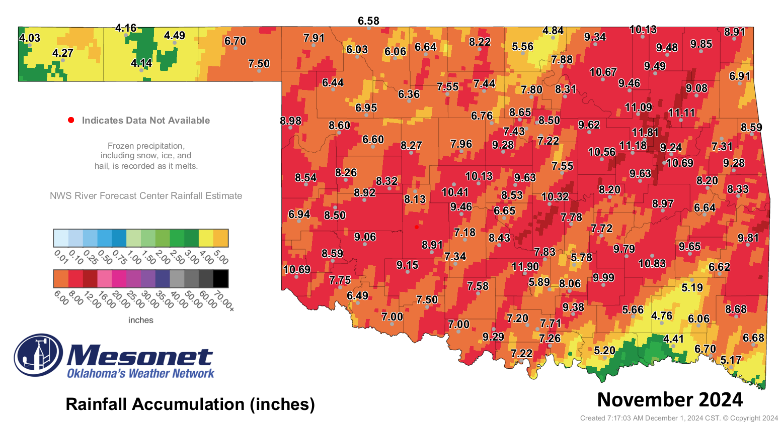
the past year. From Oklahoma's wettest November on record a year ago:
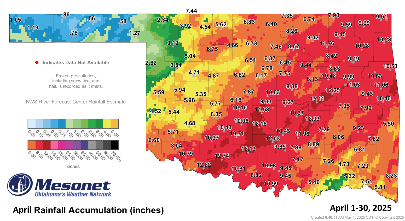
To the wettest April on record just six months ago!
And then all the times in between, like the last 60-to-90 days.
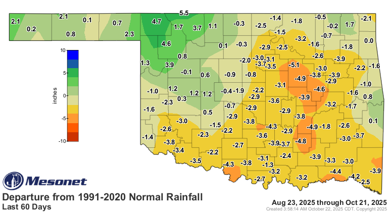
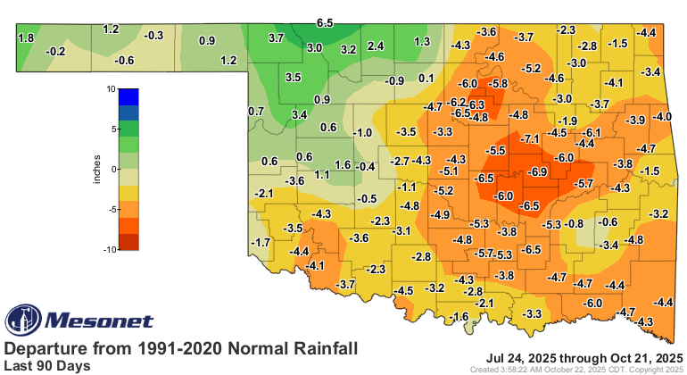
Even those maps portray a strict dichotomy (English to Okie translation: "there's
two durned sides to this thing") between an over-performing atmosphere in NW
OK and an under-performing one elsewhere.
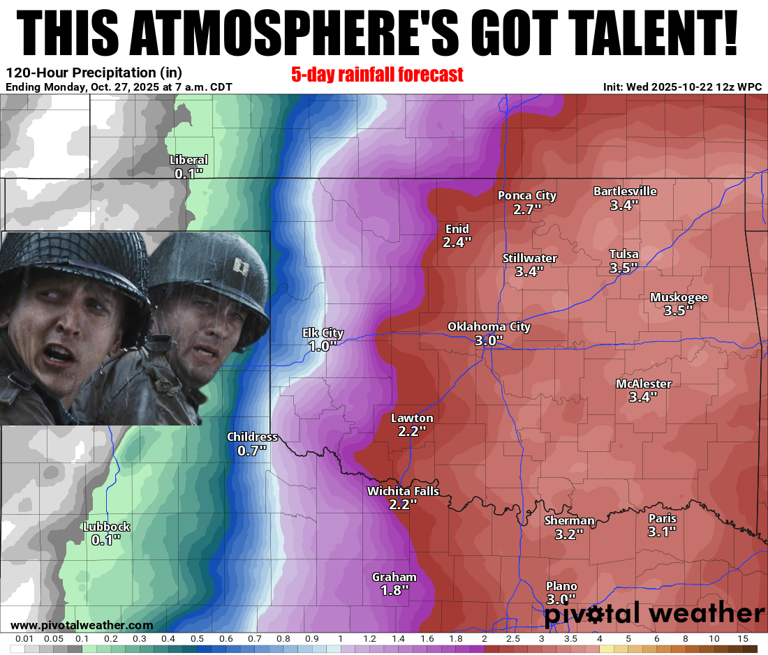
And, of course, the current rainfall forecast, which is overly generous with
its rainfall amounts, actually has to happen.
Of course.
But confidence is growing on a big slow-moving upper-level low pressure system
moving over the state and dumping lots of moisture over much of the eastern
two-thirds of the state.
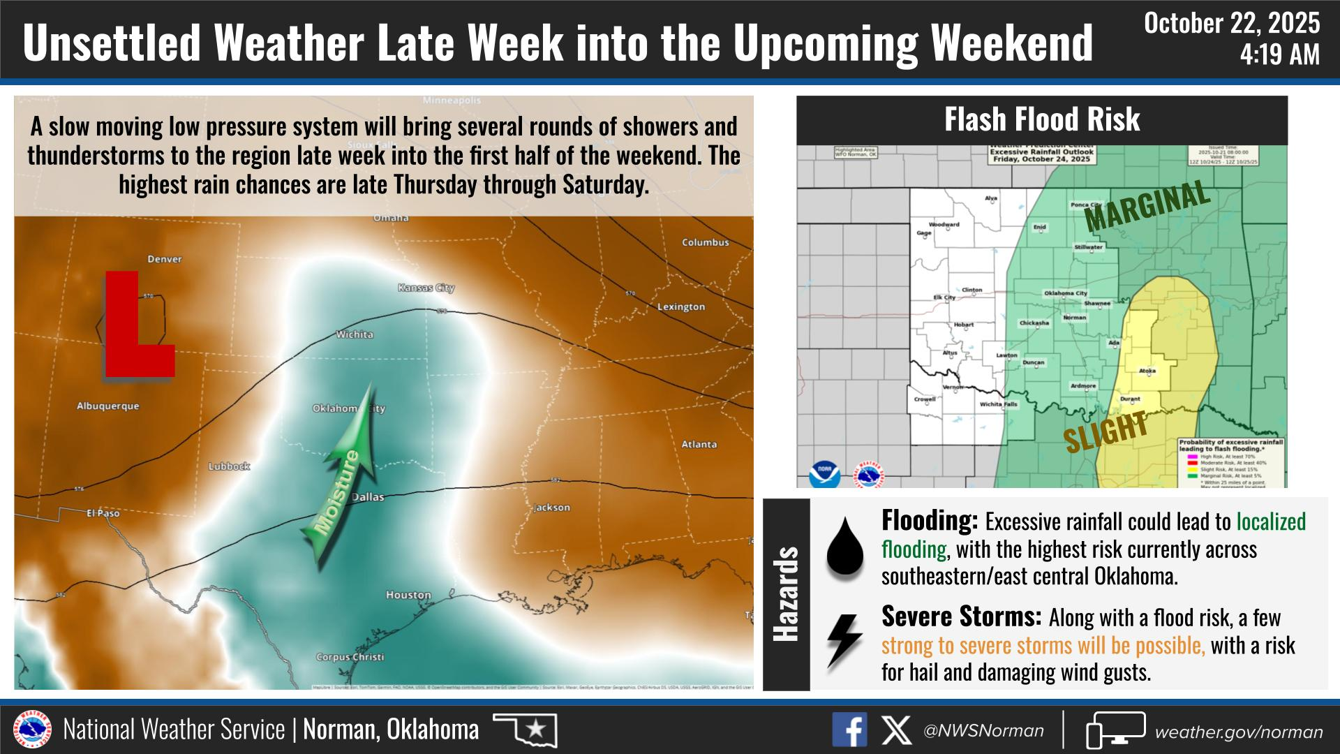
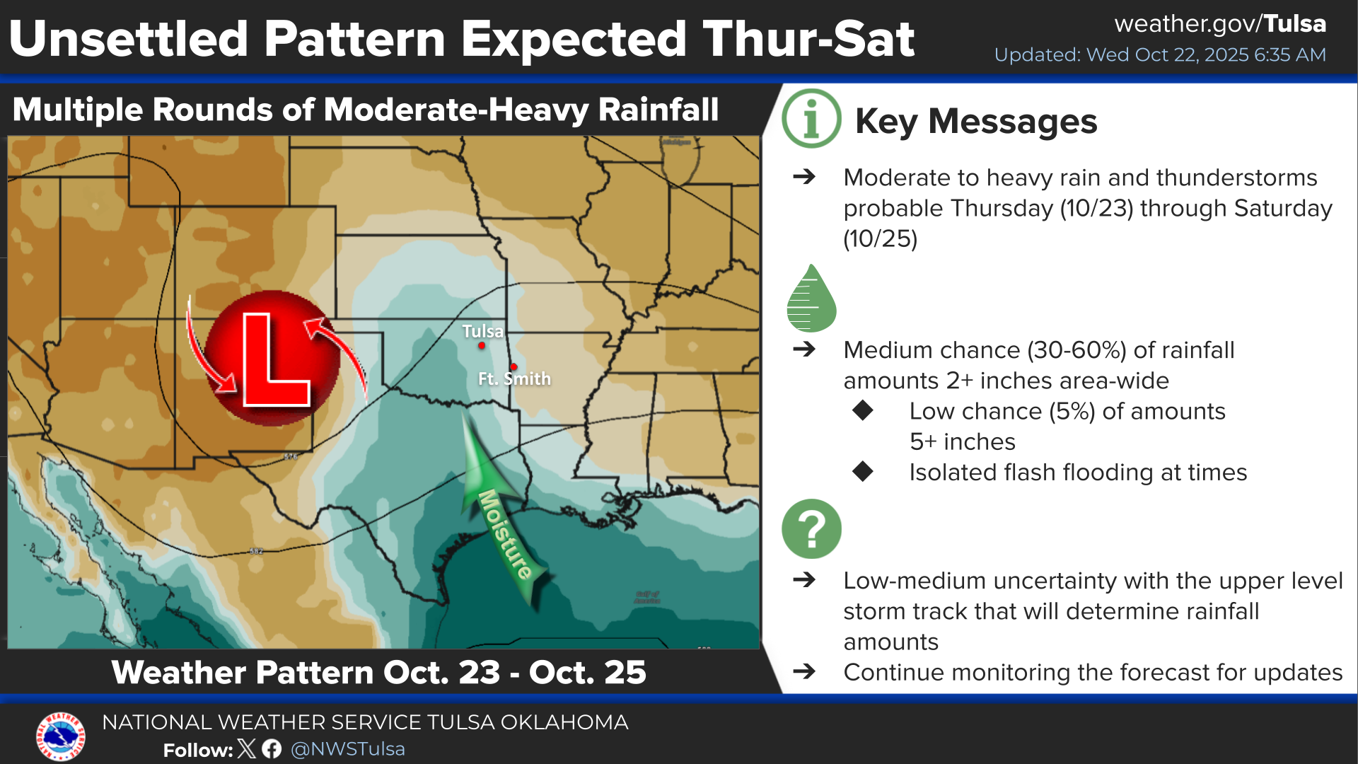
I'm sure you've heard the saying "Cut-off low, weatherperson's woe," right?
When these systems get cut off from steering winds of the jet stream, they can
often wobble and do whatever the heck they want to, so keep that in mind. The
real hope is that some of this spreads a bit farther to the west, especially
to the southwest where they missed out on all that rain NW OK has had.
That's not asking a lot, is it?
Gary McManus
State Climatologist
Oklahoma Mesonet
Oklahoma Climate Survey
gmcmanus@ou.edu
October 22 in Mesonet History
| Record | Value | Station | Year |
|---|---|---|---|
| Maximum Temperature | 96°F | GRA2 | 2022 |
| Minimum Temperature | 22°F | KENT | 2019 |
| Maximum Rainfall | 5.45 inches | TISH | 2015 |
Mesonet records begin in 1994.
Search by Date
If you're a bit off, don't worry, because just like horseshoes, “almost” counts on the Ticker website!