Ticker for October 1, 2025
MESONET TICKER ... MESONET TICKER ... MESONET TICKER ... MESONET TICKER ...
October 1, 2025 October 1, 2025 October 1, 2025 October 1, 2025
Thar she droughts
Hey, that's only the SECOND most frightening thing I've seen this morning...I've
looked in a mirror.
ba-dum DUM!
Tip your servers, I'll he here all night! Well, until I'm done typing, at least.
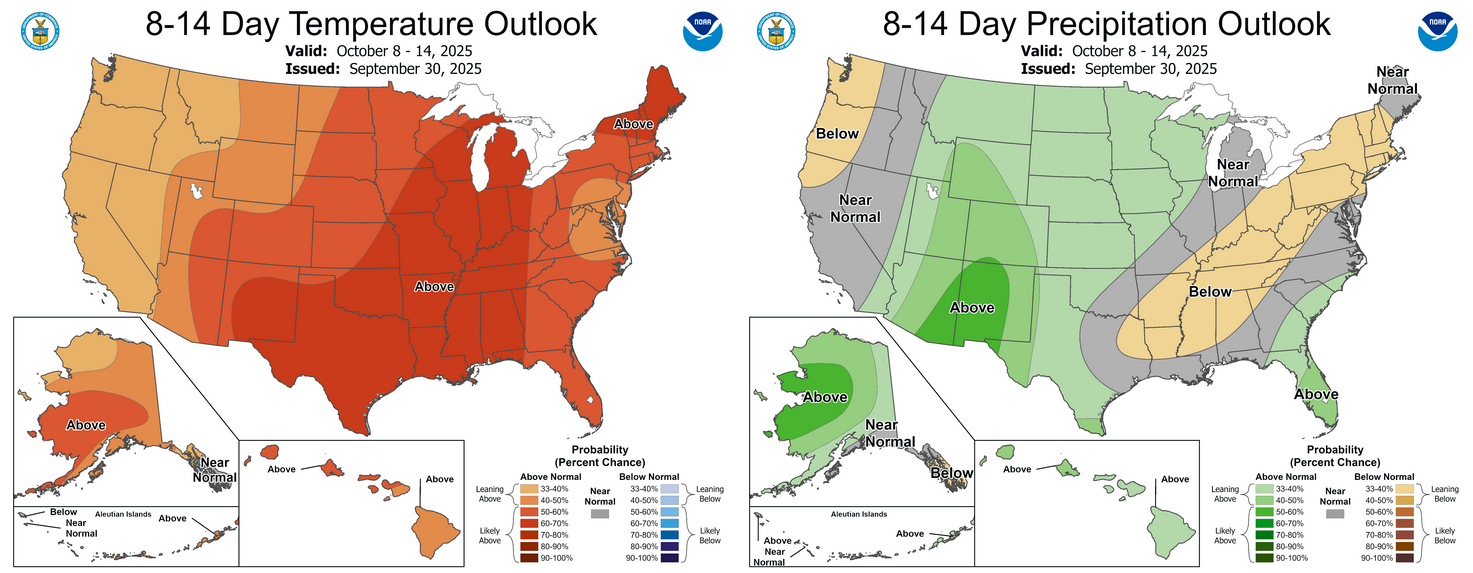
We definitely don't want to see drought flourish in October, but that's what the
outlooks are saying with above-normal temps and below-normal precip favored
for the month. That's no doubt (sorry, Gwen Stefani is down in Tishomingo...it's
just me) being influenced by what we're gonna see for the first 7-14 days of
October, which ain't pretty.
Give it up, I did that joke already!
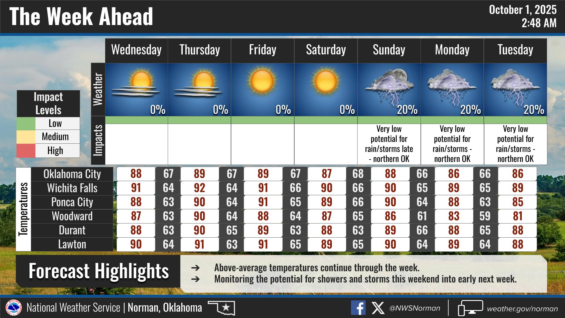
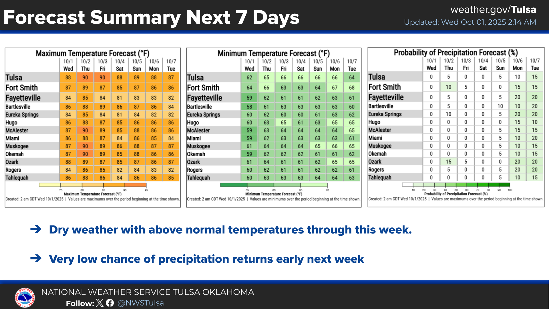
We do see a hint of a possible pattern change for next week...maybe some rain.
But frankly (you can be Frank, I'll be Gary...or better yet, I'll be Frank and
YOU can be Gary...see how YOU like it!), we've been seeing these indications for
awhile now, only to have them pushed forward a few days each time. At this rate,
we'll finally get that big cold front sometime around Halloween!
Hey, did ya know that we never saw a hundred for an actual air temperature on
the Mesonet during September? That's the first time we've seen that since
September 2008. It also occurred in 2003 and 2006, so it's not unheard of,
but uncommon nonetheless (hey, "Uncommon Nonetheless" was my band's name back
when I was in Optometrist's school!). So this is ostensibly your final 100s
count map for the year.
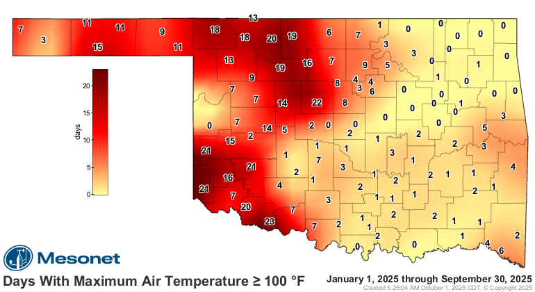
Pretty wimpy if you ask me, and while you didn't, I'm the one typing. Now that
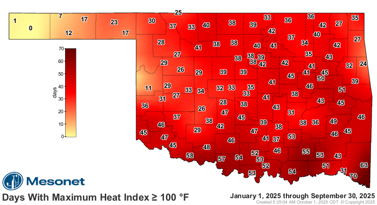
heat index map though...
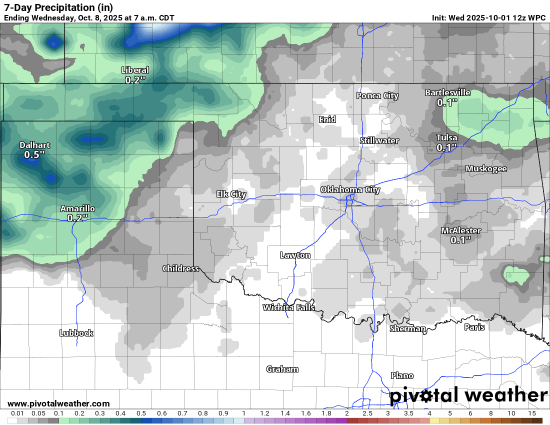
At any rate, our "beautiful" weather continues, but so does our "ugly" weather.
Yes, we need rain. Badly.
Now stick around below and read about our topsy-turvy September.
---------------------------------------------------------------------------------
September sees summer comeback
Oct. 1, 2025
The early taste of fall that delighted many Oklahomans at the end of August
lingered through the first week of September before summer grabbed the remote
control again. Gone were the autumn-like highs in the 60s and 70s, replaced by
the more customary 80s and 90s. Despite that return to normalcy, Mother Nature
couldn’t resist one more twist: for the first time since 2008, the Oklahoma
Mesonet failed to record a single 100-degree temperature during September. The
last triple-digit highs—likely the year’s final—came back on Aug. 28 at several
sites in southwest Oklahoma.
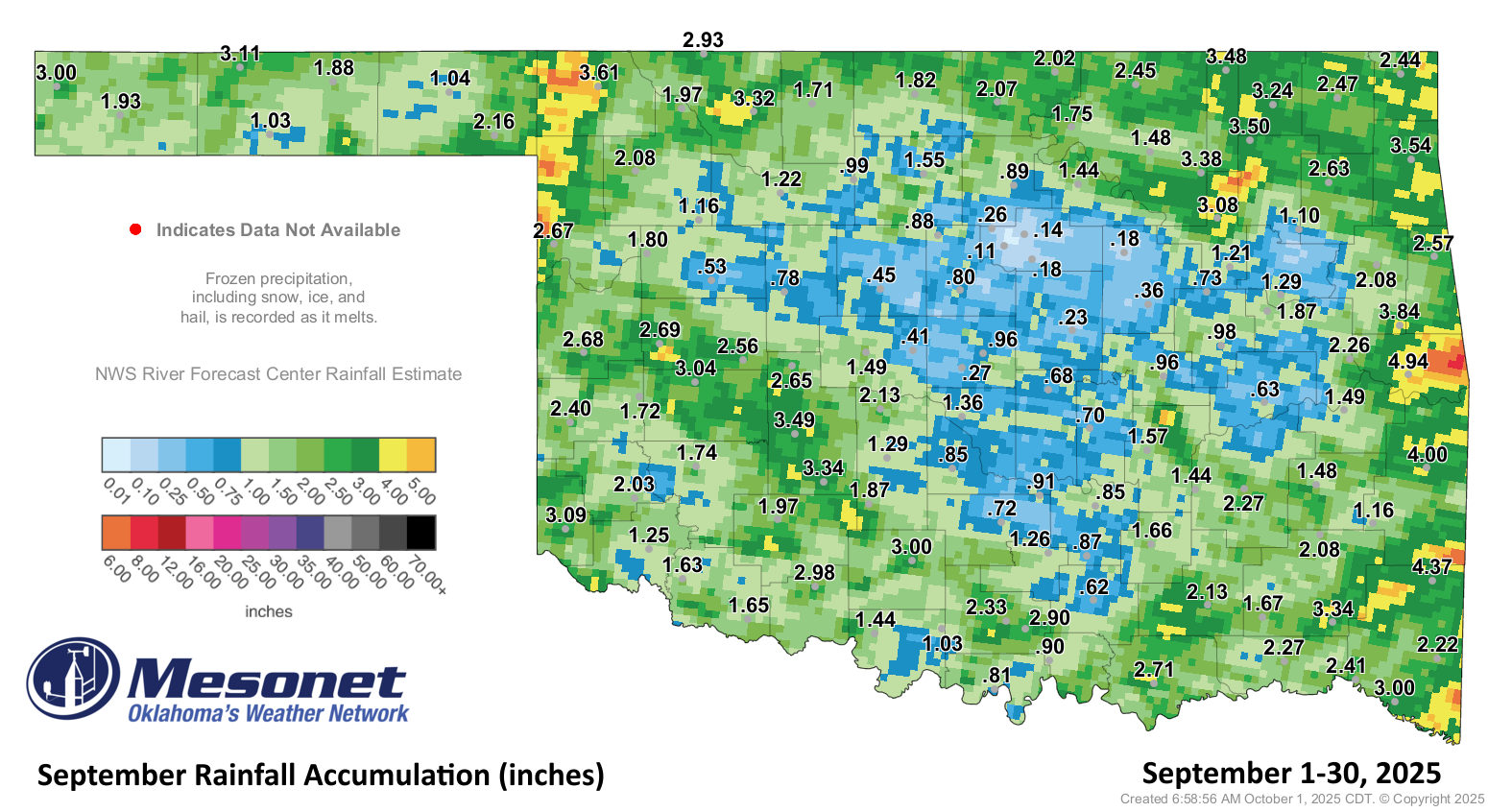
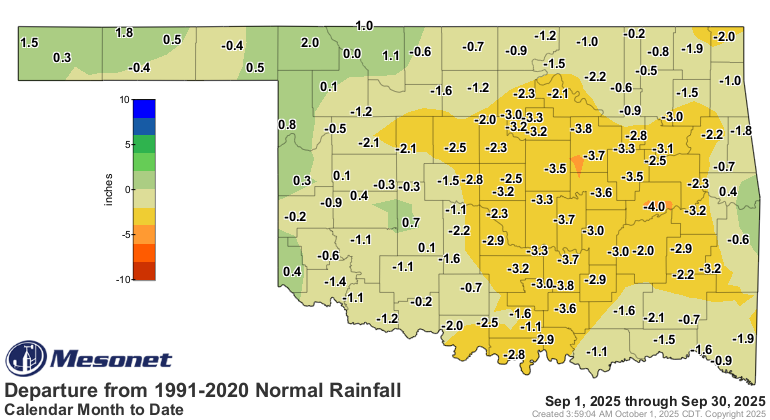
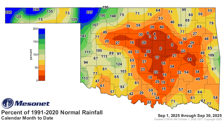
September’s rainfall disappoints
The impressive rains of August failed to carry far into September, leaving
deficits of 2–4 inches common across much of Oklahoma. Far western Oklahoma and
the Panhandle managed surplus amounts, continuing a trend from the previous
month. Statewide, the month finished 1.41 inches below normal with an average
of 1.91 inches, the 27th-driest September since records began in 1895. Central
Oklahoma fared the worst, with an average deficit of 2.87 inches—its
eighth-driest September on record. In contrast, the Panhandle and northwest
Oklahoma enjoyed a surplus of 0.71 inches, ranking as their 42nd-wettest. The
Sallisaw Mesonet site led the state with 4.94 inches, while Marena recorded
only 0.11 inches. Just 21 of the 120 Mesonet sites topped 3 inches, and only
three reached at least 4 inches.
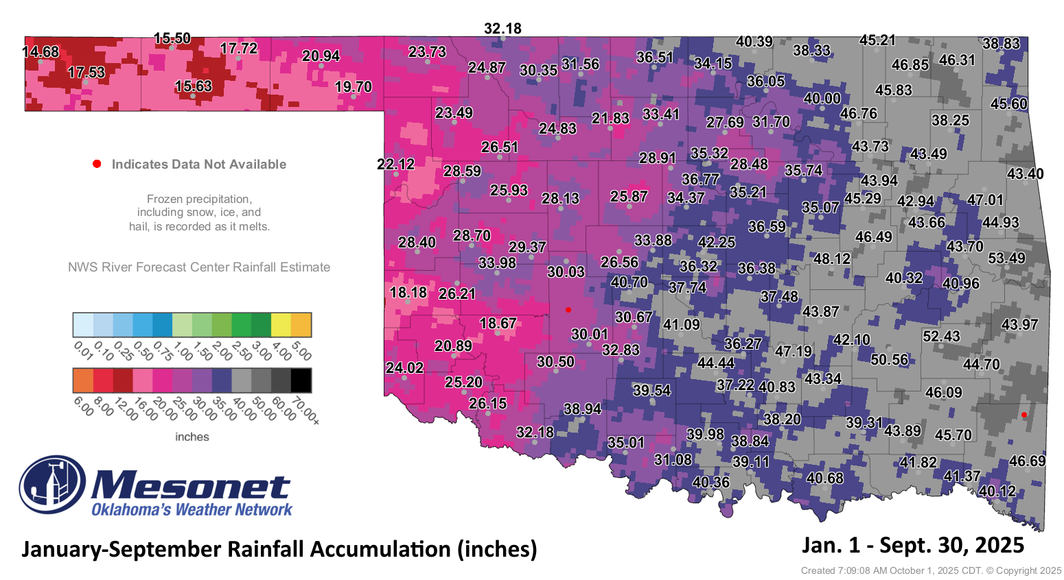
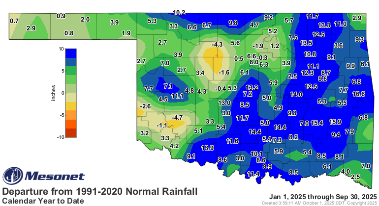
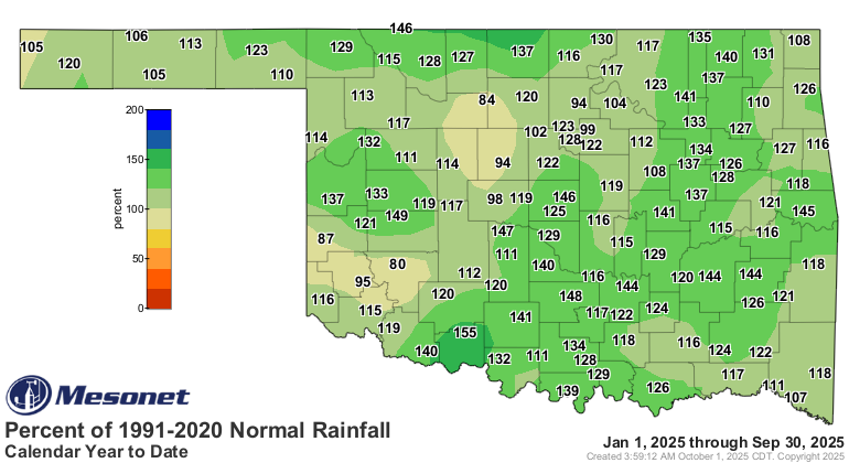
Year-to-date totals remain in positive territory
Despite September’s shortfalls, rainfall for 2025 remains impressive. Much of
the state is still running surpluses of 6–12 inches, thanks to the abundant
rains of spring and summer, including April’s record-setting statewide average
of 8.74 inches. Through the first nine months of the year, the statewide
average stood at 34.15 inches—5.58 inches above normal—ranking as the
11th-wettest January–September on record for Oklahoma. The Sallisaw Mesonet
site led all totals with 53.5 inches, 16.8 inches above normal. Even Kenton,
typically among the driest locations, recorded 14.7 inches—nearly an inch above
its normal.
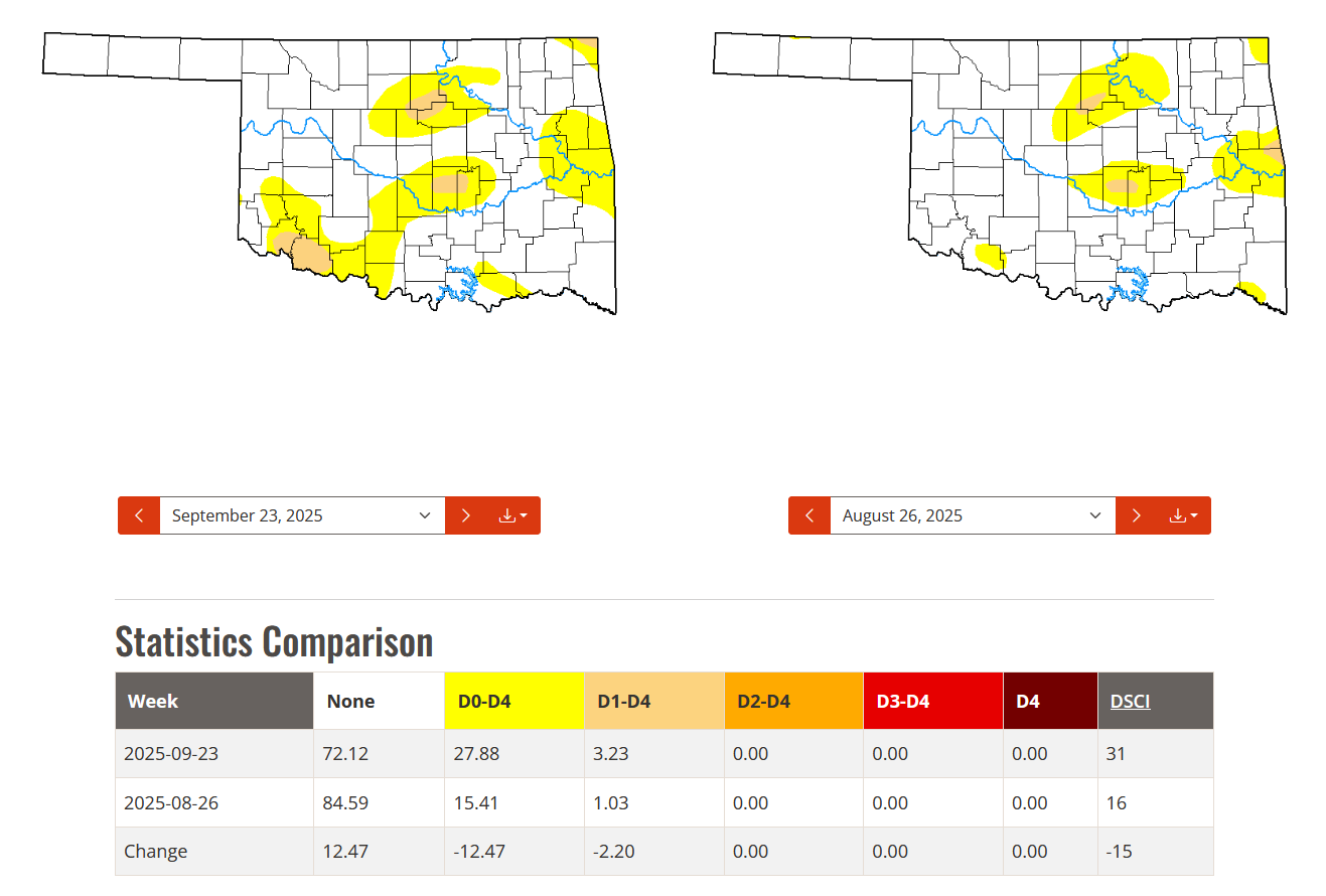
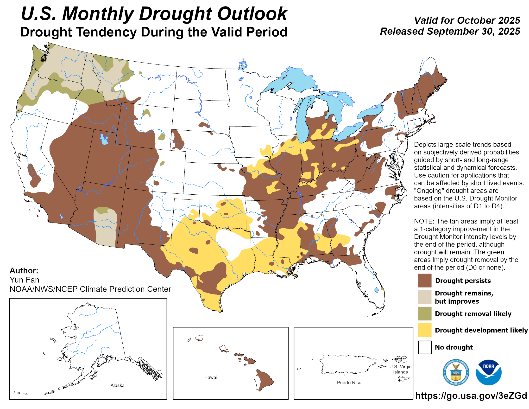
Drought creeps ahead
Long-term moisture surpluses have so far prevented widespread drought expansion
during September’s dry spell, but warning signs are emerging if beneficial
rains do not return soon. By the end of the month, drought coverage on the U.S.
Drought Monitor remained low at 3% of the state, while another 24% was
classified as “abnormally dry,” a precursor to drought on the Monitor’s scale.
Although still limited, the 3% drought coverage was the highest since May 27 of
this year.
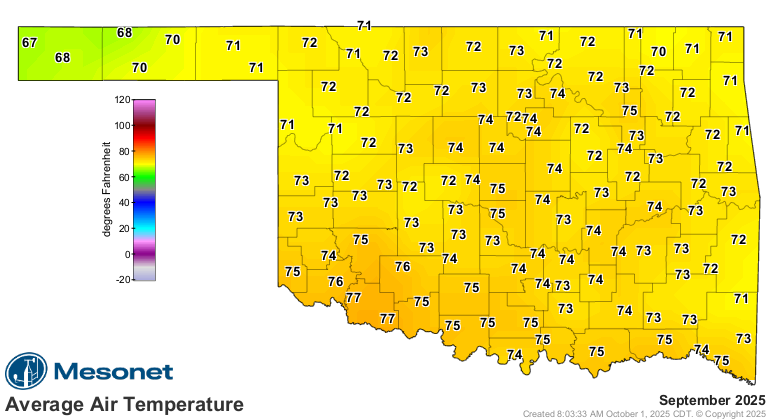
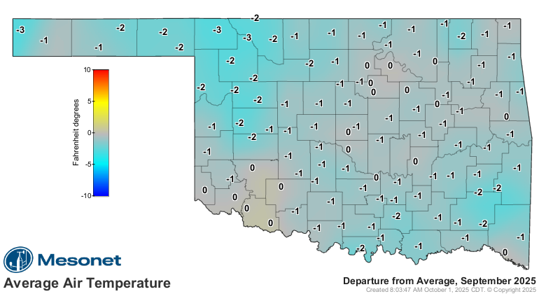
September by the numbers
• Statewide average temperature: 73.8°F, 0.9°F above normal — the 56th-warmest
September since records began in 1895
• Temperature extremes: High of 99°F at Grandfield on Sept. 11 and 12; low of
45°F at Boise City on Sept. 25 and at Eva on Sept. 26; highest heat index,
109°F at Madill on Sept. 23; lowest wind chill, 41°F at Boise City on Sept. 25
• Warmest and coolest locations: Highest monthly average, 78°F at Grandfield;
lowest, 67.9°F at Kenton
• Statewide average precipitation: 1.91 inches, 1.41 inches below normal — the
27th-driest September on record
• Rainfall extremes: High of 4.94 inches at Sallisaw; low of 0.11 inches at
Marena
• Rainfall totals below 2 inches: 70 instances recorded at the 120 Oklahoma
Mesonet sites
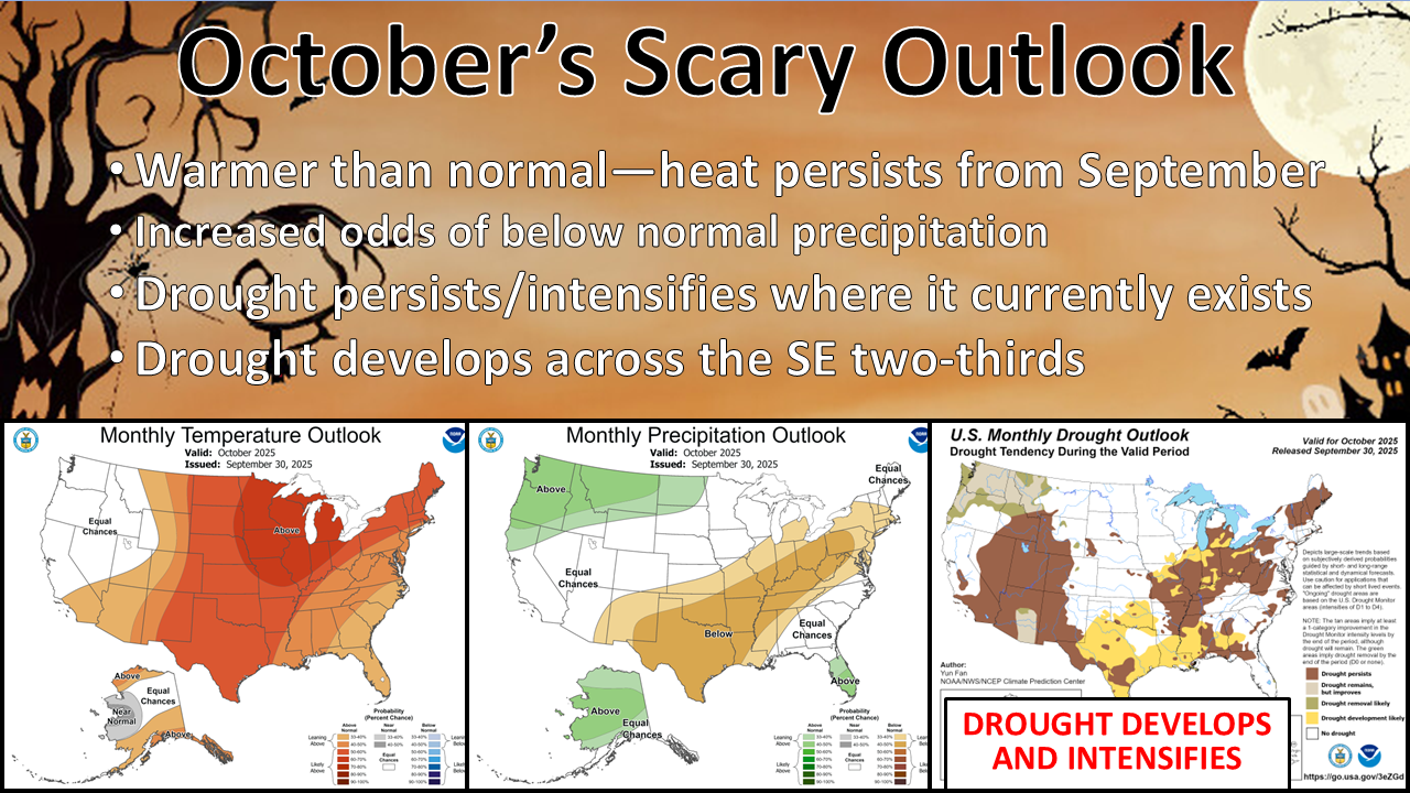
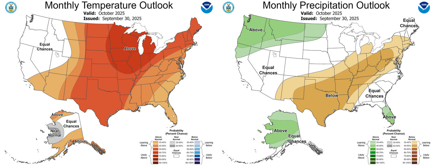
Drought threat builds in October
The Climate Prediction Center’s October outlook indicates increased odds of
above-normal temperatures and below-normal precipitation across the state.
Those odds for below-normal precipitation are slightly lower across the
northwestern quarter of Oklahoma. The CPC’s October drought outlook calls
drought development “likely” across much of the southeastern two-thirds of the
state by the end of the month.
###
Gary McManus
State Climatologist
Oklahoma Mesonet
Oklahoma Climate Survey
gmcmanus@ou.edu
October 1 in Mesonet History
| Record | Value | Station | Year |
|---|---|---|---|
| Maximum Temperature | 99°F | SLAP | 2000 |
| Minimum Temperature | 34°F | KENT | 2009 |
| Maximum Rainfall | 3.52 inches | ERIC | 1998 |
Mesonet records begin in 1994.
Search by Date
If you're a bit off, don't worry, because just like horseshoes, “almost” counts on the Ticker website!