Ticker for July 1, 2025
MESONET TICKER ... MESONET TICKER ... MESONET TICKER ... MESONET TICKER ...
July 1, 2025 July 1, 2025 July 1, 2025 July 1, 2025
June's in the books
I hate fireworks. There, I said it. It feels good to come clean (hey, I shower
monthly!). Ya see, July 4th, also known as "Independence Day," is also my
birthday. And what do ya think I got for my birthday, almost invariably, as a
kid growing up?
If you guessed a camel dressed as a butler, well...you're wrong, and also maybe
a bit disturbed.
No...fireworks. My other friends would get a Big Wheel, maybe. A BB gun. A
bicycle. Me, I got fireworks a lot of the time. What kid wouldn't want fireworks,
after all?
Here's the deal, though. Who wants a birthday present that's gone in an hour?
I mean, after you've blown up all your little plastic army men, scared the cat,
and started a few grass fires, where's the fun after that?
What would I like now? I hairbrush, and a reason to use it!
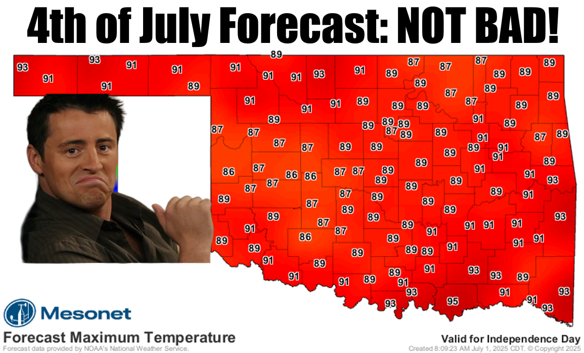
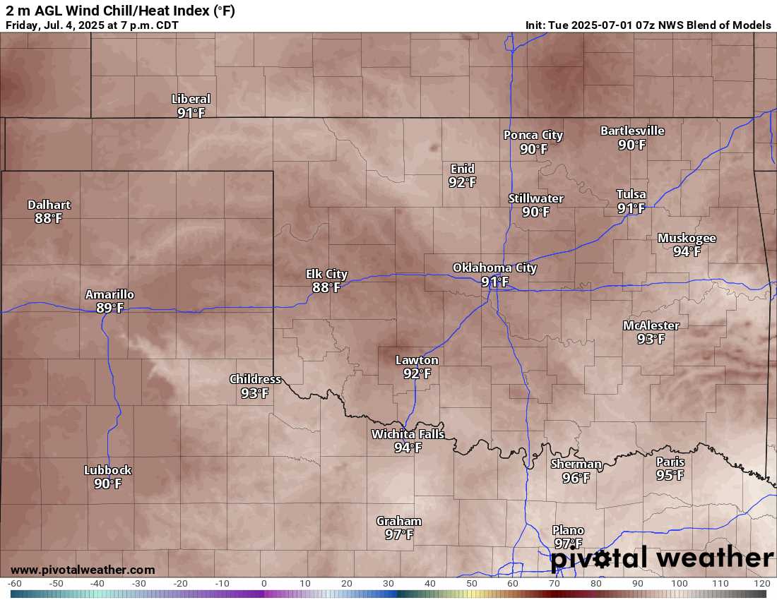
Ya know what else I usually got on July 4th? Hot. Really hot. So this coming
Friday will be a gift with highs in the 80s, mostly. There will be some steam
to go with it, and heat index values will creep up into the 90s, but that's okay
too.
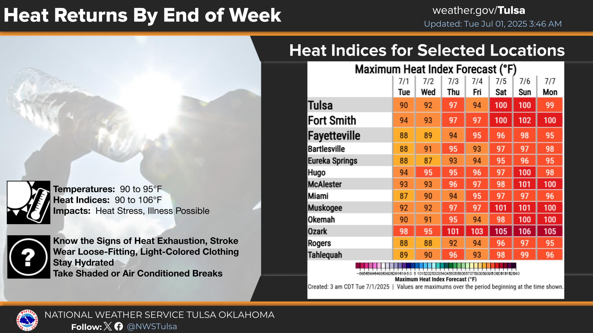
But all this week, not bad. Not bad at all. Next week...not as not bad, but it
still could be worse.
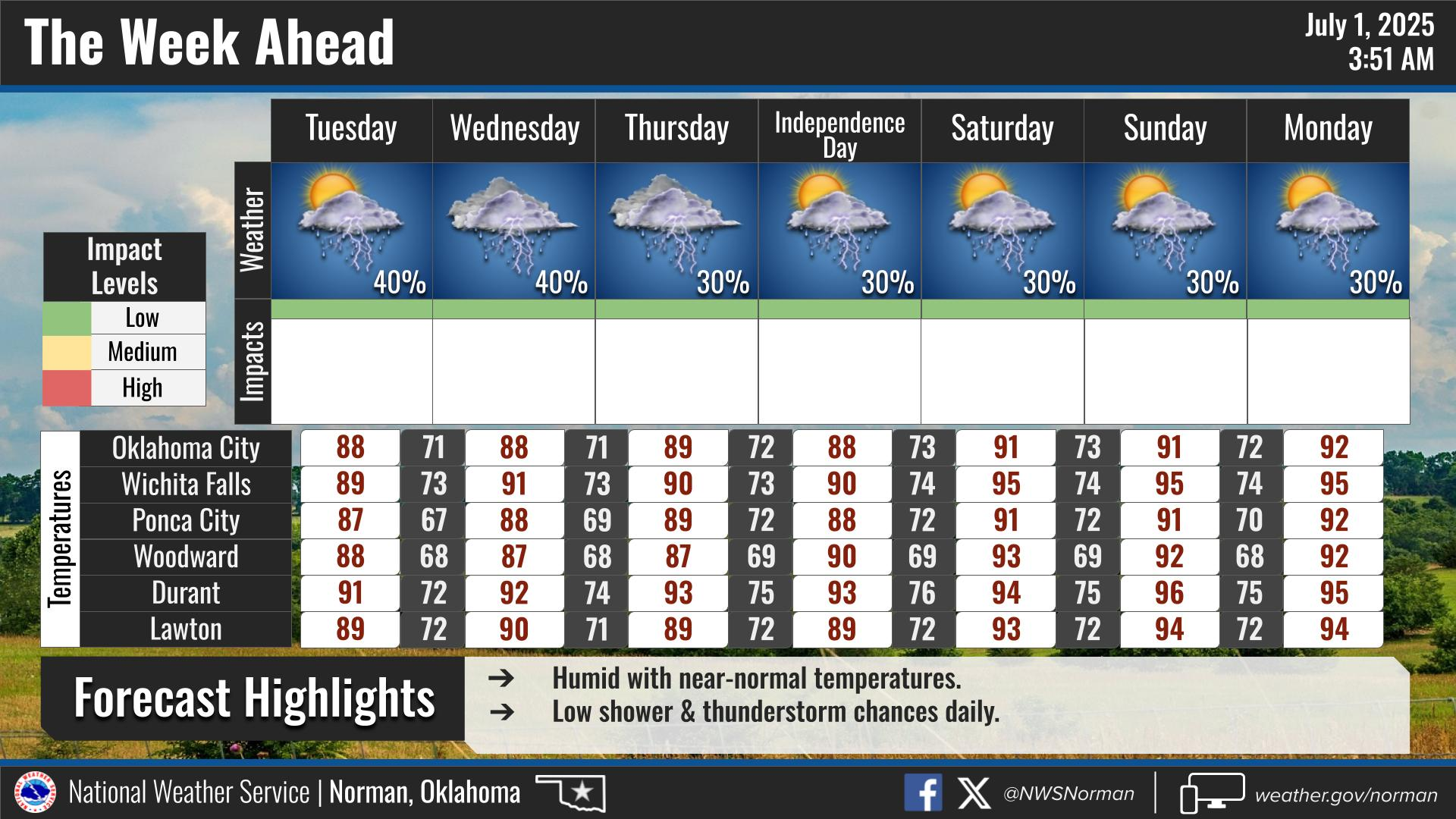
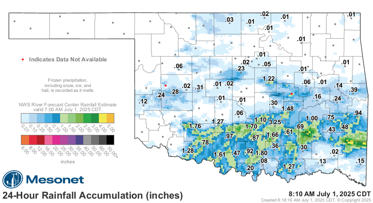
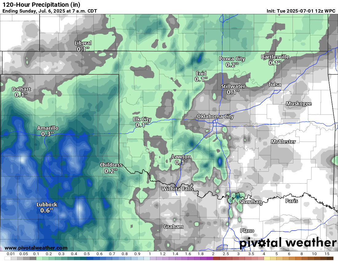
It does look like the rain will calm down just a bit. It got out of hand last
night. Again. There will be rain chances, but nothing on the too-heavy side,
at least the way it looks now.
So to sum up, not too bad (except for fireworks!).
How about June? Well, not shockingly, it was a bit shocking. Keep scrolling for
our June recap.
---------------------------------------------------------------------------------
June Rains End Drought in Oklahoma
July 1, 2025
Oklahoma’s big weather stories this spring overwhelmingly involved tornadoes
and heavy rains — and June was no exception. The month finished as the sixth-
wettest June on record, at 7.22 inches, nearly 3 inches above normal. The
preliminary tornado count swelled to 25, the second-highest for the month
on record. But there was at least one silver lining to all that active weather:
June saw drought completely eliminated from Oklahoma for the first time in
nearly six years.
2025 Tornado Count Continues to Rise
At least 25 tornadoes were confirmed across Oklahoma in June, and that number
may increase as National Weather Service (NWS) personnel continue their damage
surveys. That total is just three shy of the record of 28 from June 1995, with
accurate data available since 1950. The preliminary total for January through
June now stands at 86, far eclipsing the state’s long-term annual average of
58.8 from 1950 to 2024. The January–June average is 49.
Eighteen of the 25 tornadoes in May were rated EF0 or EF1 on the Enhanced
Fujita scale — the weakest categories, but damaging nonetheless. Another six
tornadoes were of “unknown” intensity, as they produced no damage to structures
or other indicators that would allow for a rating. McAlester was struck by an
EF1 early in the morning of June 7. The twister, in combination with straight-
line winds of 85–95 mph, badly damaged some brick buildings in the downtown
area. The storm damaged many other homes and businesses and also downed trees
and power lines. The strongest tornado of the month was an EF2 that touched
down in Ellis County near Arnett, traveling 12 miles into Roger Mills County
and reaching a width of at least 500 yards at times.
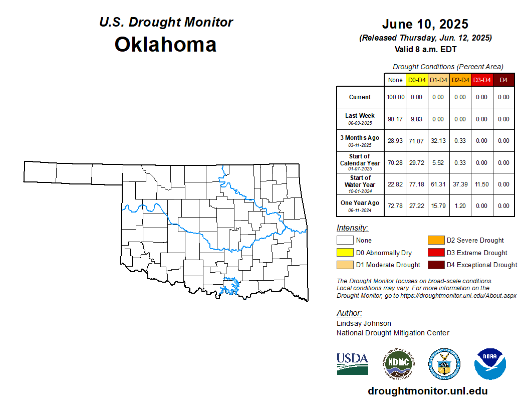
Drought Impacts Evaporate
The U.S. Drought Monitor noted that no drought — classified as D1 through D4 on
its intensity scale — existed in Oklahoma as of June 3. That was the first time
the state had been free of drought since July 23, 2019. The following week, all
abnormally dry conditions, or D0 on the scale, were also eliminated — a
milestone last achieved on June 25, 2019.
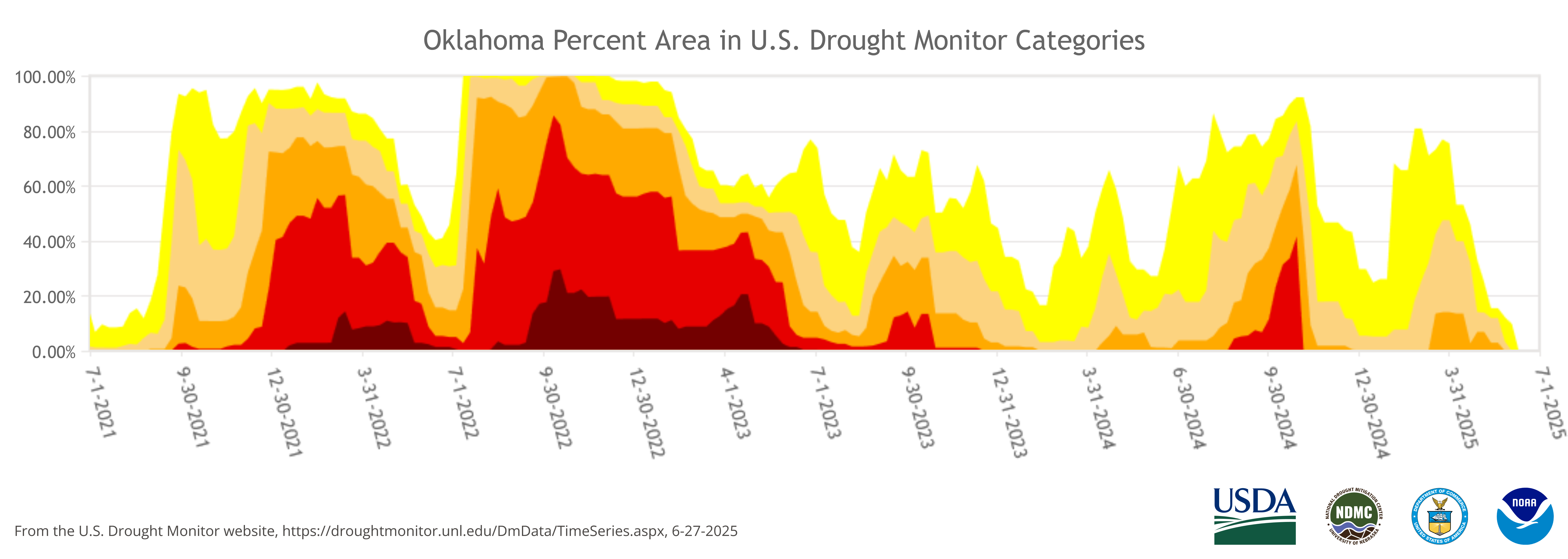
This marks the end of a drought episode that began in August 2021. The nearly
four-year-long hazard peaked on Oct. 1, 2022, when 86% of the state was in at
least extreme drought (D3), and 29% was classified under the most severe
category, exceptional drought (D4). At that time, 100% of the state was
experiencing at least moderate drought. The Drought Monitor’s intensity scale
ranges from moderate to exceptional: D1 (moderate), D2 (severe), D3 (extreme),
and D4 (exceptional).
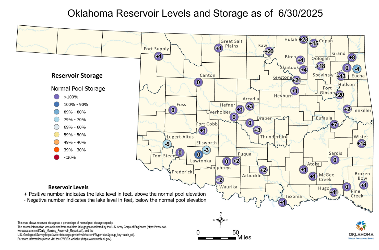
The prodigious rains added to the record totals of April and the heavy rains of
May, swelling Oklahoma’s lakes, rivers, and farm ponds. Some reservoirs
reported levels more than 20 feet above the conservation pool. Even the
seemingly perpetual rain-starved lakes of southwest Oklahoma were approaching
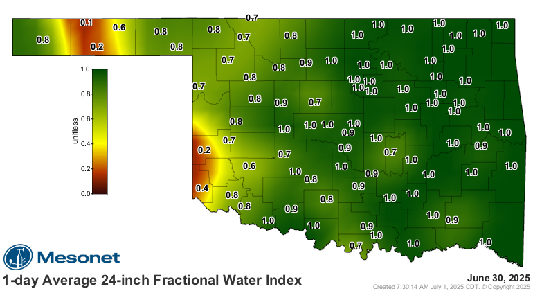
normal levels as summer began. The Oklahoma Mesonet’s soil moisture sensors
reported near-saturated conditions in the top two feet of soil across most of
the state, although values were a bit lower in far western Oklahoma. A few
sites in the Panhandle and far southwest remained on the dry side of the scale
by the month’s end.
June by the Numbers
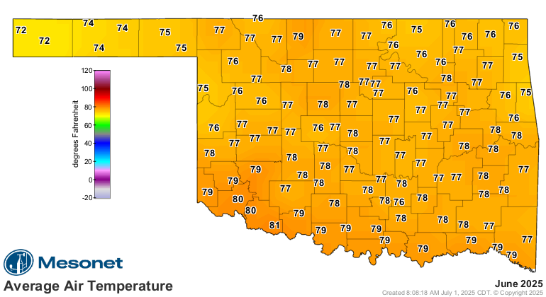
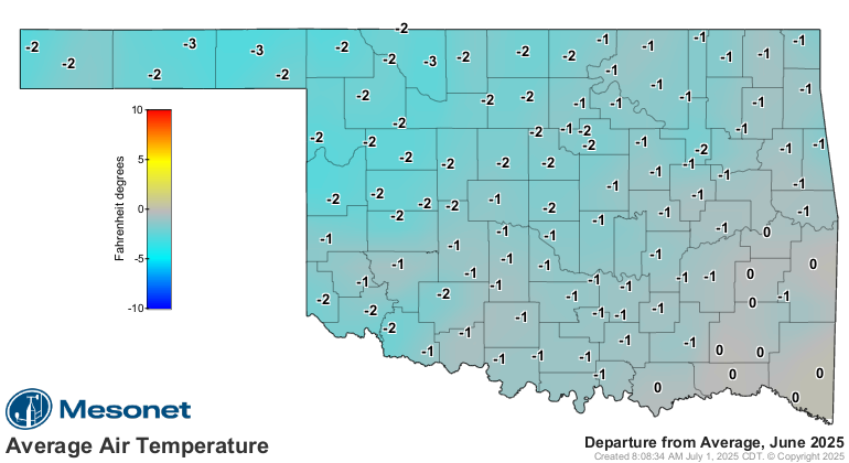
- Statewide average temperature: 77.6°F, or 0.3°F above normal — the 48th-
warmest June since records began in 1895
- Temperature extremes: High of 101°F at Buffalo, Cherokee, and Freedom on June
29; low of 43°F at Eva on June 4
- Warmest/Coolest locations: Highest monthly average temperature, 81.2°F at
Grandfield; lowest, 72.3°F at Kenton
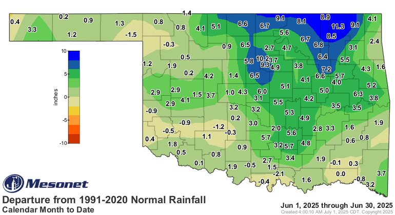
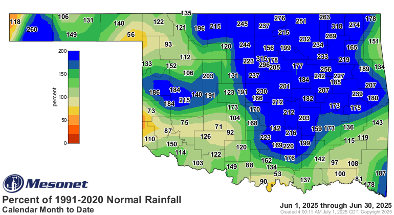
- Statewide average precipitation: 7.15 inches, or 2.89 inches above normal —
the eighth-wettest June on record
- Rainfall extremes: High of 14.8 inches at Lake Carl Blackwell; low of 1.77
inches at Kenton
- Rainfall totals greater than 5 inches: 80 instances recorded at the 119
Oklahoma Mesonet sites, including 20 above 10 inches

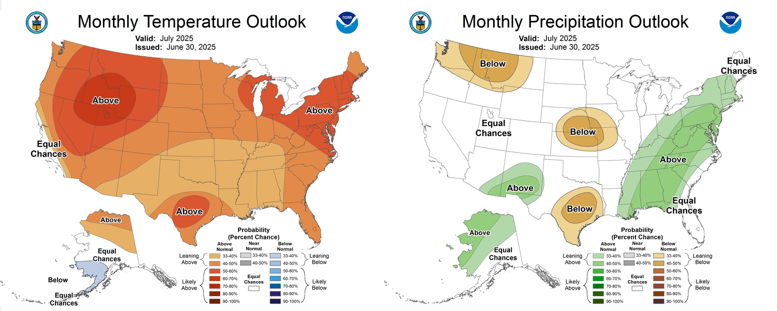
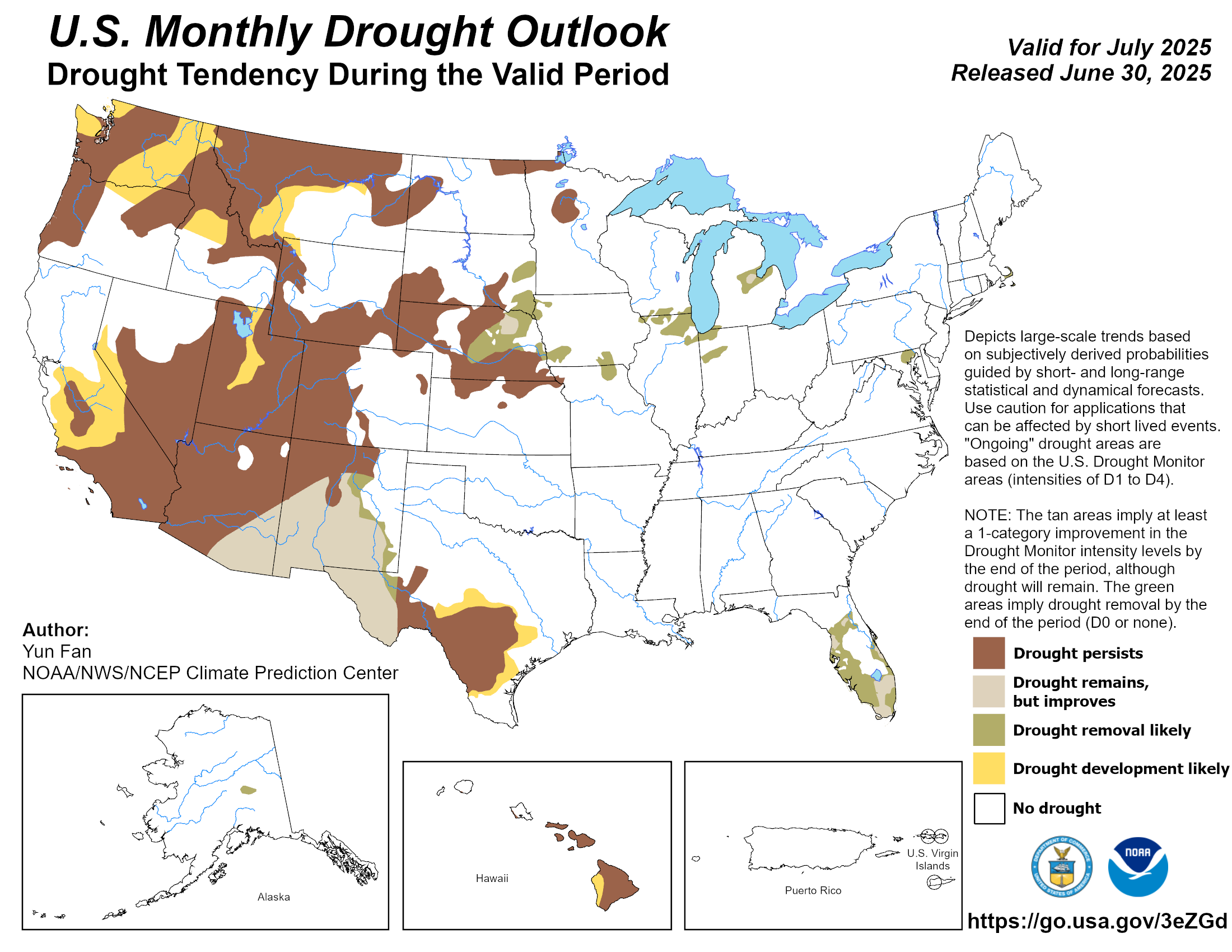
Drought Development Unlikely During July
The Climate Prediction Center’s (CPC) outlook for July shows slightly increased
odds of above-normal temperatures across all of Oklahoma, with equal chances of
above-, near-, or below-normal precipitation. The CPC’s July drought outlook
projects no new drought development through the end of the month.
###
Gary McManus
State Climatologist
Oklahoma Mesonet
Oklahoma Climate Survey
gmcmanus@ou.edu
July 1 in Mesonet History
| Record | Value | Station | Year |
|---|---|---|---|
| Maximum Temperature | 110°F | ALVA | 1997 |
| Minimum Temperature | 50°F | EVAX | 2017 |
| Maximum Rainfall | 5.82 inches | PAWN | 2016 |
Mesonet records begin in 1994.
Search by Date
If you're a bit off, don't worry, because just like horseshoes, “almost” counts on the Ticker website!