Ticker for June 25, 2025
MESONET TICKER ... MESONET TICKER ... MESONET TICKER ... MESONET TICKER ...
June 25, 2025 June 25, 2025 June 25, 2025 June 25, 2025
Mon-Sooner
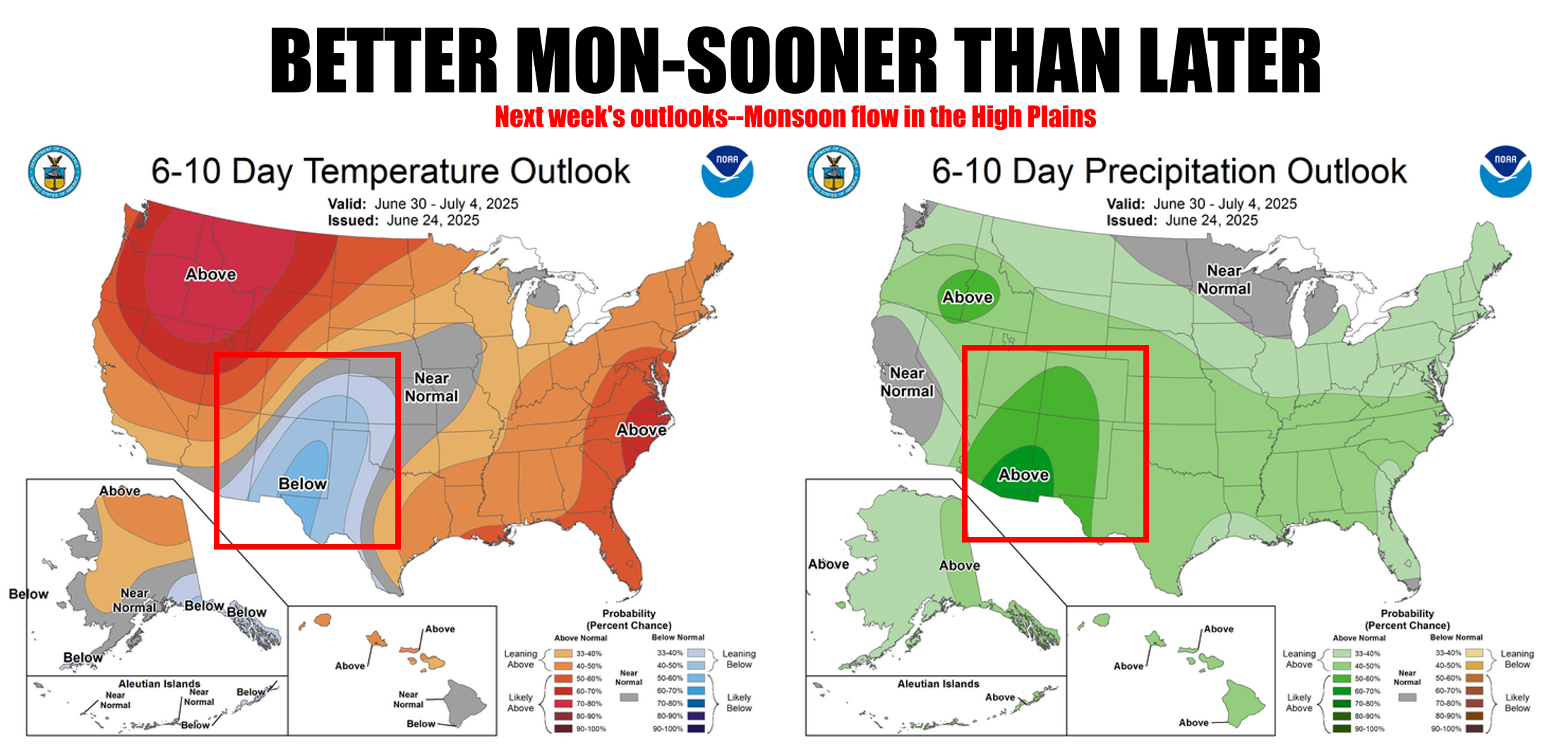
Hey Cowboys (the OSU variety) fans, don't get mad at me! I didn't name the
seasonal weather phenomenon that brings increased thunderstorm and rainfall
activity to the Southwestern United States and northwestern Mexico during the
summer months.
Pretty sure it wasn't a Sooner, either. I mean, whomever named it had to come
up with something. Whatever the case, we'll be glad to get a break from the
leftovers our High Plains friends in far western OK and the Panhandle get every
summer with this increased moisture flow from the Gulf of California and eastern
Pacific start getting in late-June through August. Well, a little bit of it, at
least, because the heat is on for awhile.


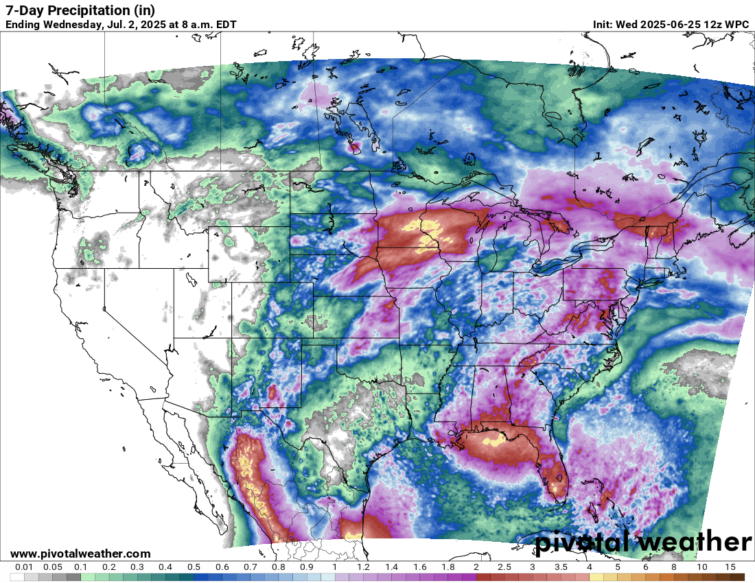
But, you can see the relief at the end of the next 7 days, around Tuesday and
possibly lasting through the 4th of July holiday.
It's an interesting thing, the monsoon. The a seasonal weather shift that
brings much-needed moisture and rain to normally dry areas like Arizona and New
Mexico during the summer. As the land heats up, it pulls in warm, moist air
from places like the Gulf of California, the Pacific Ocean, and even the Gulf
of Mexico. That moist air gets pushed up over mountains and into higher ground,
where the rising motion and intense summer heat help create afternoon
thunderstorms. These storms can bring heavy rain, lightning, strong winds, and
flash flooding, often popping up suddenly and dying out just as fast. It's
nature’s way of temporarily flipping the switch from dry to stormy in the
desert.
And we all know just how painful that can be.
So for places like Boise City, Guymon, Goodwell, and even far western OK sites
like Buffalo and Laverne, see rainfall peak or increase in the latter parts of
June through August. And the proportion of their average annual total rainfall
that they receive percentage-wise also peaks in July and August.


A weak front will help central and eastern Oklahoma next week, so maybe all can
enjoy a bit more mild, wet weather.
We'll take it.
Gary McManus
State Climatologist
Oklahoma Mesonet
Oklahoma Climate Survey
gmcmanus@ou.edu
June 25 in Mesonet History
| Record | Value | Station | Year |
|---|---|---|---|
| Maximum Temperature | 111°F | ERIC | 2011 |
| Minimum Temperature | 50°F | KENT | 2018 |
| Maximum Rainfall | 4.11 inches | WAUR | 1999 |
Mesonet records begin in 1994.
Search by Date
If you're a bit off, don't worry, because just like horseshoes, “almost” counts on the Ticker website!