Ticker for May 14, 2025
MESONET TICKER ... MESONET TICKER ... MESONET TICKER ... MESONET TICKER ...
May 14, 2025 May 14, 2025 May 14, 2025 May 14, 2025
Return of the Heat
Gary the Scorched, Lord of the High Plains, mounted atop Doppler the Mighty:
Arise, arise, Riders of the Mesonet!
Thermostats shall tremble! Pavement shall sizzle!
A flame-day… a red day… ere the dewpoint dies!
Ride now! Ride now! Ride! Ride for shade and the world’s air conditioning!
(The townsfolk roar in defiance: HEAT! HEAT! HEAT!)
Gary the Scorched (raising staff and NOAA-issued sunglasses):
Forth, Eorlingas of the Southern Plains! Let the asphalt boil beneath your
sandals!
Ummm, no, YOU'RE a nerd! Can't everybody re-cast the Charge of the Rohirrim from
"Lord of the Rings" into modern-day Oklahoma?
I love Brian Piccolo...errrr, Lord of the Rings. But I don't necessarily want to
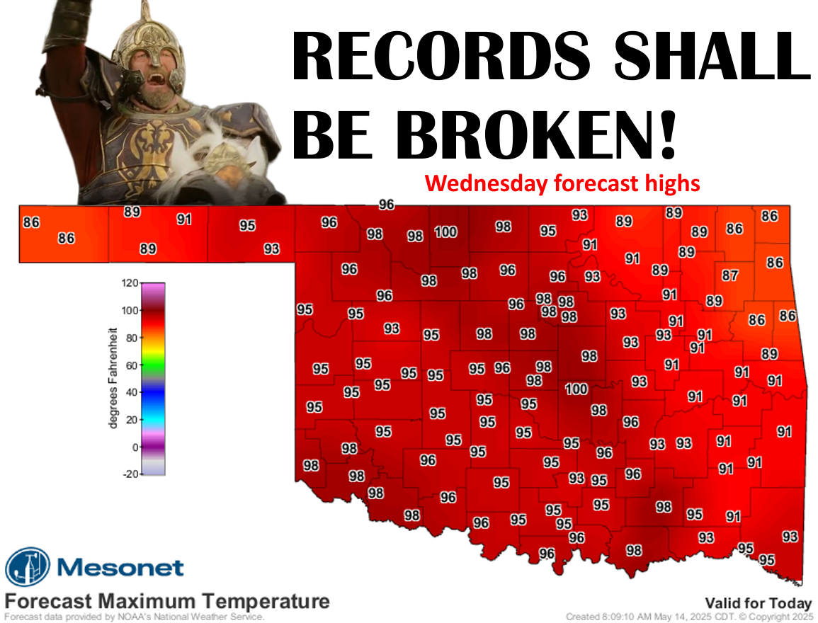
feel like we're in Mordor (okay, I'M the nerd) today. These are the temps we're
shooting for to break some record highs.
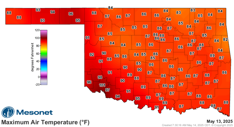
Looks pretty darned doable to me. I mean, we definitely hit some yesterday,
including a 101F in Altus that broke their record high. In fact (now WHY would
I just make things up??), that 101 in Altus tied for the highest temperature
ever recorded on a May 13 in Oklahoma, dating back to the 1880s!
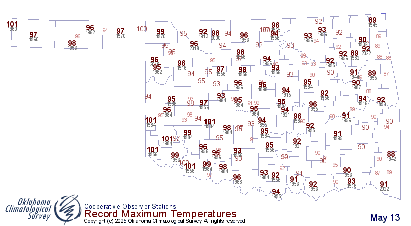
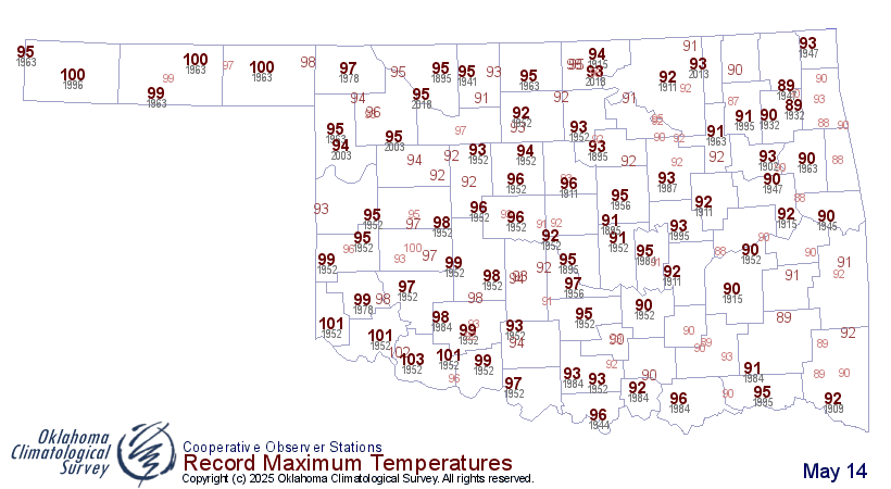
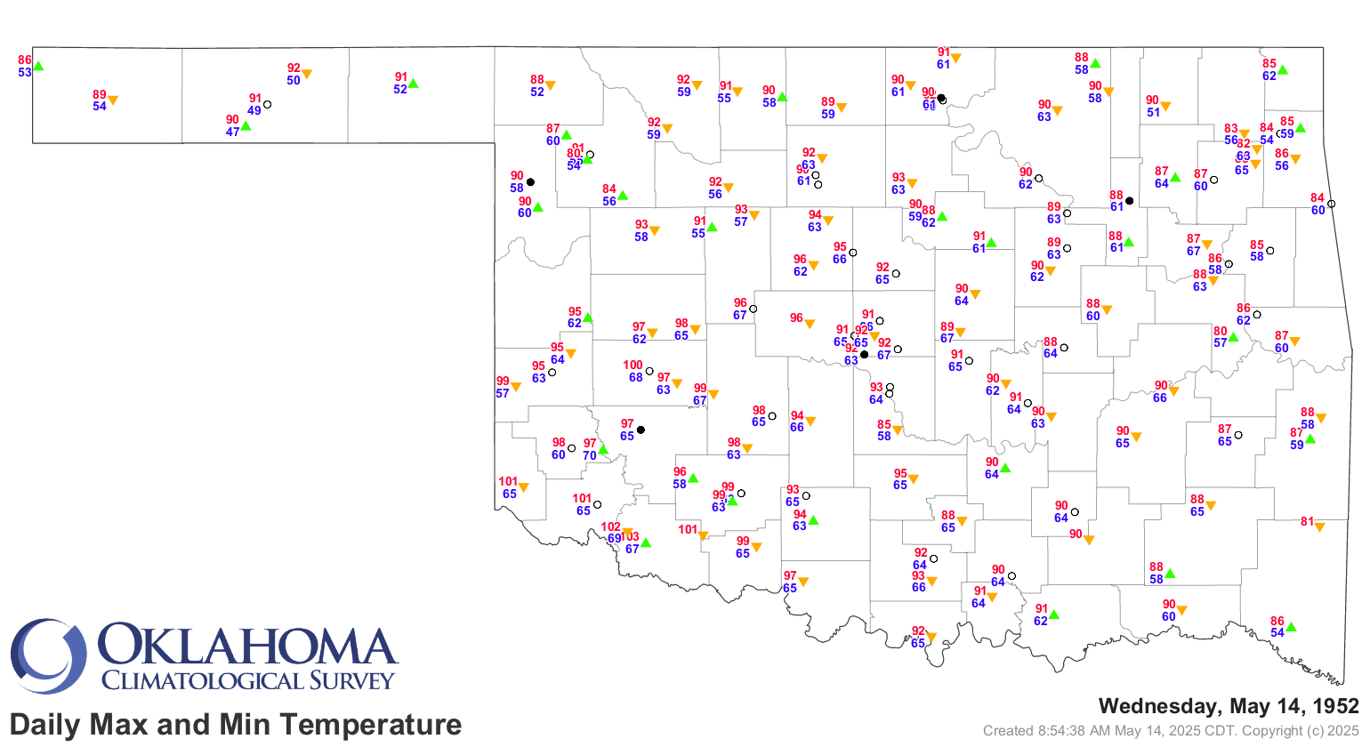
No, YOU make things up! Forget, we've done that already. So the highest all-time
May 14 temperature in Oklahoma is 103 at Frederick in 1952. In fact (again),
May 14, 1952, appears to have been rather toasty around these and those parts.
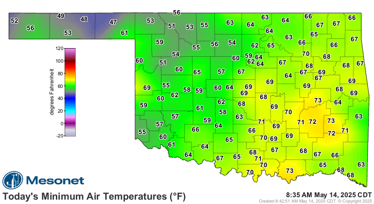
As for this morning, when you start seeing lows staying above 70F, you know
things are getting serious.
Summer is upon you, whether you risk it or not! For one more day. Then, back
to springy type weather. We'll see chances for storms in SE OK for the next few
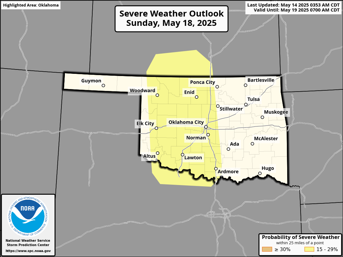
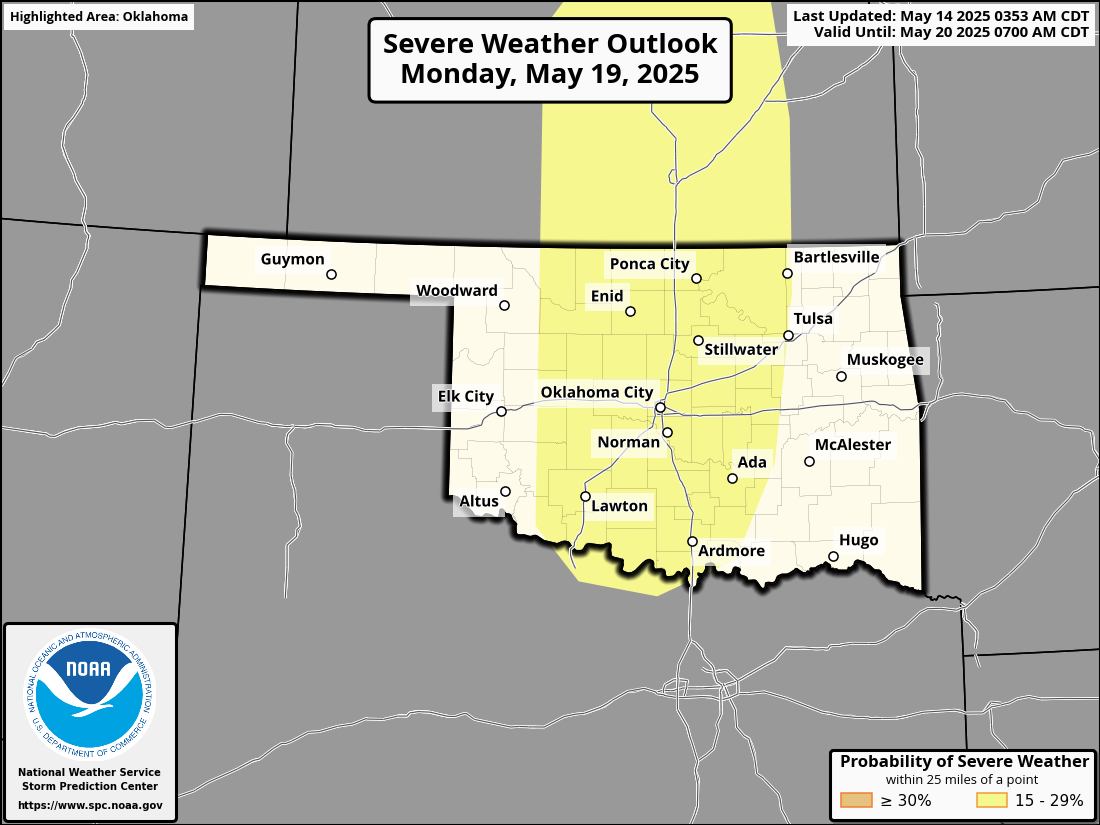
days, some strong to severe storms are possible. But the big severe weather days
appear to be Sunday and Monday, where SPC has already put their yellow magic
markers on the risk maps for those days.
Springtime in Oklahoma, right? Well, except for today.
Gary McManus
State Climatologist
Oklahoma Mesonet
Oklahoma Climate Survey
gmcmanus@ou.edu
May 14 in Mesonet History
| Record | Value | Station | Year |
|---|---|---|---|
| Maximum Temperature | 99°F | ALV2 | 2018 |
| Minimum Temperature | 30°F | HOOK | 2004 |
| Maximum Rainfall | 3.44 inches | CLOU | 2003 |
Mesonet records begin in 1994.
Search by Date
If you're a bit off, don't worry, because just like horseshoes, “almost” counts on the Ticker website!