Ticker for March 25, 2025
MESONET TICKER ... MESONET TICKER ... MESONET TICKER ... MESONET TICKER ...
March 25, 2025 March 25, 2025 March 25, 2025 March 25, 2025
Thanksgiving coming up!
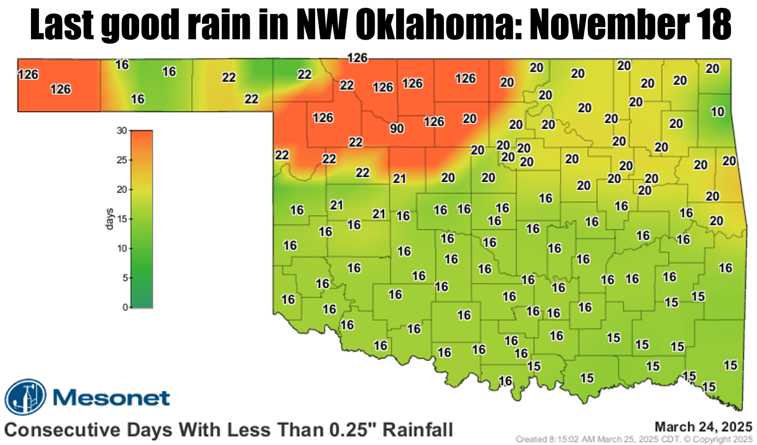
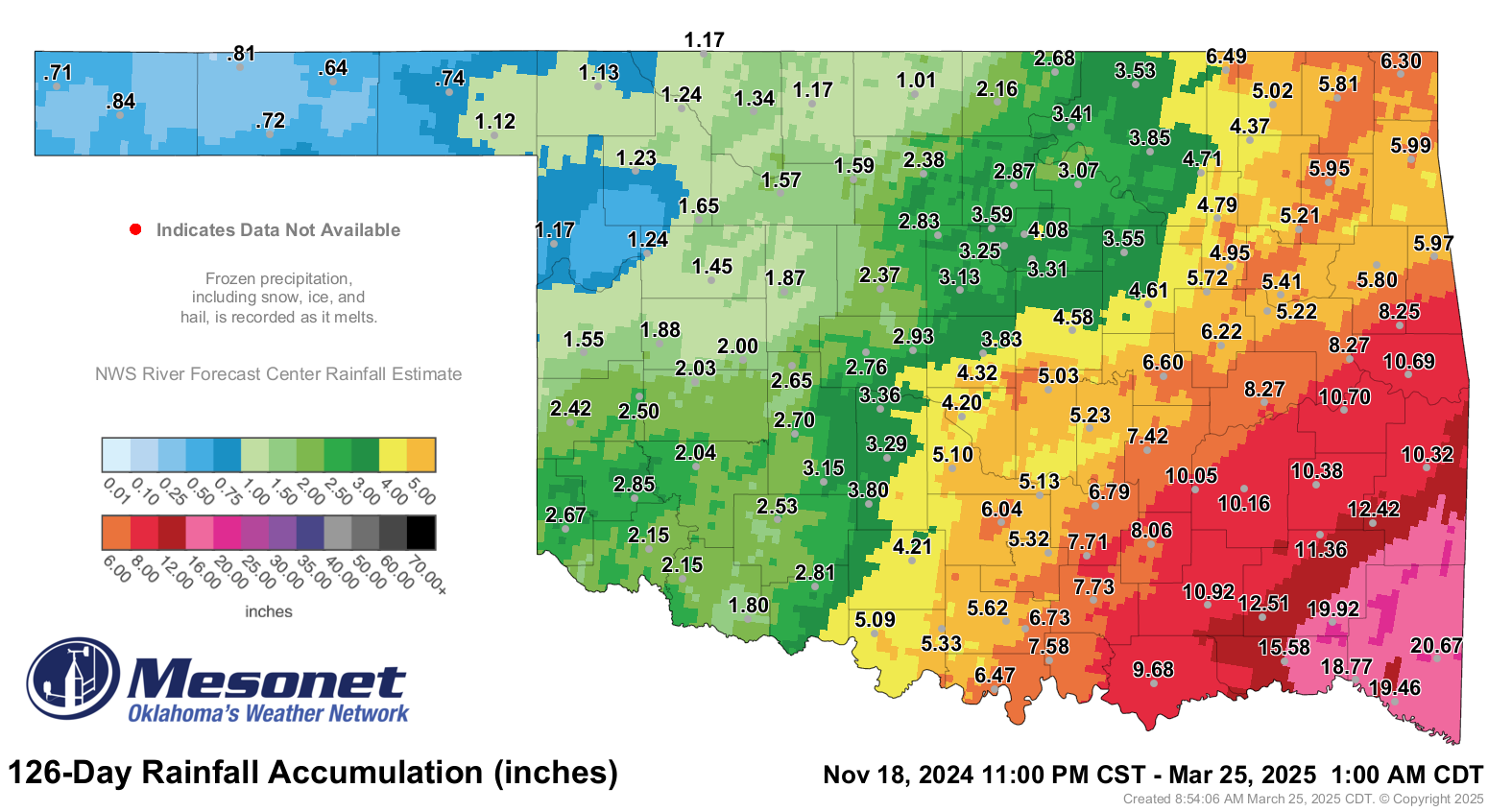
The last time Medford received at least a quarter-inch of rain (or melted snow/ice)
in a single day was back on Nov. 18 at 0.59 inches. They've only received 1.01
inches since.
Yeah, that's really bad! So was y'all calling me a more on yesterday...don't think
I've forgotten! Regressing my digressing, take a look at the historical lack-of-
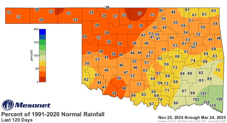
rainfall rankings across the state over the last 120 days. These go back to 1921.
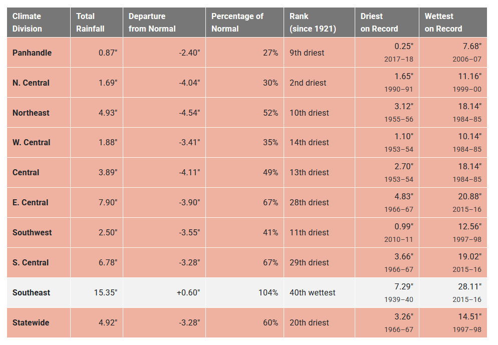
Yeah (again), that's really bad! NC OK has had their 2nd-driest last 120 days
in the last 100+ years, an average of 4" below normal. Some areas are a bit better
off, but still mostly top-15 driest last 120 days on record. So a bit better, but
still really bad. So it's like some folks having a strawberry Pop-Tart, while
others have no Pop-Tart. Sure, it's better to have A Pop-Tart, but having a
strawberry Pop-Tart is still really bad.
Southeast OK and their surplus of 0.6 inches is probably a Brown Sugar and
Cinnamononon Pop-Tart...not quite a cherry one. And no, I can't spell cinnamon.
The 120-day rainfall departure maps tell the story.
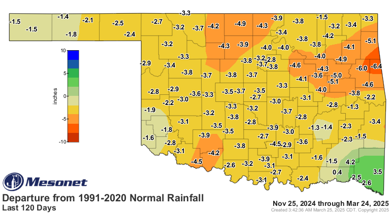
So yes, drought is intensifying once again across Oklahoma, spreading rapidly
in the blast furnace fire weather conditions we've seen over the last few weeks.
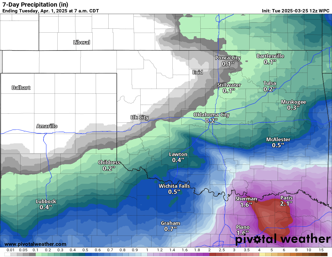
The worst part of the story is no good rains showing up just yet across much of
the driest areas. the SE third of the state comes out okay in the forecast.
The best part? Our normal wettest time of the year (for all but the Panhandle)
is just starting, with 35-50% of our normal precip being accounted for in the
April-June time frame. The Panhandle normally sees most of their precip in the
summer months, tied into the Desert Southwest monsoon season.
Reminder, these maps show what we would NORMALLY expect, based on past
conditions (i.e., "normals"). NOT getting that is how droughts increase.
So, just hope for what my parents hoped for before I was born, expect with
better results: Normal.
Gary McManus
State Climatologist
Oklahoma Mesonet
Oklahoma Climate Survey
gmcmanus@ou.edu
March 25 in Mesonet History
| Record | Value | Station | Year |
|---|---|---|---|
| Maximum Temperature | 93°F | WOOD | 1998 |
| Minimum Temperature | 15°F | BOIS | 2013 |
| Maximum Rainfall | 2.92 inches | VALL | 2024 |
Mesonet records begin in 1994.
Search by Date
If you're a bit off, don't worry, because just like horseshoes, “almost” counts on the Ticker website!