Ticker for March 11, 2025
MESONET TICKER ... MESONET TICKER ... MESONET TICKER ... MESONET TICKER ...
March 11, 2025 March 11, 2025 March 11, 2025 March 11, 2025
Panda Monium
It'll be pandemonium, ladies and gentlemen (and the rest of you curs, heathens,
and ne'er do wells), pandemonium!
Dogs and cats, living together, food getting hot while drinks get cold, 4-way
stop signs on every intersection, good shows on Netflix and good food at Taco
Bell...well, you get the picture. This weekend's weather is going to be wild
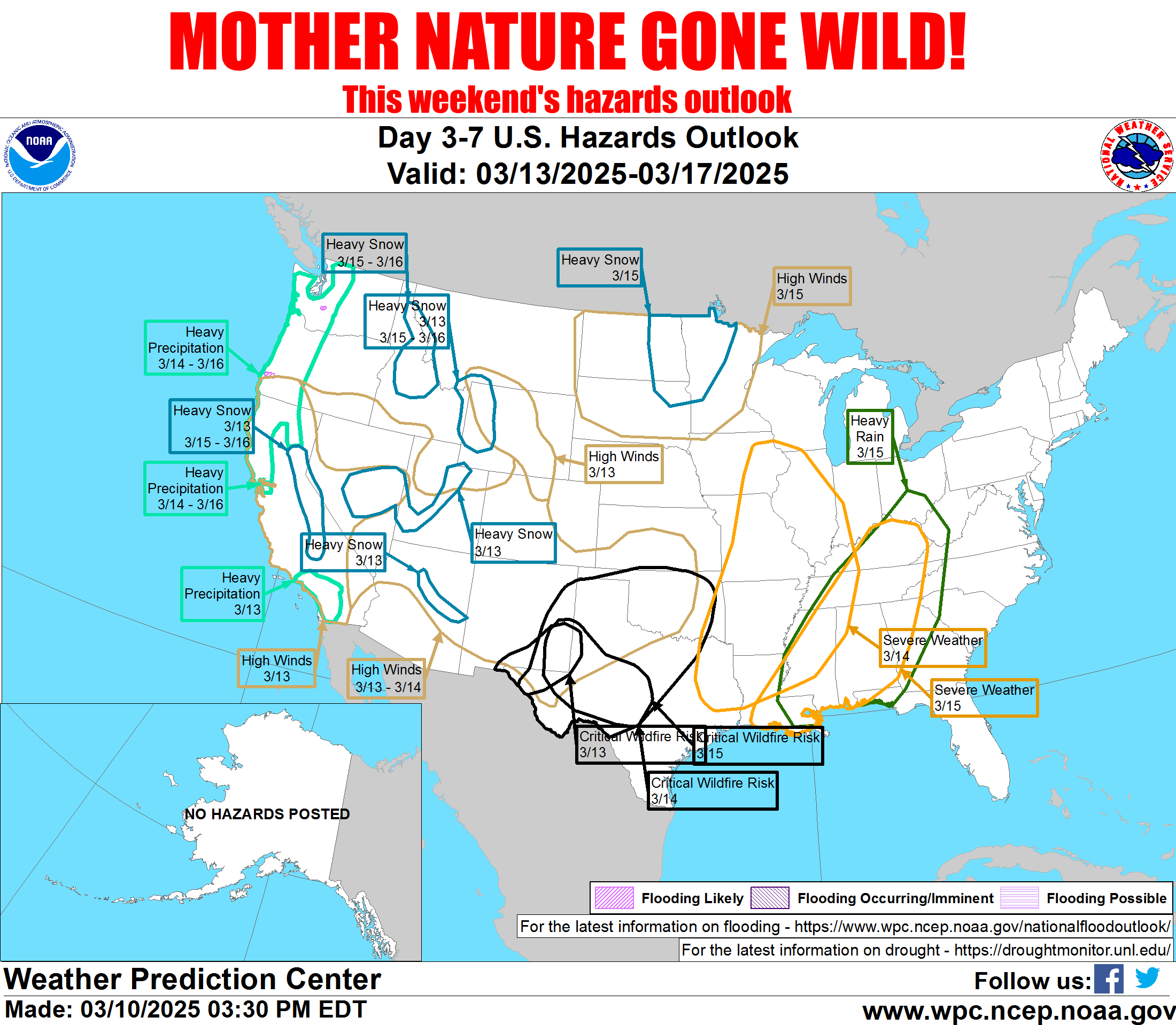
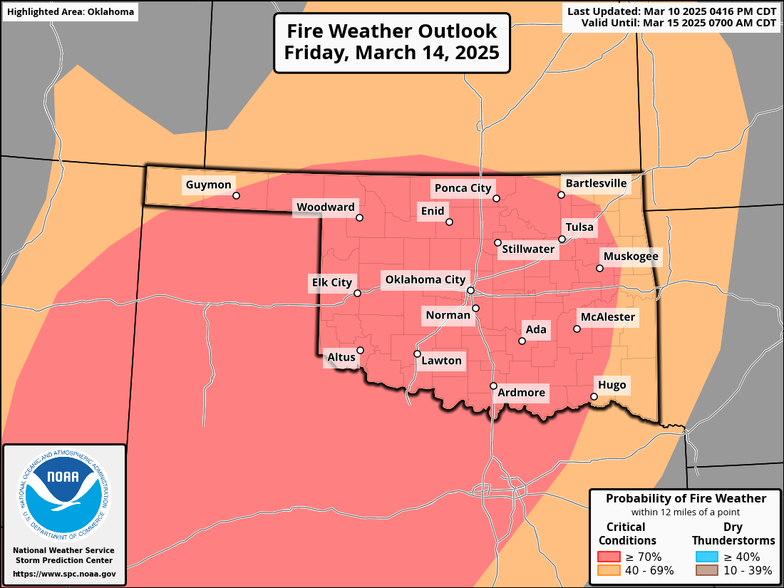
across the country. As you can tell from the top graphic (if you click for
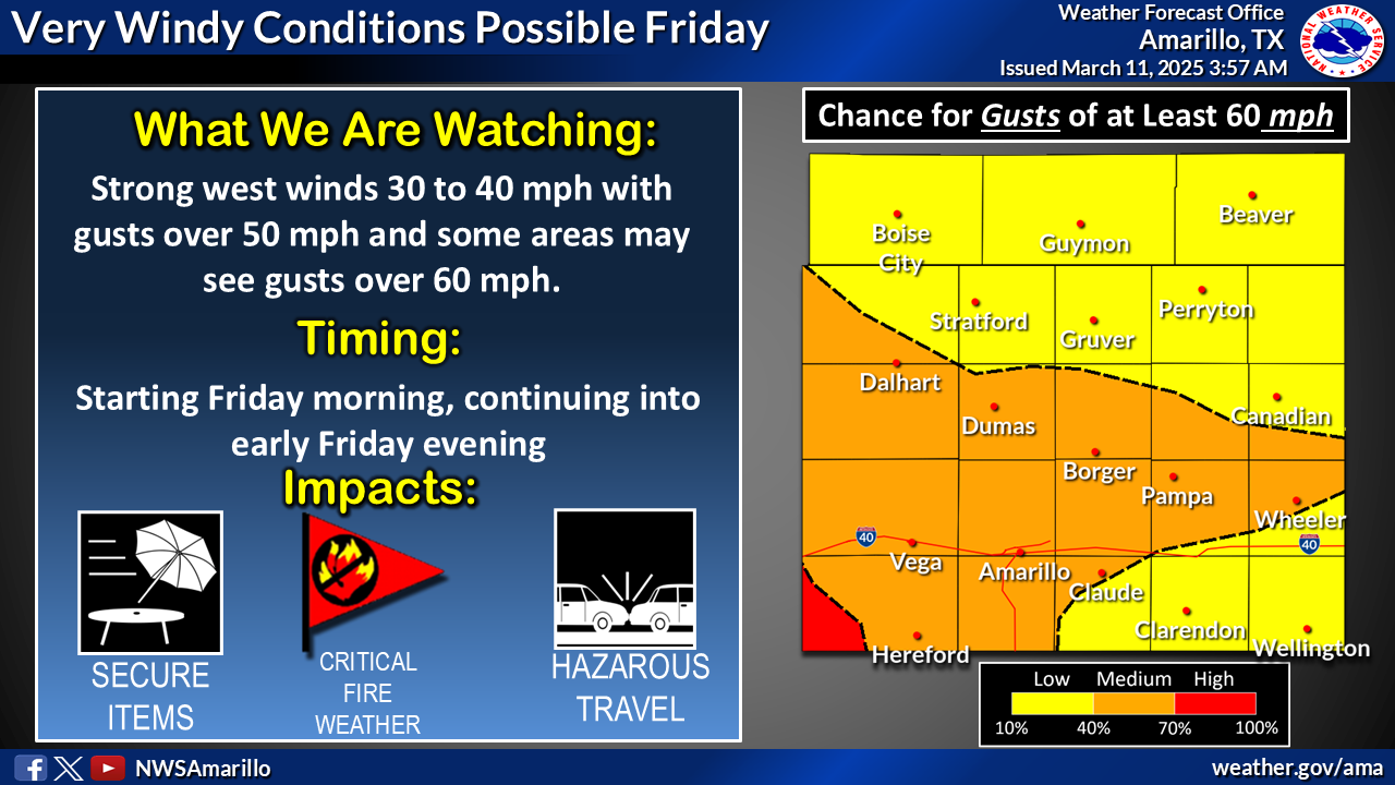
embiggenation), you'll see that Oklahoma gets the high winds and critical fire
weather portion of the Venn diagram, with a bit of severe weather thrown in across
eastern Oklahoma for bad measure.
Here's a bit more about that. Give me a moment to find the graphics. Talk
amongst yourselves...here's a topic: The peanut is neither a pea nor a nut.
Discuss.
Oh, here we are:
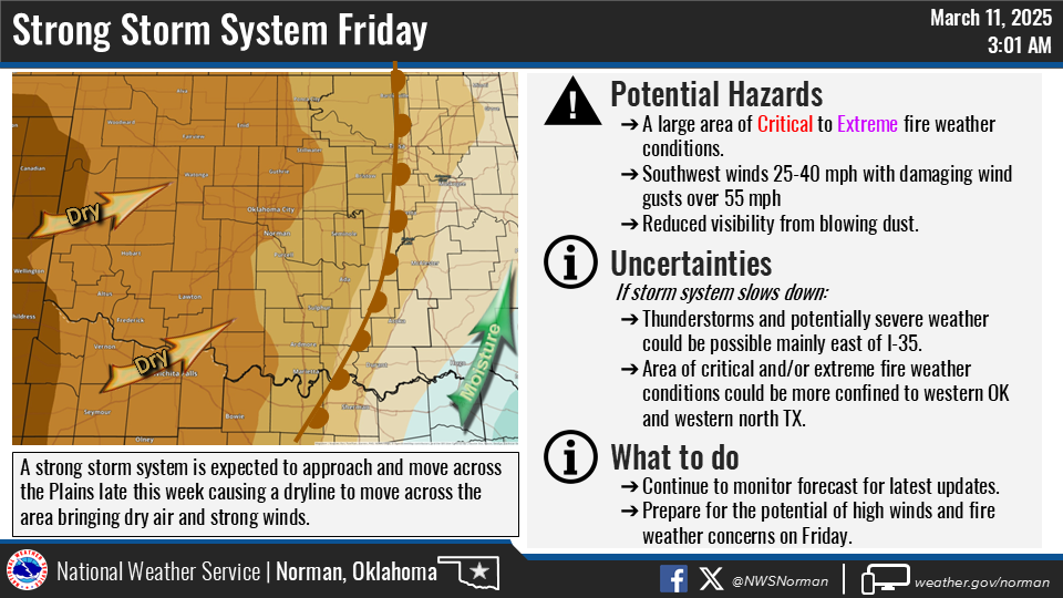
I'm not bullish on Friday's storm chances across SE OK. Heck, I'm not even
cowish. Heck, part 2, we have to get by tomorrow first before we can worry about
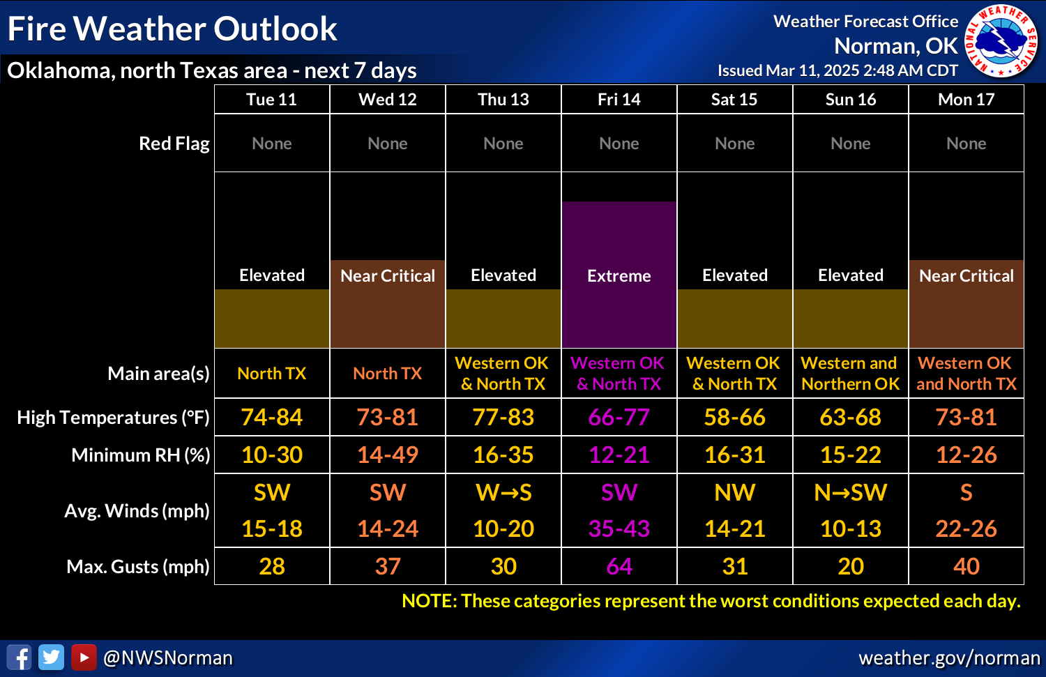
Friday, because we do have severe weather in the forecast on Wednesday as well.
All hazards will be possible, but you know the drill...tornado threat is low,
but not zero. The last "low but not zero" we had on March 4 resulted in 13
twisters.
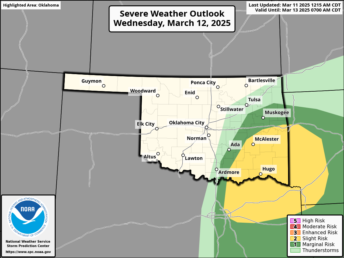
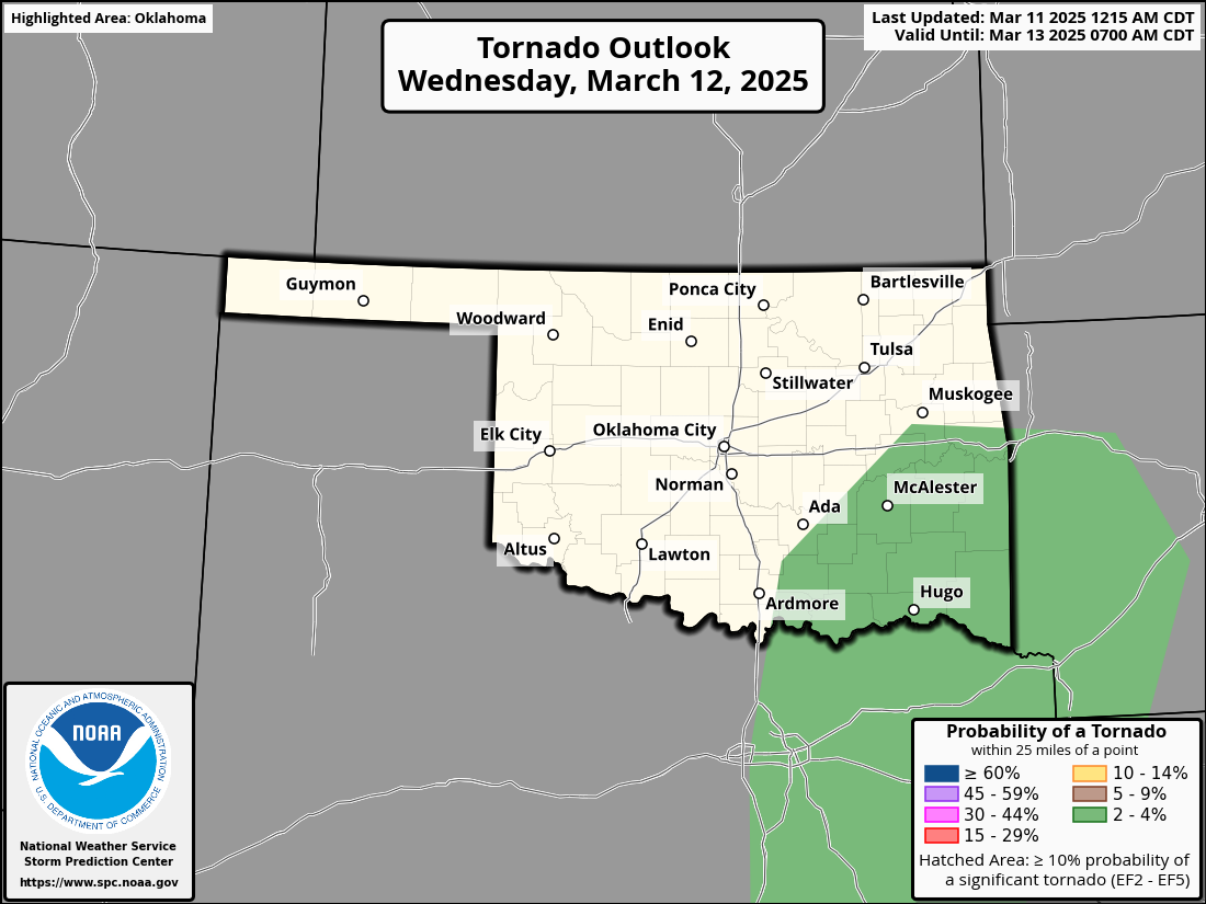

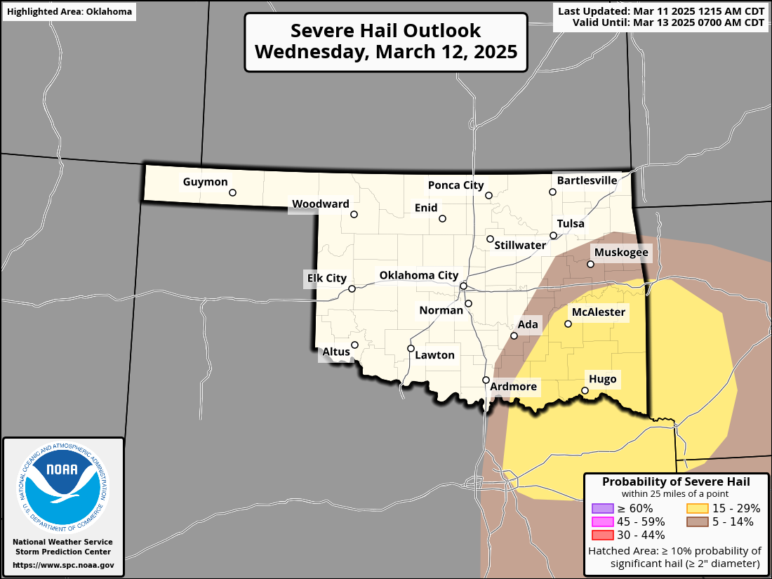
First you gotta get the storms to develop, and that's definitely not a sure
thing. If they do, watch out.
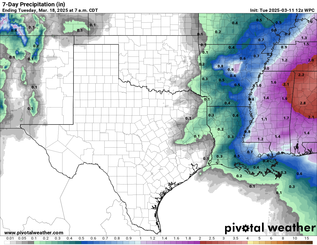
Need rain? Yeah, well I need hair. We'll get nothing and like it!
Gary McManus
State Climatologist
Oklahoma Mesonet
Oklahoma Climate Survey
gmcmanus@ou.edu
March 11 in Mesonet History
| Record | Value | Station | Year |
|---|---|---|---|
| Maximum Temperature | 90°F | MANG | 2023 |
| Minimum Temperature | 9°F | SLAP | 1998 |
| Maximum Rainfall | 2.62 inches | IDAB | 2012 |
Mesonet records begin in 1994.
Search by Date
If you're a bit off, don't worry, because just like horseshoes, “almost” counts on the Ticker website!