Ticker for September 26, 2024
MESONET TICKER ... MESONET TICKER ... MESONET TICKER ... MESONET TICKER ...
September 26, 2024 September 26, 2024 September 26, 2024 September 26, 2024
A good word
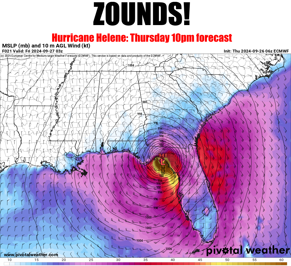
"ZOUNDS" is a good word for this occasion, no? Wow, I can't believe I spelled
"occaision right."
DANG IT!
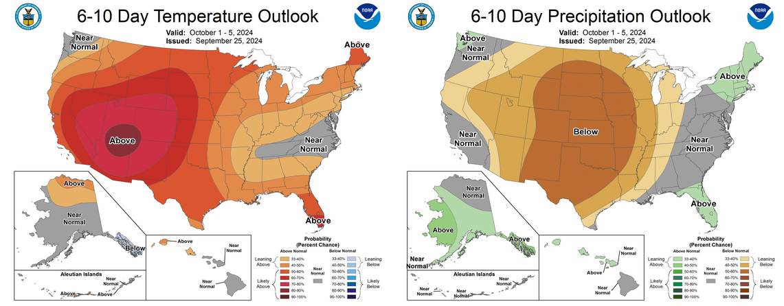
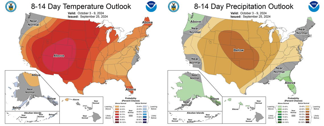
Well, there are many other words I could use when I see a forecast like that, but
most of them would result in me getting fired and then how would I maintain my
3 Cherry Pop-Tarts a day habit? My wife wanted to try one of those Pumpkin Spice
Pop-Tarts, and I just gave her one of these:

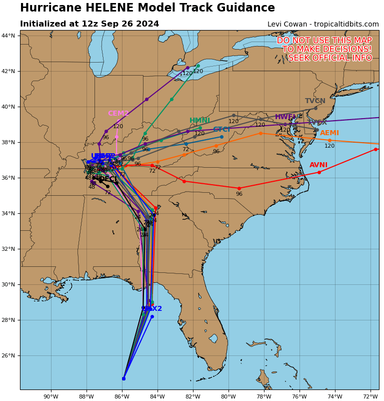
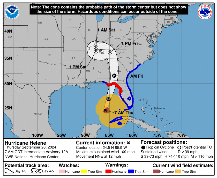
Still expecting a landfall on the Florida Coast of a major hurricane, Cat-3 or
greater, unfortunately.
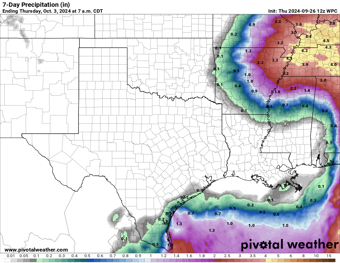
Our hopes for at least getting some benefit from this monstrosity in the form
of rain across eastern OK from the remnants are all but dashed at this point.
In fact (opinion, maybe), I'm worried we're going right back into drought
intensification mode for the next couple of weeks at least.
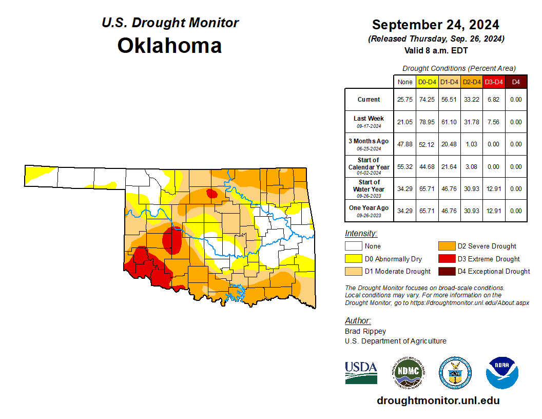
Speaking of drought...it's still here.
Even those rains in the last 30 days only brought up a few areas to normal or
above. I thought education would bring me up to normal or above...I was wrong
about that, too!
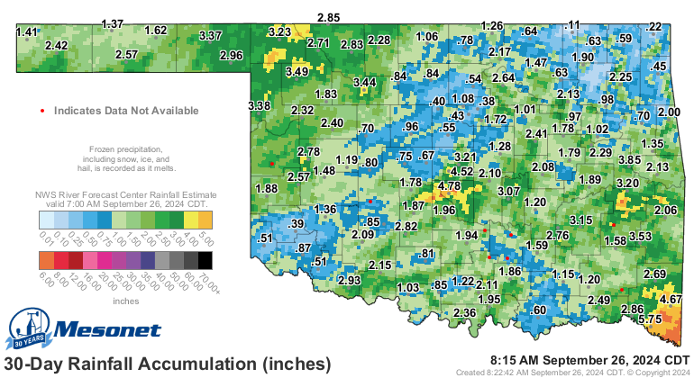
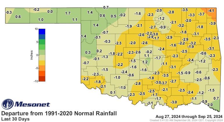
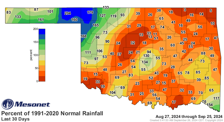
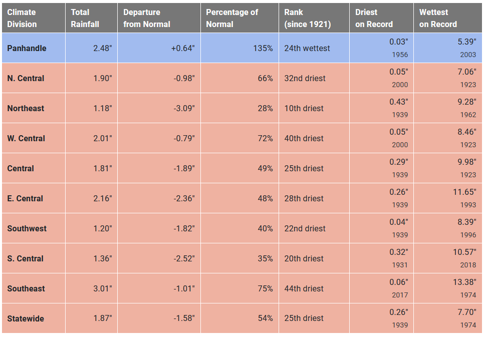
Bleak, to say the least.
Gary McManus
State Climatologist
Oklahoma Mesonet
Oklahoma Climate Survey
gmcmanus@ou.edu
September 26 in Mesonet History
| Record | Value | Station | Year |
|---|---|---|---|
| Maximum Temperature | 101°F | SLAP | 2020 |
| Minimum Temperature | 29°F | CAMA | 2000 |
| Maximum Rainfall | 7.70 inches | WEST | 1996 |
Mesonet records begin in 1994.
Search by Date
If you're a bit off, don't worry, because just like horseshoes, “almost” counts on the Ticker website!