Ticker for July 30, 2024
MESONET TICKER ... MESONET TICKER ... MESONET TICKER ... MESONET TICKER ...
July 30, 2024      July 30, 2024      July 30, 2024      July 30, 2024


Fault


da - DA - da-da-da - DA-da

I tried out for the Olympics, but when coach asked me to jump I replied "How low,"
and I was asked to leave. That's what I get for trying out for the Summer Olympics
luge team. Now if there was a division for scalp glare...well, you know. But we're
talking heat back here in Oklahoma. there's really not much else to talk about
except when will it end, and the answer to that is November 16. Yes, a guess, but
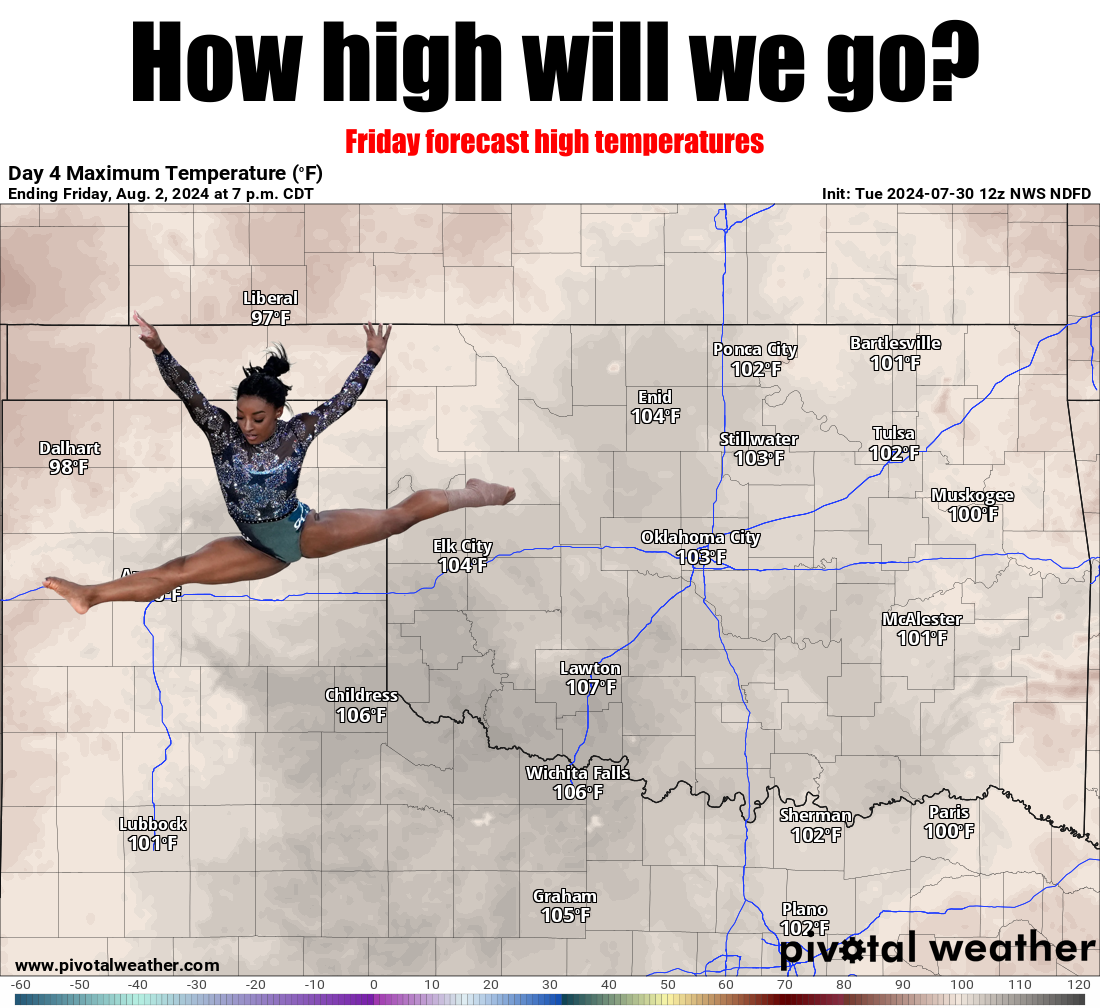
that's also an Olympic sport I'd excel at. And that forecast above for Friday is
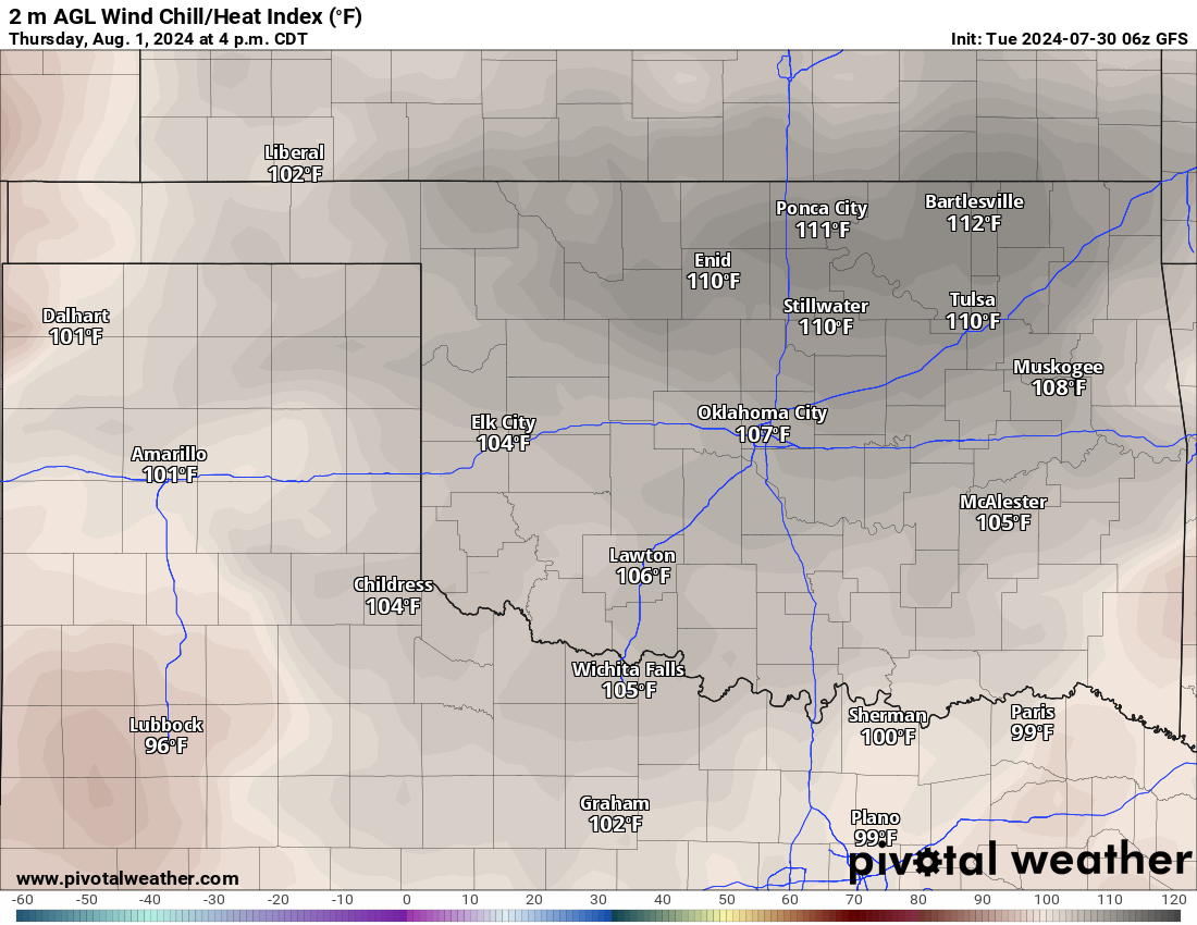
actual air temperatures...add in the humidity and you get another 5-10 degrees
in some areas. Take Thursday's heat index forecast. Please.


The heat dome will wobble and stretch and flatten and allow some minor relief and
rain chances from time to time, but expect this type of weather for the next 7-10
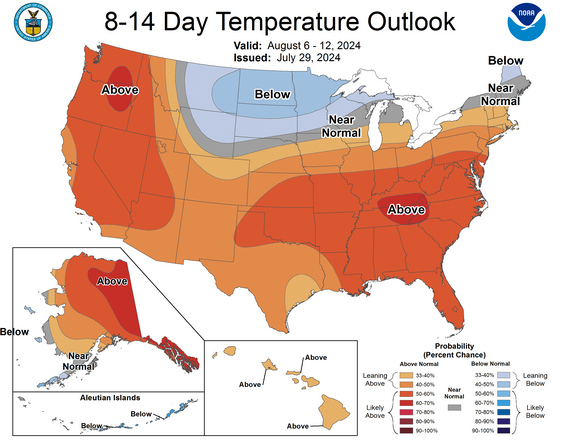
days or so. Maybe we start to see some changes after that? Not sure if those
increased odds of milder air will make it down this way, it does signal a
pattern change of some sort.


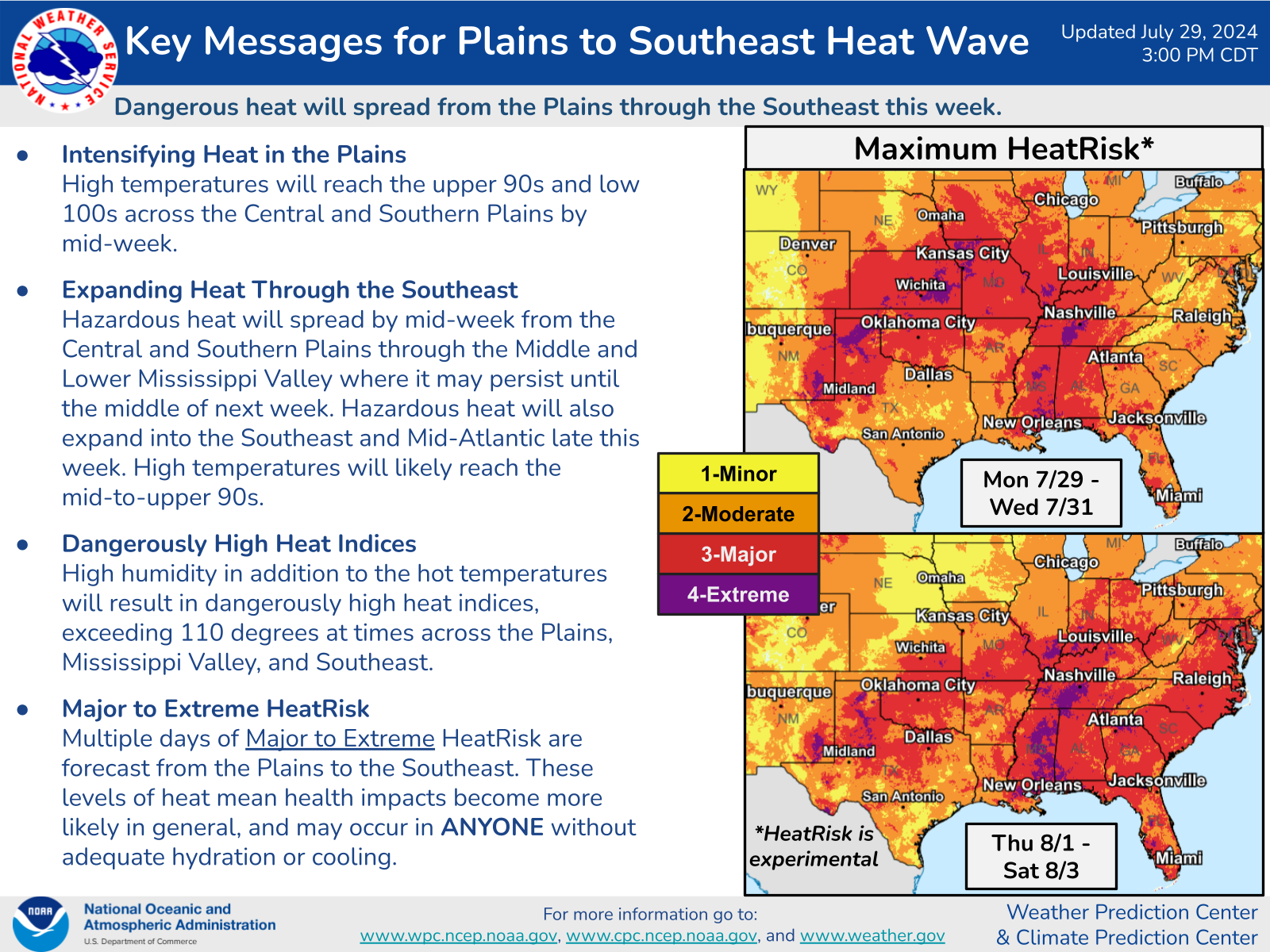
Something to hope for I guess. Otherwise...this:


Gary McManus
State Climatologist
Oklahoma Mesonet
Oklahoma Climate Survey
gmcmanus@ou.edu
July 30 in Mesonet History
| Record | Value | Station | Year |
|---|---|---|---|
| Maximum Temperature | 111°F | CHER | 2012 |
| Minimum Temperature | 54°F | BOIS | 2004 |
| Maximum Rainfall | 4.89 inches | SPEN | 2014 |
Mesonet records begin in 1994.
Search by Date
If you're a bit off, don't worry, because just like horseshoes, “almost” counts on the Ticker website!