Ticker for July 17, 2024
MESONET TICKER ... MESONET TICKER ... MESONET TICKER ... MESONET TICKER ...
July 17, 2024 July 17, 2024 July 17, 2024 July 17, 2024
Talk to me Mother Nature
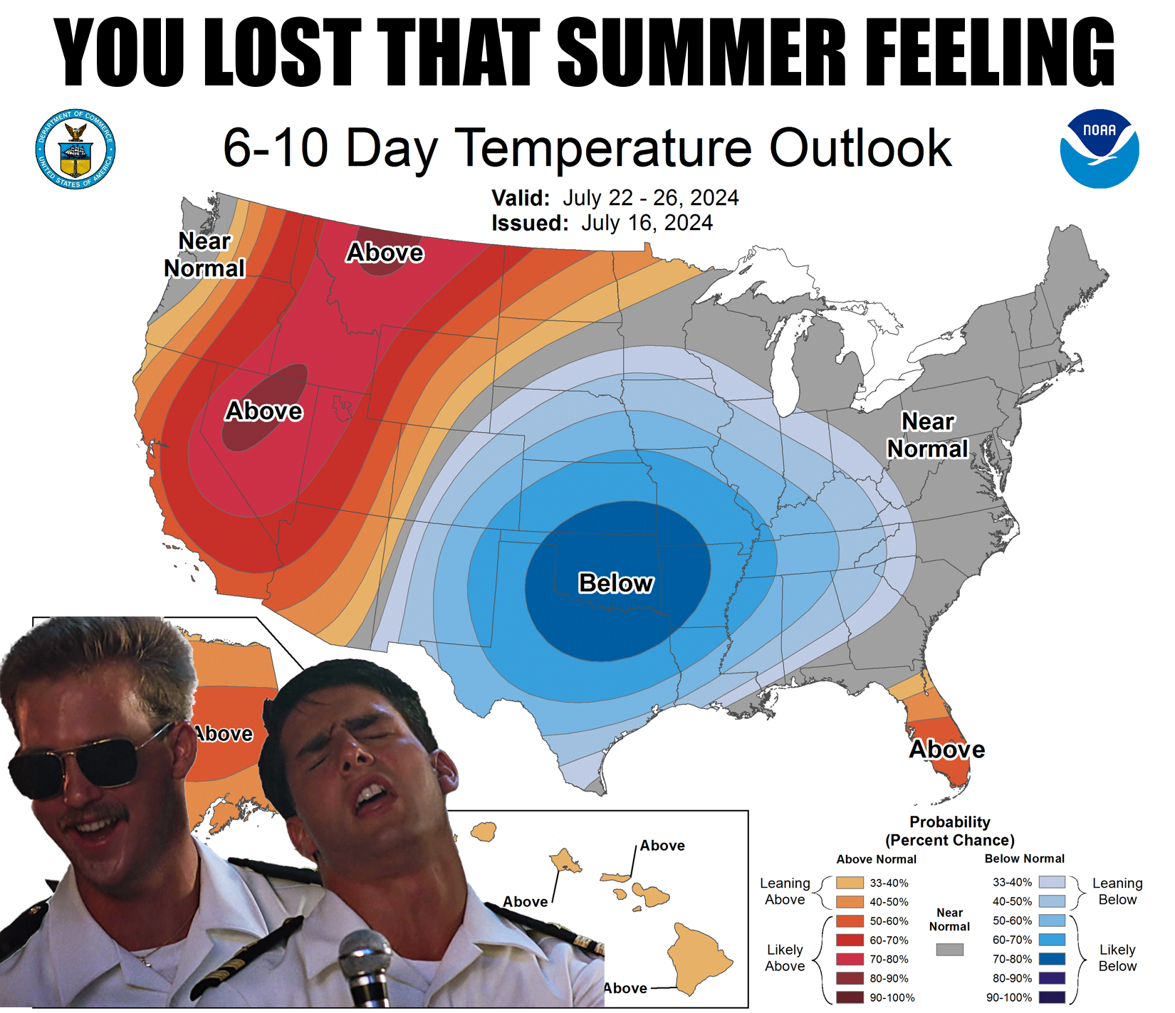
We crashed and burned on the first summer-swoon earlier this month, but this one
is looking good so far.
Get it? Watch the movie (the first one)!
So we'll have a nice big trough camp out over the eastern half of the country for
the next week, and the Heat Dome of Doom gets pushed to the west, away from the
Southern Plains. That means very VERY VERY (darned font limitations!) unusually
mild (and wet) weather for Oklahoma through that time. Wet?
Heck, it's raining right now for crying out loud! And those rain chances will also
continue, especially across SE OK.
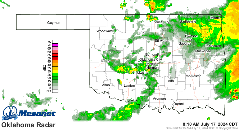
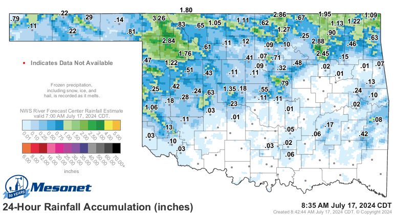
Look at all that awesome rain across northern Oklahoma just in the last day.
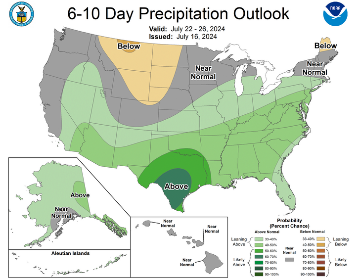
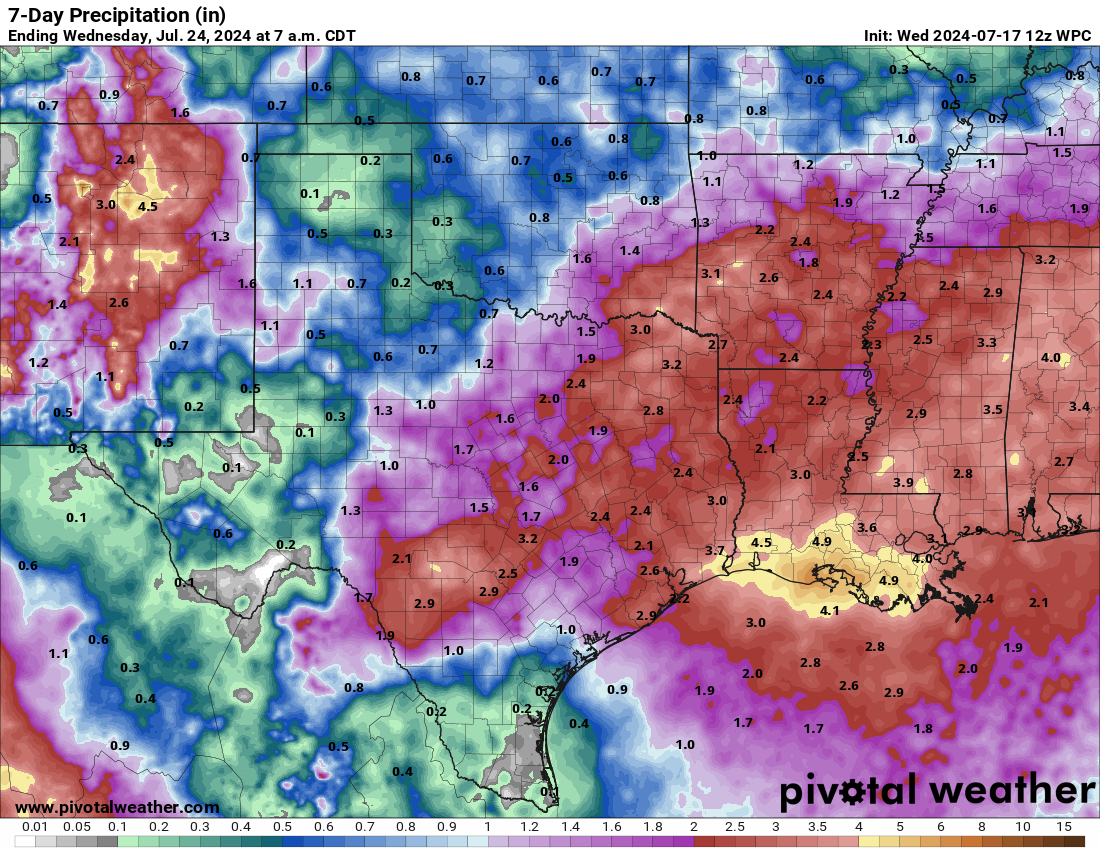
So no more of this for awhile.
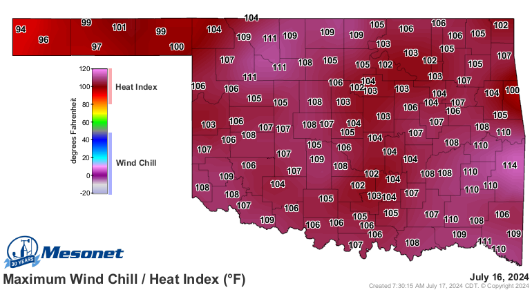
Or this.
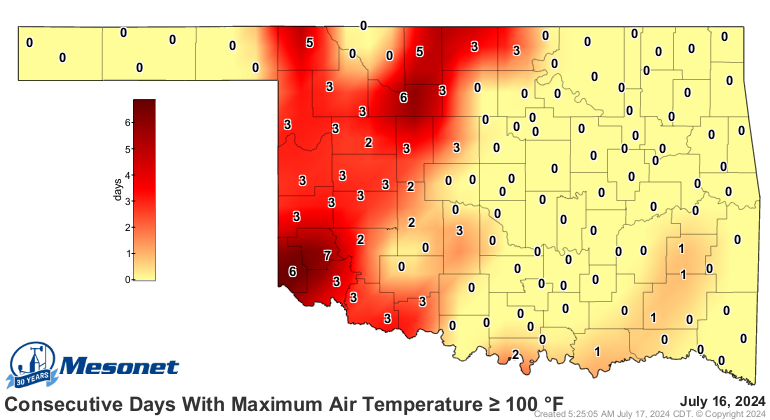
And no more adding to this.
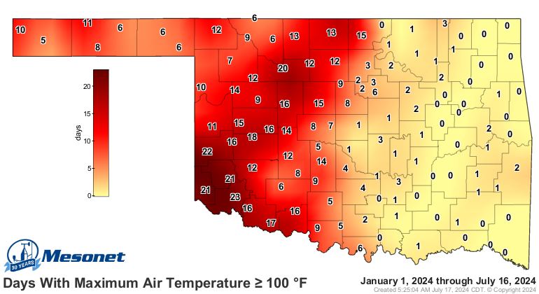
A week to 10 days of 80s and a few lower 90s (sorry SW OK) in mid-July?
GREAT BALLS OF FIRE!
Gary McManus
State Climatologist
Oklahoma Mesonet
Oklahoma Climatological Survey
gmcmanus@ou.edu
July 17 in Mesonet History
| Record | Value | Station | Year |
|---|---|---|---|
| Maximum Temperature | 111°F | HOLL | 2022 |
| Minimum Temperature | 54°F | KENT | 2009 |
| Maximum Rainfall | 6.42 inches | BURB | 1997 |
Mesonet records begin in 1994.
Search by Date
If you're a bit off, don't worry, because just like horseshoes, “almost” counts on the Ticker website!