Ticker for May 6, 2024
MESONET TICKER ... MESONET TICKER ... MESONET TICKER ... MESONET TICKER ...
May 6, 2024 May 6, 2024 May 6, 2024 May 6, 2024
Listen to me now and believe me later
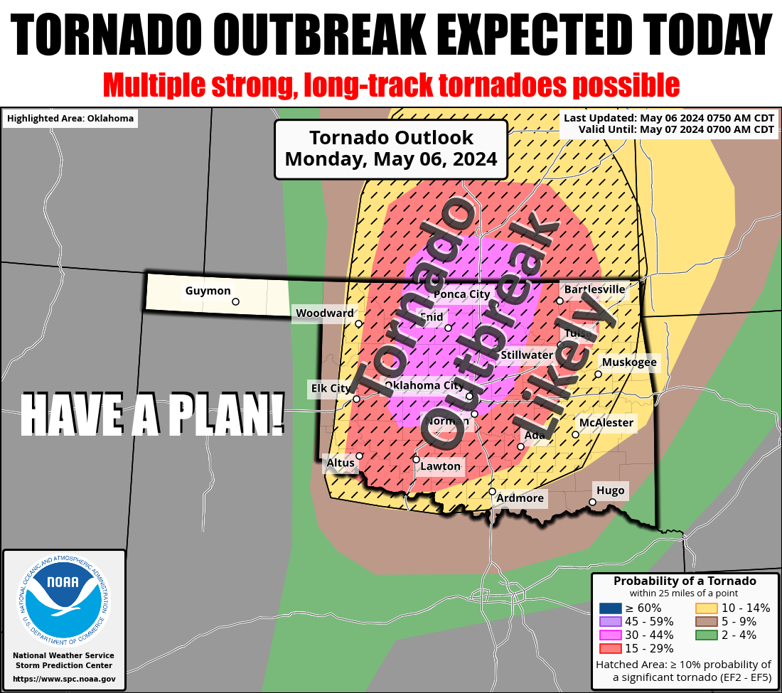
It's one of "those" spring days in Oklahoma. The ones we dread. The ones we
worry about. The ones where the hype doesn't seem enough. And the Ticker despises
hype. In case you long-term readers have forgotten, much of our so-called hype is
actually a parody of hype...a tool, if you will, to get folks to sit up and take
notice. But this one day. This May 6th day, I'm asking you to believe the hype.
Just this one day, so you can keep you and your family safe. Don't be
scared, don't be frightened...just be prepared. Boy Scouts already have this
down, and so should you. It's just one day. Be vigilant, be aware, stay keenly
attuned to what's going on in the weather. It might save your life, and the
people you hold dear. We can all hope for a big bust.

NO NO NO...well, that'd be cool alright, but I'm talking NO tornadoes. That would
be nice, but the atmosphere has already signaled us that it's not kidding around
this year when it dropped 5 tornadoes, and one of those is becoming mythic for
it's non-damage-verified strength as one of the most intense in recent memory in
Tillman County, when the risk was pretty darned low back on April 30. Agreed,
one bad day does not beget the other, especially 7 days later, but still...
Lots of moisture already streaming back into the area from a pretty potent
source area over the Gulf of Mexico.
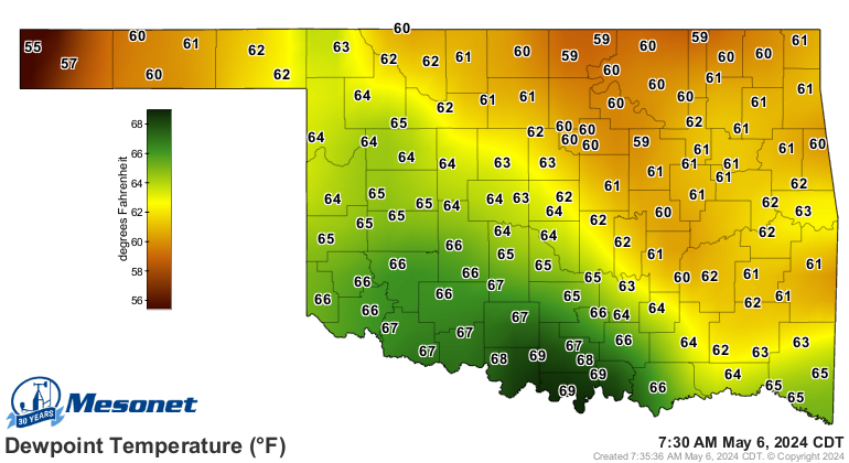
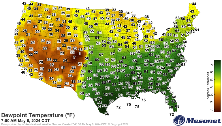
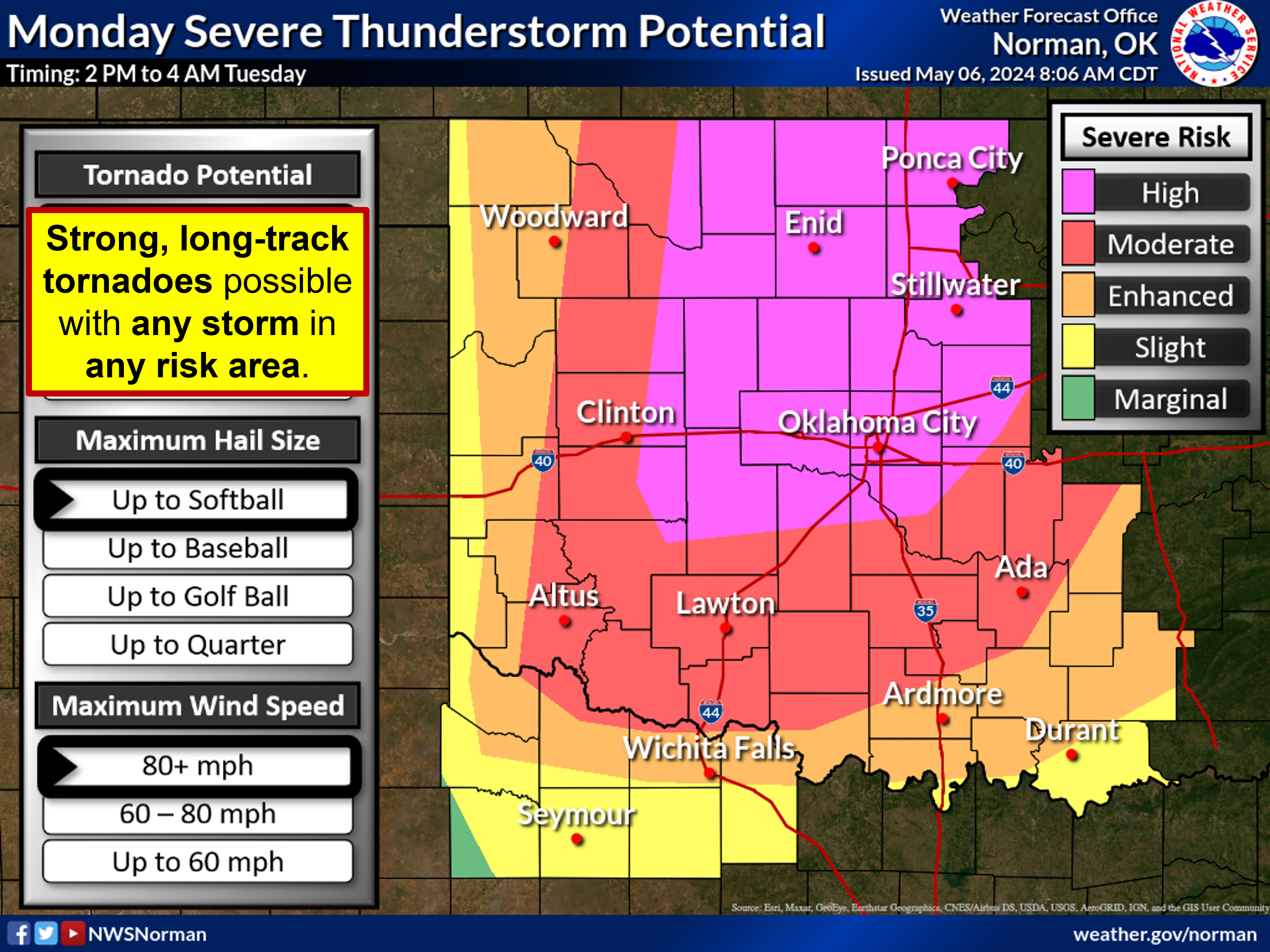
I'm not gonna bore you (I HEARD THAT!) with the setup so much, because it
doesn't really matter, does it? Suffice it to say we have a storm system
coming in with just the right amount of wind turning with height (sheer) and
instability (lift; warm, buoyant parcels of air exploding upward), and the
aforementioned moisture, to create our high risk environment. And don't sleep
on the hail danger either. Stones up to the size of softballs will put knots
on your noggin faster'n you can rub 'em! There will be a substantial damaging
wind threat (other than the tornadic winds) coming across parts of the area
as well.
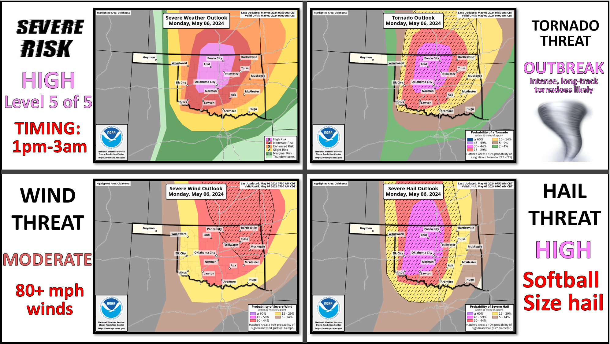
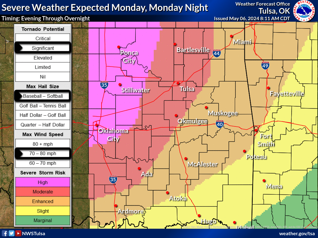
And don't get too hung up on where those lines between the risk areas begin
and end. Consider those fuzzy boundaries (like the area between my forehead and
scalp...I mean, who could tell at this point?). And also don't think you're
out of danger because you're in the yellow or green vs. those higher risk areas
for each of the hazards. You ain't. Again, remember April 30? We could see two
rounds of storms...first in the warm sector out ahead of the dryline if we
break the cap, then along the dryline later on. Don't make the mistake we saw
on April 27 when expected early storms didn't fire, so folks let their guards
down, which left them vulnerable to storms later that evening.
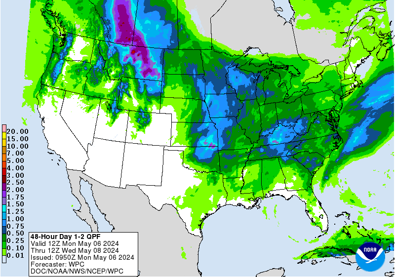
And don't sleep on the flash flooding threat, either. You thinking of driving
into that water rushing over the road? Don't do it. Turn around, don't drown!
Go the longer way home. We could see 2-4 inches of rain with some of these
storms.
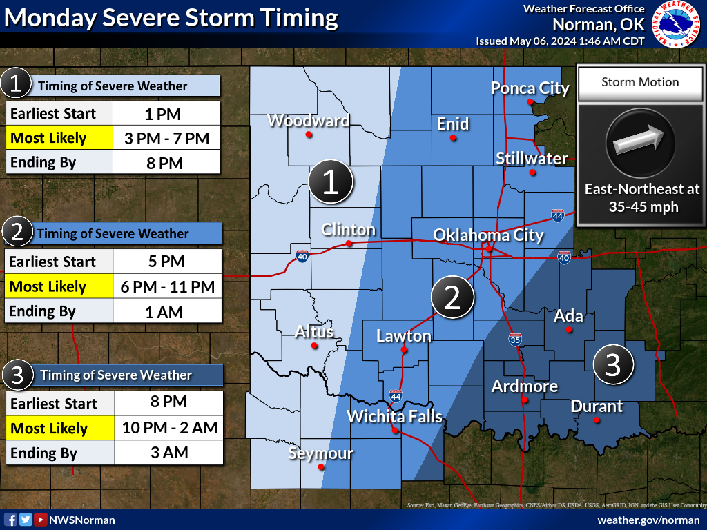
Timing is later this afternoon and into the overnight hours as the storms form,
then march to the east. Standard drill with our severe weather outbreak
situations, but be mindful again of multiple possible rounds.
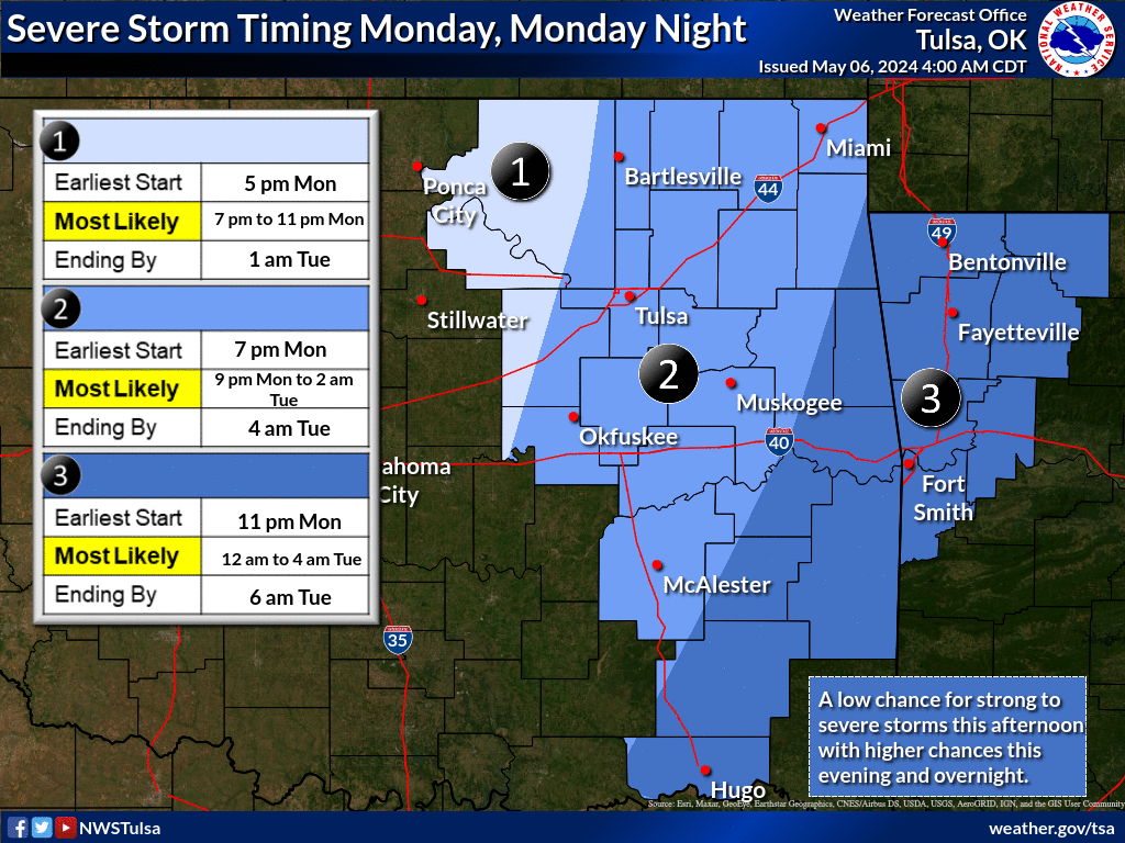
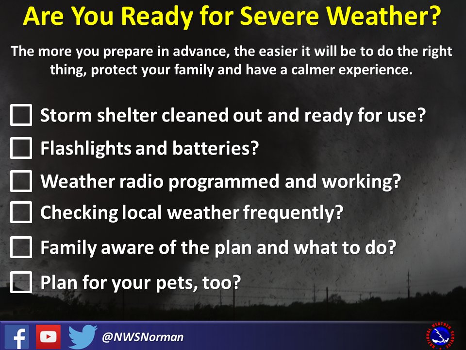
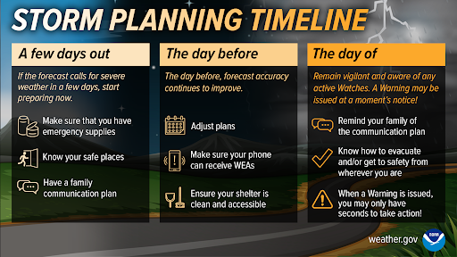
Not everybody will see storms. But some will, and probably folks you know. Not
everybody will be under a tornado threat, but you and yours could. Are you ready
for severe weather? Are they?
Don't be this guy!

Hmmm, some Cherry Pop-Tarts sound pretty good right now, not gonna lie!
Gary McManus
State Climatologist
Oklahoma Mesonet
Oklahoma Climatological Survey
gmcmanus@mesonet.org
May 6 in Mesonet History
| Record | Value | Station | Year |
|---|---|---|---|
| Maximum Temperature | 105°F | CHER | 2014 |
| Minimum Temperature | 33°F | BOIS | 1999 |
| Maximum Rainfall | 5.02 inches | OKCE | 2015 |
Mesonet records begin in 1994.
Search by Date
If you're a bit off, don't worry, because just like horseshoes, “almost” counts on the Ticker website!