Ticker for April 15, 2024
MESONET TICKER ... MESONET TICKER ... MESONET TICKER ... MESONET TICKER ...
April 15, 2024 April 15, 2024 April 15, 2024 April 15, 2024
Nyah ah ah!
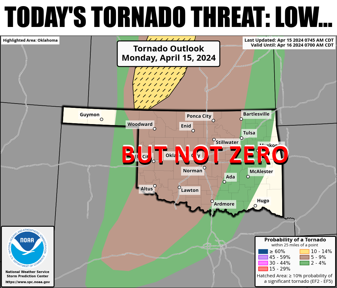
I had a highbrow debate with my brother last Friday about who made the best
"scared" sound between Curly of the Three Stooges ("NYAH-AH-AH!!) and Oliver
Hardy of Laurel and Hardy (sort of an elongated "Oooooooh" "Ohhhhhhhhhh" hybrid,
with a good deal of vibrato thrown in). I know this debate is well above all but
the most advanced intellects, but I went with Ollie's version.
With that question of the ages settled, now we can move onto today's puzzler...is
it better that our severe weather risk outlook has been scuttled from a widespread
peak-heating dryline event to more of a conditional risk in the afternoon to early
evening, and then later on into the overnight hours when the actual cold front
arrives? Well, the answer to that is unattainable because you just don't know
what would have occurred with the previous scenario (and truthfully...it could
still occur because Oklahoma, but it doesn't appear likely at this point). I do
think more people dodged a bullet because of this change in the timing of the
severe ingredients, but the overall hazard is still there nonetheless.
Because this is still one of THOSE days in Oklahoma that you can tell something's
up from the moment you stepped outside this morning and your glasses fogged
over due to the transition from your deliciously air conditioned environment
to the soggy spring return of Gulf moisture to the region (by the way, if you
don't wear glasses and experienced this, get to the eye doctor!!).

You can see that the dryline has set up rather loosely (sudden .38 Special
moment: "But don't let go. If you cling too tightly, you're gonna lose
control!") across the High Plains, and it should sharpen up quite a bit later
this afternoon into the evening, making a trip into western Oklahoma.
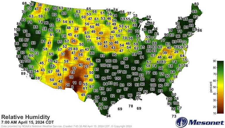
And of course, because this is how these things work, the folks to the west of
the dryline will have some pretty potent fire danger to deal with. And then
again after the front tomorrow.
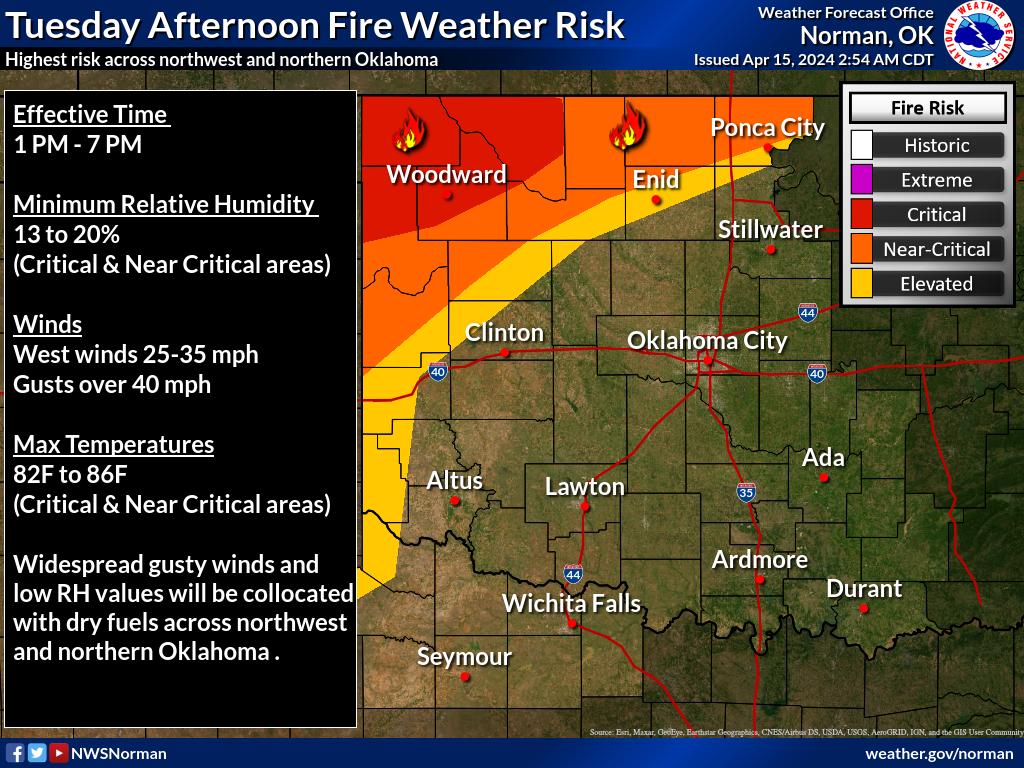

Severe weather remains the real threat for most of the state, however, in quite
a conditional/complicated forecast. All modes of severe weather are possible,
just depends on if/when/where storms fire and traverse.
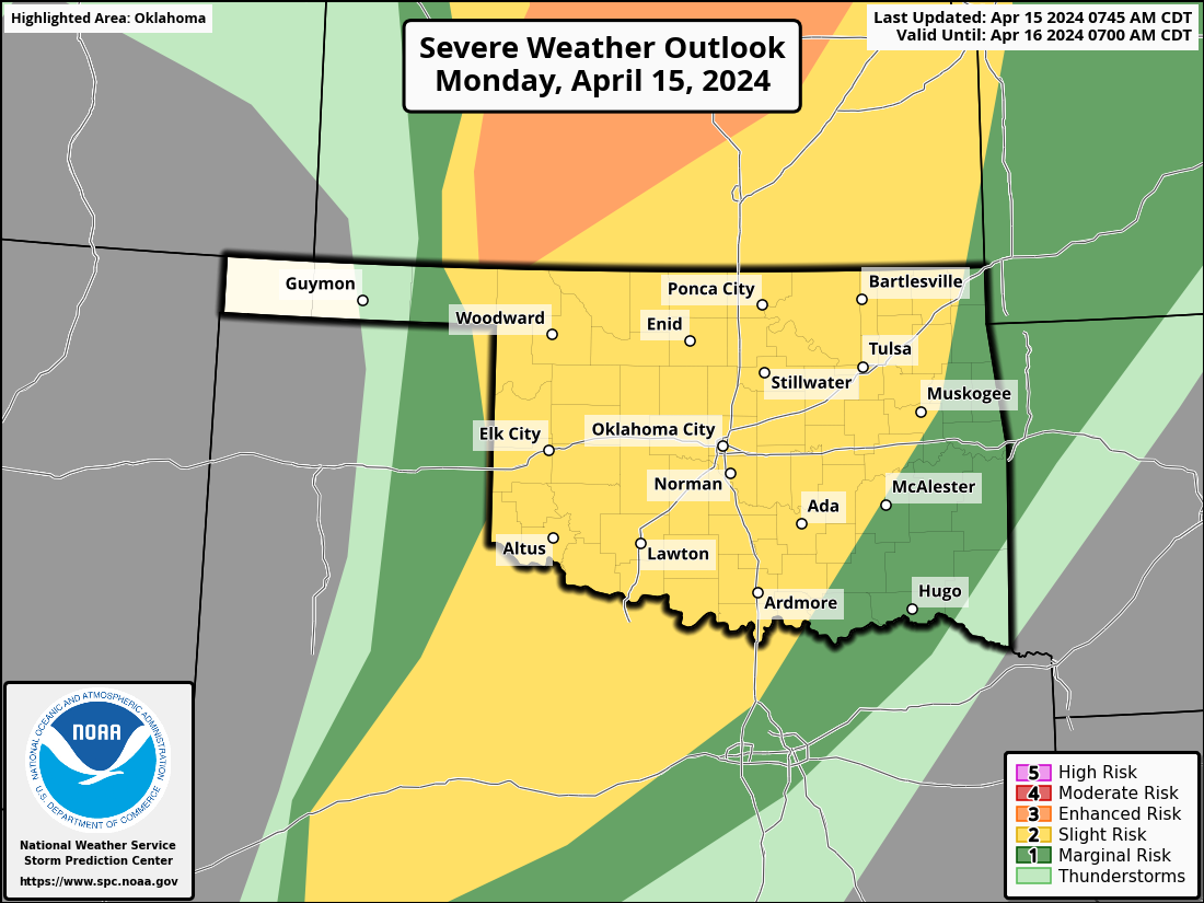


Here are some graphics from the local NWS offices attempting to give some
guidelines on the timing of today's possible severe weather. However, you should
definitely stay abreast of the latest forecasts throughout the day in case this
forecast evolves even more, which is almost a certainty.
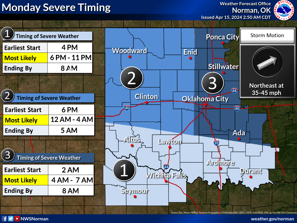
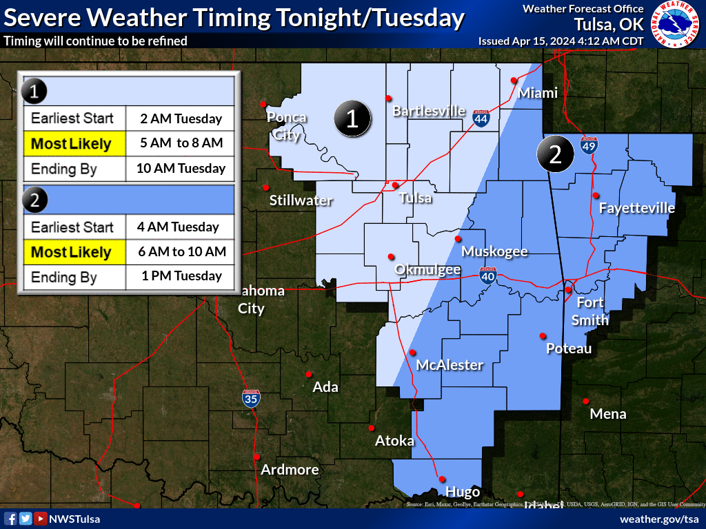
All of the above (especially my writing) should be considered low confidence
with an added dose of uncertainty. And if storms are uncertain, rainfall is
as well. In fact, I'm certain there's lots of uncertainty considering how
some of these contours get a bit jumbled.

But hey, we did have a bout with summer yesterday!
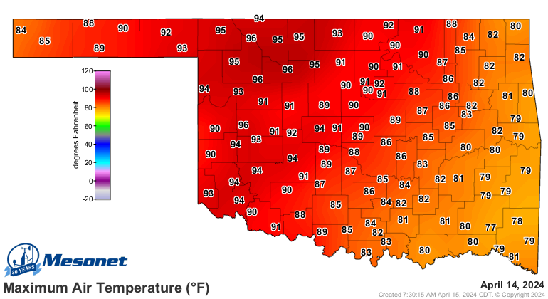
(By the way, those 96s we saw up in NW OK yesterday are the highest temperatures
recorded by the Mesonet since Sept. 30!).
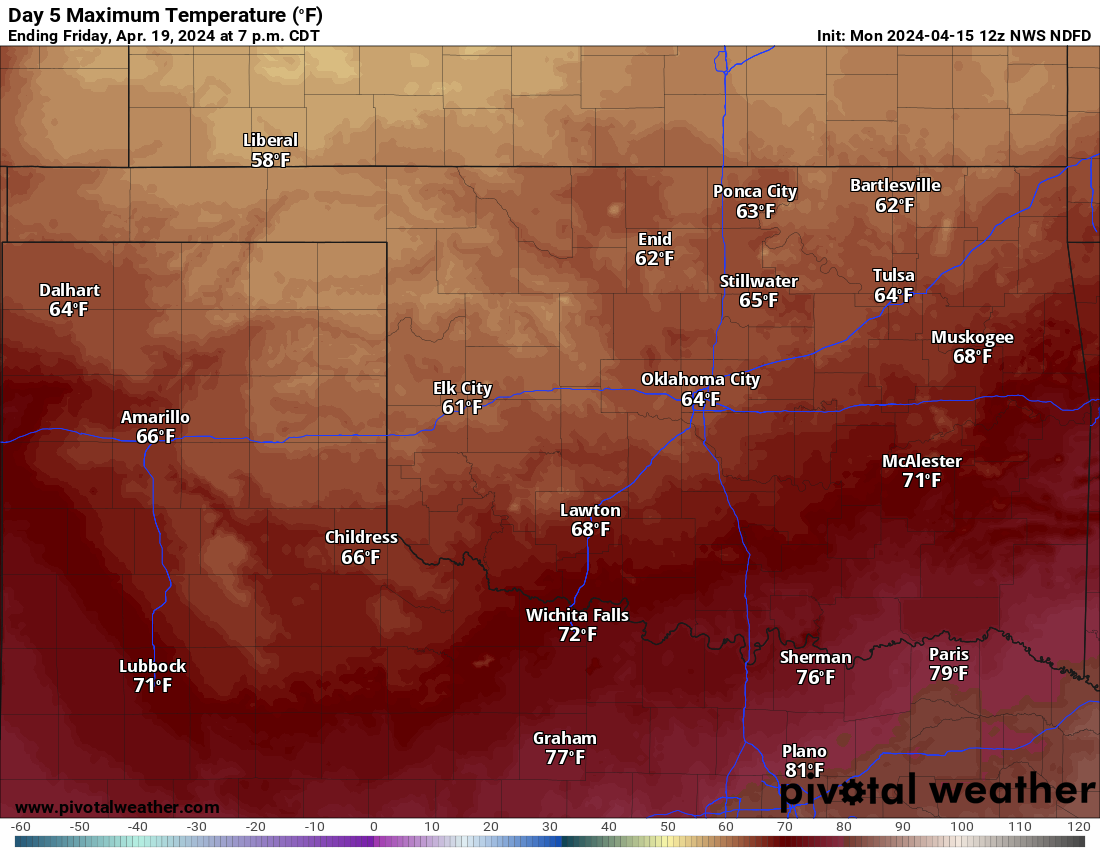
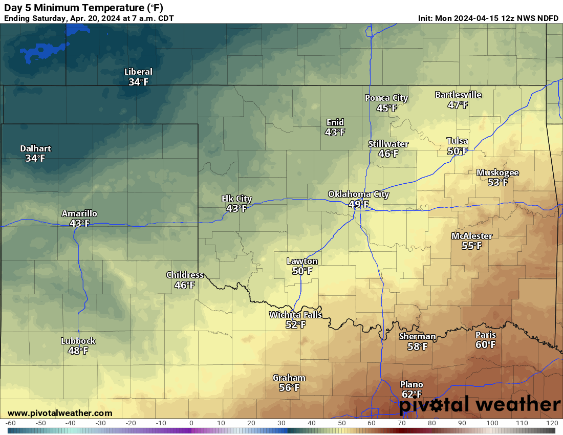
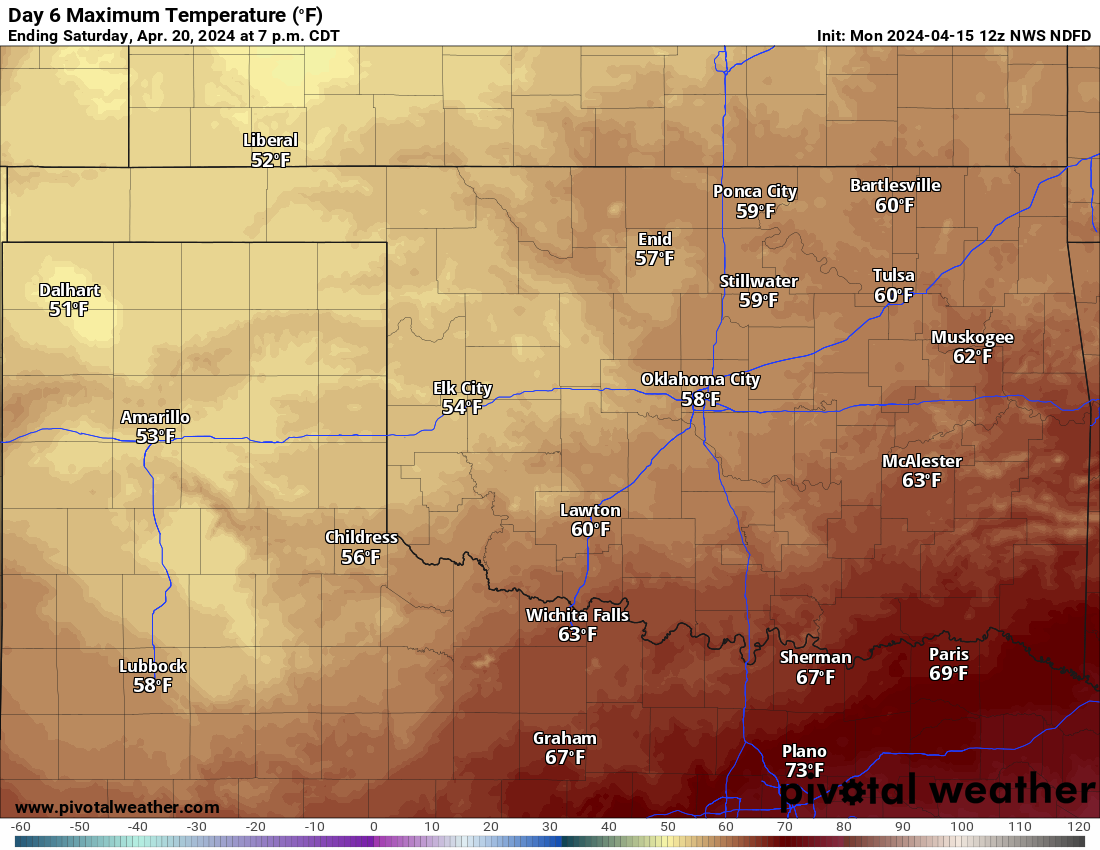
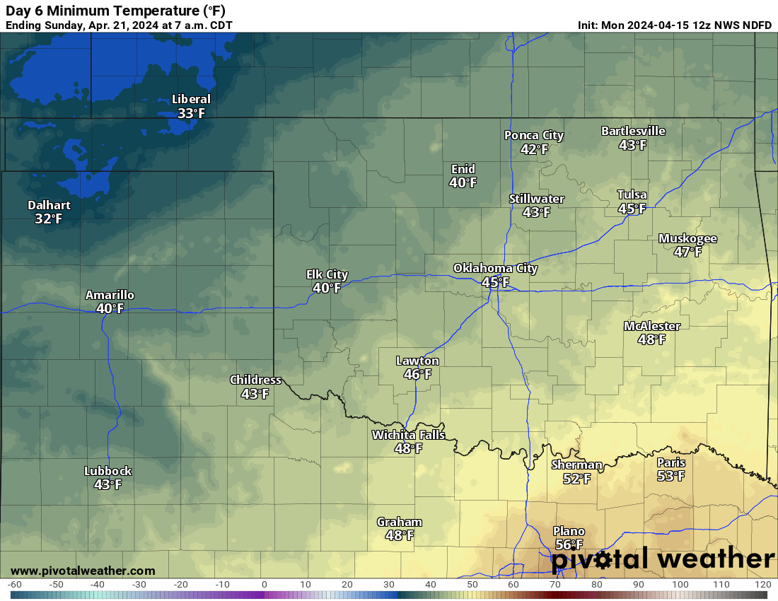
Watch for a bit of a milding through the week, as well as more made-up words
by me, then downright chilly for the weekend.
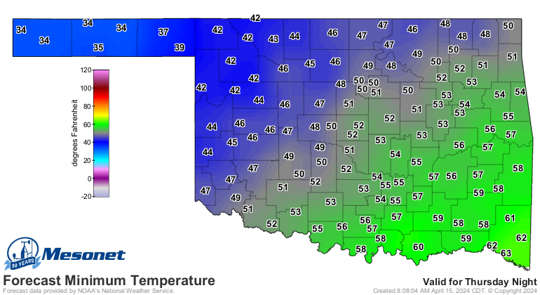
96 degrees! That's nothing to be proud of, Russ.
Gary McManus
State Climatologist
Oklahoma Mesonet
Oklahoma Climate Survey
gmcmanus@Mesonet.org
April 15 in Mesonet History
| Record | Value | Station | Year |
|---|---|---|---|
| Maximum Temperature | 102°F | GRA2 | 2006 |
| Minimum Temperature | 19°F | KENT | 2020 |
| Maximum Rainfall | 3.01 inches | BOIS | 2016 |
Mesonet records begin in 1994.
Search by Date
If you're a bit off, don't worry, because just like horseshoes, “almost” counts on the Ticker website!