Ticker for April 1, 2024
MESONET TICKER ... MESONET TICKER ... MESONET TICKER ... MESONET TICKER ...
April 1, 2024 April 1, 2024 April 1, 2024 April 1, 2024
Noggin knockers
Ugh. It's one of THOSE days in Oklahoma. You know the type, when you wake up in
the morning and walk outside but then realize you forgot to put clothes on. Okay,
maybe that's just me, but in addition to that, at least after you're done talking
to the police, you probably also notice just how moist it is outside, that air
having that hair-frizzing (why do you want to hurt me?) feel to it.
Now in a vacuum, this isn't a problem, right? Other than we'd all croak without
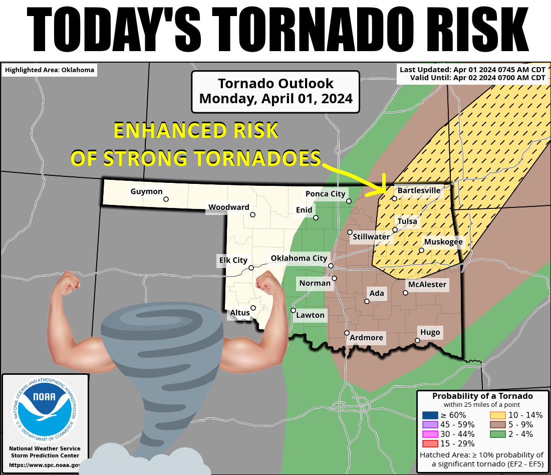
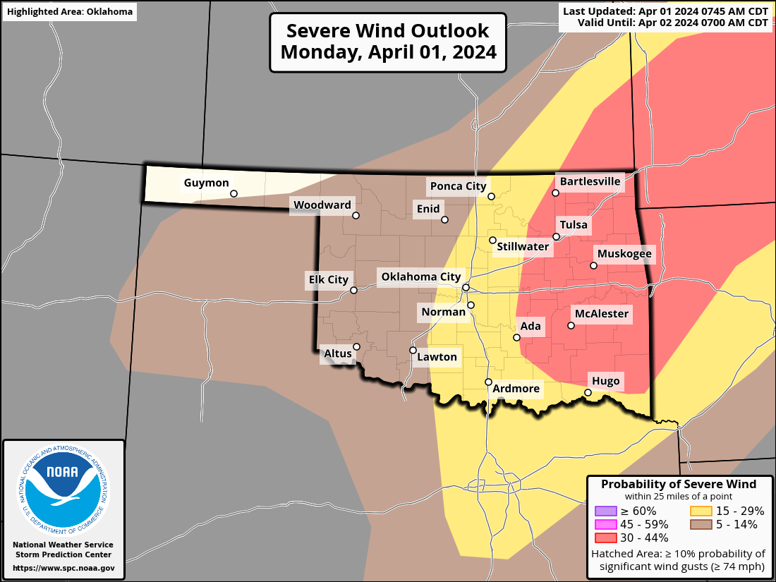
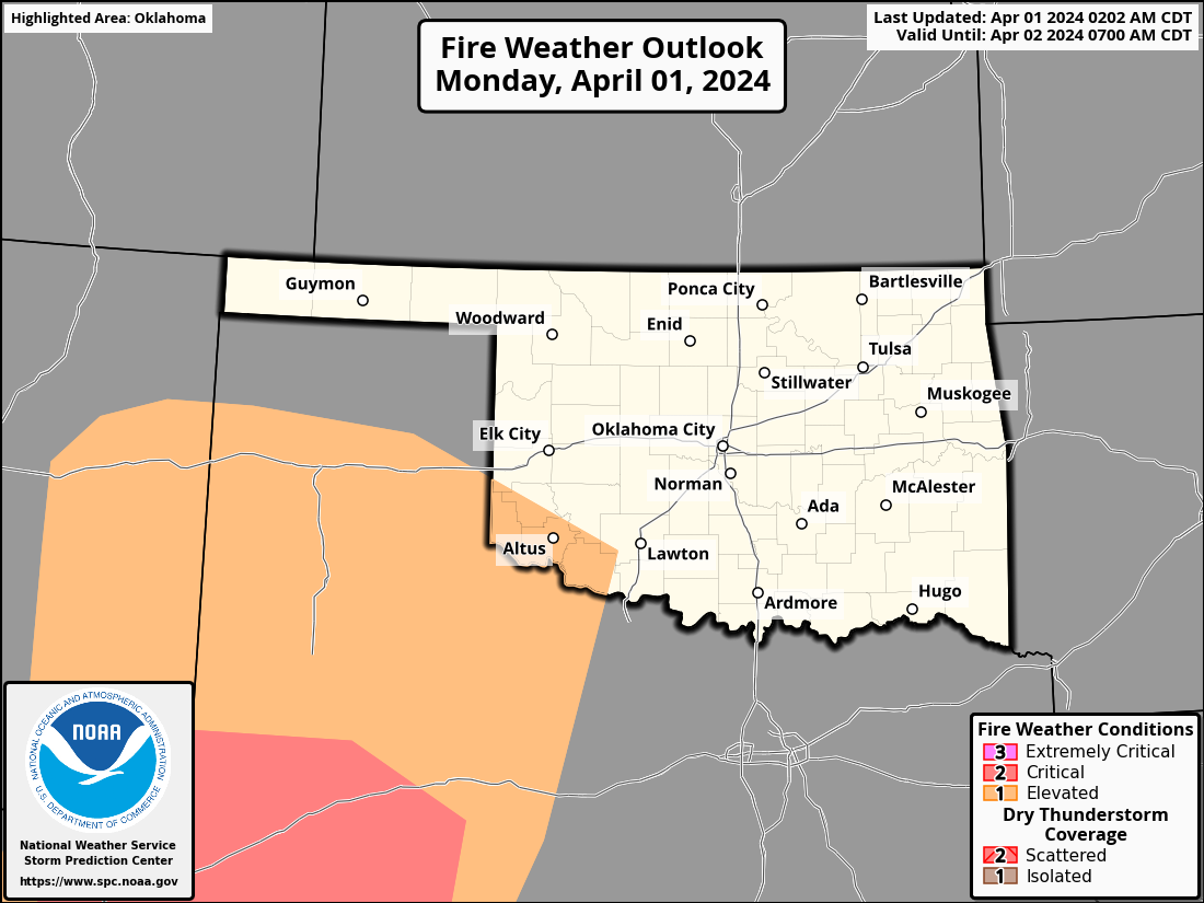
oxygen, but EVERYBODY should be aware of the enhanced severe weather risk today,
with large hail being a very likely hazard today, as well as the above-mentioned
(in the graphic) tornadoes and severe winds. Sure, tornadic winds are also
severe, but remember not all severe winds are tornadic.
Also remember tornadic winds suck, but so do severe winds.
SCIENCE!
Timing, you ask? Dangit Jim, I'm a climatologist, not a watch! Oh, you mean the
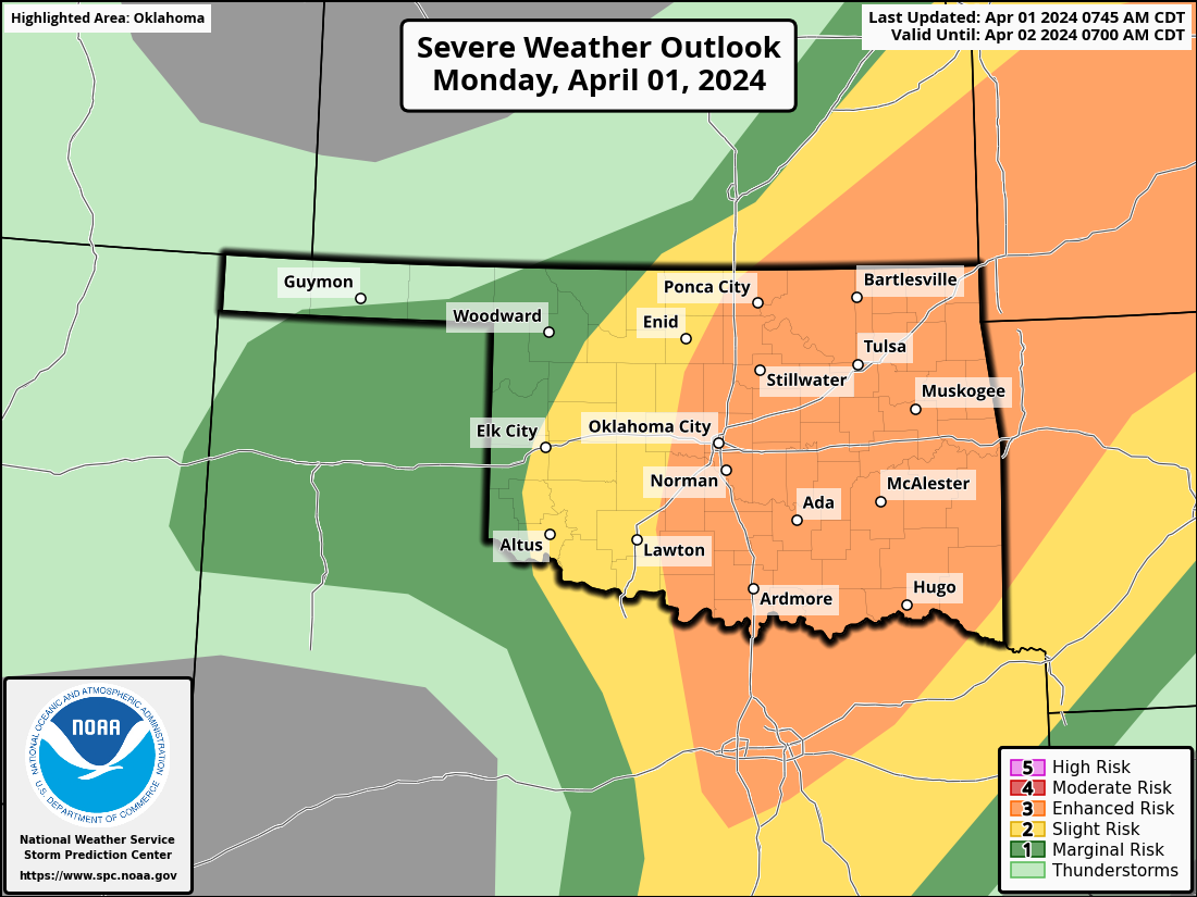
severe weather timing? Well here are some helpful graphics from our NWS friends.
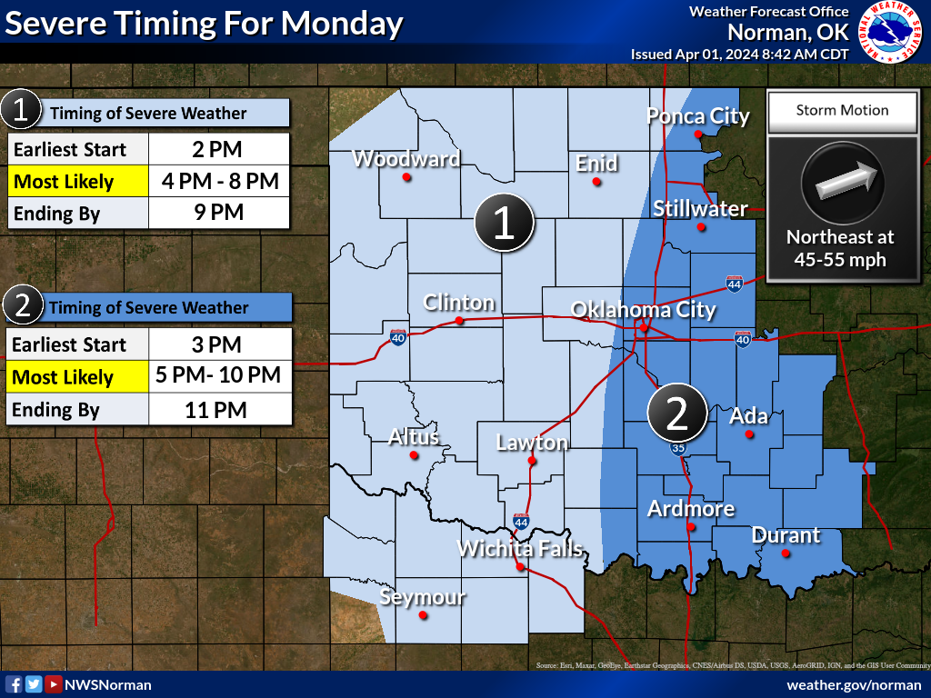
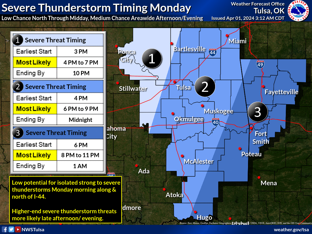
Basically, a mid-afternoon start, with storms rapidly going severe. The threat
for severe hail will start almost immediately, and then we'll see that tornado
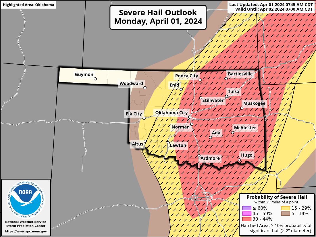
threat ramp up later in the evening. That hail outlook is concerning. I mean,
the Storm Prediction Center keeps mentioning "occasional significant to gigantic
hailstones" for crying out loud, which is a danger to property AND life.
Yeah, it'll put knots on your noggin faster'n you can rub 'em.
These storms will be hauling along at over 50 mph in some cases, so you won't
have as long to prepare when storms do fire, so go ahead and prepare early.
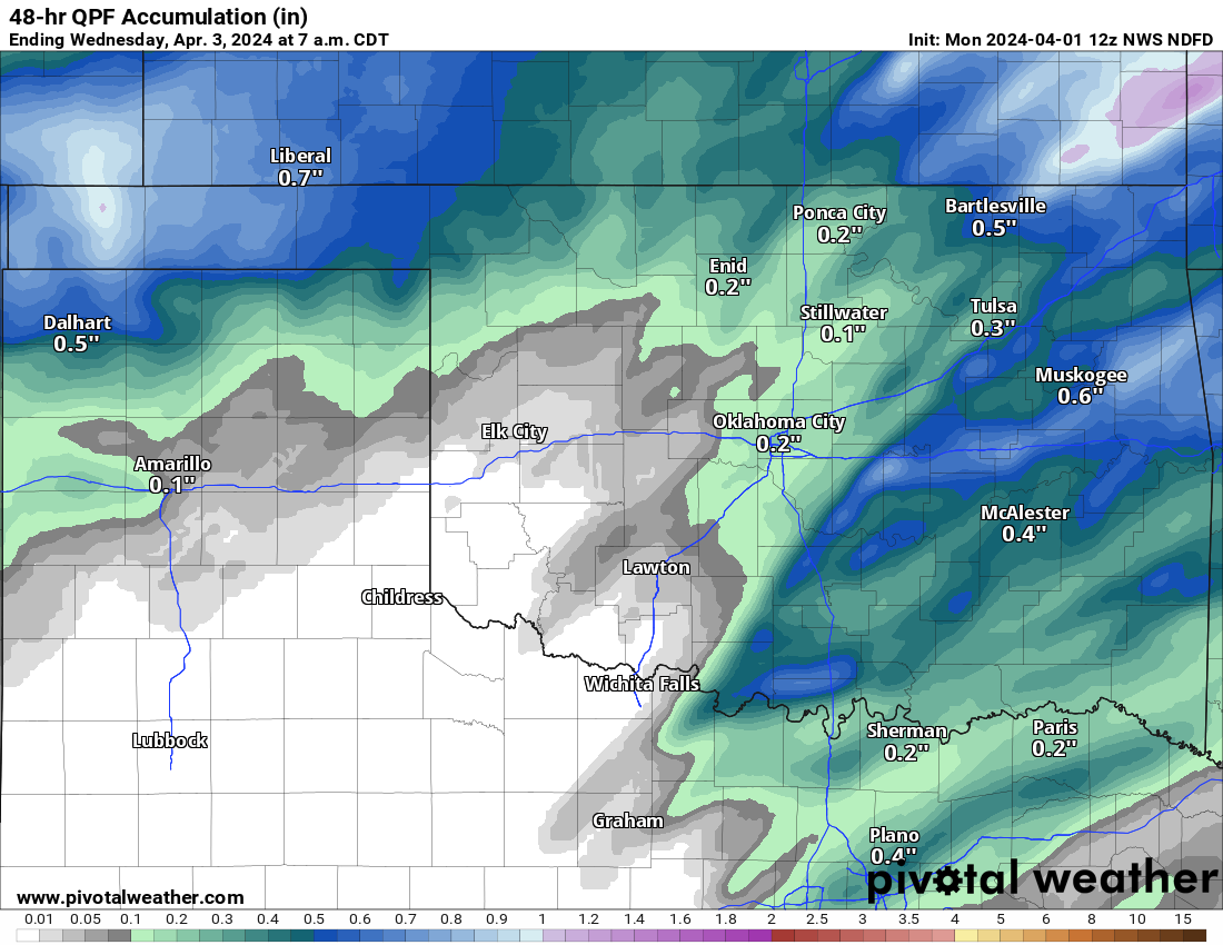
Rainfall could be better, and there might be some flooding, but if you're in SW
OK behind the dryline, wildfires will be a concern. So be on the lookout for
smoke and report anything you see.
Hey, speaking to tornadoes (you handle 'em the way YOU want to, I like to yell
at them), didya know that Oklahoma had gone nearly 5 months without a tornado,
all the way back to late October? And the two tornadoes from late October were
the only ones from early July to March 14, when we saw our first two twisters of
2024?
HA! Everybody knows that! Maybe you should read the March summary below and
catch up.
STAY WEATHER AWARE TODAY!
---------------------------------------------------------------------------------
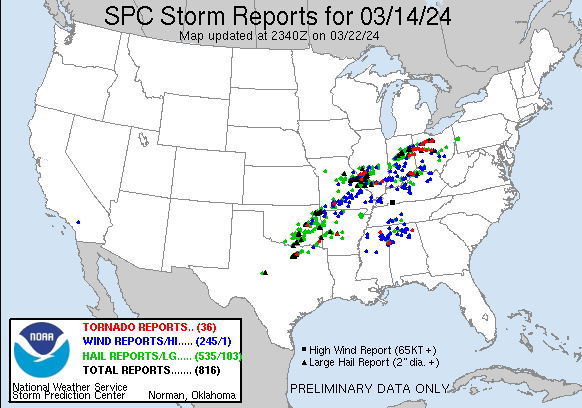
Tornadoes Return to Oklahoma in March
April 1, 2024
Oklahoma’s weather was mostly lamb during March, although it did have its lion
moments. The state experienced only one true outbreak of severe weather, but
that single event on March 14 was significant nonetheless with two confirmed
tornadoes in McIntosh and McCurtain counties and hail greater than softball
size in Ada. Remarkably, Oklahoma had gone nearly five months without a
confirmed tornado since the previous two back on October 24, 2023, in Garvin
and Pottawatomie counties. These October tornadoes were the only ones in the
state for the majority of the past nine months, aside from a solitary tornado
near Woodward on July 7, 2023. The five confirmed tornadoes from July through
March are notably fewer than the 1951-2022 average of 15 tornadoes for the same
nine-month span. The hailstorm on March 14 caused significant property damage in
Ada, with reports of hailstones the size of baseballs and one measuring nearly 6
inches—the largest ever recorded in Pottawatomie County, according to the
National Weather Service. March also brought a late-season snowfall that
deposited 3-4 inches of snow in the Oklahoma Panhandle on the 25th, with central
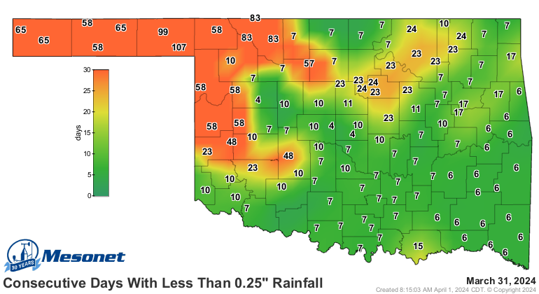
Oklahoma receiving a few inches as well. A flash drought emerged in northwestern
Oklahoma at the month’s end, following an extended dry spell of up to 107
consecutive days without at least a quarter-inch of rain. Elevated temperatures
during this period further exacerbated the drought conditions.
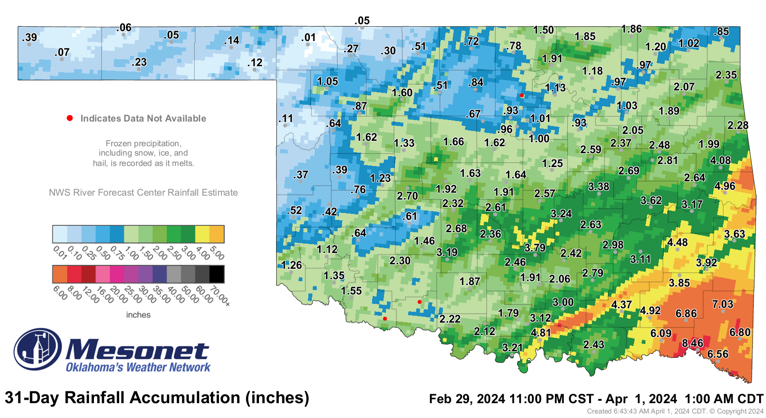
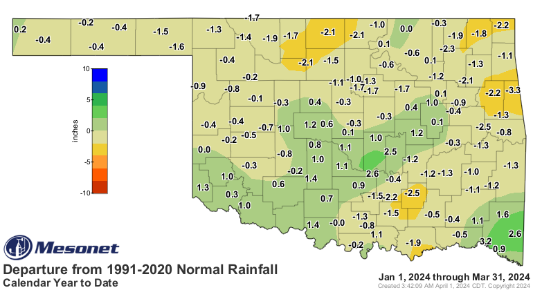
The statewide average precipitation for March tallied 1.95 inches, as per
preliminary data from the Oklahoma Mesonet, marking it as the 47th driest March
since records began in 1895 and 0.83 inches below normal. In the Panhandle, the
average total precipitation of 0.13 inches ranked as its 13th driest March on
record, with an average deficit of 1.17 inches. Deficits predominated across
much of the state, although smaller areas experienced surplus precipitation,
notably in central and southeastern Oklahoma. Valliant reported the highest
total for the month at 8.46 inches, exceeding the normal by 3.6 inches, whereas
Buffalo recorded a mere 0.01 inches—barely enough to register on the rain
gauge—marking a deficit of 1.5 inches below normal. Thirty-three Mesonet sites,
including Buffalo, reported totals at or below an inch, while twenty-five sites
accumulated at least 3 inches throughout the month. The statewide average
precipitation for the first three months of the year stood at 5.57 inches, 0.47
inches below normal, marking it as the 60th wettest January through March on
record.
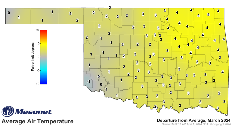
The statewide average temperature was 54.1 degrees, 2.9 degrees above normal
and ranked as the 22nd warmest March on record. Temperatures across the state
ranged from a high of 88 degrees on March 31 at Alva, to 11 degrees at Boise
City on the 26th. The first half of the month was several degrees warmer on
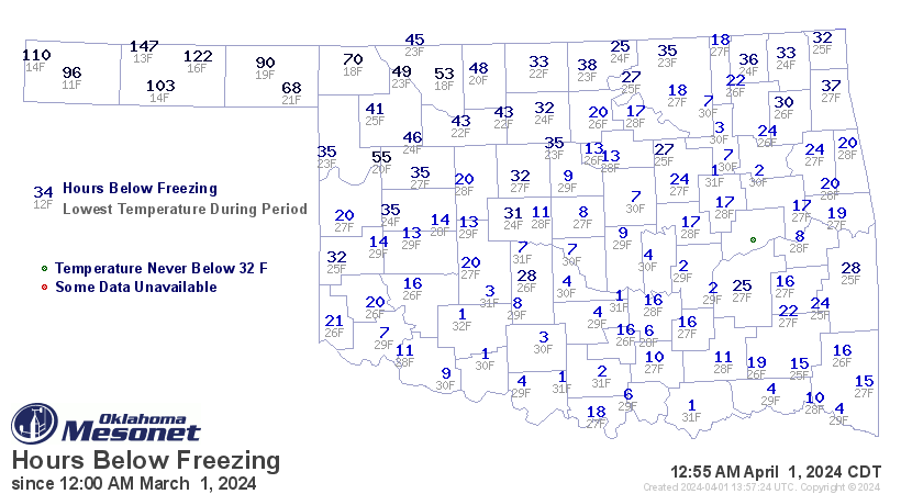
average than the second half, and most of the state spent more hours at or
below freezing during the latter half of March. Freezing hours ranged from about
one hour in parts of southern Oklahoma during March, to nearly 150 hours in the
Panhandle. The first three months of the year were 1.9 degrees above normal at
45.9 degrees statewide, the 19th warmest January through march on record.

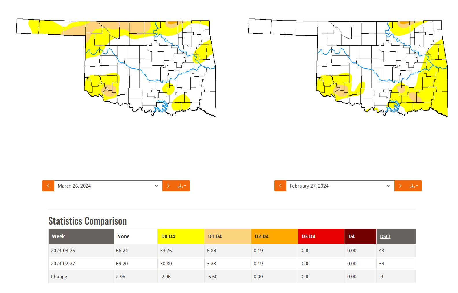
Drought coverage in the state expanded by over 5% throughout the month—from 3%
to 9%—primarily due to the emerging flash drought across northwestern Oklahoma.
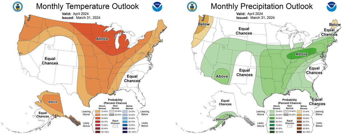
However, there is some optimism for the state according to the Climate
Prediction Center's April outlooks. These forecasts suggest increased chances of
above-normal precipitation for all areas except the western Panhandle. Also,
above-normal temperatures are anticipated across much of the same region.
Additionally, the CPC's April drought outlook indicates the potential for the
improvement or complete removal of the current drought conditions in Oklahoma.

###
Gary McManus
State Climatologist
Oklahoma Mesonet
Oklahoma Climatological Survey
gmcmanus@mesonet.org
April 1 in Mesonet History
| Record | Value | Station | Year |
|---|---|---|---|
| Maximum Temperature | 98°F | ALTU | 2012 |
| Minimum Temperature | 19°F | EVAX | 2023 |
| Maximum Rainfall | 2.57 inches | TIPT | 2006 |
Mesonet records begin in 1994.
Search by Date
If you're a bit off, don't worry, because just like horseshoes, “almost” counts on the Ticker website!