Ticker for February 28, 2024
MESONET TICKER ... MESONET TICKER ... MESONET TICKER ... MESONET TICKER ...
February 28, 2024 February 28, 2024 February 28, 2024 February 28, 2024
I wan't the heat
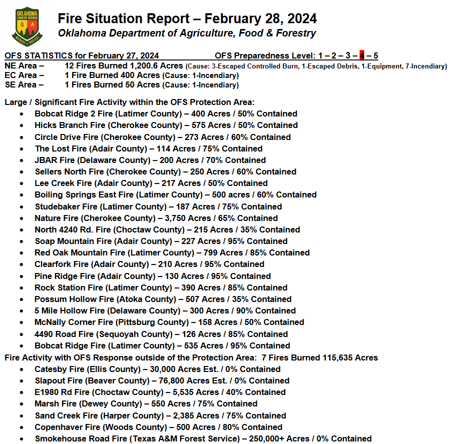
Well that about covers the wildfires. What a ridiculous display by Mother Nature,
with over a hundred thousand acres burned yesterday in Oklahoma, and hundreds of
thousands in the Texas Panhandle. Want to see why a wind shift like we saw
yesterday with the cold front's passage is so dangerous to firefighters (and
those thinking they're safe from the path of the fire? Check out this video
where you see the cold front surging south and the wind shift changing the
direction of those fires from NE to S.
https://content.mesonet.org/ticker/archive/20240228/fires.mpg
Just look at this list of fires from this mornings sit-rep (military to English
translation: situation report) from the OK Forestry Service:
I think the fuel load--the amount of dry and desiccated vegetation available
for the wildfires to take advantage of--was a bit higher than expected given
the amount of rain up in that part of the state through the warm season last
year. The summer alone saw amounts 5-10 inches above normal up that way (west
central Oklahoma's wettest summer on record, and the Panhandle's 3rd wettest),
and it has dried out considerably since.

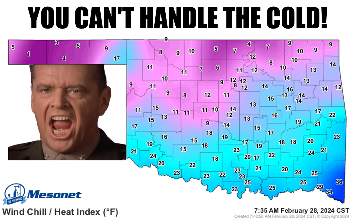
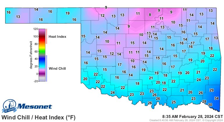
Then we wake up to even more foolishness with wind chills in the single digits
and teens/twenties, and a hard freeze.
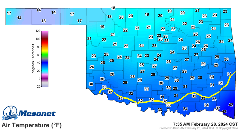
And there's just not a lot of relief showing up just yet.
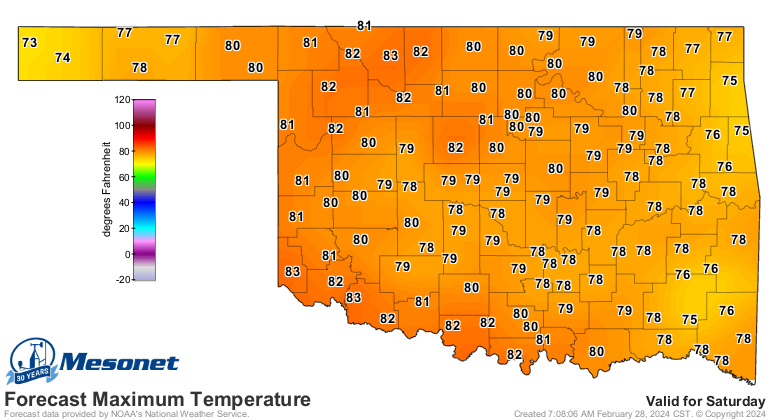
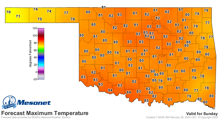
Well, the sun'll come out tomorrow (just like it did today), but the heat will
be back on Friday and peaking over the weekend.
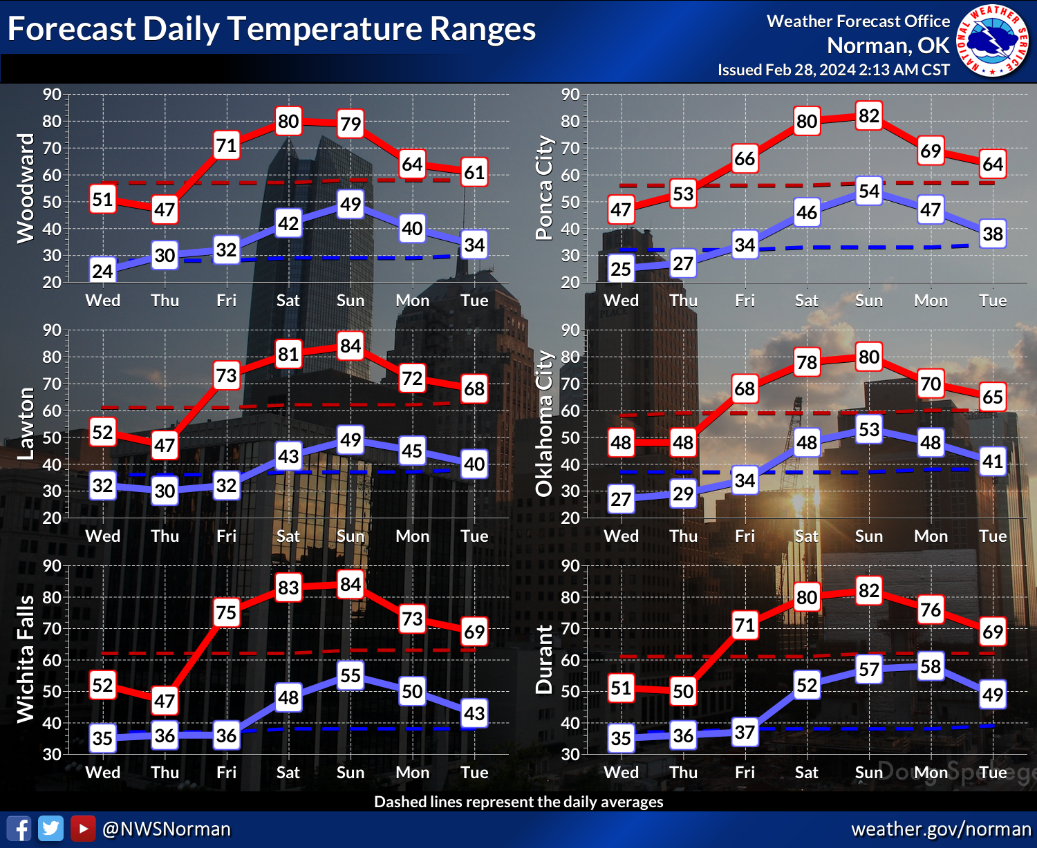
But so will the fire danger!
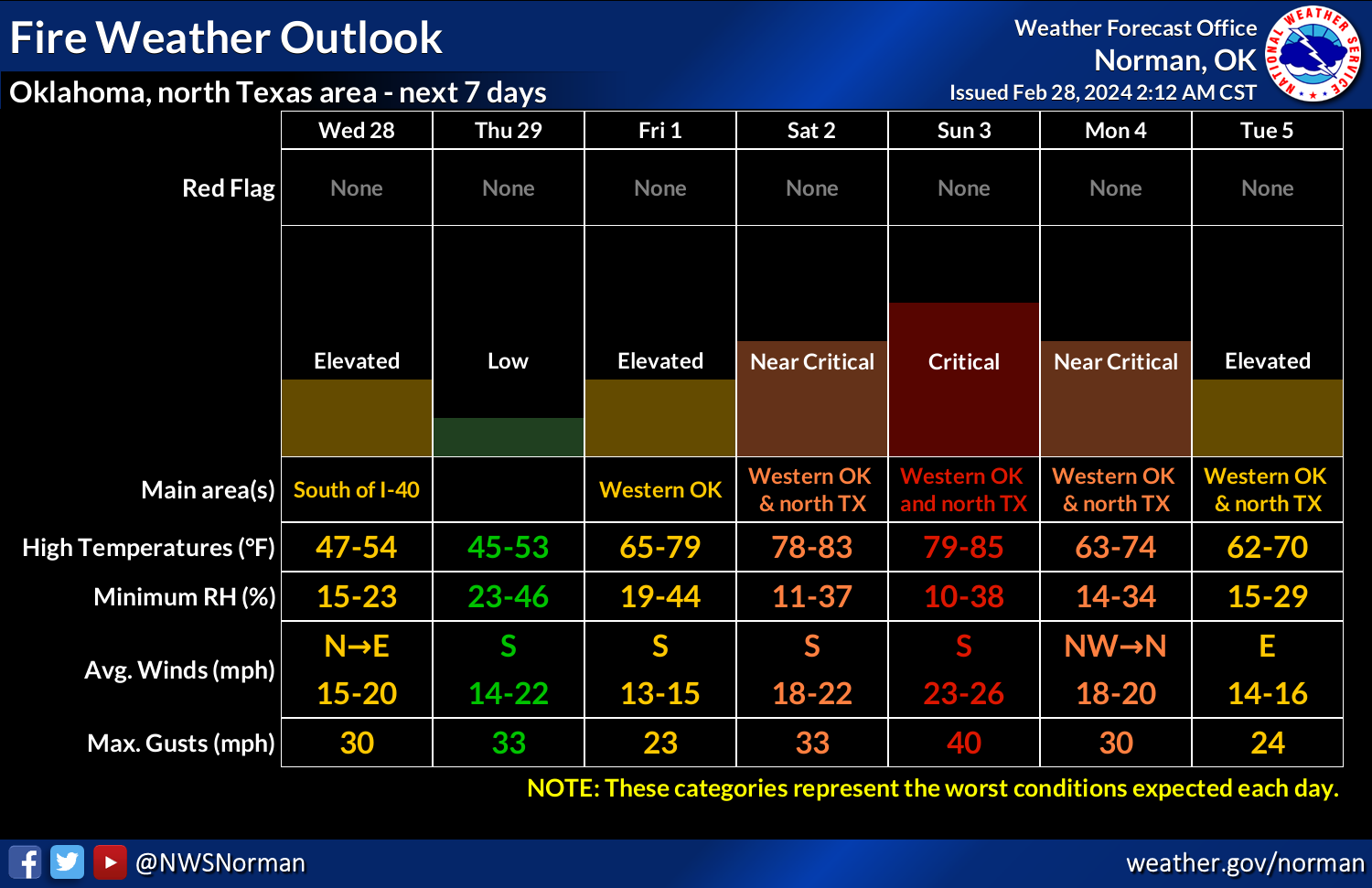
It'll be this way with every dry frontal passage, every day with low RH and high
winds, every day until we green up.
Hey, maybe it's warmed up since I started writing this!
Wow, what a heat wave.
Gary McManus
State Climatologist
Oklahoma Mesonet
Oklahoma Climatological Survey
gmcmanus@mesonet.org
February 28 in Mesonet History
| Record | Value | Station | Year |
|---|---|---|---|
| Maximum Temperature | 90°F | HOLL | 2006 |
| Minimum Temperature | 7°F | BEAV | 2019 |
| Maximum Rainfall | 3.70 inches | BROK | 2018 |
Mesonet records begin in 1994.
Search by Date
If you're a bit off, don't worry, because just like horseshoes, “almost” counts on the Ticker website!