Ticker for June 22, 2023
MESONET TICKER ... MESONET TICKER ... MESONET TICKER ... MESONET TICKER ...
June 22, 2023 June 22, 2023 June 22, 2023 June 22, 2023
Anti-horror
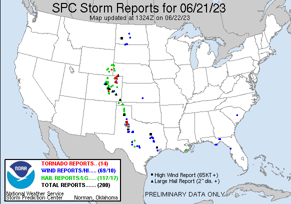
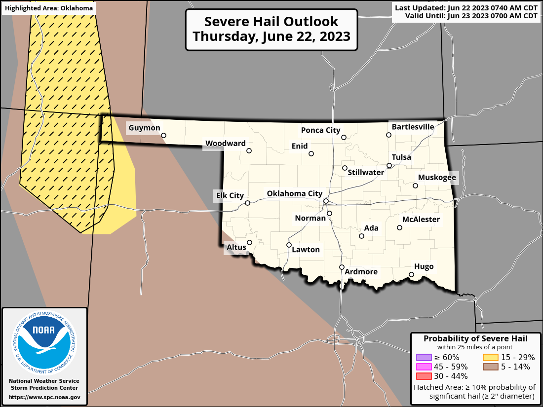
First off, Oklahoma dodged the proverbial bullet yesterday. The storm complex that
barreled down through the center of the state sent out an outflow boundary backed
by a mass of colder, denser air (and we all know just how painful that can be)
that killed our severe storm chances. At least in the main body of the state.
Unfortunately for the Panhandle and the High Plains region, it set up a perfect
storm genesis device as the outflow boundary interacted with a dryline that had
set up out there. The resulting discrete supercells spawned at least two killer
tornadoes in Colorado and Texas.
There will be a chance of storms again today and tomorrow in the Panhandle and
High Plains. Tornado chances are low but not zero, just like yesterday, so it's
best to stay weather aware if you live or are traveling through those areas.
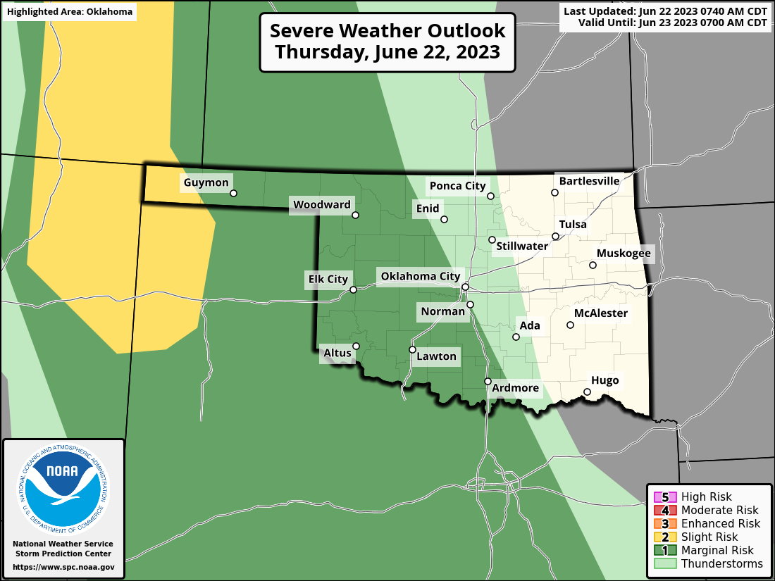
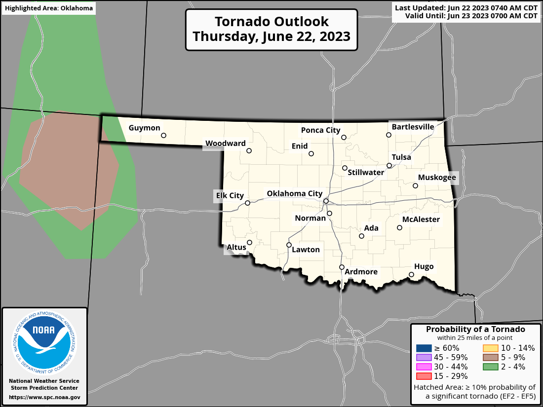

It's sort of the same setup as yesterday with a complex of storms in KS
coming down to the south across Oklahoma, then storms forming later in the
afternoon out west.
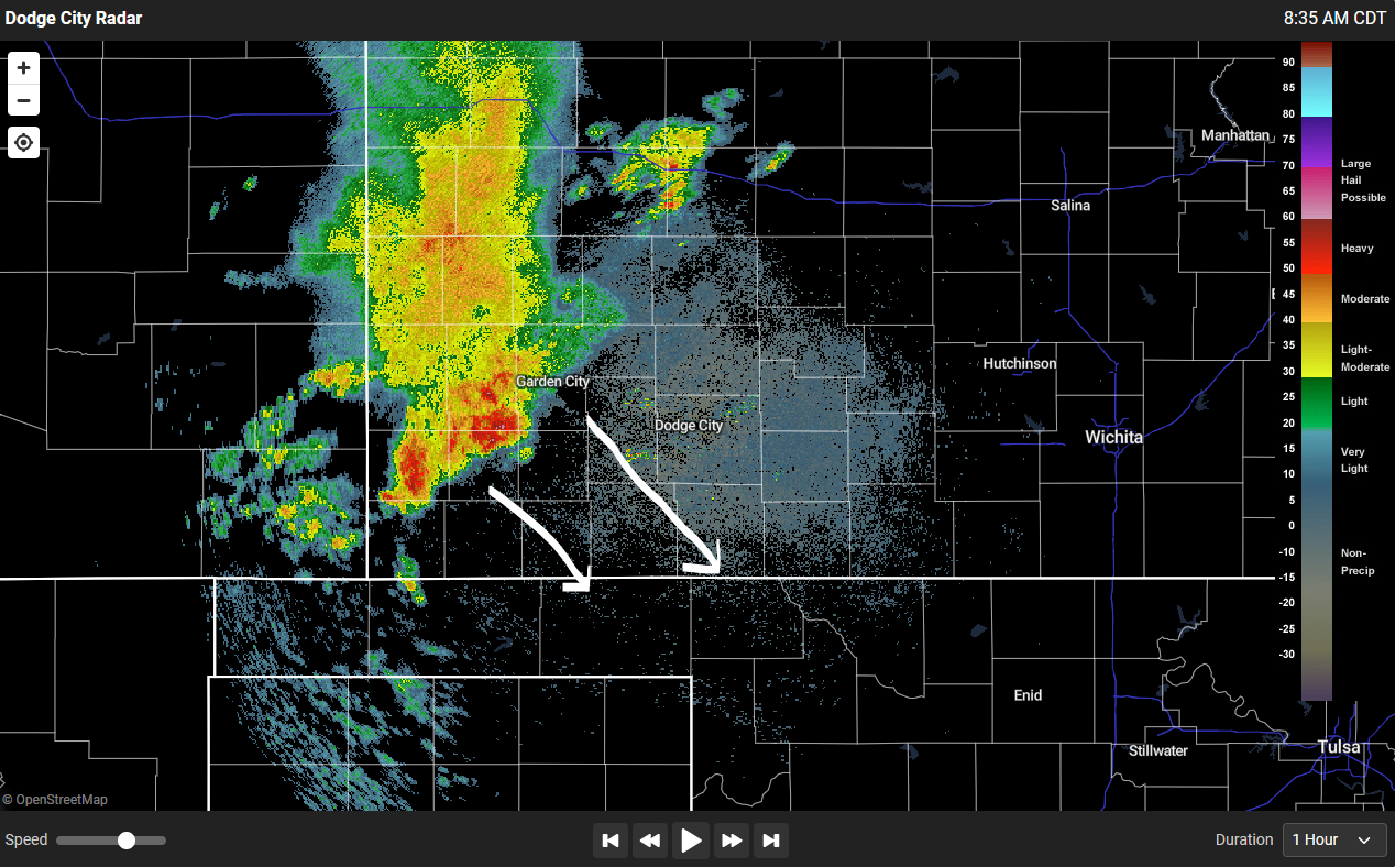
How far they make it and how severe they get needs to be watched throughout
the day. It will provide more rain, should they make it down our way (and it
looks like they will)...shockingly, across western OK again.
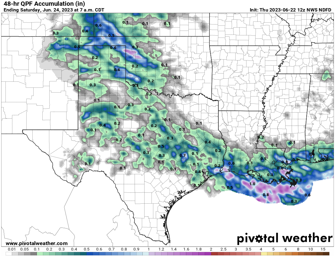
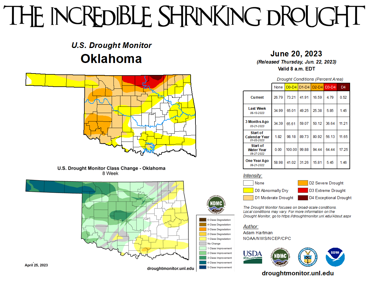
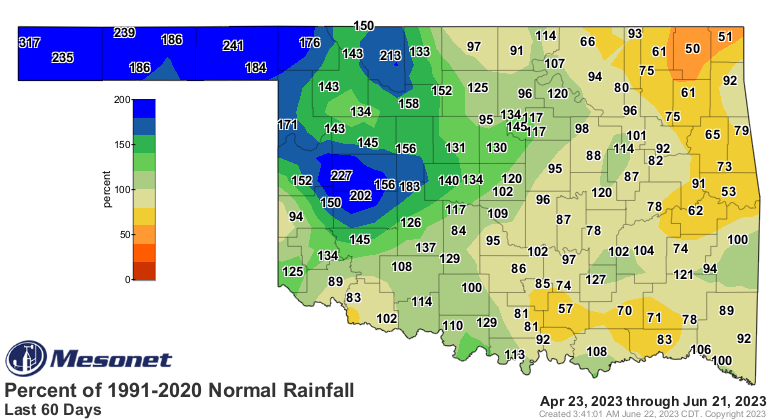
And that sets us up to talk about drought. Oh, it's still here, and gaining
some traction in eastern OK, but it's dwindling with each storm system across
western OK. Still holding strong in parts of north central OK, unfortunately.
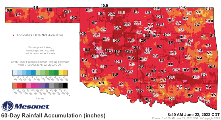
Cimarron County in the far western Panhandle is drought free for the first time
since August of 2021! And the rains of the past couple of months are the main
reason.

Now we all remember last summer and how we were largely out of drought across
most of the state at this time last year, and how the heat and drought
EXPLODED over the next 6 months. There's really no sign of that happening again,
but again that was so extreme (one of the most extreme flash droughts that I've
seen in my career) that it's not worth worrying about at this time. Not saying
it couldn't happen, not saying it won't happen, I'm saying it PROBABLY won't
happen. That's how extremes work.
Okay, stay weather aware today. I'll stay climate aware, which is much MUCH more
boring.
Gary McManus
State Climatologist
Oklahoma Mesonet
Oklahoma Climatological Survey
gmcmanus@mesonet.org
June 22 in Mesonet History
| Record | Value | Station | Year |
|---|---|---|---|
| Maximum Temperature | 104°F | TIPT | 1998 |
| Minimum Temperature | 49°F | BOIS | 2004 |
| Maximum Rainfall | 4.73 inches | MANG | 1999 |
Mesonet records begin in 1994.
Search by Date
If you're a bit off, don't worry, because just like horseshoes, “almost” counts on the Ticker website!