Ticker for May 15, 2023
MESONET TICKER ... MESONET TICKER ... MESONET TICKER ... MESONET TICKER ...
May 15, 2023 May 15, 2023 May 15, 2023 May 15, 2023
It could be worse or better
First off, let me just begin with telling you that, heck, it's raining right now
for crying out loud!
Now I promised you a week ago that we were gonna have a, uhhhhhh, week of actual
spring rainy season. What I failed to see that that (and that, too) was about
half the story. For some, it was an actual week of spring rainy season, but for
others, it was a big bust.
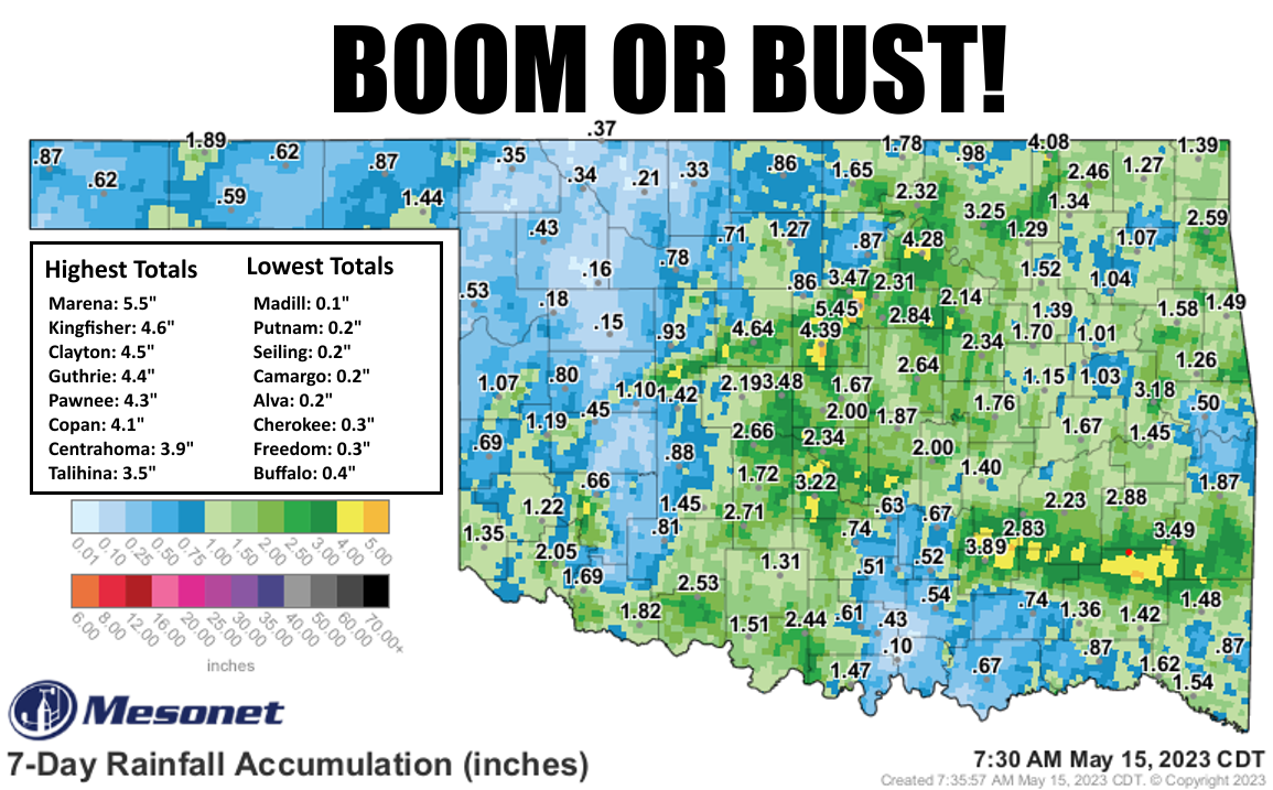
Speaking of big busts, here's a bust of a big bust bust bust (WATCH IT!):

But if you're in just about anywhere in NW OK...yeah, the week was a big bust. And
that goes for folks in the Panhandle, parts of southwest, south central, and
even east central Oklahoma. Other areas in between gauges received radar-
indicated totals of 4-6 inches, if not higher. And that's the nature of our
convective systems. Areas where the storms trained over the same area again
and again dealt with flooding. But it remains in places like Madill, Putnam,
Seiling, Camargo, etc., not nearly enough.
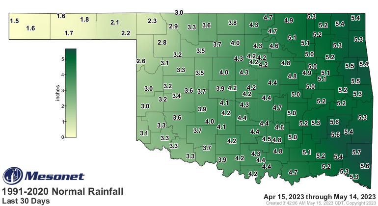
How does that shake out for our "normal" rainiest part of the rainy season
thus far, about mid-April through mid-May? Well, same story...feast or famine
as indicated in the 30-day rainfall maps. Keep in mind THIS is what we'd expect
over the last 30 days.
And this is what actually occurred.
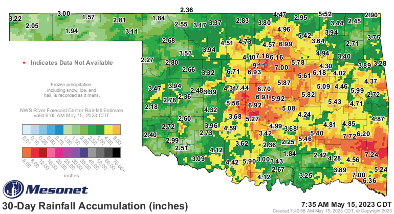
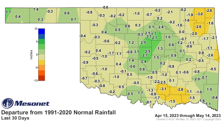
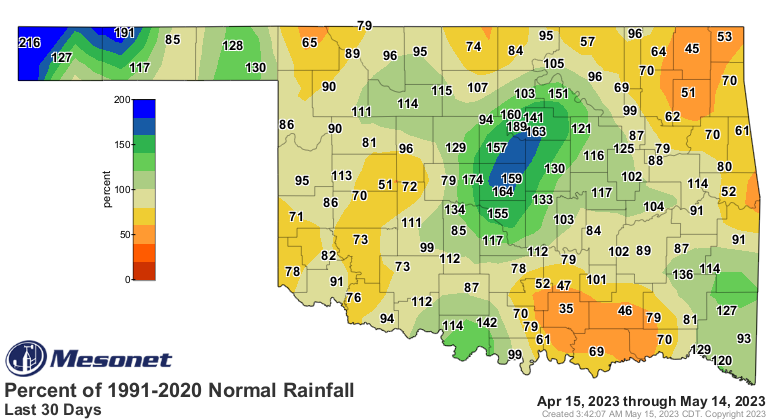
Any of the darker yellows or oranges indicate less than 75% of normal rainfall,
and we can see parts of south central and northeast Oklahoma have the biggest
deficits, unfortunately. I guess the good news is we should see continued rain
chances throughout the week.

The bad news is these rain forecast maps from the Weather Prediction Center have
been less than helpful for those bust areas. This is what the actual NWS
gridded forecast shows, at least for the next 48 hours.
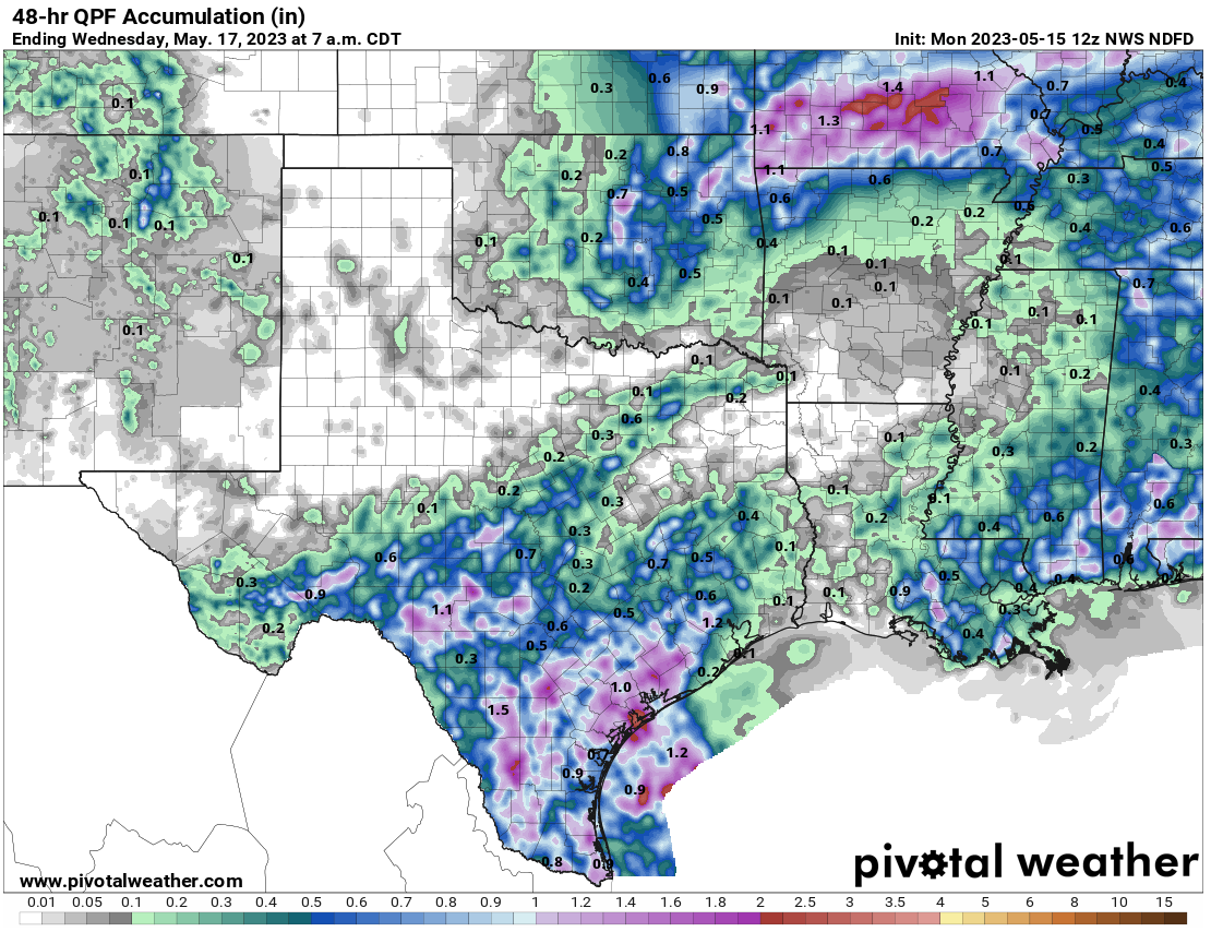
So we'll hope for the best across NE OK, maybe fill in one of those deficit
areas a little better. As for the other areas, we'll hope for the best in a few
days with our next good chance of rain.
Gary McManus
State Climatologist
Oklahoma Mesonet
Oklahoma Climatological Survey
gmcmanus@mesonet.org
May 15 in Mesonet History
| Record | Value | Station | Year |
|---|---|---|---|
| Maximum Temperature | 104°F | GRA2 | 2022 |
| Minimum Temperature | 32°F | BOIS | 2011 |
| Maximum Rainfall | 5.38 inches | KETC | 2020 |
Mesonet records begin in 1994.
Search by Date
If you're a bit off, don't worry, because just like horseshoes, “almost” counts on the Ticker website!