Ticker for March 30, 2023
MESONET TICKER ... MESONET TICKER ... MESONET TICKER ... MESONET TICKER ...
March 30, 2023 March 30, 2023 March 30, 2023 March 30, 2023
WHOOSH!

Yes, that's my industrial strength hair dryer and yes...I CAN live without it,
sadly. And it's not even going to be a hot wind, at least until later on tomorrow,
but an oncoming storm system is going to kick up the wind starting today, but
especially tomorrow, and it's bringing all sorts of trouble with it.
Let's start with the fire danger. I'd prefer to end the fire danger, but this is
Oklahoma and we can't have nice things in the spring. There will be a Red Flag
Fire Warning for tomorrow with extreme fire danger in store. Check out the
conditions we gathered from the Mesonet's OK-FIRE program for 4 p.m. tomorrow
afternoon.
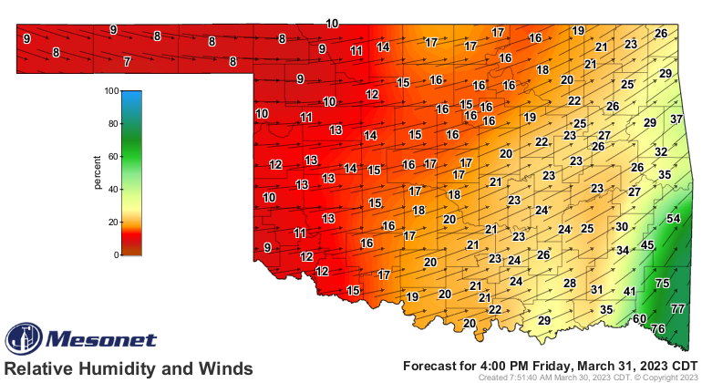
Relative humidity in the single-digits to the teens at that time, and a howling
west-southwest wind at 30-40 mph, gusting to 60 mph+. A westerly component of the
wind brings downslope compression of those air parcels, which means the
temperatures should kick up close to 80 as well. In fact, in some areas we
might see wind speeds and high temperatures trying to converge. Watch out
west central Oklahoma!

So those conditions, combined with our lack of green in most areas--both due
to drought as well as vegetation being still dormant--will produce fire danger
well into the extreme category.
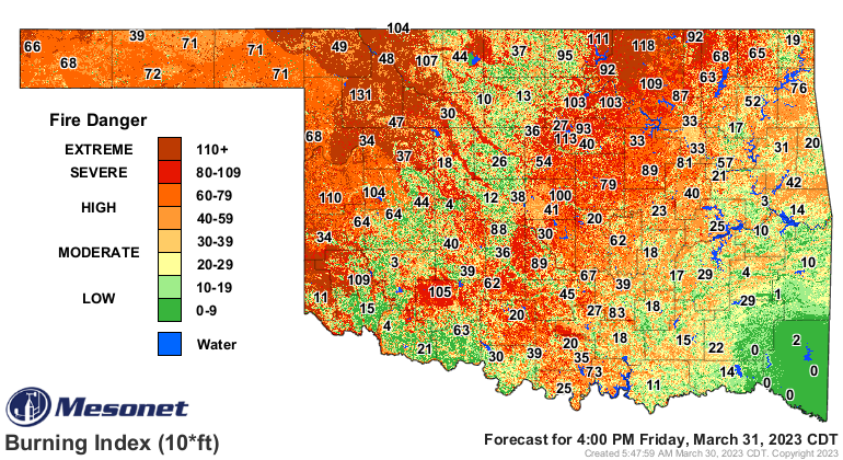
We're getting into the time of year where drought becomes much more important
in the scheme of wildfire danger, when we should be seeing green up. No water,
no green up, right? At least for the most part. Want to see something crazy?

Now you want to see something REALLY crazy?
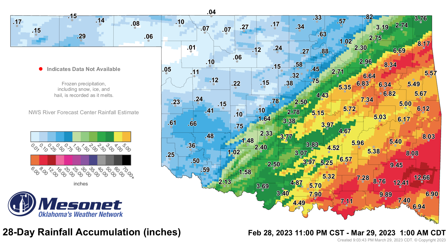
That's right, Woodward has had a whopping HUNDREDTH OF AN INCH for the month
of March. And radar estimates show some areas have had a goose egg for the
month. Here's the deal...a hundredth of an inch could be from a horny toad
spitting in the gauge!
If you're asking me "don't you mean a horned lizard?" first off, that marks you
as a substitute Okie, and secondly it's really weird of you because I can't
hear you, you know!
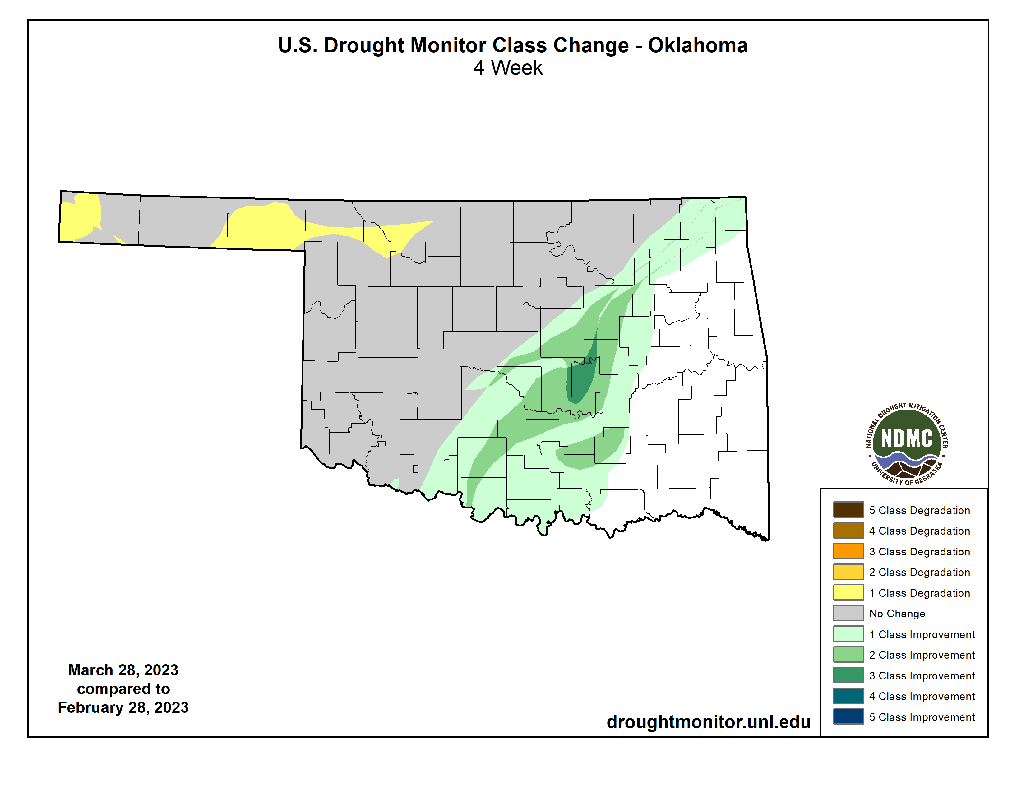
So we continue with our basic drought configuration on the U.S. Drought
Monitor, with nearly all of Oklahoma to the south and east of the I-44 corridor
being drought free, but to the north and west of that boundary, drought continues
to not only thrive, but intensify.
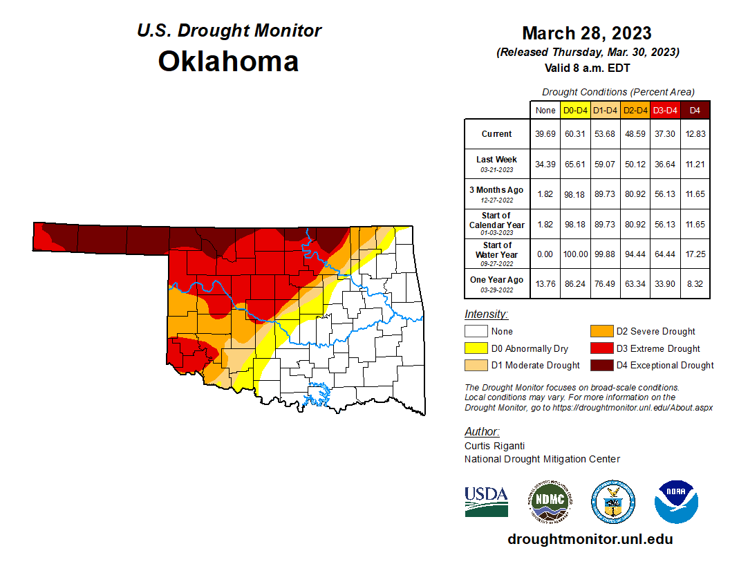
Look how the drought has changed in March due to our differing rain fortunes.
But wait!
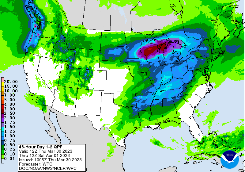
Okay, come on back...we do have a chance of rain today into tomorrow morning, but
I'm afraid for most it'll just be a chance of pain. There's simply too much of
a capping inversion in place (and we all know just how painful that can be)
for any bigtime storm chances.
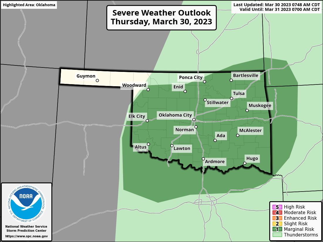
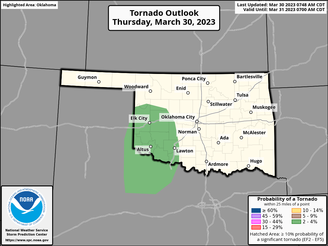
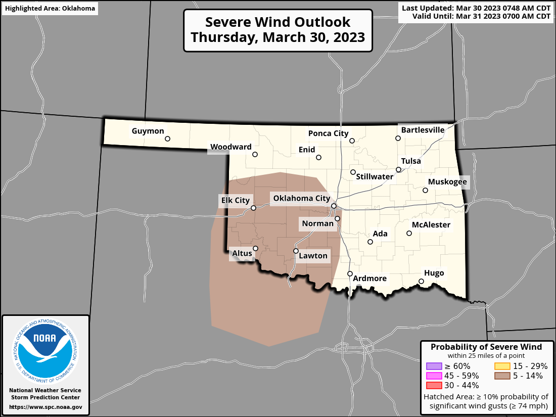
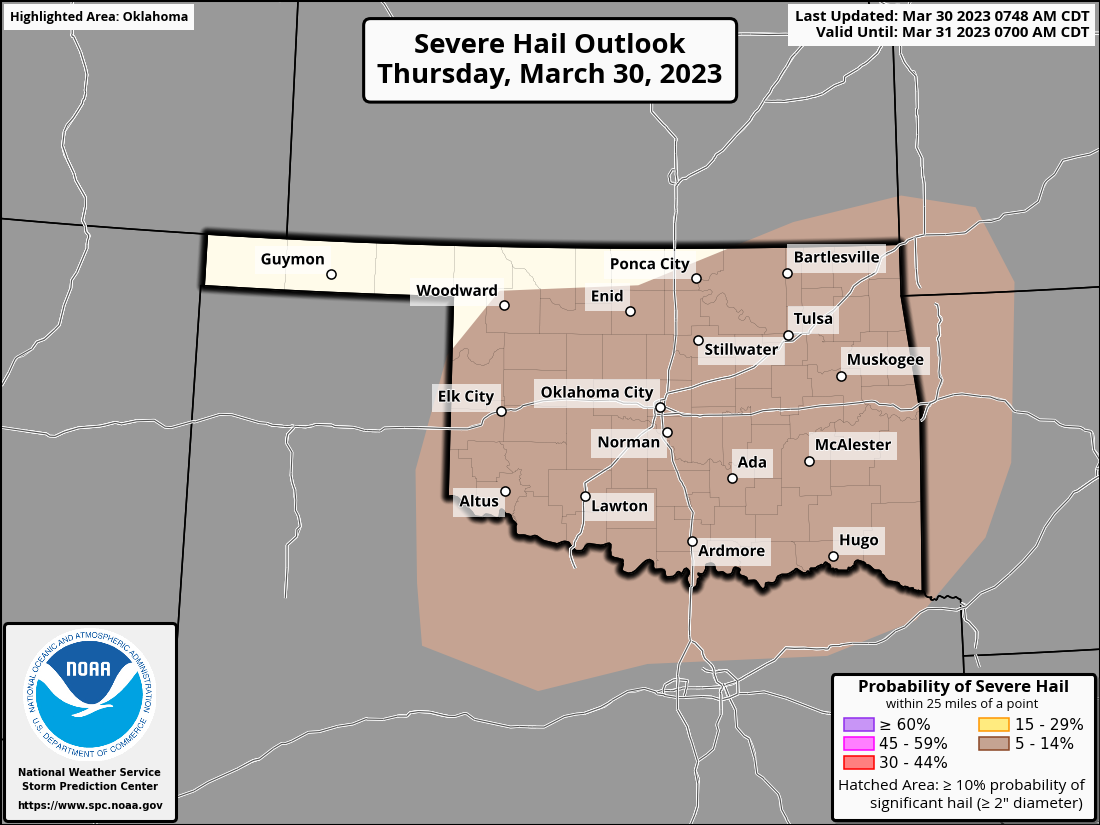
The severe threat is very conditional, but if some storms do manage to fire,
they could get rambunctious.
Maybe better luck with some moisture next week for western OK? Not looking great
right now, but hope is about all we have for now.
So batten down the hatches, hatten down the batches, tie up the hogs, cats, and
cattle...whatever sounds prudent before the wind hits the fan tomorrow.
Gary McManus
State Climatologist
Oklahoma Mesonet
Oklahoma Climatological Survey
gmcmanus@mesonet.org
March 30 in Mesonet History
| Record | Value | Station | Year |
|---|---|---|---|
| Maximum Temperature | 92°F | ARNE | 2010 |
| Minimum Temperature | 20°F | ANTL | 2003 |
| Maximum Rainfall | 5.20″ | IDAB | 2002 |
Mesonet records begin in 1994.
Search by Date
If you're a bit off, don't worry, because just like horseshoes, “almost” counts on the Ticker website!