Ticker for March 20, 2023
MESONET TICKER ... MESONET TICKER ... MESONET TICKER ... MESONET TICKER ...
March 20, 2023 March 20, 2023 March 20, 2023 March 20, 2023
The I44 Curse Continues
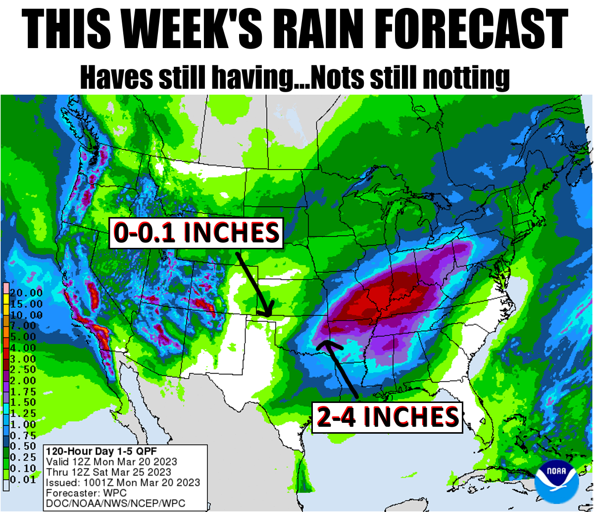
Okay, so spring break was broke in Oklahoma, what else is new? Let's get that cold
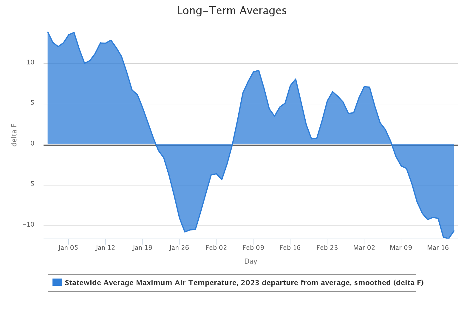
weather out of the way first (PLEASE??). A harder-than-hard freeze occurred over
the weekend, so that ought to take care of all the trees and whatnot that thought
it was safe to come out of hiding for the winter. And NOT-SHOCKINGLY, it coincided
nearly perfectly with Oklahoma's spring break.
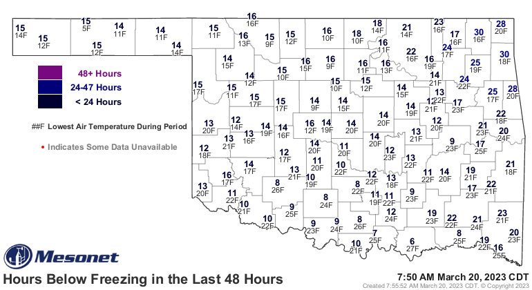
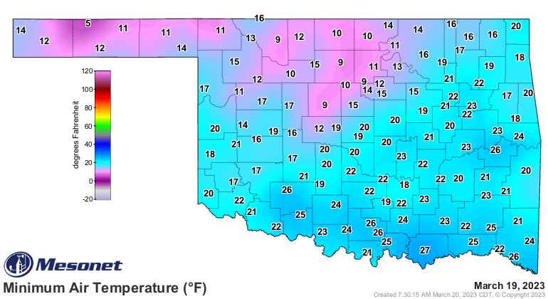
Heck, yesterday's lows were darned near (or just plain old darned) record
breaking! The 5 degrees recorded at Eva was tied for the 4th coldest temperature
ever for a March 19 in Oklahoma. Kenton holds the record with ZERO back in 1951.
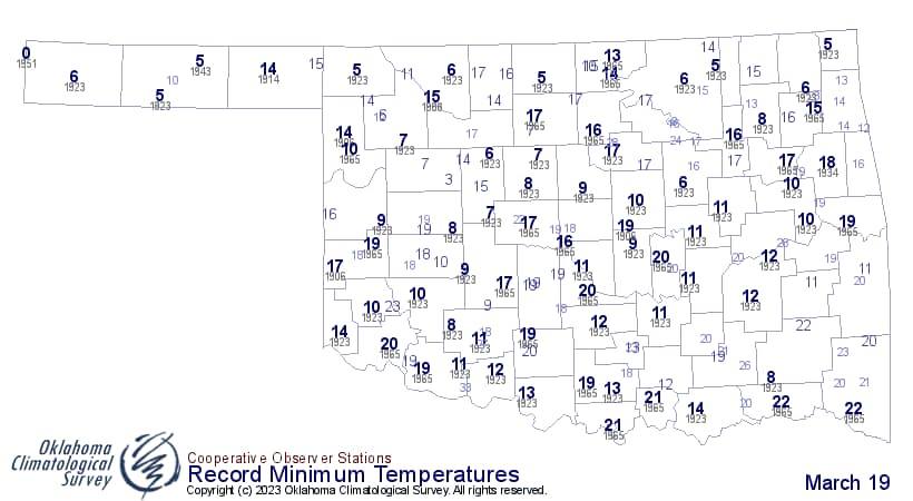
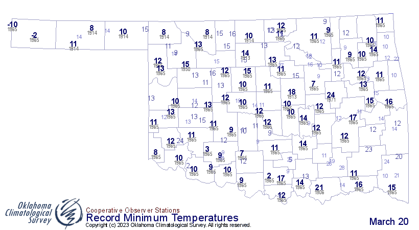
Heck, part 2 (notice I don't say "hell"...wouldn't want to get in trouble): we
had record lows in SE OK this morning!
So we've blown past my hopes for the earliest last spring freeze date across
much of the state (earliest 10th percentile 1991-2020 normals, that is), so
now we go to the avg. avg. date, which is in the next couple of weeks for most of
the state.

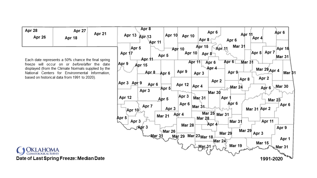
If we go past that, we start to threaten the LATEST last freeze date.
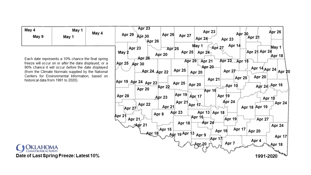
Oh, there will be HECK (safe, see?) to pay if that happens! There is a bigtime
cold front in fantasy-cast territory at the end of March, so keep that in mind.
But for this week, we go back to spring mode, at least for awhile, and fitting
for the first day of astronomical spring. Wednesday looks to be the warmest day
of the bunch.
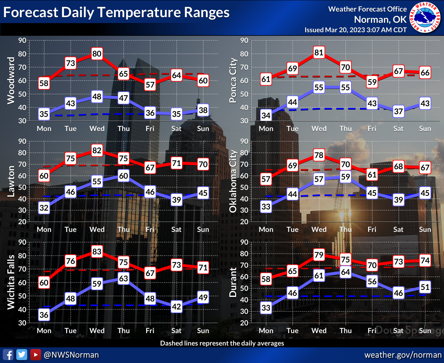
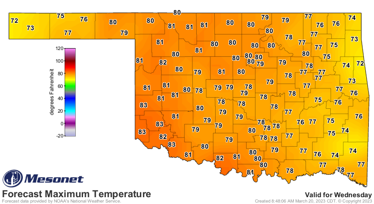
Astronomical spring is much better than astronomical spring. Oh, you want your
horroscope for spring? Well, here it is again.

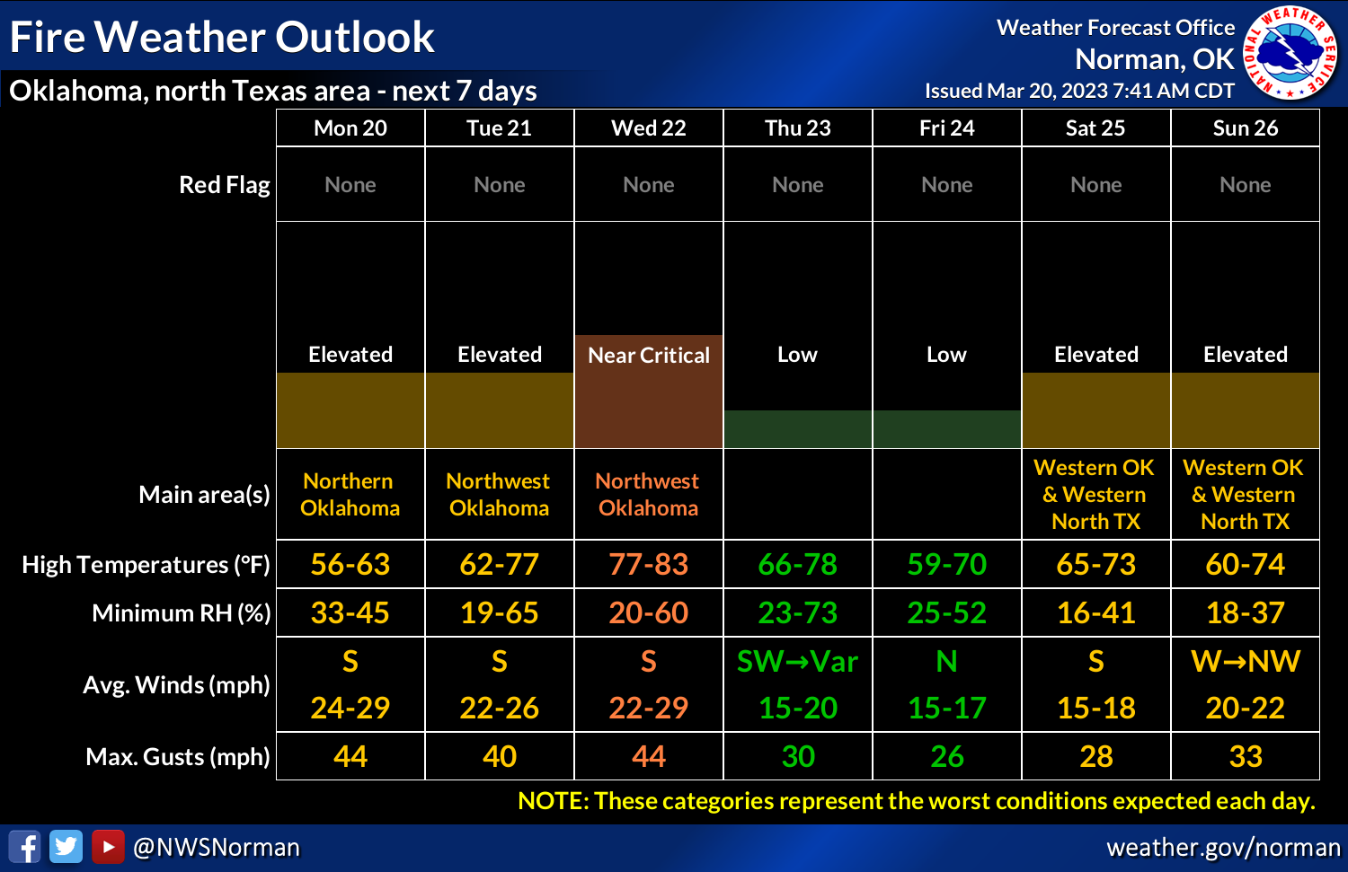
Given the time of year, the lack of green, and the approaching storm system
that I haven't talked about yet, fire danger is inevitable.
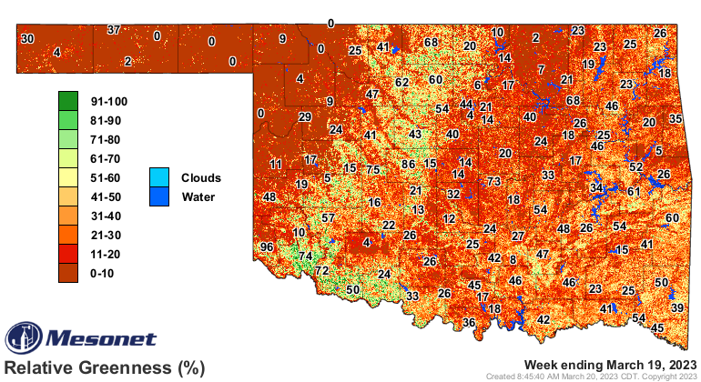
OK-FIRE's relative greenness map is showing Oklahoma's winter wheat belt
starting to pop just a bit from SW to NC OK, but to the NW of there...NOTHING!
The SE half of the state is showing a bit of greenness too, but the cool
weather has counteracted the rains of the last few weeks.
So that storm system should approach the state Wednesday, kick up the winds
to ferocious level and thus the fire danger. Now Thursday is the day to look
at for possible severe weather. So far, the "danger" area appears to be SE of
I-40 mostly, but that could definitely shift as we get closer, so one of those
days you need to sit up and take notice of.
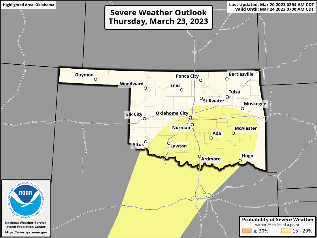
Slight chances of rain tonight through the next few days, but the most hopeful
rainfall day will be Thursday, even as we hope there's not much severe weather.
Good luck, right? It's Oklahoma, after all.
Gary McManus
State Climatologist
Oklahoma Mesonet
Oklahoma Climatological Survey
gmcmanus@mesonet.org
March 20 in Mesonet History
| Record | Value | Station | Year |
|---|---|---|---|
| Maximum Temperature | 98°F | BUTL | 2017 |
| Minimum Temperature | 8°F | KENT | 2016 |
| Maximum Rainfall | 5.14″ | FORA | 2007 |
Mesonet records begin in 1994.
Search by Date
If you're a bit off, don't worry, because just like horseshoes, “almost” counts on the Ticker website!