Ticker for March 6, 2023
MESONET TICKER ... MESONET TICKER ... MESONET TICKER ... MESONET TICKER ...
March 6, 2023 March 6, 2023 March 6, 2023 March 6, 2023
Haves and Have-Nots
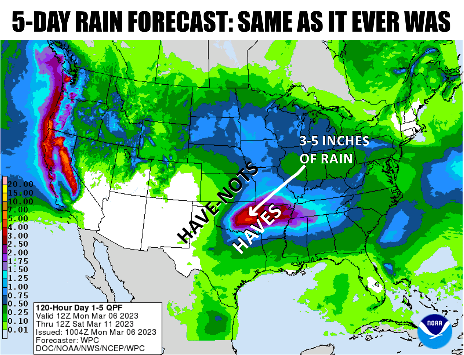
Hey, I might be out of touch, but not when it comes to the lack of rainfall!
And anyways, how can the guy that cornered the central Oklahoma cardboard
market be considered out of touch? After all, I bought cardboard when it was
13 cents/ton, and it's now up to 17 cents/ton, and I own 4 tons of it. I'll
let you do the math on that. Ever hear of Warren Buffet? Elon Musk? Jeff Bezos?
Morons.
But back to less pleasant matters...
Did you know that it has been 152 days since our site at Eva in the central
Panhandle has received at least a tenth of an inch of rain in a single day? Oh
yeah? Well did you know that it has been 188 days since Goodwell or Hooker in
the central Panhandle have received at least a quarter-inch of rain in a single
day?
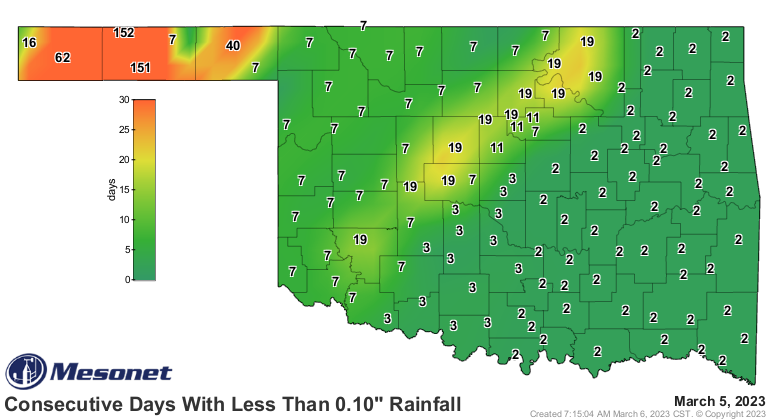
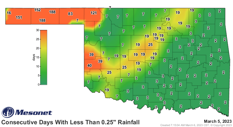
If your answers are "no," I won't ask "where ya been?" because I know where you
HAVEN'T been...and that's the central Panhandle. Or anywhere in the Panhandle or
far NW OK, an area that has largely avoided any significant moisture in the last,
uhhhhhh, 188 days or so. Now if you've been roughly along the I-44 corridor or
to the southeast, especially in the last 60 days, you are LOL'ing at the mention
of drought (I would have said ROTFLYAO but that might have gotten me in trouble).
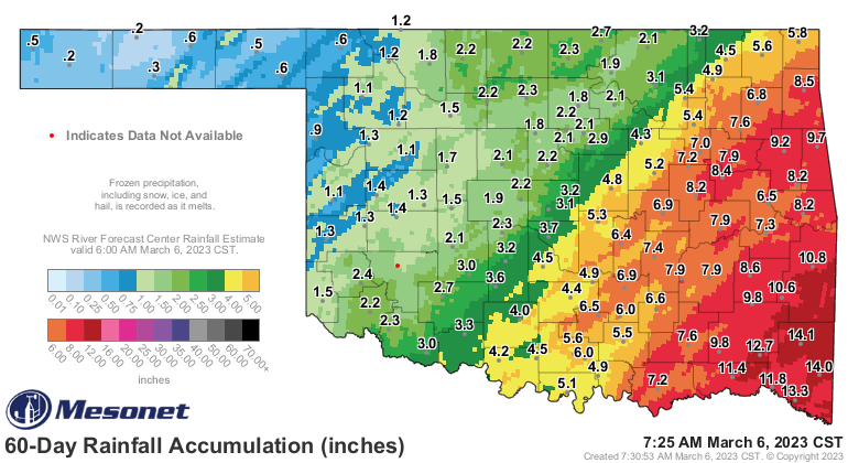
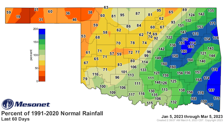
And while, like Forrest, I'm not a smart man...I know what drought is. And the
NW half or so of Oklahoma is it (work with me on the grammar there). Even
though the rain being forecast appears to be headed in that same direction once
again, there is at least SOME hope that we can spread some of that to the NW.
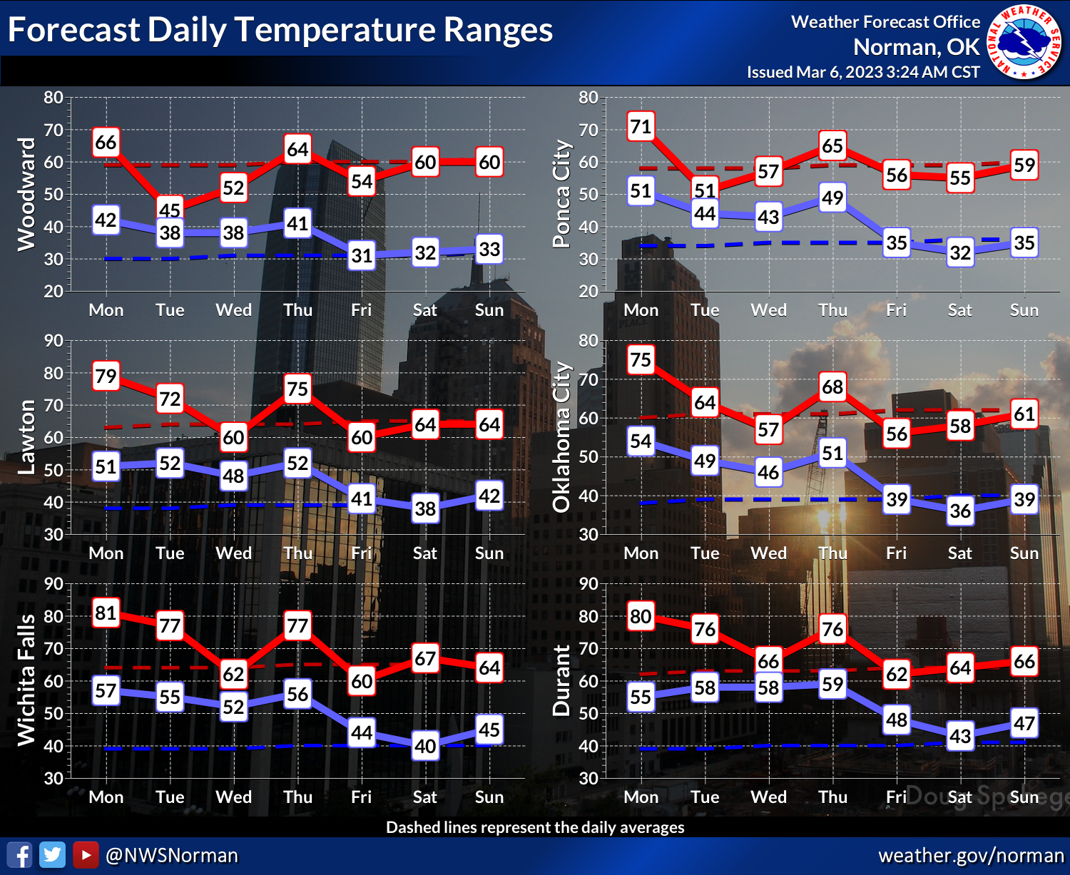
We're dealing with a frontal system this week focusing that heavy rain that
hasn't yet made up its mind where it's gonna stall and hang out. Well, IT has
made up its mind, but the forecast models haven't decided yet. But it does
appear like we'll have a wide range of conditions this week, with heavy rains
along the stalled front and cool and relatively drier conditions farther to
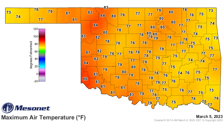
the NW of the front. We should have one more warm day in us before the really
cool air moves in, and then we'll see the gray skies and moisture follow.
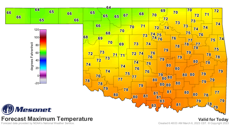
Not QUITE as warm as yesterday, but not bad...but beware any high clouds raining
on our high temperature parade, however (but not raining on our drought). High
clouds in the spring are like that person driving 58 mph in the left lane on
the interstate...they're just there to spoil a good thing!
It still looks like it will be a bit cool for spring break, and unlike me...it
doesn't look as bad as it previously did.
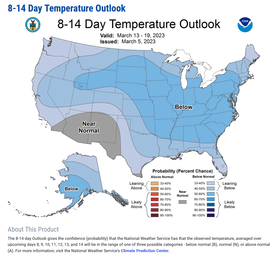
For bigtime cardboard investors like myself...we'll be sticking around these
parts for Spring Break while all the cool people go to Saskatchewan. Hey, that's
where the cool people *I* know have always gone. I'm hoping for warmer weather,
but I generally always say that.
Gary McManus
State Climatologist
Oklahoma Mesonet
Oklahoma Climatological Survey
gmcmanus@mesonet.org
March 6 in Mesonet History
| Record | Value | Station | Year |
|---|---|---|---|
| Maximum Temperature | 87°F | ALV2 | 2017 |
| Minimum Temperature | 9°F | KENT | 2018 |
| Maximum Rainfall | 2.10 inches | COOK | 1995 |
Mesonet records begin in 1994.
Search by Date
If you're a bit off, don't worry, because just like horseshoes, “almost” counts on the Ticker website!