Ticker for December 19, 2022
MESONET TICKER ... MESONET TICKER ... MESONET TICKER ... MESONET TICKER ...
December 19, 2022 December 19, 2022 December 19, 2022 December 19, 2022
BLAST OFF
Just a quick Tick to Tock about what everybody else is talking about, but the
difference about the talk is the Tock, innit? Sorry to go all Jason Statham at the
end there, but I'm officially off for the week, as opposed to being unofficially
off the rest of the time. You know, just a little off, as they say.
Well, it's all over but the shouting now. The forecast models are finally getting
a bit better handle on things coming this week, so why bury the lede? No, it's
NOT bury the lead...I learned that the hard way. There are enough people out there
checking my grammar that I...well there I go again, burying the lead!
Sometime late Wednesday night, a front is gonna blow through here and it's gonna
knock Grandma off her rocker...a Blue Norther of epic proportions. Okay, it's not
the first time we've seen a cold front of this magnitude. Heck, it's not even the
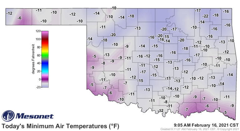
first time this year it has gotten really cold. Remember these hits from February
of THIS year (NO, not February 2021...that's a whole other animal).
Remember this?
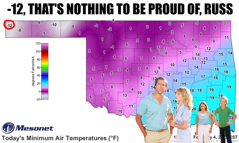
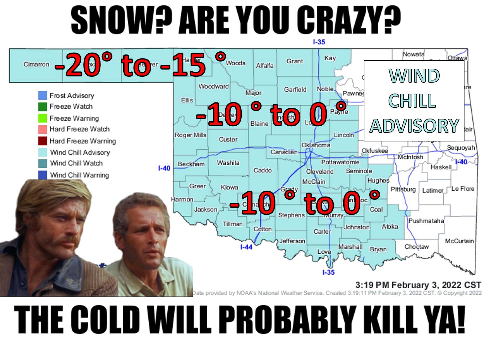
So that was pretty darned cold, but this one will top that one. However it won't
be as long or as severe as our February 2021 Deep Freeze event either. You
know, like when every single Mesonet site fell below zero at the same time, and
we had wind chills into the -30s and actual temperatures into the -20s? And the
coldest day in Oklahoma history?
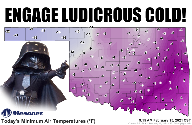
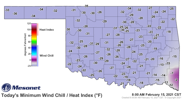
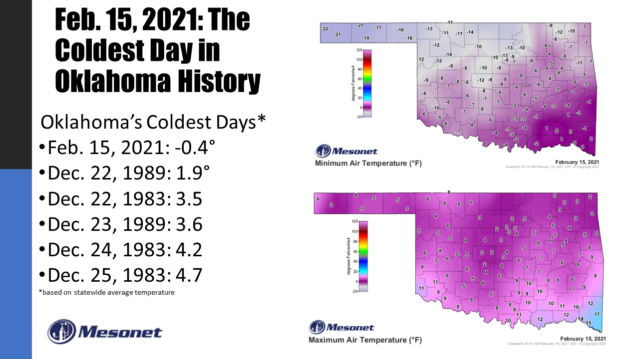
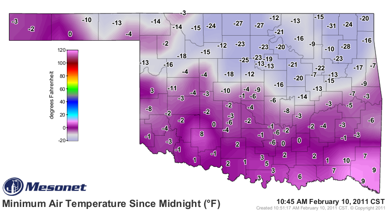
So not as bad as that one. And of course, there's the Granddaddy of them all,
Feb. 10, 2011, when we saw our lowest temperature ever recorded in state history,
-31 degrees at the Nowata Mesonet site, and wind chills down close to -50!
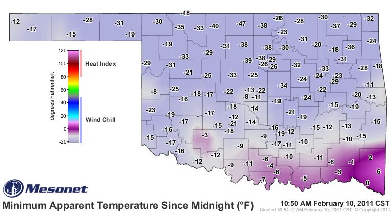
Now why did I put all that in today's Ticker? Filler, of course! But also for
perspective. And those two recent cold blasts, AND the one back in Feb. 2011,
came with a lot more snow. A *LOT* more. however, we need to give the upcoming
frigid weather its due, because it will be life-threatening cold weather that
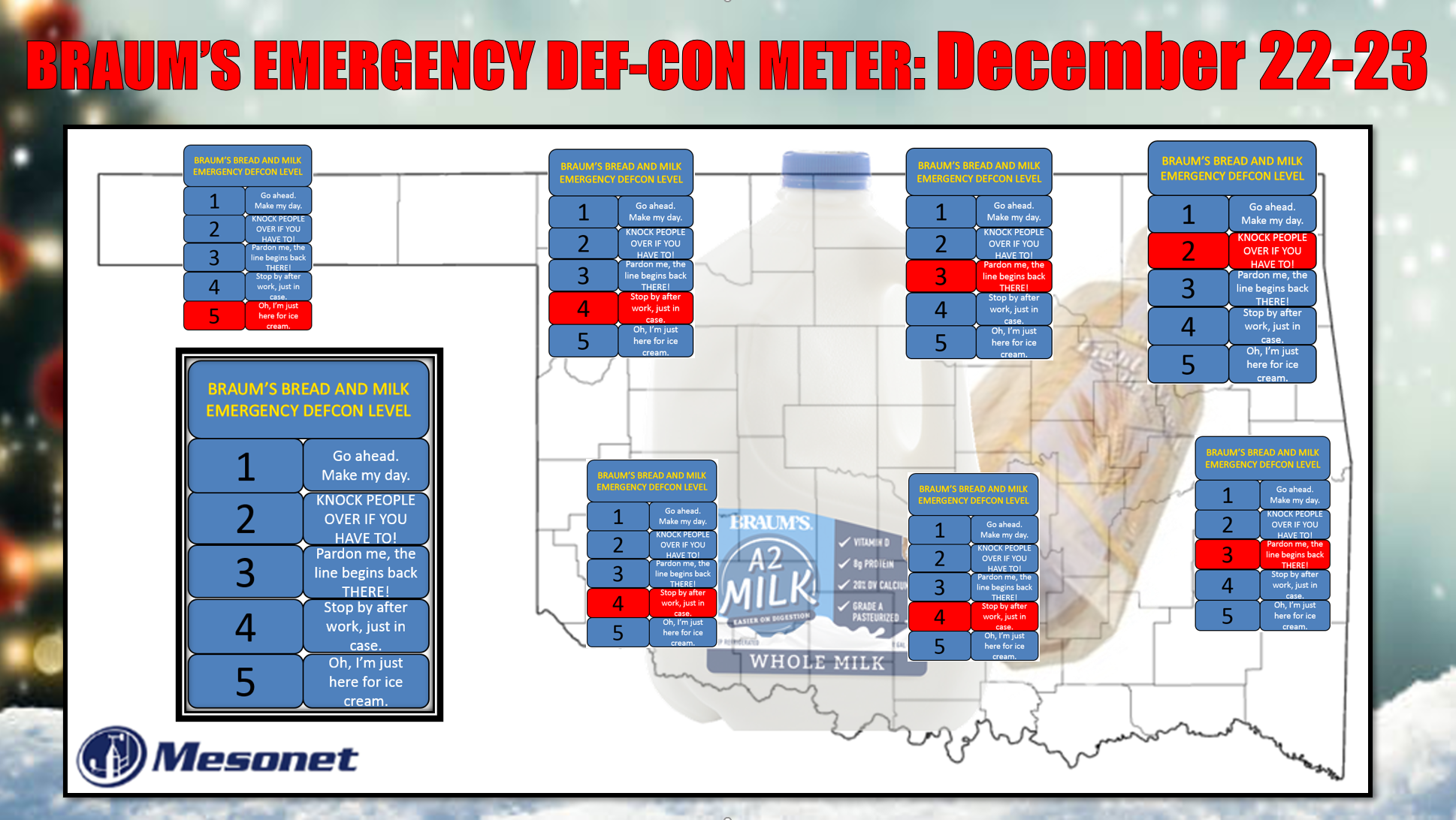
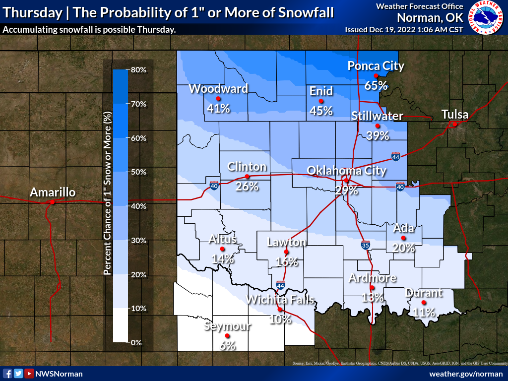
can cause a lot of misery if you're not prepared. The Braum's Emergency DEF-CON
Meter went below level 5 because there is a bit of a chance for some accumulating
snow across northern and eastern Oklahoma that could cause some travel disruptions,
but any sort of travel in this type of cold with wind chills down into the -10s
to -20s level will be dangerous. Even in light snow with winds blowing 30-50 mph
with higher gusts, ground blizzard conditions could be experienced, which would
make travel dangerous.

https://www.weather.gov/safety/winter-ground-blizzard
Here are some helpful graphics from our NWS friends to tell you about what to
expect, above and beyond my masterful and very scientific "IT'S GONNA BE FRIGGING
COLD!"
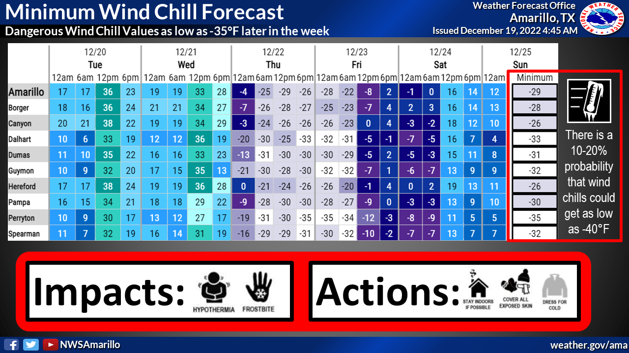
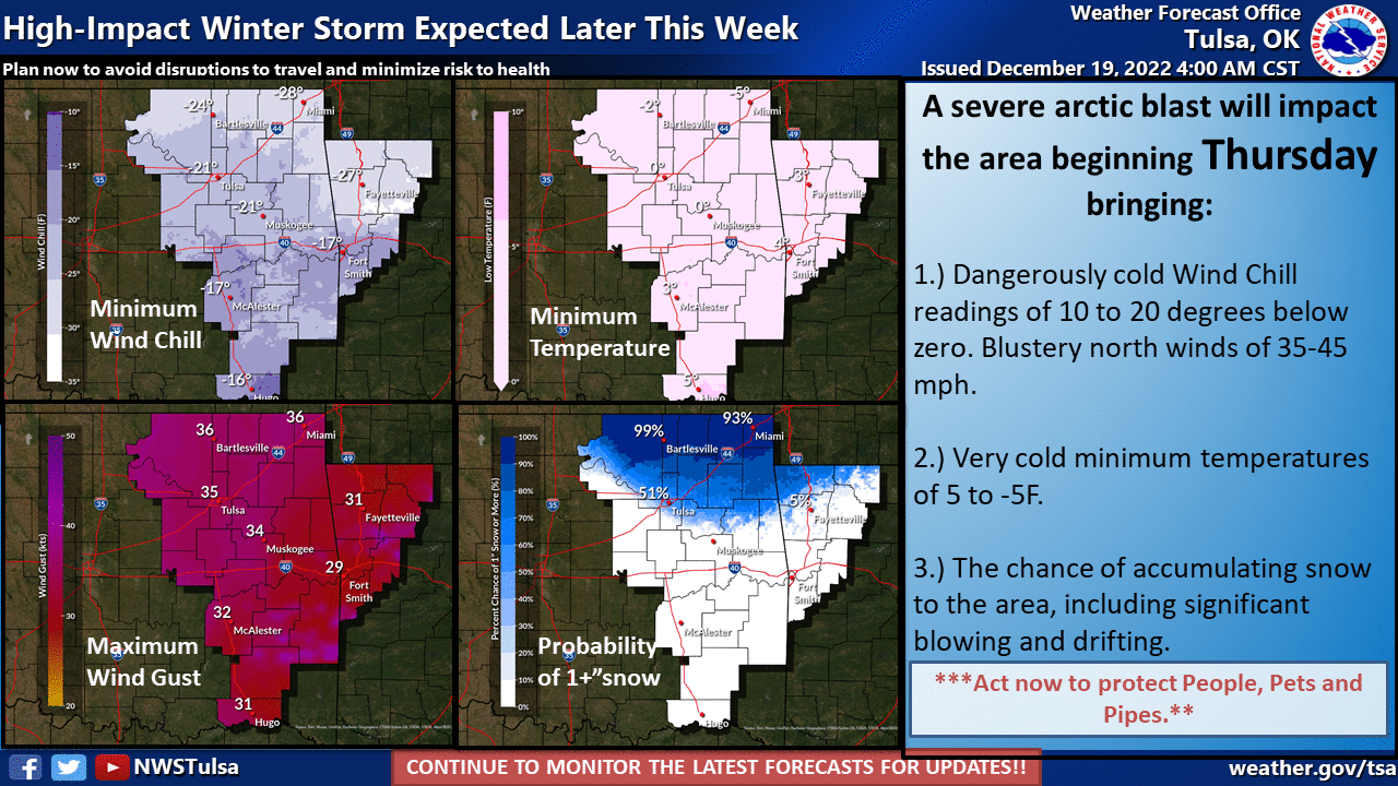
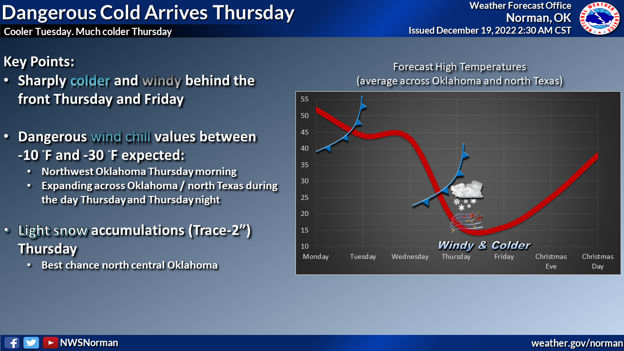
Friday's gonna be a doozy.
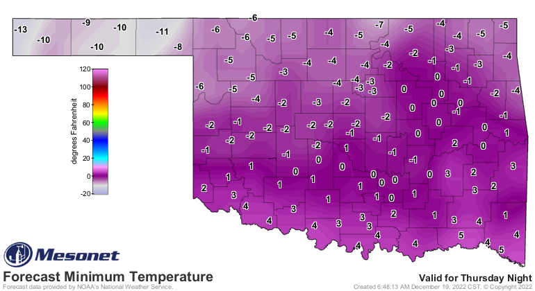
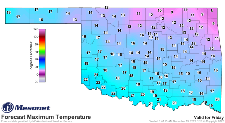
As with most arctic excursions Mother Nature takes in Oklahoma, it will be
short-lived. Help IS on the way already.
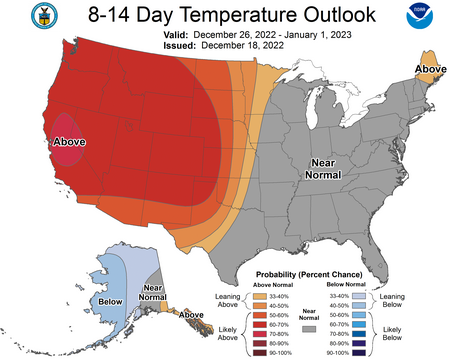
And remember, since we're still 3 days away from all this bidness, the forecast
can still change just a bit...not only for the better, but also for the worse.
Here's something to stare at on Friday, when you are hopefully hunkered down
somewhere warm.

We'll be back to that map in another 3-4 months. Oh wait, it's Oklahoma...1-2
months?
Gary McManus
State Climatologist
Oklahoma Mesonet
Oklahoma Climatological Survey
gmcmanus@mesonet.org
December 19 in Mesonet History
| Record | Value | Station | Year |
|---|---|---|---|
| Maximum Temperature | 75°F | IDAB | 2012 |
| Minimum Temperature | -10°F | EVAX | 2016 |
| Maximum Rainfall | 2.94″ | BUTL | 2006 |
Mesonet records begin in 1994.
Search by Date
If you're a bit off, don't worry, because just like horseshoes, “almost” counts on the Ticker website!