Ticker for November 11, 2022
MESONET TICKER ... MESONET TICKER ... MESONET TICKER ... MESONET TICKER ...
November 11, 2022 November 11, 2022 November 11, 2022 November 11, 2022
11s all around
Well this is rather fitting, isn't it? Some of you lunat...I mean "people" are still
celebrating the Blue Norther that crashed down from the North last night, bringing
us the "lovely" weather we're having.
"What, didn't you know that quotation marks indicate sarcasm?"
More on (yes, when you read that in your head, it comes out as my nickname) the
palindrome from the last century in a bit...let's take a look at that lovely
weather today, shall we?
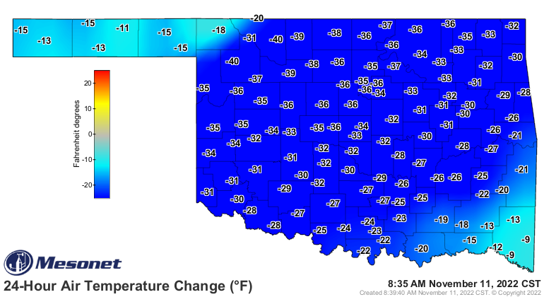
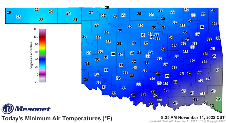
Temperatures have crashed from a lovely fall/spring day yesterday all the way down
to January levels.
That's okay I guess. I mean, it IS November, after all, smack dab in the warm
season. It just seems really bad because of how long and much above normal we've
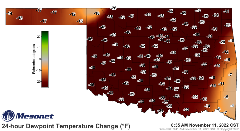
been for the last 5 months or so. And with our temperatures dropping following
yesterday's warm front...WRONG, it was a cold front! Thought you could fool me,
didn't ya! With our temperatures dropping following yesterday's cold front, so
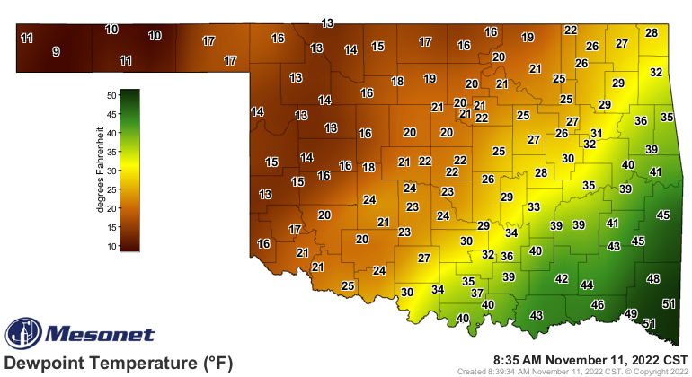
goes the moisture as well.
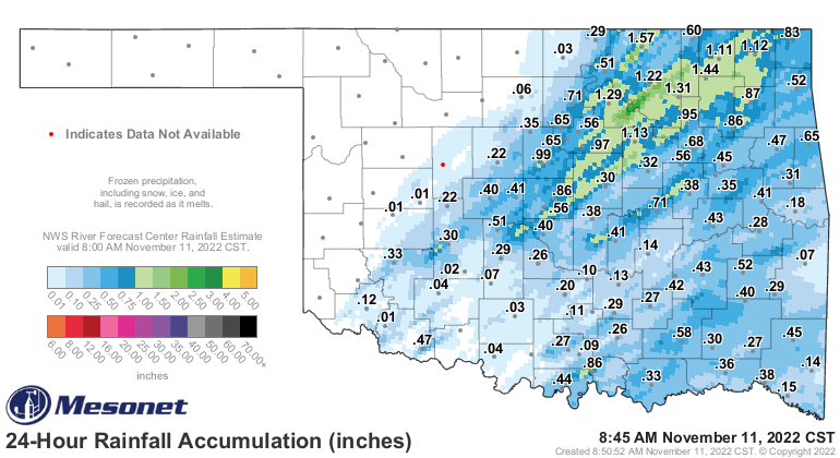
At least we got some rain out of this mess, which is about the only good point
I can find, other than the one on top of my head.
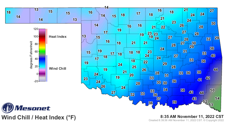
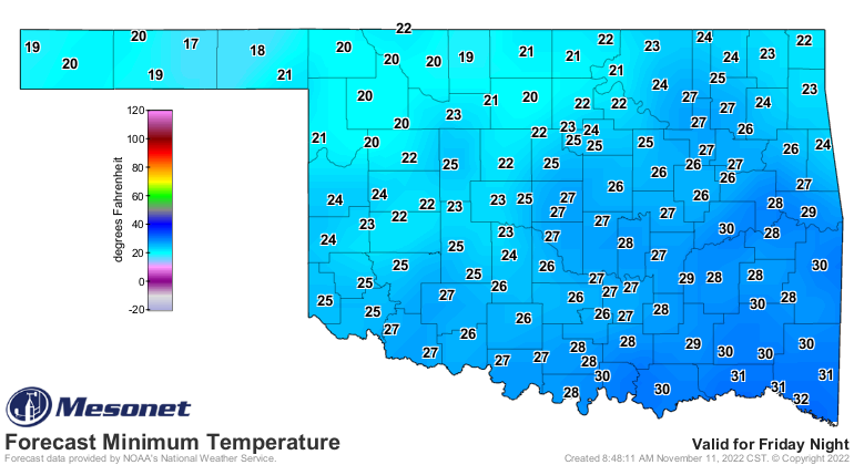
So winter is here...I don't care about the calendar, and it darned doesn't care
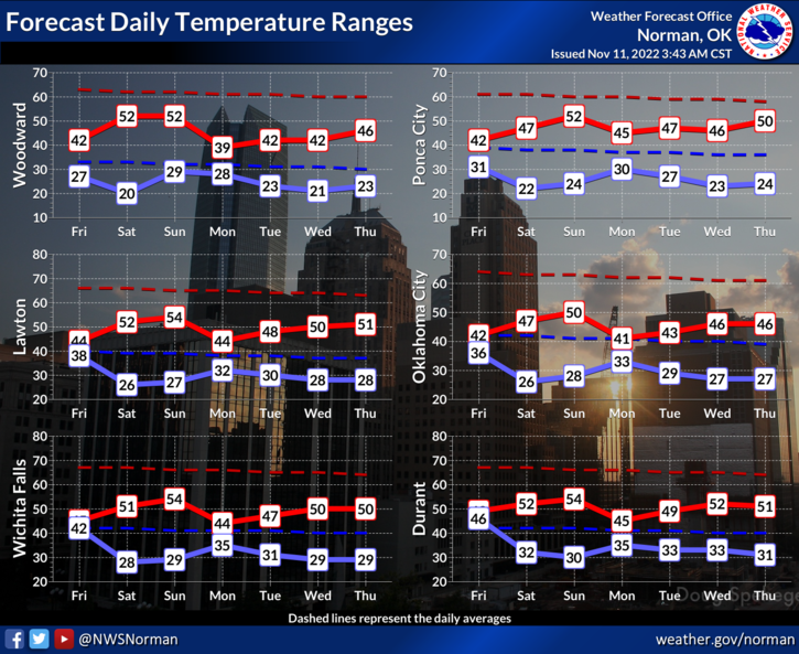
about me! This is winter. And it's gonna stay that way for awhile. In the next
few days, Saturday and Tuesday mornings look particularly cold.
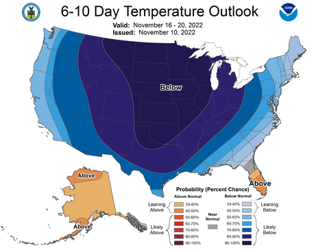
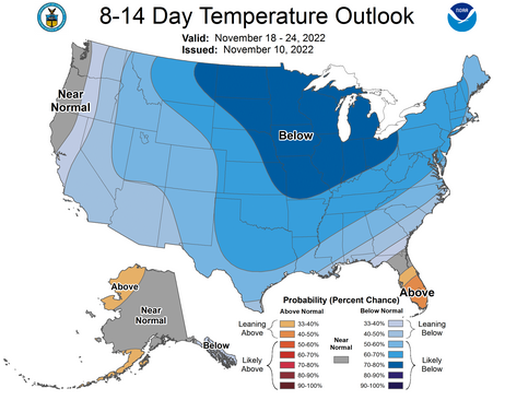
In fact (or fiction, considering we're into fantasy-cast territory), it looks
possible that we could remain in this cold pattern through Thanksgiving!
Now the big question I get is "Have you TRULY sought help?", but the other big
one is "Is it gonna snow?"
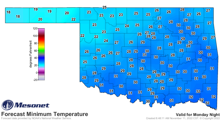
Yes, it will probably snow next Monday, maybe into early Tuesday. Unfortunately,
the forecast models just don't have a great handle on the situation just yet.
The storm system that could bring us snow is still off the West Coast in the
Pacific Northwest, so it's not well-sampled yet (much like my green bean
casserole at Thanksgiving). Once it moves on land, the forecast models should
get a better look at the storms track and potential. At this point chaos still
reigns. Yep, in the weather too.
And then of course the trick for the models is to get the vertical profile of
the atmosphere correct, IN ADVANCE, to determine what kind of precipitation
might fall. You have a warm layer above the surface, you might get a really
cold rain, you might get freezing drizzle, you might get sleet. If you can
keep that snowflake from melting as it falls, you MIGHT get snow.
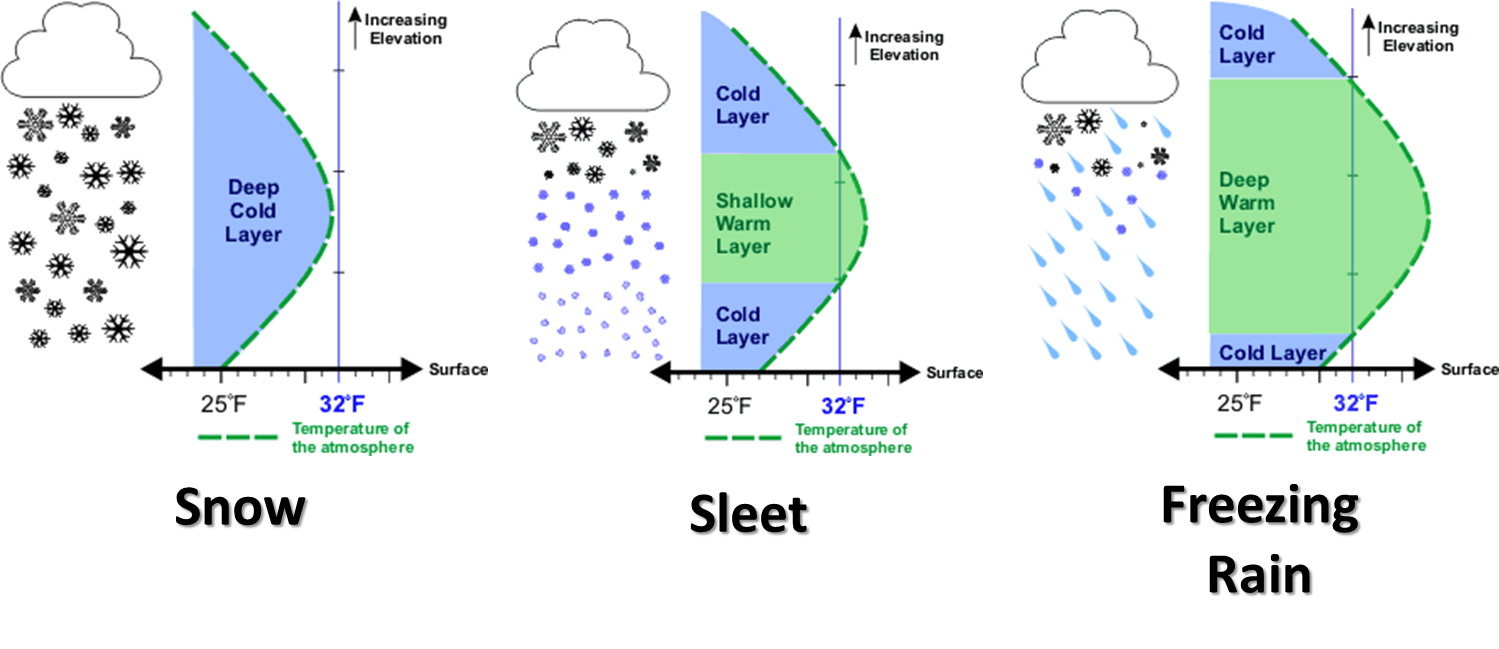
Right now, it does look like the vertical profile favors snow, but the surface
temperature looks a bit iffy. That snow might fall and then get closer to the
surface and melt into a chilly rain, with some snowflakes mixing in. Or, if
that moisture that falls can cool the air down (through evaporation) close to
the freezing level, we might see accumulating snowfall.

Doesn't look like a snowstorm as of now, but stranger things have happened. My
face proves that.
Okay, with all that out of the way, let's take a look back at the crazy weather
on this date from 111 years ago.
Wait, 11/11/11, 111 years ago?
Yikes!
-------------------------------------------------------------------------------
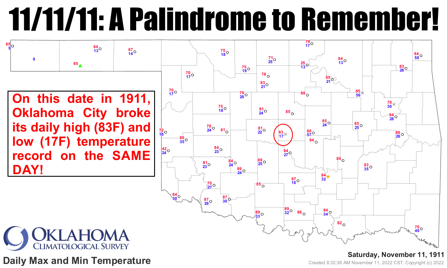
On that afternoon, Oklahoma City reached a record high temperature of 83 degrees.
Soon thereafter, a ?norther? barreled through the state, dropping temperatures
50-65 degrees in the span of a few hours. By midnight, the temperature at
Oklahoma City had plunged to a frigid 17 degrees, the record low for that same
date.
Both records still stand, marking November 11th, 1911, as the only date in
state history in which the record high and low temperatures were broken on the
same day for a single location.
The Great Blue Norther of 11/11/1911 wasn't just confined to Oklahoma. This was
a massive cold frontal assault (hint: Erie, PA also set its record high and low
on Nov 12, 1911)
-------------------------------------------------------------------------------
Gary McManus
State Climatologist
Oklahoma Mesonet
Oklahoma Climatological Survey
gmcmanus@mesonet.org
November 11 in Mesonet History
| Record | Value | Station | Year |
|---|---|---|---|
| Maximum Temperature | 86°F | SLAP | 2005 |
| Minimum Temperature | 1°F | EVAX | 2019 |
| Maximum Rainfall | 1.24 inches | COPA | 2012 |
Mesonet records begin in 1994.
Search by Date
If you're a bit off, don't worry, because just like horseshoes, “almost” counts on the Ticker website!