Ticker for October 21, 2022
MESONET TICKER ... MESONET TICKER ... MESONET TICKER ... MESONET TICKER ...
October 21, 2022 October 21, 2022 October 21, 2022 October 21, 2022
Frankenweather
Strap in. Batten down the hatches. Hatten down the batches.
Whatever it takes.
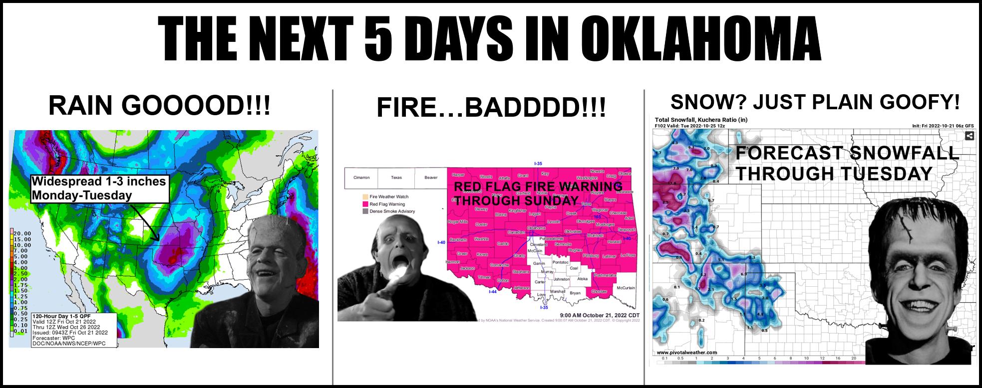
Oklahoma is in for a wild ride over the next 5 days, thanks to a powerful storm
system that's about to hit the Pacific Northwest and come rolling down to our area
in a classic late fall/early winter pattern, bringing lots of wind, moisture, and
lift with it.
So we have pretty darned bad fire danger over the next 3 days...certain.
Then a cold front...certain.
And possible multiple rounds of showers/storms...probable.
And some snow in the Panhandle...possible.
Now here's the deal...remember that this storm system isn't even over land yet
where it can be sampled by our much-better land-based instruments, whose data
gets fed into the forecast models to give more accurate forecasts. It's chaos,
man!

So two things to keep in mind:
1) It might fizzle and not be nearly as impactful
2) It might be MORE impactful
Well, I guess there's a third...might be just as forecast now.
Gary McManus
State Climatologist
Oklahoma Mesonet
Oklahoma Climatological Survey
gmcmanus@mesonet.org
October 21 in Mesonet History
| Record | Value | Station | Year |
|---|---|---|---|
| Maximum Temperature | 98°F | MANG | 2012 |
| Minimum Temperature | 23°F | KENT | 2019 |
| Maximum Rainfall | 5.60 inches | ANTL | 1996 |
Mesonet records begin in 1994.
Search by Date
If you're a bit off, don't worry, because just like horseshoes, “almost” counts on the Ticker website!