Ticker for January 11, 2022
MESONET TICKER ... MESONET TICKER ... MESONET TICKER ... MESONET TICKER ...
January 11, 2022 January 11, 2022 January 11, 2022 January 11, 2022
Lost memo
Some folks seem to thing we're having lovely weather. No, not for a sleigh ride
together! That was last month (but it wasn't because it was 183 degrees on
Christmas). In actuality, we're in a drought so all this sunshine is definitely
not lovely, but no denying the draw of somewhat-warm sunny days in January.
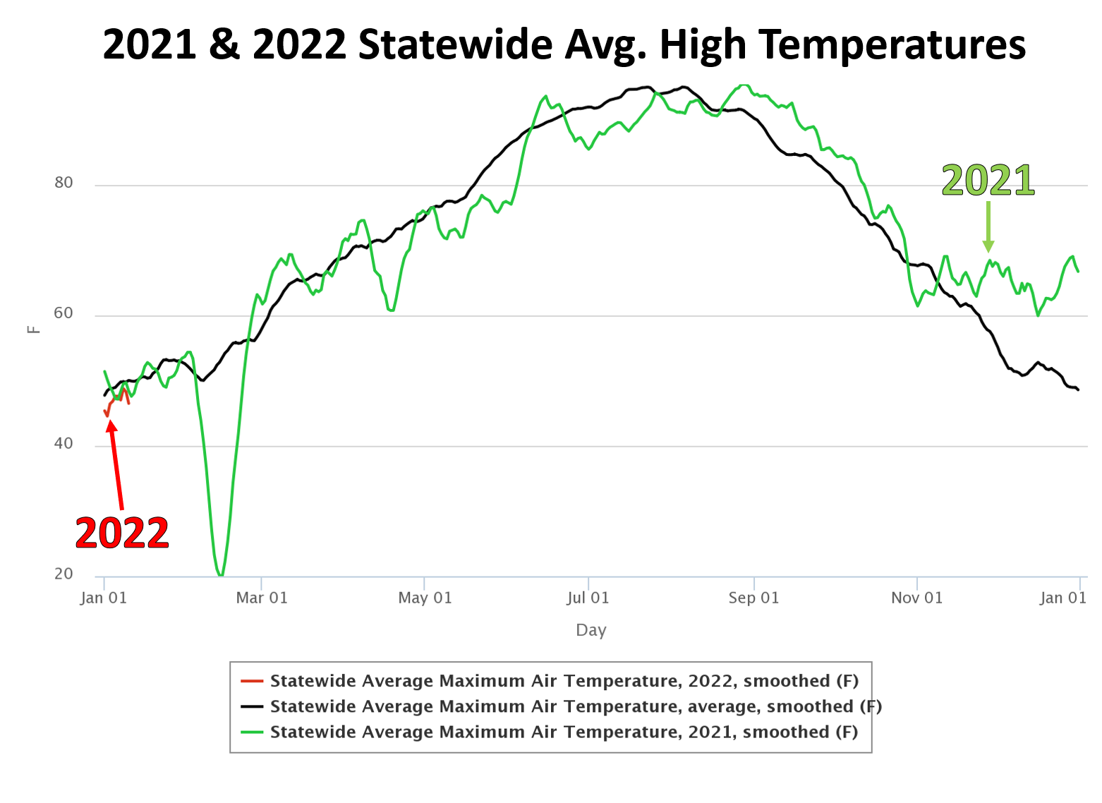
However, the chart above shows the difference between the "LOVELY" weather we
were having in December vs. what we've had so far in January. Again, right at
the drop of the ball on 2022.
A quick primer...those are statewide average high temps from the Mesonet. The black
line is the 2006-2020 long-term average. The green is what we had in 2021, the
red is 2022. Now there are some shenanigans at play thanks to the smoothing
schemes, but this isn't to show you actual values but the longer-term weather
pattern at the time. Pretty easy to see here the weather turn much warmer than
average at the beginning of November and it basically stayed that way all the
way through Dec. 31!! Isn't that wild? I'm astounded in just looking at that graph.
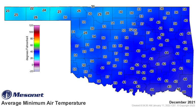
December basically just carried right on with November's warm ride. In fact, the
statewide avg. temp for November was 51 degrees, and for December it was 50.4
degrees. Those are average averages, not highs, so all the highs and lows
during the month across the state averaged together. So basically we had one
long warm November.
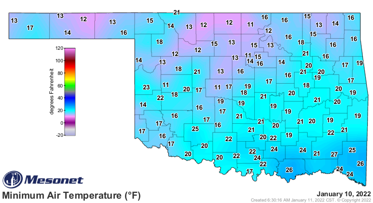
Then we see 2022 come along and BAM, below average weather for the majority of
the first 10 days of the month. Heck, even yesterday's "lovely" day was well
below what we had ON AVERAGE in December, although today might be just a tad
closer.
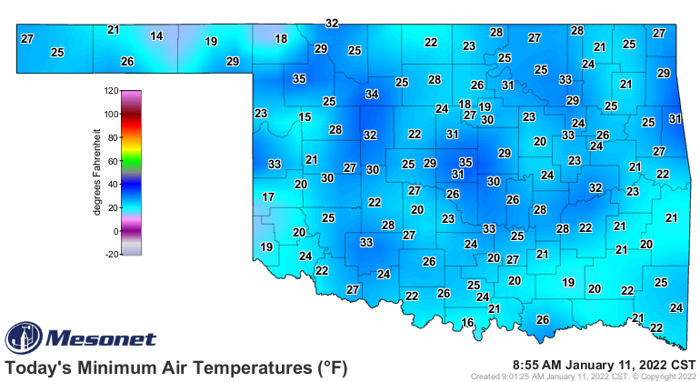
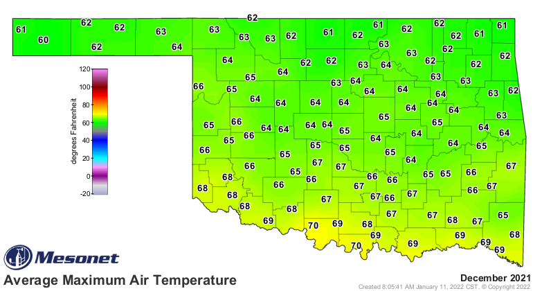
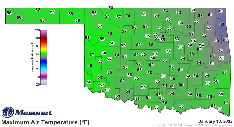
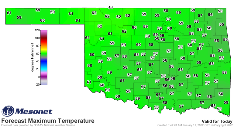
That last one is a forecast. With all this sun, I don't see much stopping that
from happening. Still, a far cry from all the days with 70s and 80s for
highs. This is like the fourth time I've lamented the loss of December's warmth.
All I can say is I am ready for spring, in more ways than one. I'm ready for the
warm southerly air bringing moisture back from the Gulf, so "above normal"
rainfall maps will be for 3 inches of rain instead of 0.3 inches (which is
above normal for this time of year).
It can always get worse, as that big green dip in February 2021 shows.
Gary McManus
State Climatologist
Oklahoma Mesonet
Oklahoma Climatological Survey
gmcmanus@mesonet.org
January 11 in Mesonet History
| Record | Value | Station | Year |
|---|---|---|---|
| Maximum Temperature | 85°F | BURN | 2023 |
| Minimum Temperature | -8°F | HOOK | 2011 |
| Maximum Rainfall | 2.07″ | BBOW | 1998 |
Mesonet records begin in 1994.
Search by Date
If you're a bit off, don't worry, because just like horseshoes, “almost” counts on the Ticker website!