Ticker for August 12, 2021
MESONET TICKER ... MESONET TICKER ... MESONET TICKER ... MESONET TICKER ...
August 12, 2021 August 12, 2021 August 12, 2021 August 12, 2021
Spongebob DriedOutPants
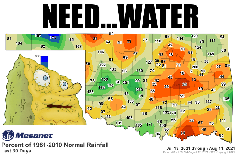
We're right on the cusp of having a flash drought problem in Oklahoma. I SAID
"WE'RE RIGHT ON THE CUSP OF HAVING A FLASH DROUGHT PROBLEM IN OKLAHOMA." Sorry, I
forgot some of you are hard of reading, like I am. Yes, it has gotten dry over
the last 30 days or so in Oklahoma. No, we're not plummeting into drought just
yet. Yes, we are in a possible flash drought weather pattern. No, that pattern
isn't set in stone. Yes, this is a very annoying way of writing. No, I don't like
it either. Yes, I wish I could stop. No, I...
Whew, thanks. Now you know how my mind works so I'll expect lots of sympathy
cards. The last 30 days does look pretty nasty for parts of the state (pretty
obvious where from the map above). Here are the rest of the 30-day maps, and the
stats.
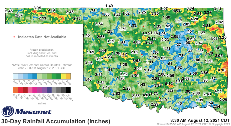
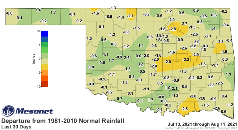
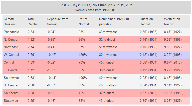
It sorta looks like Mother Nature just vomited on the state with rainfall, no?
So if you were under one of the chunks, you're probably doing okay. But some
of those areas have started to really hurt for water. That shows up in our
soil moisture maps as well.
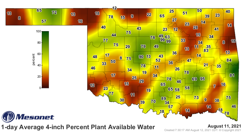
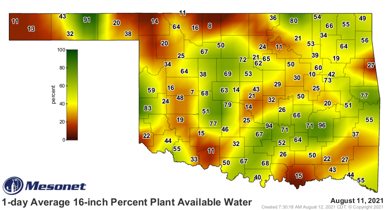
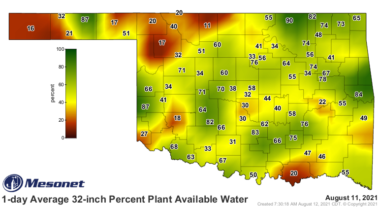
Don't be fooled by the colors on those maps. Look at the numbers. Our contouring
program is having trouble dealing with the spew-like nature of the rainfall
(which translates to the soil moisture patterns). However, things aren't as bad
as they could be, for sure. Say that line in a Valley Girl dialect if it helps.
The reason we're not dealing with a full-blown flash drought over more of the
state is the rains we had over the 60-day period.
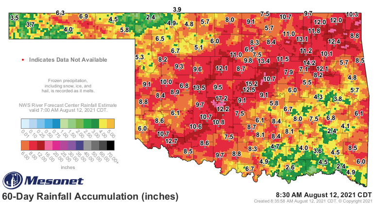
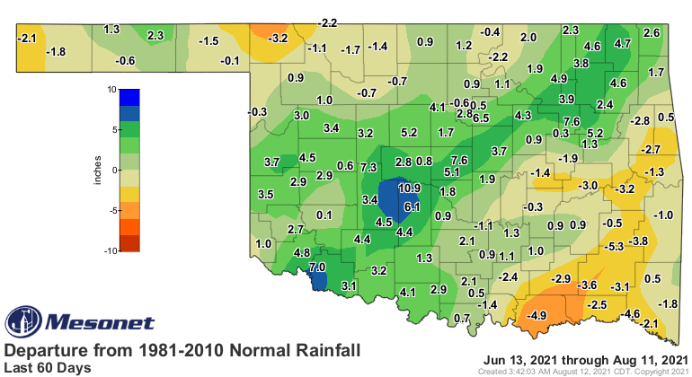
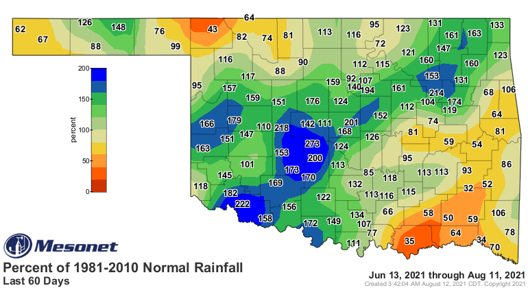
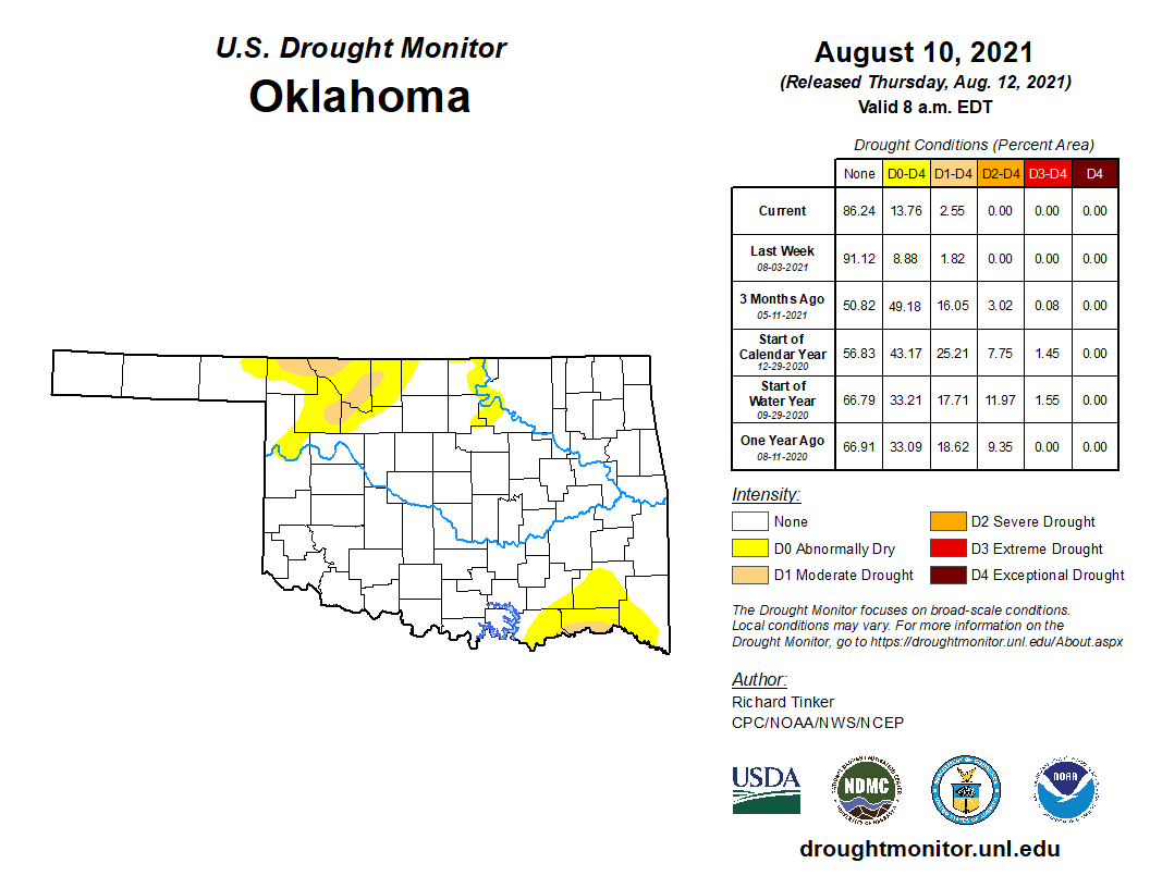
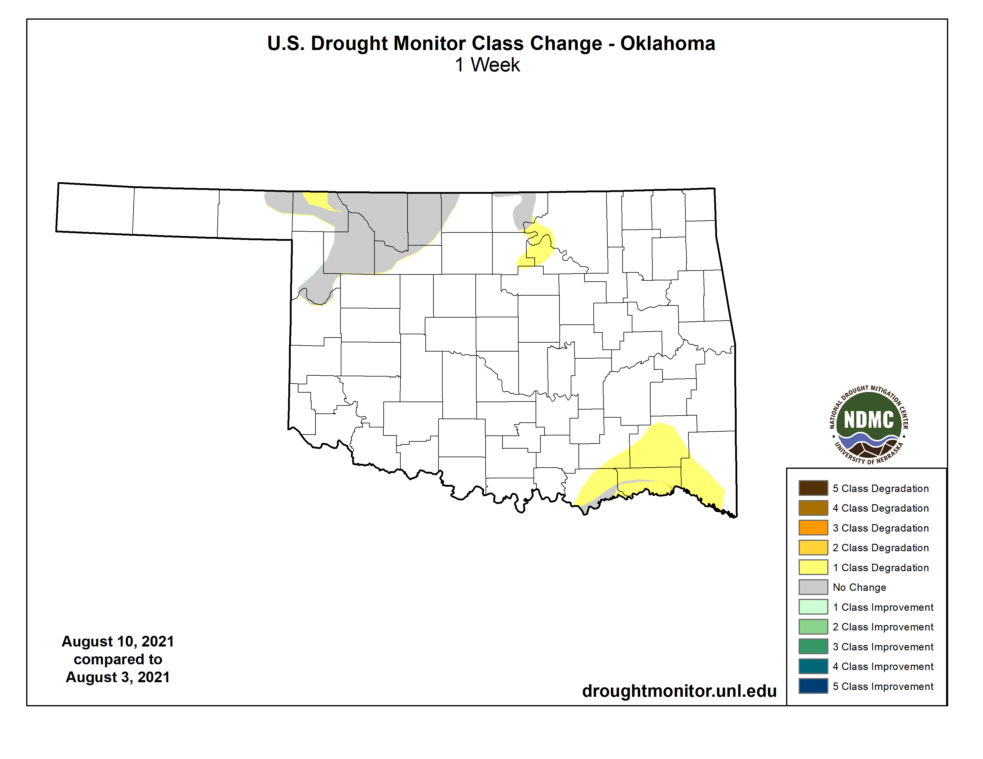
Okay, so there you see a much nicer picture, and the problem areas that show
up on this week's U.S. Drought Monitor map become more clear, and also point to
areas to watch out for drought development if we don't see some beneficial
moisture soon.
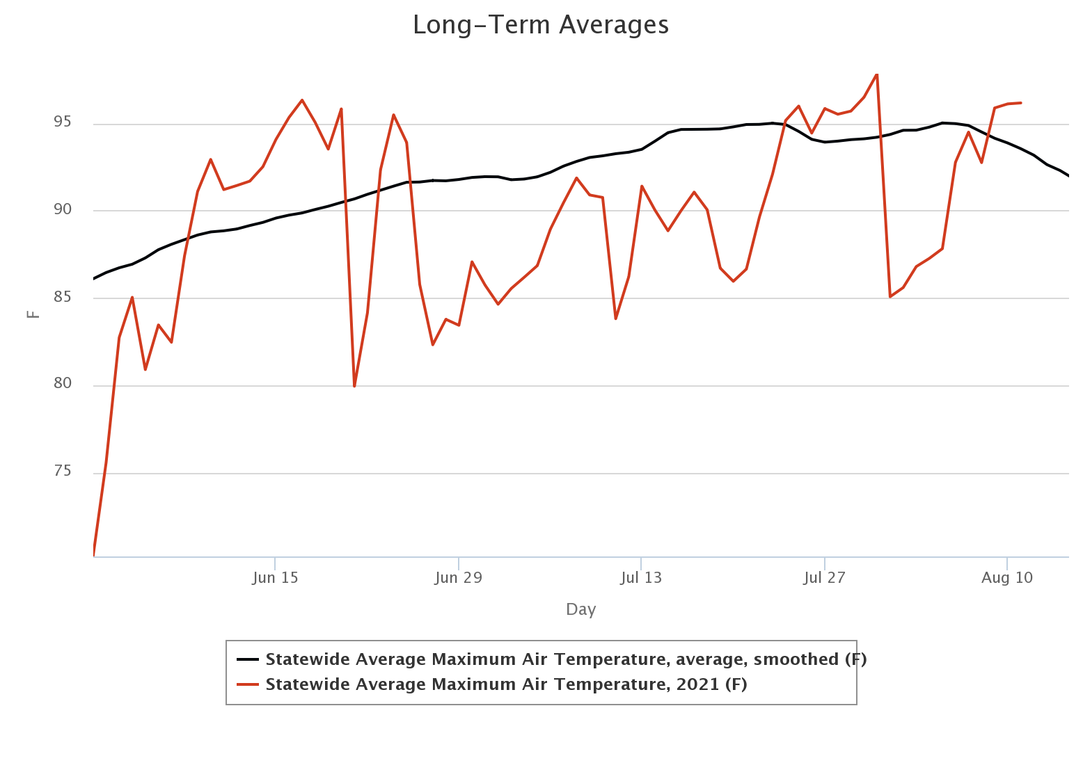
Another reason why things aren't a runaway trainload of bad is that we have
been cooler than average for much of the summer. Note that it has been hot,
especially across western OK, but again that doesn't factor in the humidity that
evens things out a little bit across the rest of the state. Still, a bit on
the milder side of things compared to the 2006-2020 long-term Mesonet average.
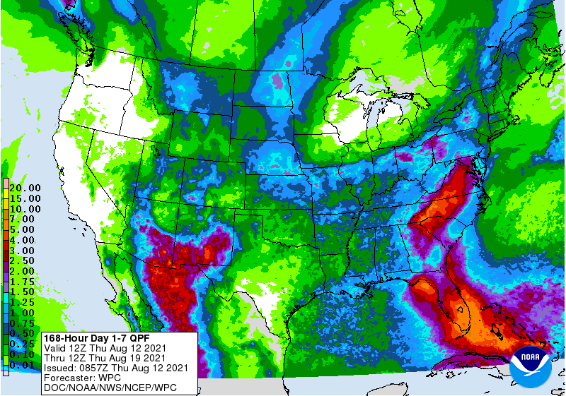
About those rain chances...we will see low chances of rain off and on over the
next week, but a bit higher chances on Friday and Saturday. The predicted
rainfall pattern is pretty useless, given the nature of rainfall this time of
year (again, think puke...just don't hurl when you do or then I'll blow chunks).
Some folks will get a lot of rain and others maybe not so much.
At any rate, the lower temperature regime after the cool front on Friday should
reduce pressure on the soil moisture. Rain would be an added bonus.
Gary McManus
State Climatologist
Oklahoma Mesonet
Oklahoma Climatological Survey
(405) 325-2253
gmcmanus@mesonet.org
August 12 in Mesonet History
| Record | Value | Station | Year |
|---|---|---|---|
| Maximum Temperature | 112°F | GRA2 | 2023 |
| Minimum Temperature | 48°F | MIAM | 2004 |
| Maximum Rainfall | 3.93 inches | PRYO | 2011 |
Mesonet records begin in 1994.
Search by Date
If you're a bit off, don't worry, because just like horseshoes, “almost” counts on the Ticker website!