Ticker for February 8, 2021
MESONET TICKER ... MESONET TICKER ... MESONET TICKER ... MESONET TICKER ...
February 8, 2021 February 8, 2021 February 8, 2021 February 8, 2021
Word to your wrecker
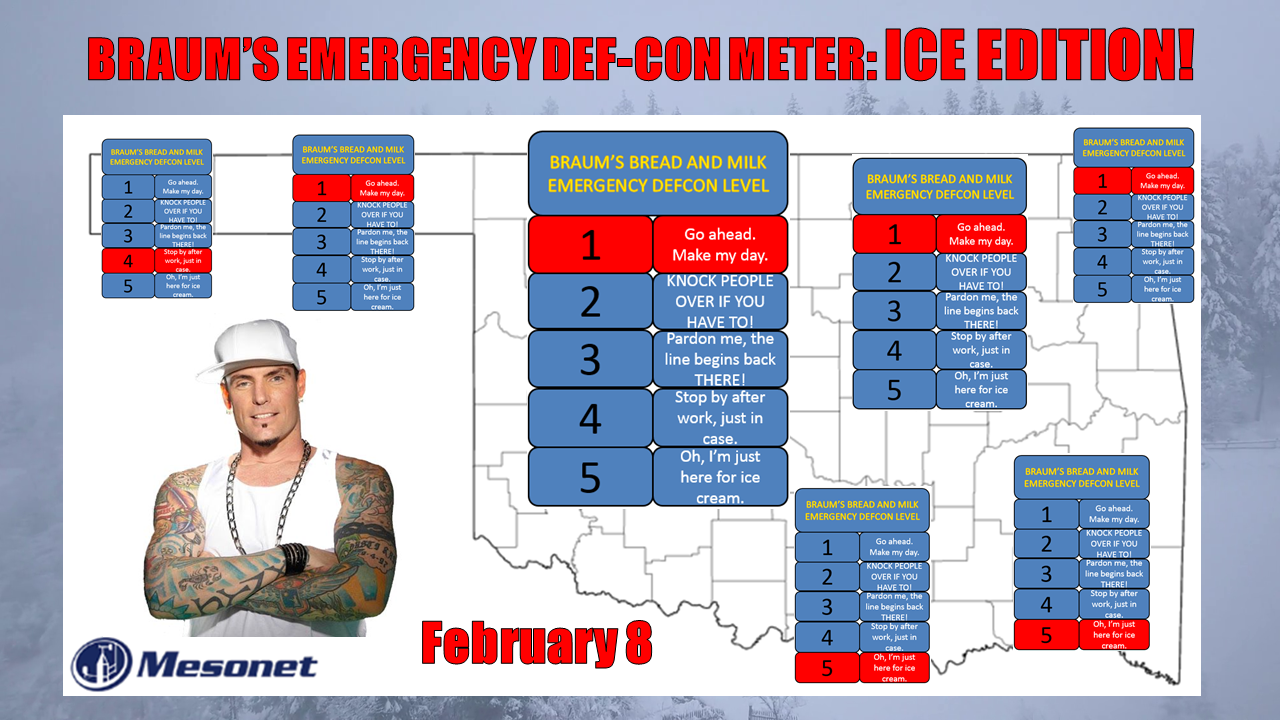
Ice. Just like those sand worms in "Beetlejuice," you hate it, don't ya? Yeah, my
advice is just don't. Don't chance it driving today at least through this
afternoon while the freezing drizzle and fog is around, and temperature continue
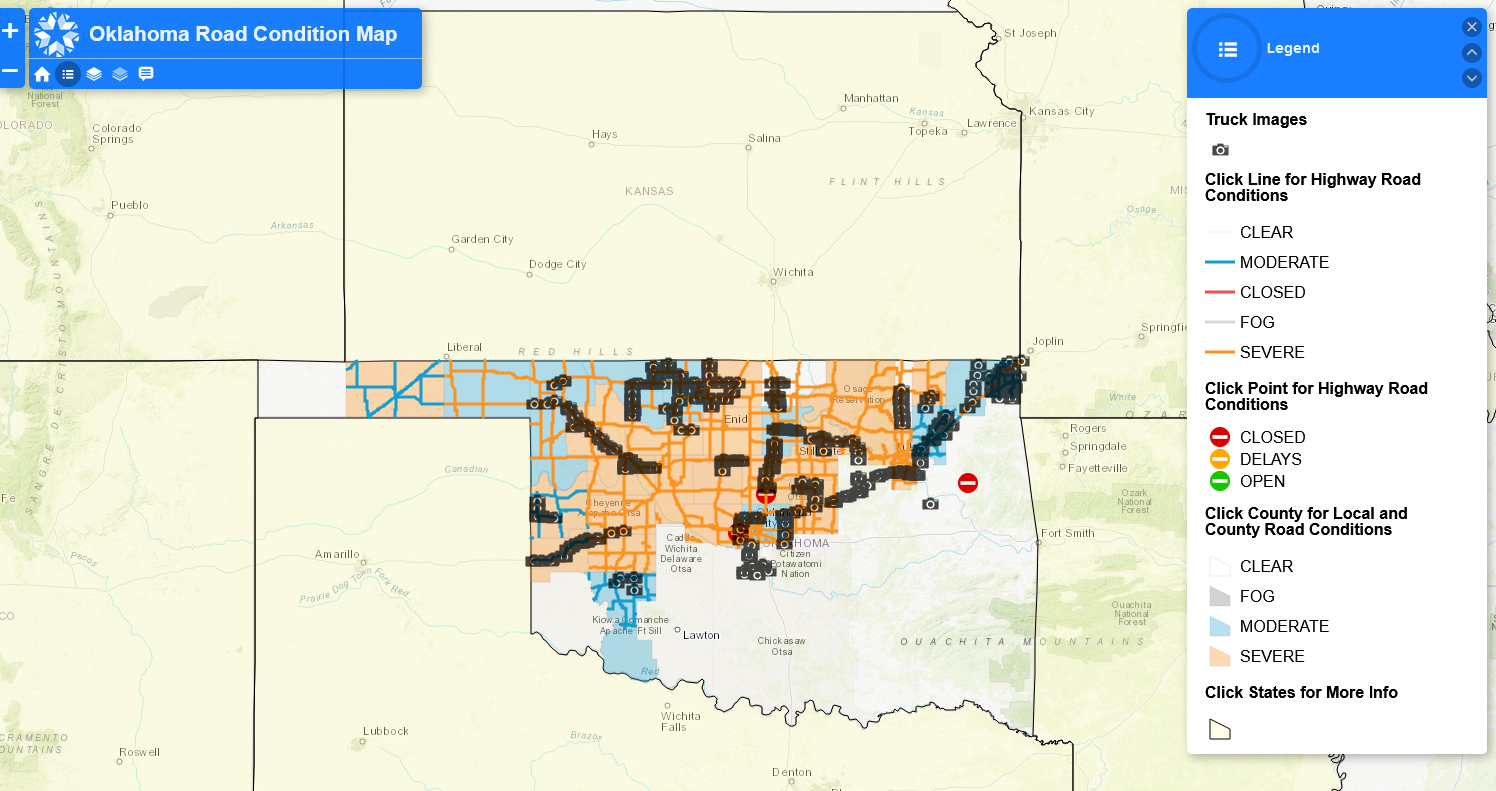
to drop below freezing across the NW half of the state. Look at these road
conditions as we Tick. Check out all the "severe" conditions.
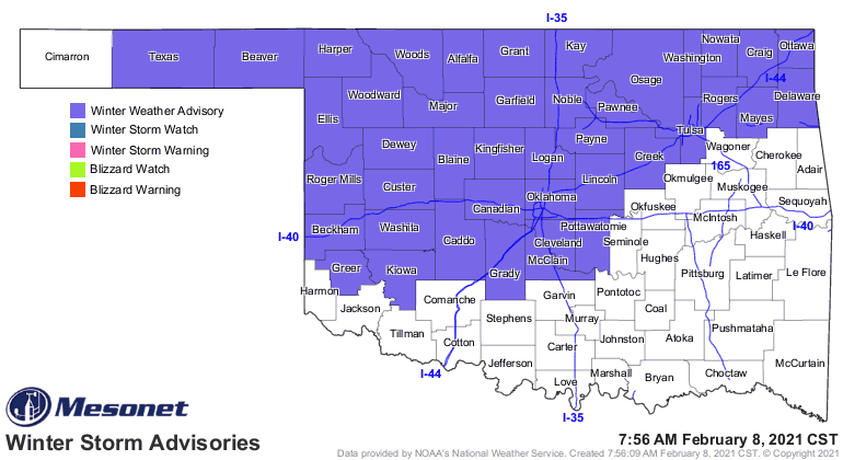
Not coincidentally, this is also where the NWS has a winter weather advisory
through late this afternoon.
So now that we have that covered, let's continue with our "good" news. Unless
you've been living in a cave (and a cave would be good right now), you know that
we are just beginning a long stretch of freezing weather across most of the state.
And it now appears this stretch at or below freezing could last 10 days or more
in some areas.
And listen closely...we have the chance to get some of the coldest weather we've
seen in these parts since Feb. 10, 2011 (of -31 degrees at Nowata fame, the
lowest temperature ever recorded in the state). I know we're not supposed to
look at just one model, but we can take a gander just to see what some of the
forecast's look like. You know, in what vicinity they're hanging out. Check
out this temperature and wind chill forecast from the GFS for Sunday at 9am.
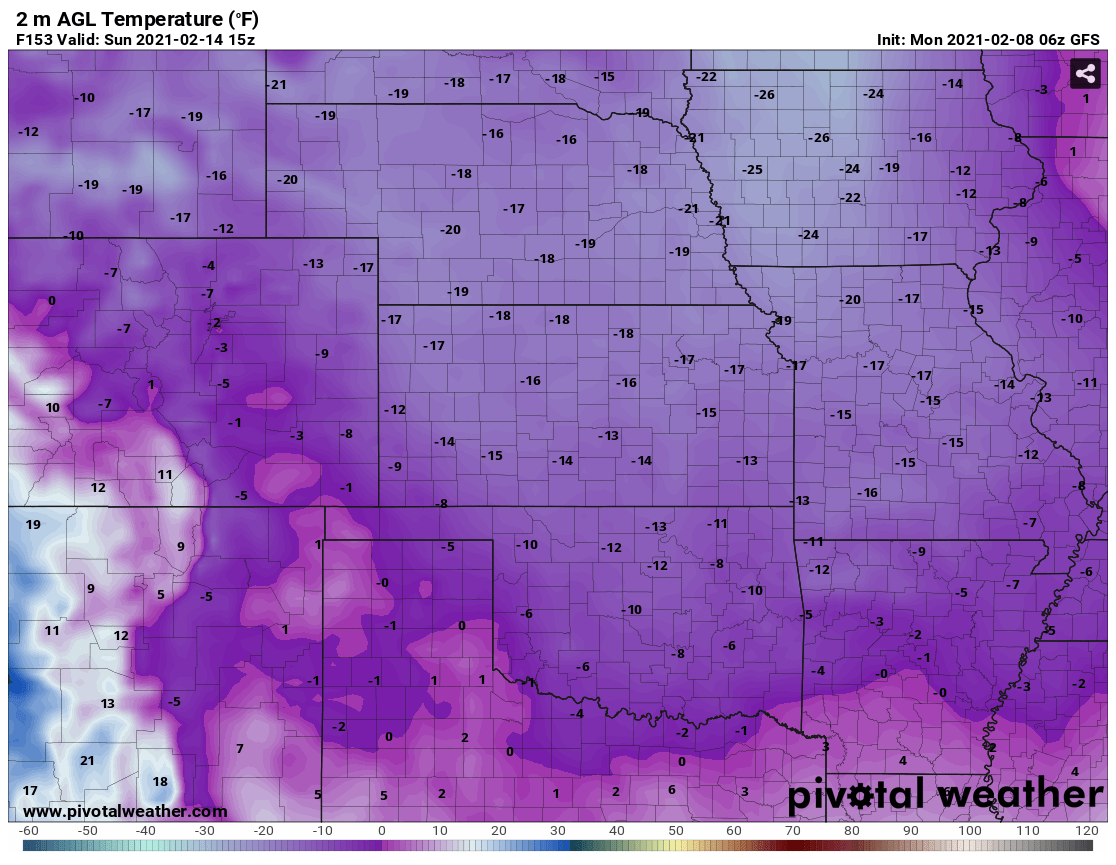
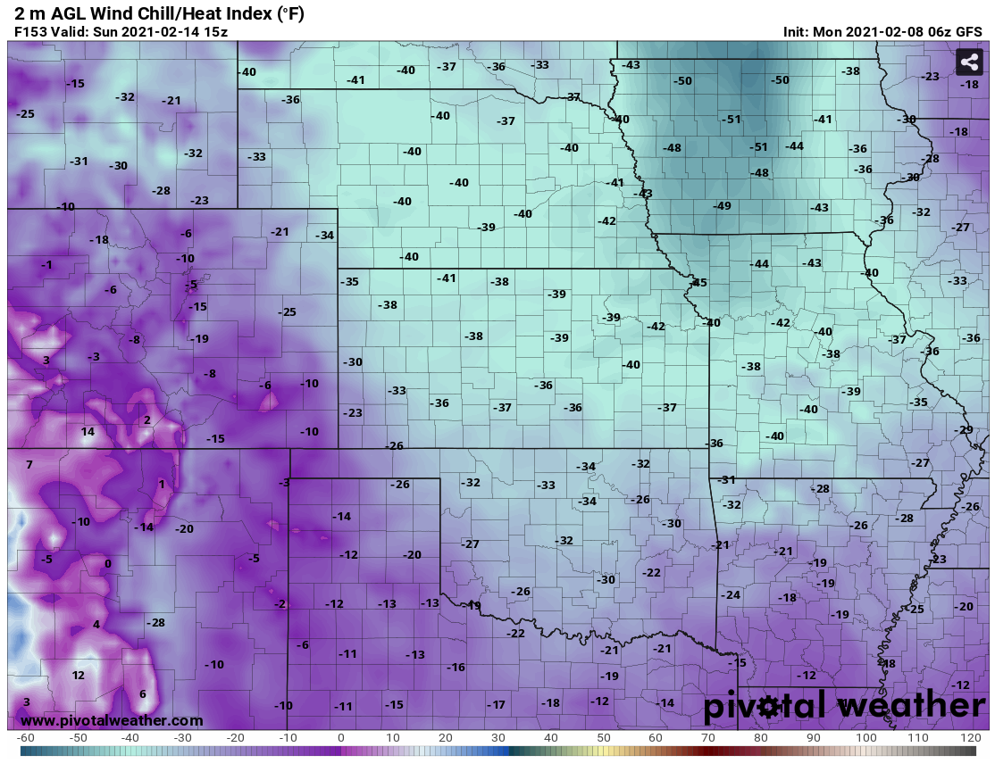
That's probably too cold...has to be. Let's hope that disappears the next run.
I'm betting it will. I'm praying that it will. Lord, let it disappear!
Seven days out, still just a fantasycast at this point, but it does give an
indication that the bulk of that cold air will probably still be in the vicinity
a week from now. We'll continue to cool off today and tomorrow, maybe rebound
a bit on Wednesday before we get another surge of colder air later in the
week. Now if the above forecast gets anywhere close, the entire U.S. could be
in the deep chill. Who knows. That's the kind of cold weather that's extremely
dangerous, however.
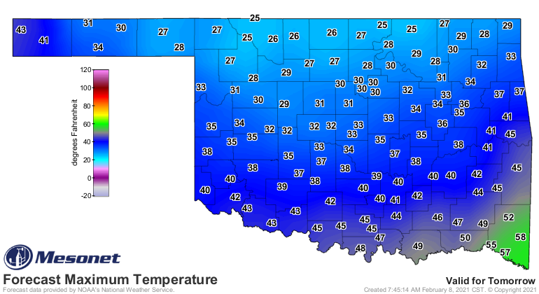
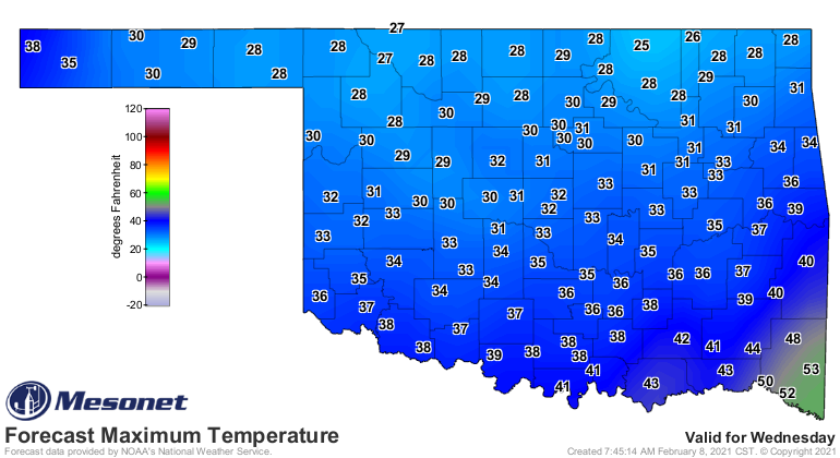
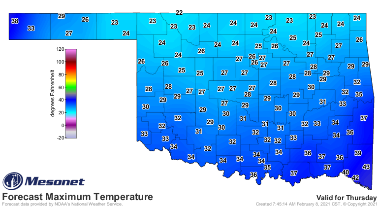
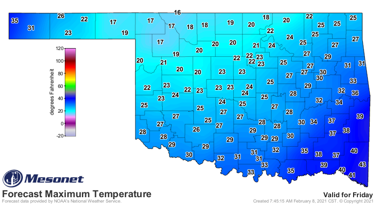
Closer to today, we can see the forecast highs for the next few days, and they
ain't pretty. Remember, take 5-10 degrees off of these to allow for wind chill
values (and remember the forecast lows are much, well...lower).
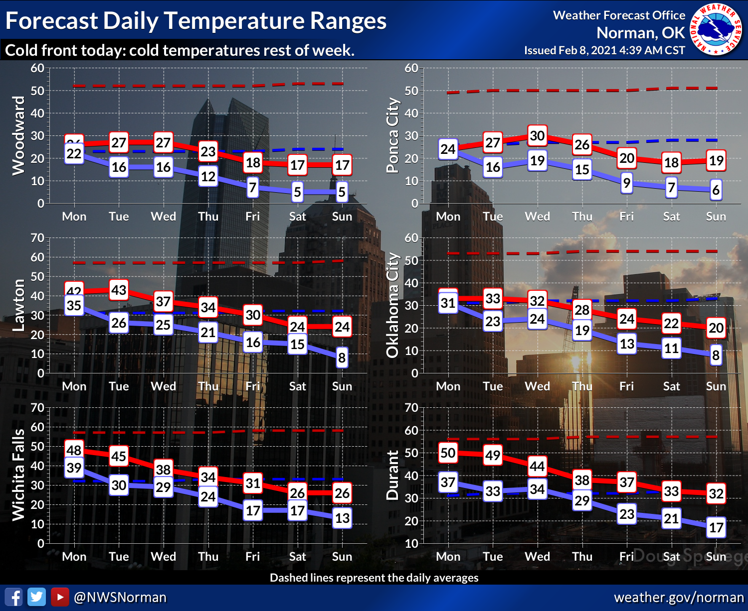
Our friends at the Norman NWS office show us how they expect the temperatures
to range over the next 7 days. Yeah, how about 30 degrees below normal for the
next 7 days?
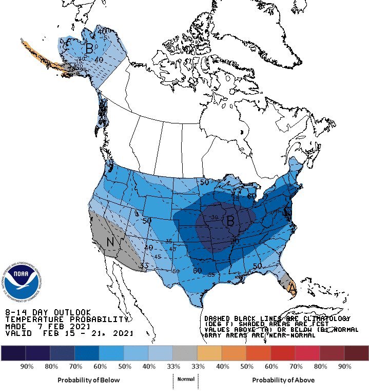
Oh by the way, when does that GFS forecast model have the bulk of the state
getting back above freezing? Sometime Saturday evening. No, not Saturday the
13th...Saturday the 20th! Again, just a fantasycast at this point, but some
of the other forecast model, while they have us above freezing earlier than that,
we'd still be in the 30s, mostly. CPC lends some credence to that with their
Feb. 15-21 temperature outlook.
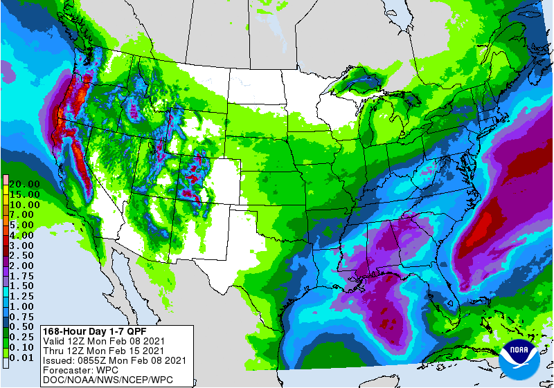
Not a lot of moisture to work with over the next 7 days, but this could also
change. And it doesn't take a lot with freezing weather to cause big problems,
as we're seeing today.
Best idea is to hunker down and stay abreast of the latest conditions and
forecasts, until this whole winter craze passes over.
Gary McManus
State Climatologist
Oklahoma Mesonet
Oklahoma Climatological Survey
(405) 325-2253
gmcmanus@mesonet.org
February 8 in Mesonet History
| Record | Value | Station | Year |
|---|---|---|---|
| Maximum Temperature | 83°F | BROK | 2025 |
| Minimum Temperature | -5°F | BOIS | 2011 |
| Maximum Rainfall | 4.35 inches | BROK | 2023 |
Mesonet records begin in 1994.
Search by Date
If you're a bit off, don't worry, because just like horseshoes, “almost” counts on the Ticker website!