Ticker for December 14, 2020
MESONET TICKER ... MESONET TICKER ... MESONET TICKER ... MESONET TICKER ...
December 14, 2020 December 14, 2020 December 14, 2020 December 14, 2020
Shall we play a game?
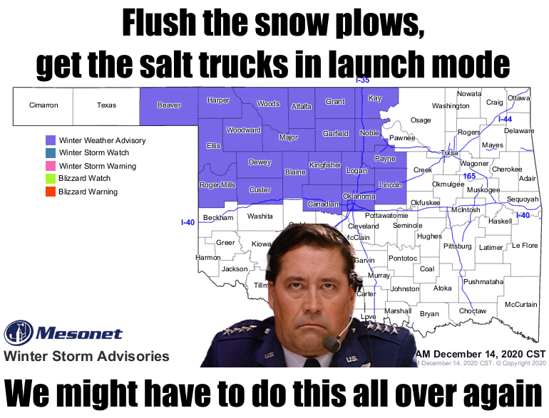
So much for Sunday being the best chance of any snow for awhile! Whoever said that
is a real dolt. Hi. But here we go again. Amounts are shaping up to be 2-4 inches
across the northwestern quarter of the state, with some locations receiving higher
(or lower) amounts, so we're painting with a very wide brush here, and definitely
NOT staying in the lines.
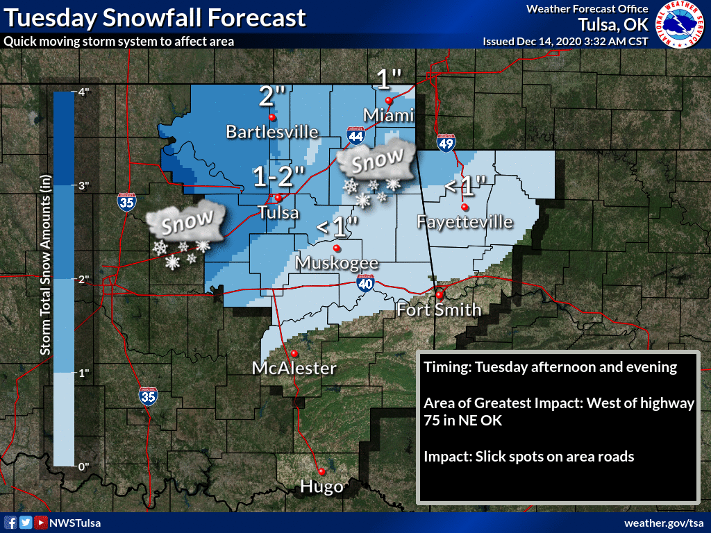
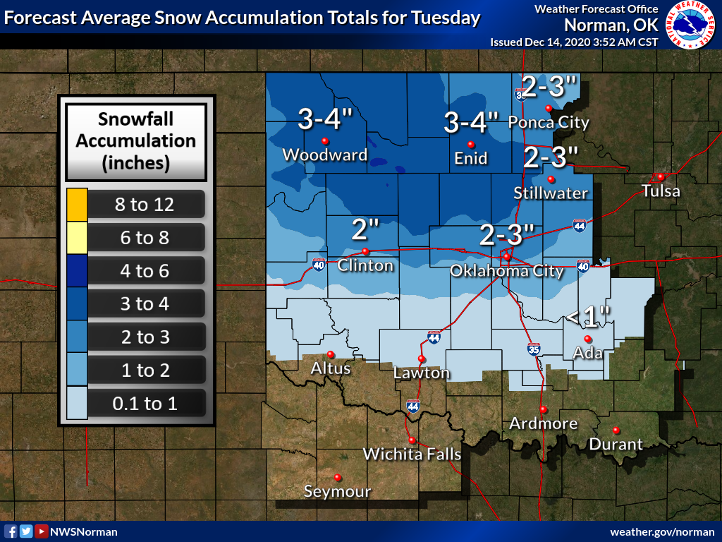
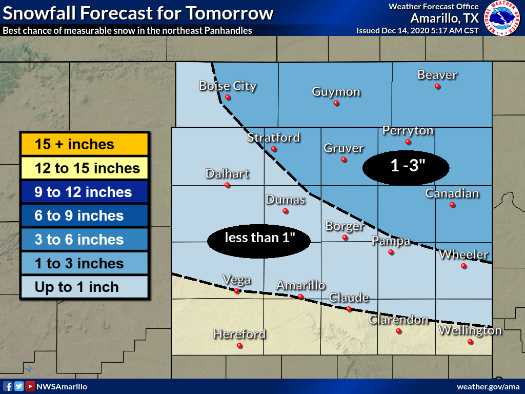
I believe this snow will be just a bit different than Sunday's in that it will
be in a colder environment, so not as much melting. Therefore, we might expect
more significant impacts to driving. Not that the impacts Sunday weren't severe,
just it melted rather quickly. The lows tonight and then the highs tomorrow will
be impacted by the snowpack that's already here, as we've already seen the coldest
air mass of the season this morning (aided by that snowpack).
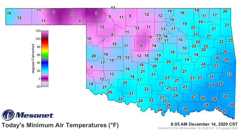
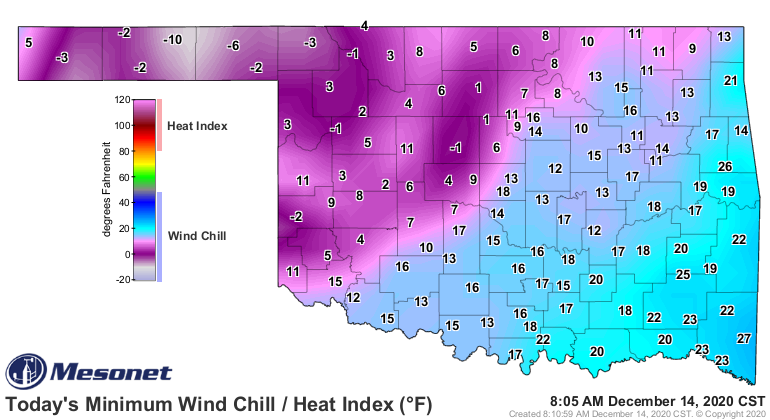
This morning's low of 2 degrees at Hooker is easily the coldest reading of the
season; well, save for Kenton's 4 degrees yesterday, but that occurred late
last night, so it's all the same air mass, impacted by the same snowpack. But
watch for cold mornings the next 2 days at least, then a bit more going forward
as we try and melt that snow. Wednesday will be a chiller!
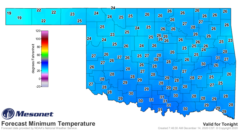
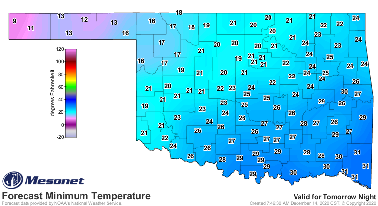
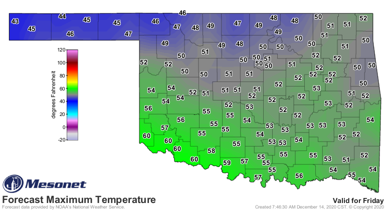
And the highs will be impacted by the snowpack for awhile. Friday is looking
"okay" for this time of year.
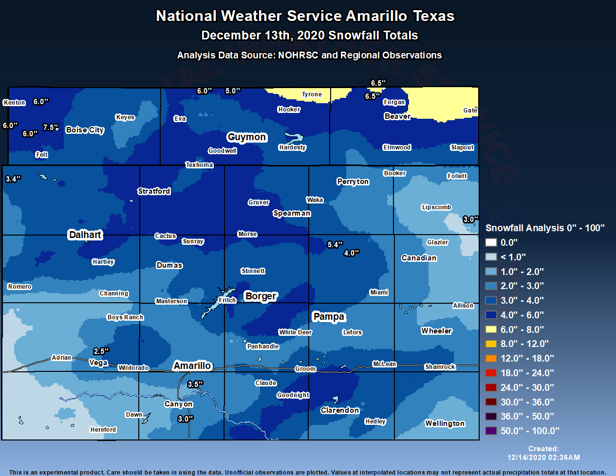
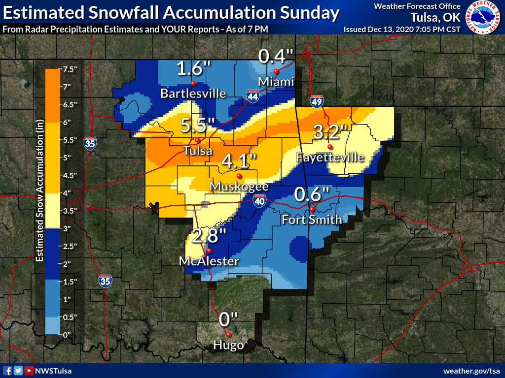
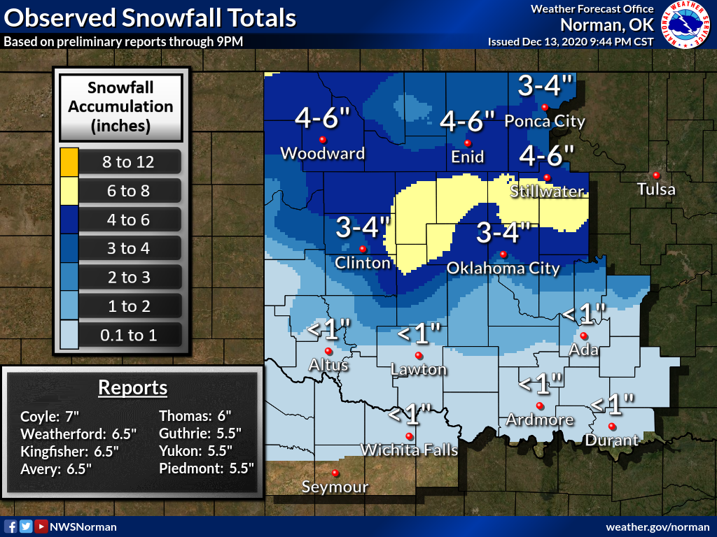
As for yesterday's snow, we got a good dose with widespread totals of 4-8 inches
north of I-40, from border to border.
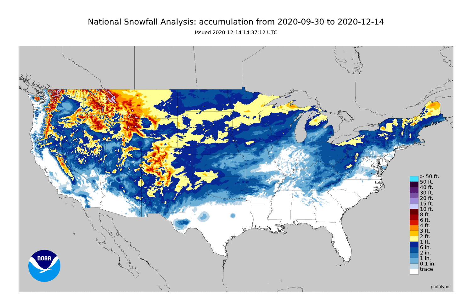
And oh by the way, parts of Oklahoma have had more snow than Chicago, New York
City, and MOST OF NORTH DAKOTA!
Now just watch...we'll have 70s on Christmas Day with 45 mph winds and blowing
dust.
Gary McManus
State Climatologist
Oklahoma Mesonet
Oklahoma Climatological Survey
(405) 325-2253
gmcmanus@mesonet.org
December 14 in Mesonet History
| Record | Value | Station | Year |
|---|---|---|---|
| Maximum Temperature | 83°F | ARNE | 2021 |
| Minimum Temperature | -3°F | MEDF | 2000 |
| Maximum Rainfall | 2.69 inches | SLAP | 2023 |
Mesonet records begin in 1994.
Search by Date
If you're a bit off, don't worry, because just like horseshoes, “almost” counts on the Ticker website!