Ticker for December 10, 2020
MESONET TICKER ... MESONET TICKER ... MESONET TICKER ... MESONET TICKER ...
December 10, 2020 December 10, 2020 December 10, 2020 December 10, 2020
FIRE UP!
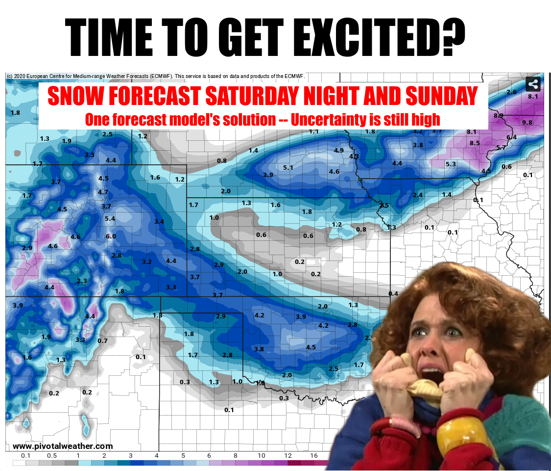
SURPRISE SURPRISE SURPRISE! Those of an ancient variety, such as myself, will
recognize Gomer's words there. For the rest of you, take it literally, literally.
There were some hints of possible snow this weekend being teased during the week,
but now we get more and more forecast model solutions starting to paint Oklahoma
with some snow in varying locations. The European model, like shown above, has a
bullseye on central Oklahoma of 4-5 inches. The models still have a long way to
go to coalesce on a single solution, but it's good enough to get us excited about
SOME snow, SOMEWHERE, SOMETIME between Saturday night and Sunday night. Now I'm
not saying it's the same setup, but 2-3 days before the big 15-inch snowfall
of last week, the forecast was still forming then as well, and they're STILL
dealing with snow up there.
Here is the GFS solution for another take.
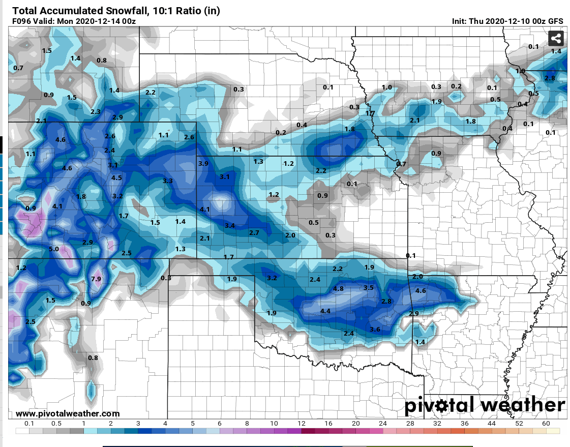
Again, SOME snow, SOMEWHERE, SOMETIME between Saturday night and Sunday night.
The folks at the Amarillo NWS office have a nice graphic depicting the
uncertainty in the storm track, and the corresponding uncertainty of where the
greatest impacts would be. If you want snow, hope for the more southerly
solution.
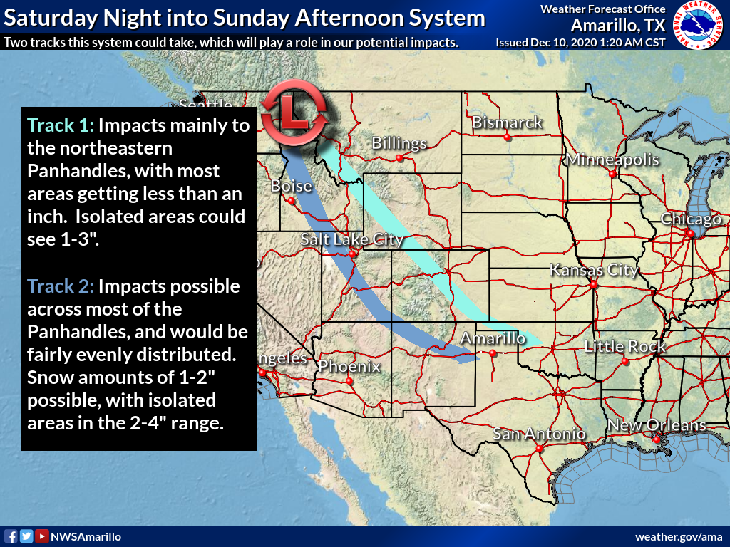
These things can go just about any which way, but maybe it's our turn again?
Stay tuned.
Oh yeah, rain is in the forecast as well for Thursday night into Friday.
BORRRRINNNNGGGGG!!! But still necessary, and very much appreciated. Not much
being forecast, but it all helps. Mostly being forecast for central through
eastern Oklahoma, as per usual.
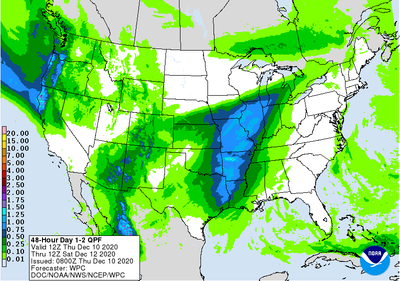
We need that moisture desperately across the droughty areas of western and
south central OK, especially.
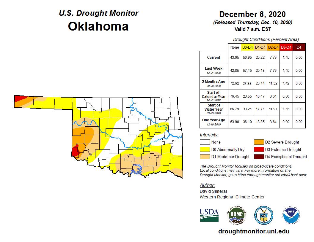
It's tough to focus when snow enters the forecast period. We zero in on that
Saturday-Sunday time frame like a dog spotting a squirrel. We could definitely
be setting ourselves up for disappointment. Or it could be even bigger. This
year, anything could happen.
Heck, we could end up with a volcano!
Gary McManus
State Climatologist
Oklahoma Mesonet
Oklahoma Climatological Survey
(405) 325-2253
gmcmanus@mesonet.org
December 10 in Mesonet History
| Record | Value | Station | Year |
|---|---|---|---|
| Maximum Temperature | 85°F | WAUR | 2021 |
| Minimum Temperature | -5°F | CAMA | 2013 |
| Maximum Rainfall | 2.15 inches | JAYX | 2022 |
Mesonet records begin in 1994.
Search by Date
If you're a bit off, don't worry, because just like horseshoes, “almost” counts on the Ticker website!