Ticker for June 1, 2020
MESONET TICKER ... MESONET TICKER ... MESONET TICKER ... MESONET TICKER ...
June 1, 2020 June 1, 2020 June 1, 2020 June 1, 2020
The Long Slog
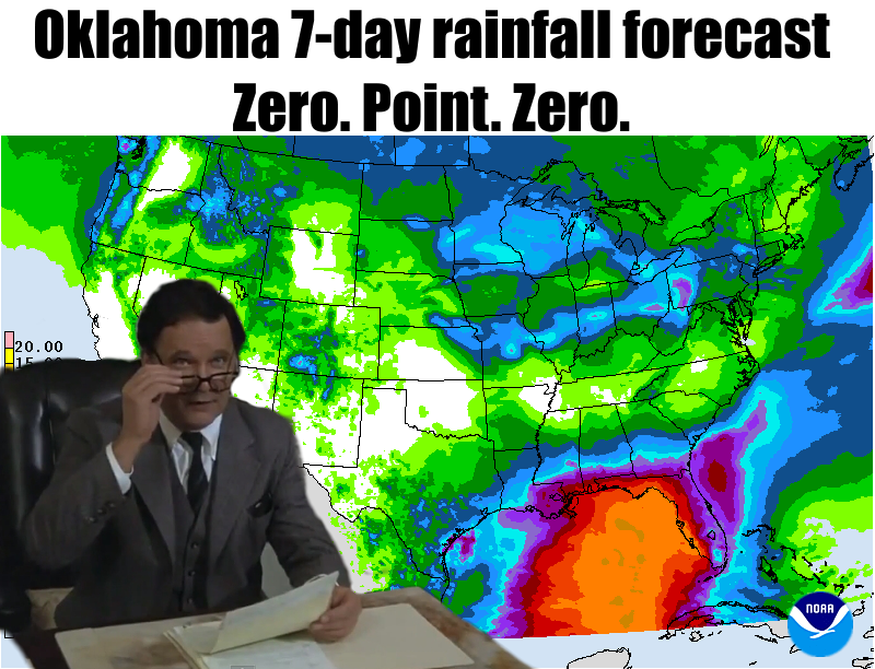
Hey, I don't even know what "slog" means, but it sounded good as a representation
of what appears to be the REAL arrival of summer. I must have heard it somewhere.
I hope I'm not mistaking it for the Harry Potter World word for kiss..."snog."
But maybe that term would work as well: "The Long Snog Goodnight," maybe? I hope
I didn't out myself as a nerd, there? I HEARD THAT!
EXPELLIARMUS!!
Well, I had to look it up, so maybe that saves me.
Enough nonsense (well, not quite or I'd just stop writing altogether). It does
look like we're in for a somewhat extended version of mid-summer, right here at
the beginning of that climatological season. A week or longer more fit for July
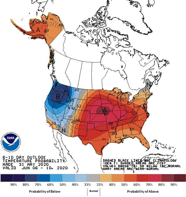
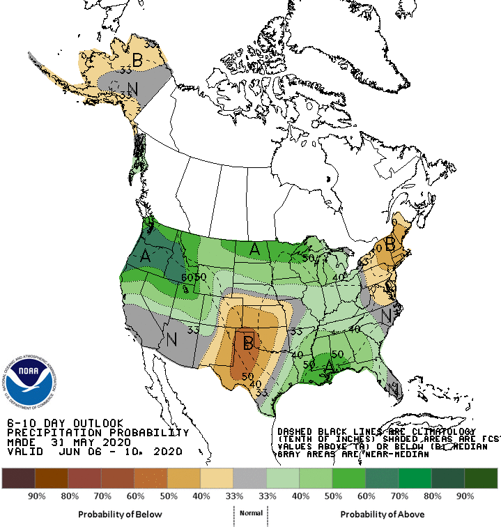
than early June. Little rainfall is expected anywhere in the state, if at all.
Just a slight chance for showers here and there. And the temperatures are going
to start that uphill climb to the century mark by the end of the week.
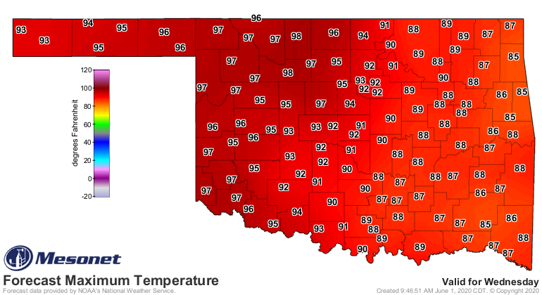
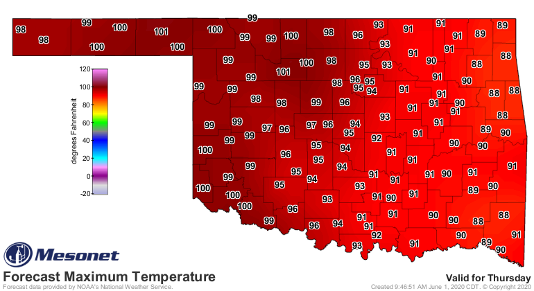
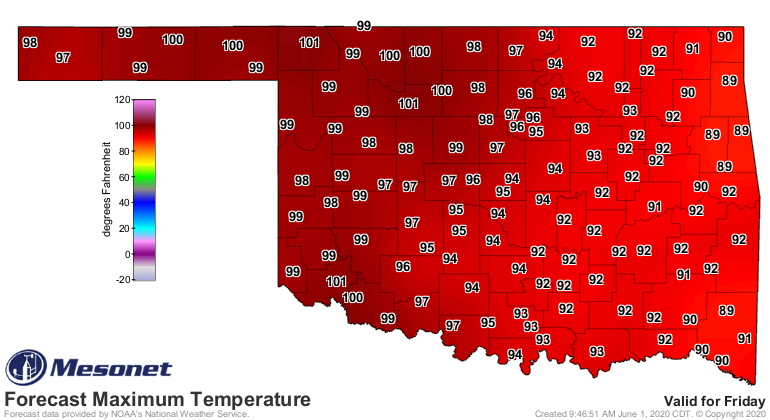
Things don't look so great beyond that, either, with these conditions
extending into early next week as well.
Maybe a pattern change after that? One can hope, because believe it or not,
parts of the state do need the rainfall...desperately. Western Oklahoma is
really starting to hurt, as you'll read in the May weather summary.
Which begins...now!
Just kidding. NOW now.
-------------------------------------------------------------------------------
Tornado Count Slows During May
June 1, 2020
Cool weather dominated a good part of May, and possibly robbed Mother Nature of
the heat needed for her most exotic springtime menu item; tornadoes. There was
still the normal offering of large hail, damaging winds, and flash flooding,
but the twister count was below average. The National Weather Service indicated
a preliminary total of 13 tornadoes for the month, well below the 1950-2019
average of 24.4, and a relatively minuscule tally compared to last May’s
all-time Oklahoma monthly record of 105. The 2020 preliminary total of 33 also
falls below the January-May average of 41.
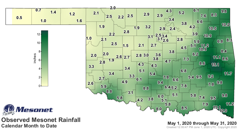
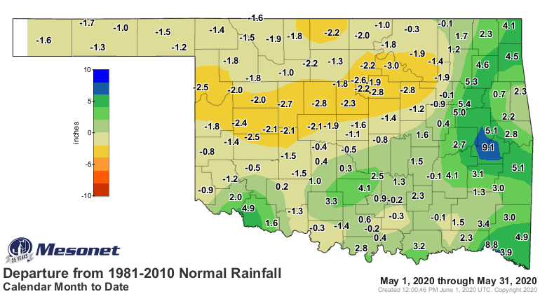
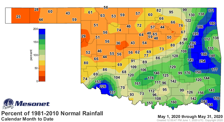
The statewide average precipitation total was 5.04 inches according to the
Oklahoma Mesonet, 0.22 inches above normal and ranked as the 50th wettest May
since records began in 1895. It was an all too familiar rainfall pattern for
Oklahoma, with roughly the southeastern half of the state receiving an
abundance of moisture while the northwestern half suffered deficits. Those
deficits approached 3 inches in parts of central Oklahoma, and were generally
1-2 inches elsewhere. Surpluses of 2-4 inches were common across the southeast.
Stigler was 9.5 inches above normal with a state-leading 15.06 inches, although
Valliant was just a hair behind at 15.05 inches. Kenton occupied a familiar
spot with the state’s lowest total of 0.48 inches.
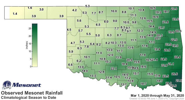
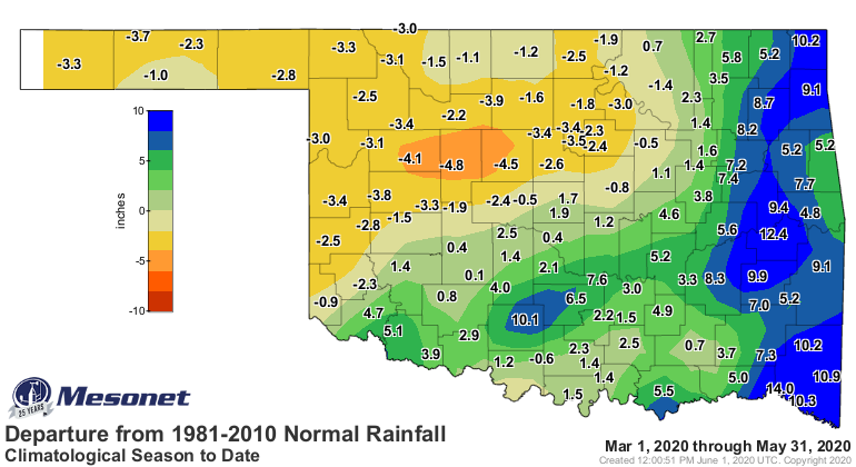
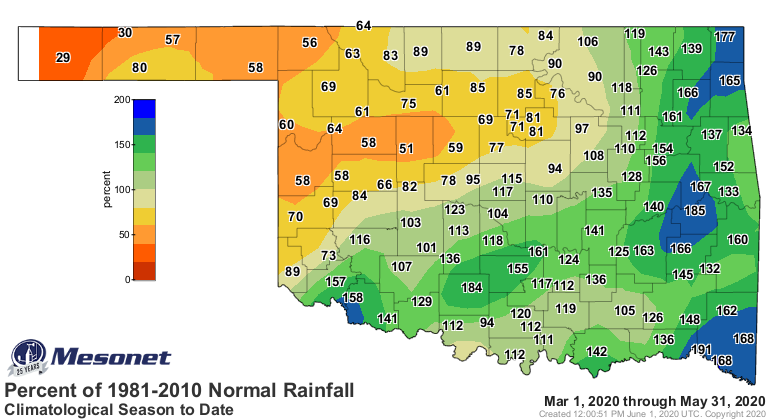
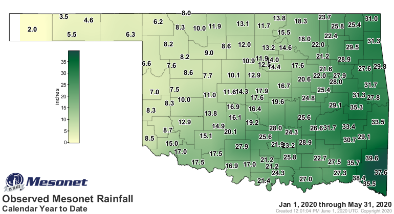
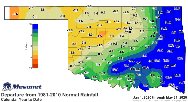
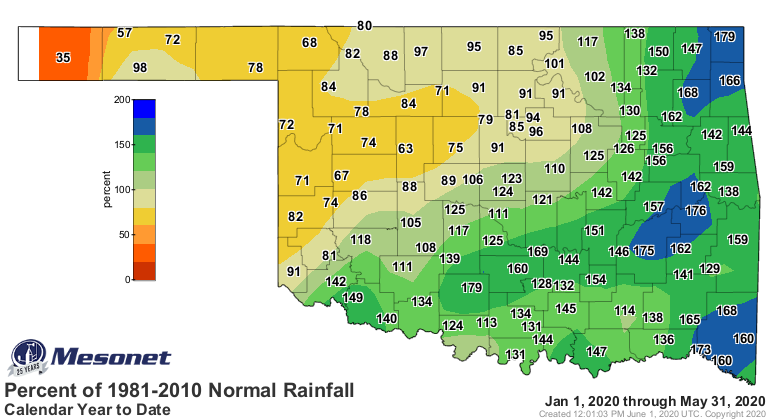
The northwest versus southeast rain pattern extended from spring back to the
beginning of the year. Spring ended as the 24th on record wettest with a
statewide average of 13.1 inches, 1.98 inches above normal, yet the Panhandle
suffered its 24th driest at 3.31 inches, 2.58 inches below normal. Spring
deficits ranged from 2-4 inches across the northwest quarter, but a bit above
that in Blaine and Kingfisher counties. Surpluses peaked at 8-12 inches in far
eastern Oklahoma.
The first five months of the year ended with a surplus of 4.01 inches, the 14th
wettest January-May on record at 18.52 inches averaged statewide.
The month both began and ended with summer-like conditions, but sandwiched in
between was an extended period of much cooler than normal weather. Temperatures
soared into the 80s and 90s the first few days of the month, while the
southwest saw triple-digits. The airport at Frederick reached 108 degrees on
May 4 to become the highest temperature ever recorded in the state that early
in the year, topping Buffalo’s 107 degrees from May 1, 1992. The weather cooled
from there until the final week when highs once again reached the 80s and 90s.
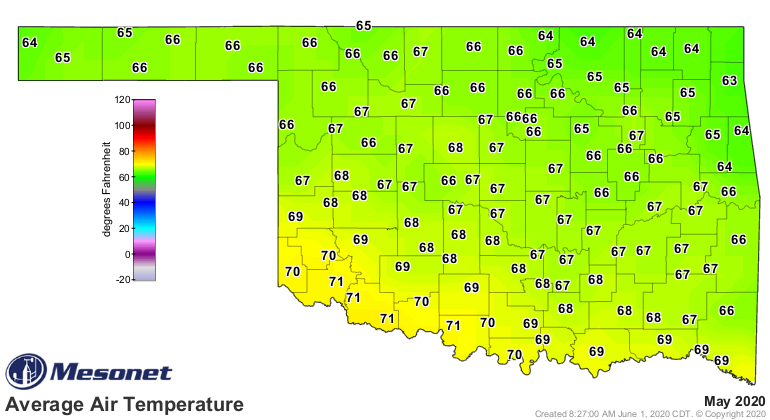
Overall, the statewide average temperature as measured by the Oklahoma Mesonet
was 66.8 degrees, 1.4 degrees below normal to rank as the 35th coolest May on
record.
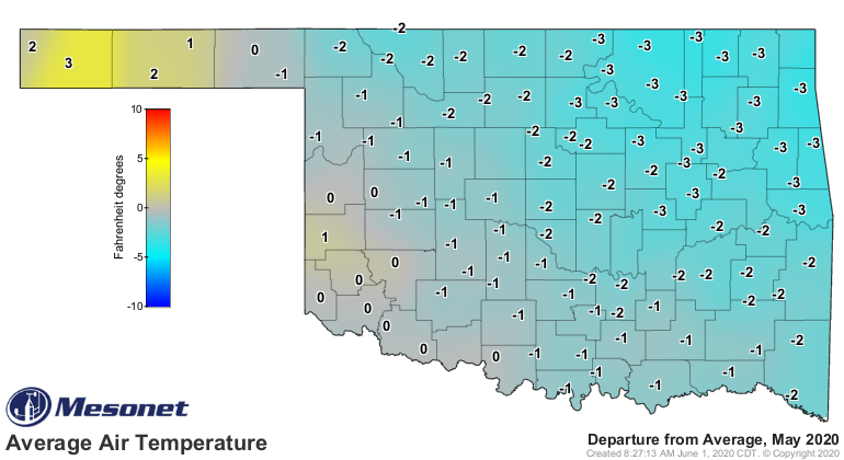
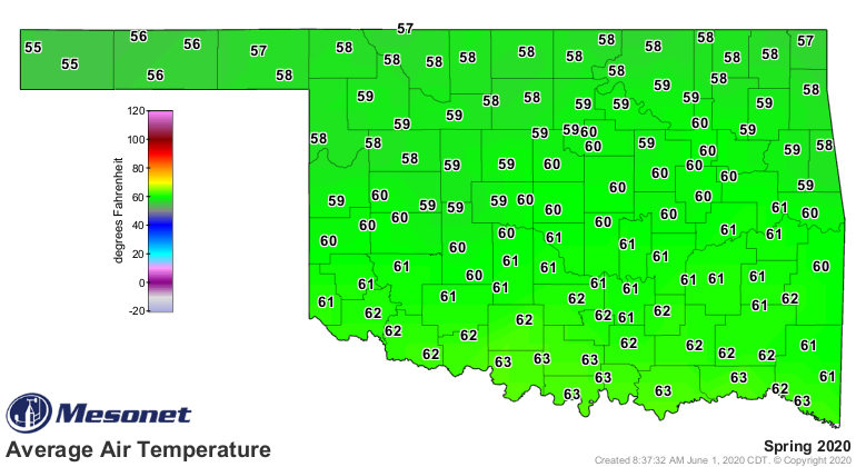
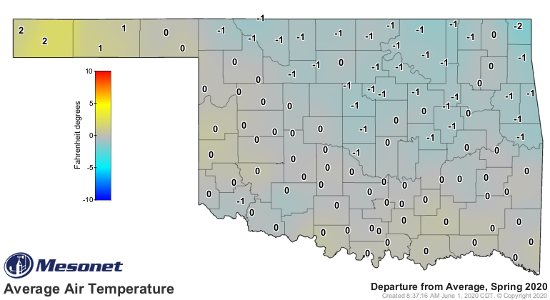
The lowest temperature of the month was 31 degrees at Eva on the ninth – the
state’s final freeze of the season. Spring finished on the warm side by 0.8
degrees at 60.1 degrees, the 38th warmest on record.
The year was still on a warm pace at 52.9 degrees, 1.3 degrees above normal for
the 21st warmest January-May in the books.
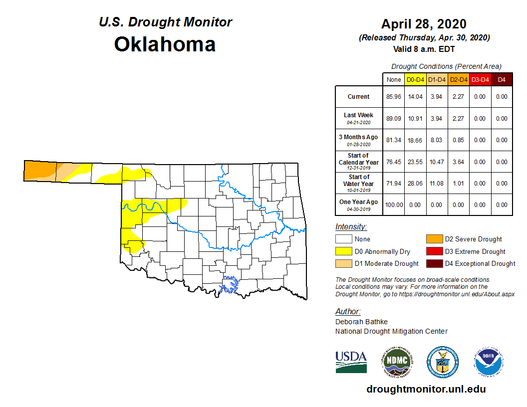
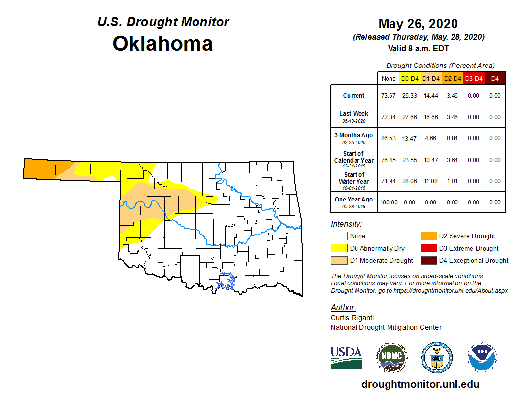
Drought took a large step forward across western into central Oklahoma,
increasing its areal coverage from about 4% at the end of April to more than
14% at the end of May. Drought also increased in severity in the far western
Panhandle with most of Cimarron and Texas counties covered by moderate to
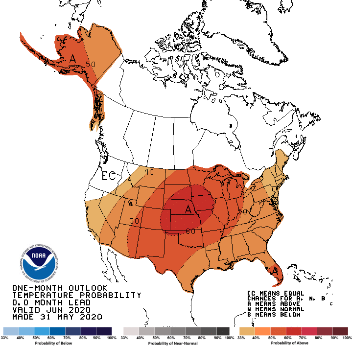
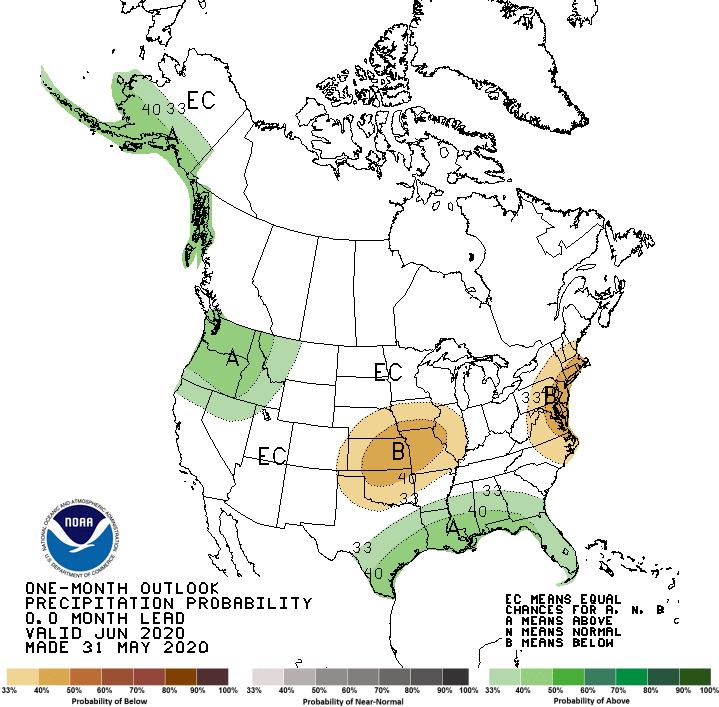
severe drought by the end of the month. The June temperature and rainfall
outlooks from the Climate Prediction Center (CPC) show little hope for
substantial drought relief; increased odds of above normal temperatures and
below normal precipitation are indicated across all of Oklahoma. Those odds
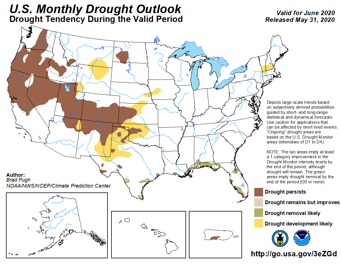
are reflected in CPC’s June drought outlook, with those areas of existing
drought in the state expected to persist and intensify. Additional drought
development is termed “likely” across much the rest of northern and western
Oklahoma.
Gary McManus
State Climatologist
Oklahoma Mesonet
Oklahoma Climatological Survey
(405) 325-2253
gmcmanus@mesonet.org
June 1 in Mesonet History
| Record | Value | Station | Year |
|---|---|---|---|
| Maximum Temperature | 110°F | ALTU | 1998 |
| Minimum Temperature | 44°F | OILT | 2012 |
| Maximum Rainfall | 6.51″ | OKEM | 2013 |
Mesonet records begin in 1994.
Search by Date
If you're a bit off, don't worry, because just like horseshoes, “almost” counts on the Ticker website!