Ticker for March 2, 2020
MESONET TICKER ... MESONET TICKER ... MESONET TICKER ... MESONET TICKER ...
March 2, 2020 March 2, 2020 March 2, 2020 March 2, 2020
Marching into dry
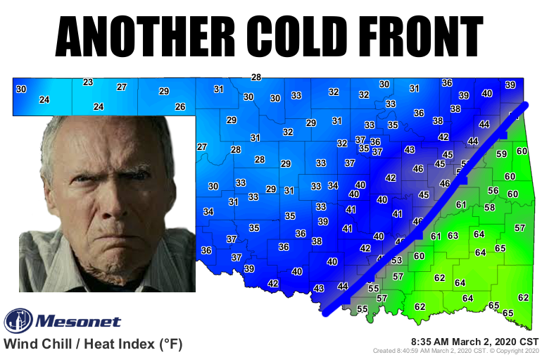
Yeah, does Clint look happy? Neither are we. After a darned near perfect (a bit
too windy and fiery) weekend with highs in the 70s and even a few 80s, we now
are jolted back to reality. Early March...the "Joanie and Chachi" of spring.
Yeah, I'm that old. Still too early in the month to get sustained warmth, but
too late in the winter to count on a big snow for excitement. We can still get
big snows, of course. Many of our heftiest snowstorms have come during March.
But we couldn't even count on them in December and January this year. And if you
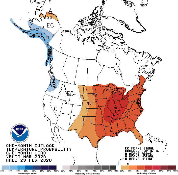
keep scrolling down below, you'll see the CPC outlooks for March look decidedly
warmish for us.
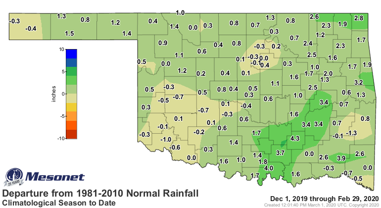
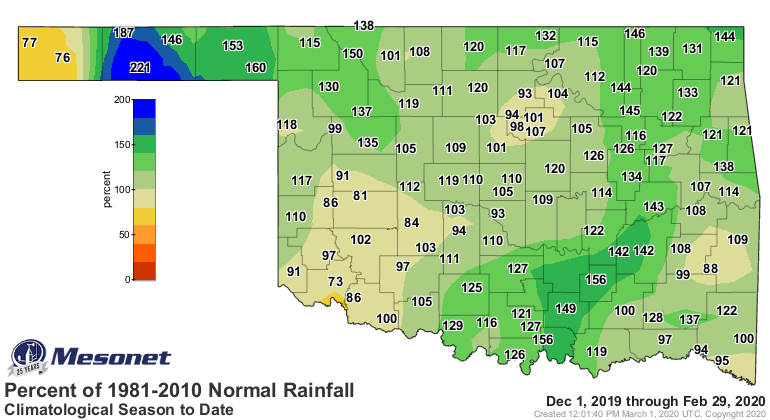
And it's getting dry! You can again scroll down to see the growing deficits that
began during February, or you can take a gander at these maps showing how
significant moisture has avoided us recently.
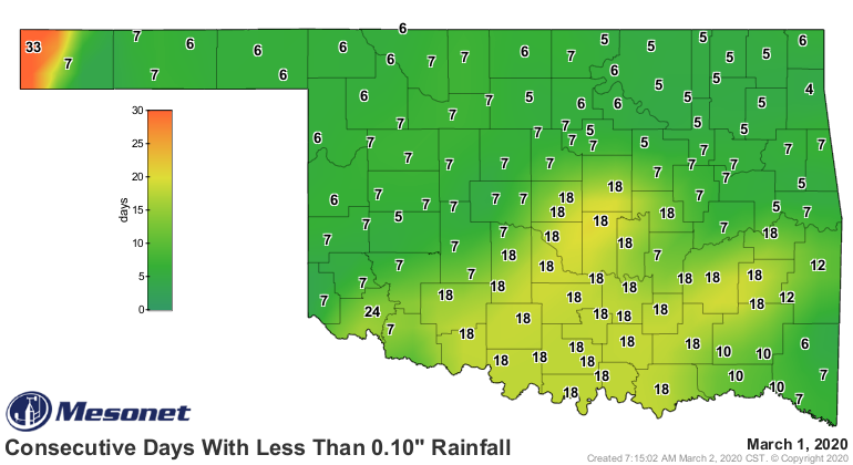
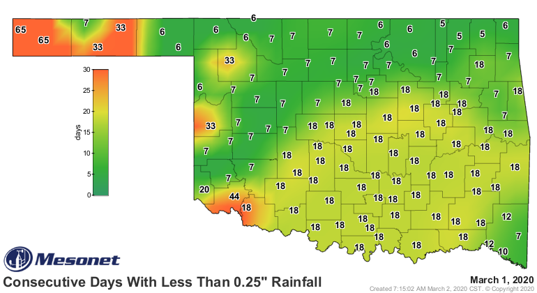
Yikes! Sneaks up on ya, doesn't it? Well, there are chances for rain coming up
tomorrow night into Wednesday, and then we'll give it the old "we'll see" for
later this week.
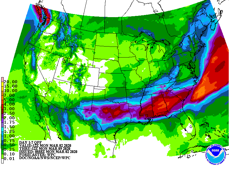
That definitely looks like a southern Oklahoma rainfall. The biggest hope there
is that it will at least hit the southwest quarter and try and knock that
drought out. Thursday looks nice though, after the rain has moved out.
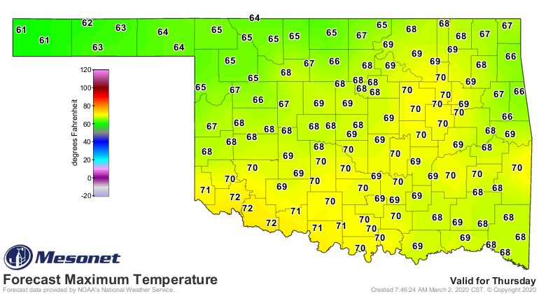
So let's go back to look at the future!
----------------------------------------------------------------------------------
Snowstorm Highlights February Weather
March 2, 2020
In February, Oklahoma finally received a month worthy of winter. It wasn’t
tremendously cold, nor was it excessively wet, but it did provide much of
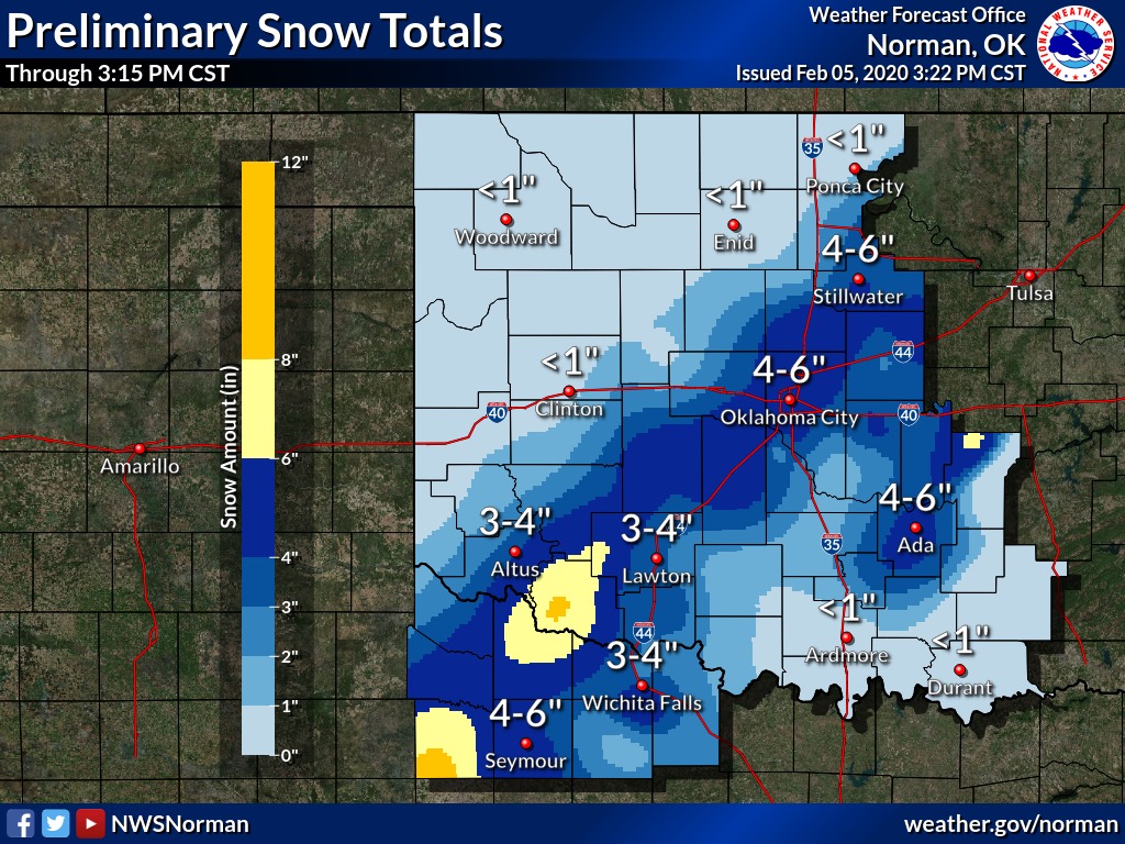
Oklahoma with its first decent snow of the season. A strong storm system passed
through the state on February 5 and dropped sleet, freezing rain, and 4-6 inches
of snow along and around the Interstate 44 corridor. Higher totals of 6-8 inches
were reported in the southwest, with a few localized areas receiving as much as
10 inches.

There were other minor winter systems throughout the month, but none that packed
the punch of the February 5 storm. For the cool season through February, all of
Oklahoma has had at least a trace of snow. Portions of northwestern Oklahoma
and the western Panhandle have received more than a foot of snow. Severe
weather was rare during February, other than some storms in the southeast on
the 18th that had large associated with them.
According to preliminary data from the Oklahoma Mesonet, the statewide average
temperature was 41.6 degrees, half of a degree below normal to rank as the 68th
coolest February dating back to 1895. That statewide reading was influenced by
below normal temperatures in the far southwest, as well as sustained frigid
conditions in the far western Panhandle; readings there were 2-3 degrees cooler
than normal.


The month’s high temperature of 83 degrees was recorded at three different
Mesonet sites on February 2. The lowest temperature of 1 degree came just four
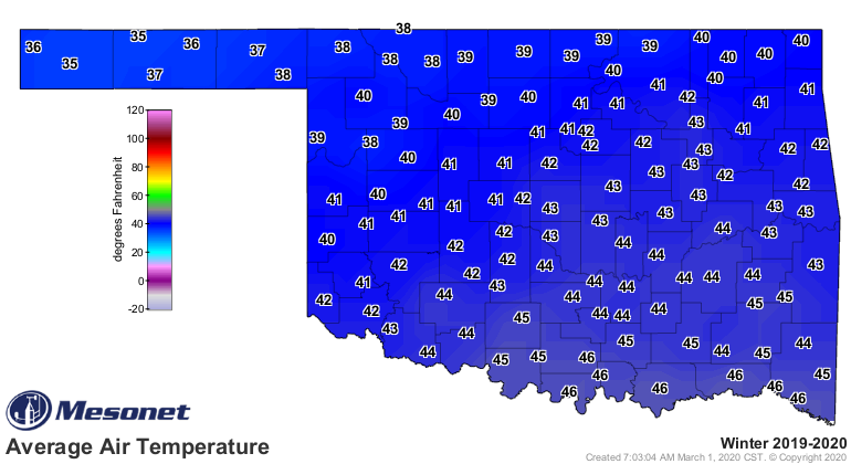
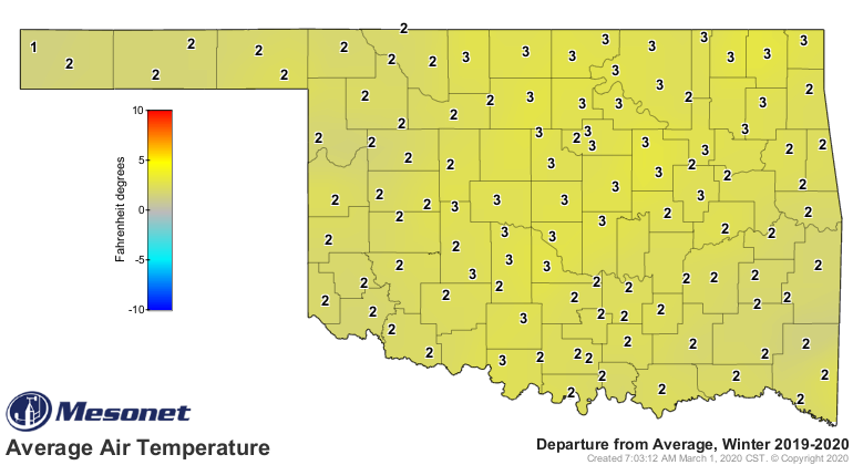
days later at Tipton. Buoyed by unusual warmth during December and January, the
climatological winter (December-February) was significantly warm at 42.3
degrees, 2.8 degrees above normal and ranked as the 10th warmest on record.
February’s highest and lowest temperatures also served as winter’s extremes.
The first two months of the year ranked as the 28th warmest such period on
record at 41.9 degrees, 2.1 degrees above normal.
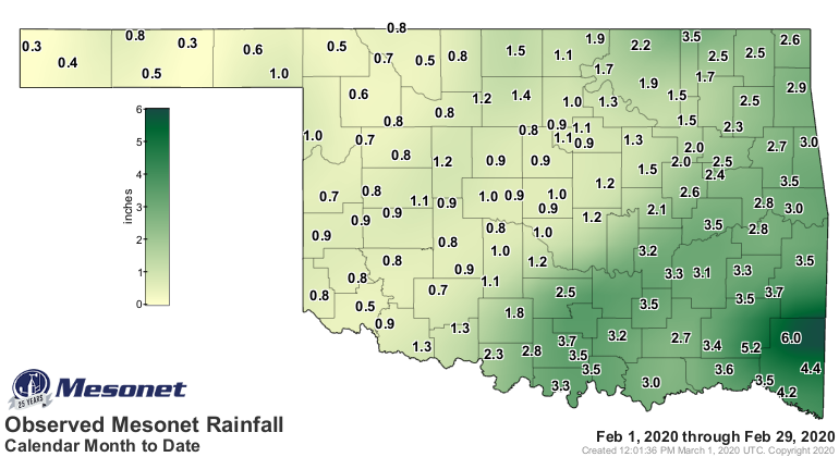
There were some hefty rainfall totals during February, but those were uncommon.
Heavy rainfall for the month was concentrated in the most likely area; far
southeastern Oklahoma had totals from 4-6 inches, with the Mt. Herman Mesonet
site leading the way at 6.02 inches. The driest area also came as no surprise.
The far western Panhandle station of Kenton had the lowest total with 0.26
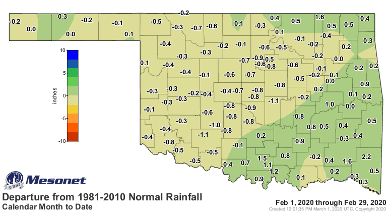
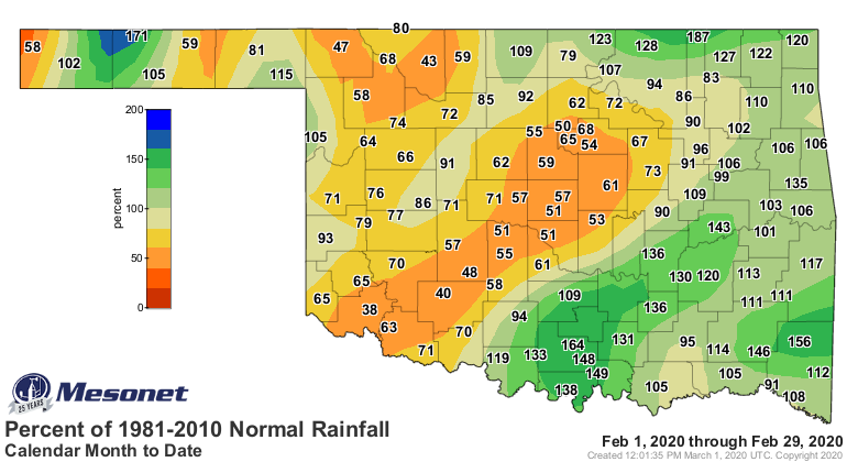
inches. Most surpluses and deficits were within a half-inch of normal. Combined,
the statewide average was 1.81 inches, just 2 hundredths below normal to rank
as the 45th wettest February since 1895. Of the Mesonet’s 120 sites, 41 recorded
less than an inch of moisture for the month.
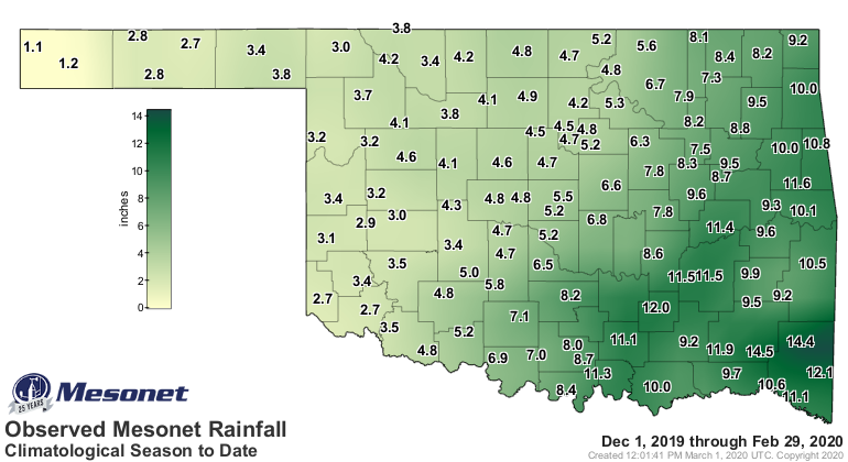
Winter ended as the 28th wettest on record, but only 0.85 inches above normal
with a statewide average of 6.3 inches. Cloudy led all sites with 14.46 inches
of rainfall for the season. Kenton had the lowest winter total of 1.06 inches.
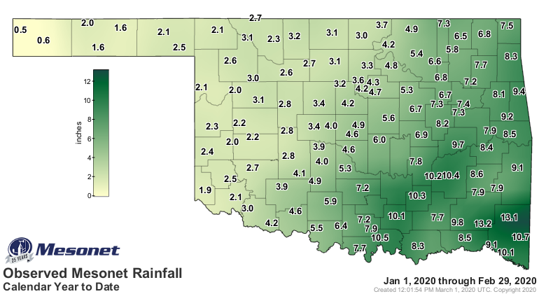
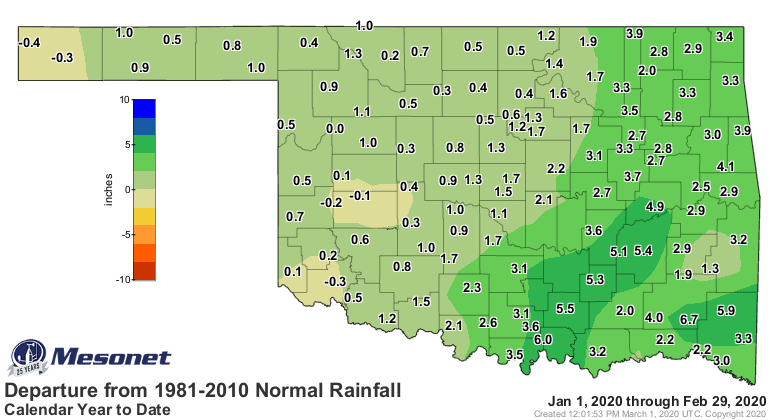
The first two months of 2020 were the 10th wettest January-February on record
at 5.25 inches, 1.86 inches above normal.

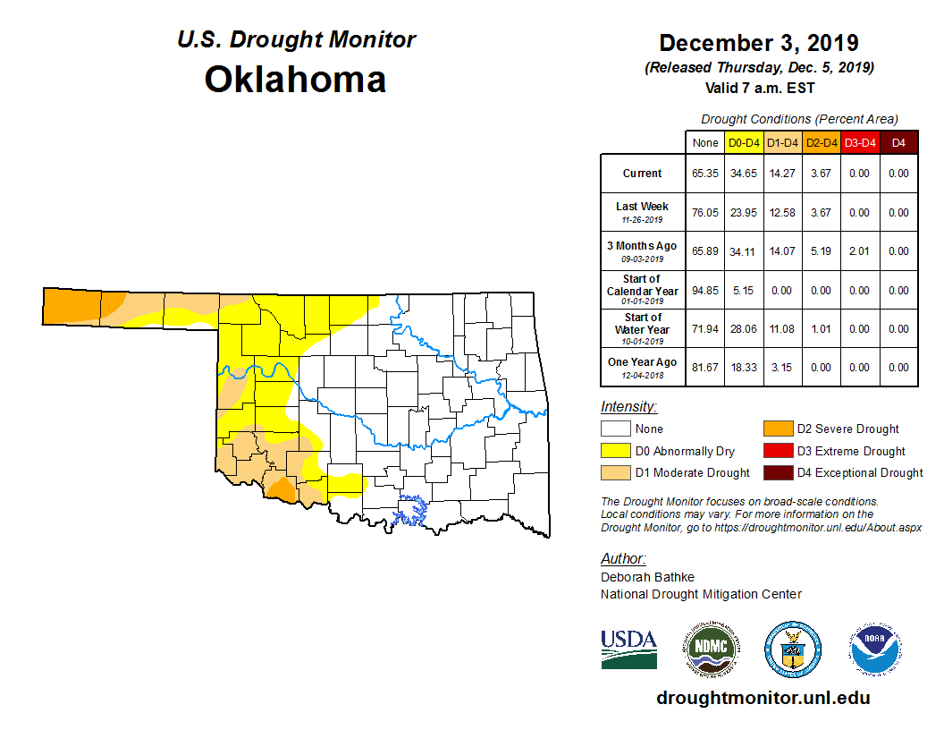
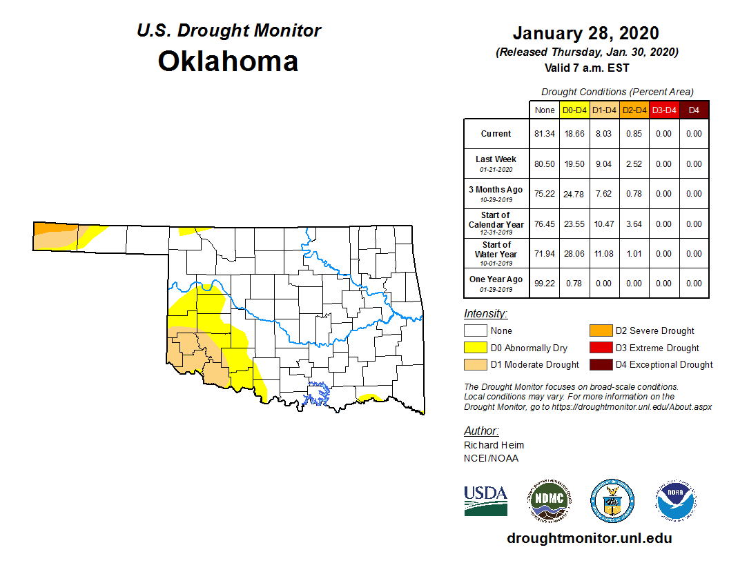
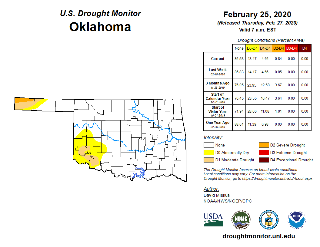
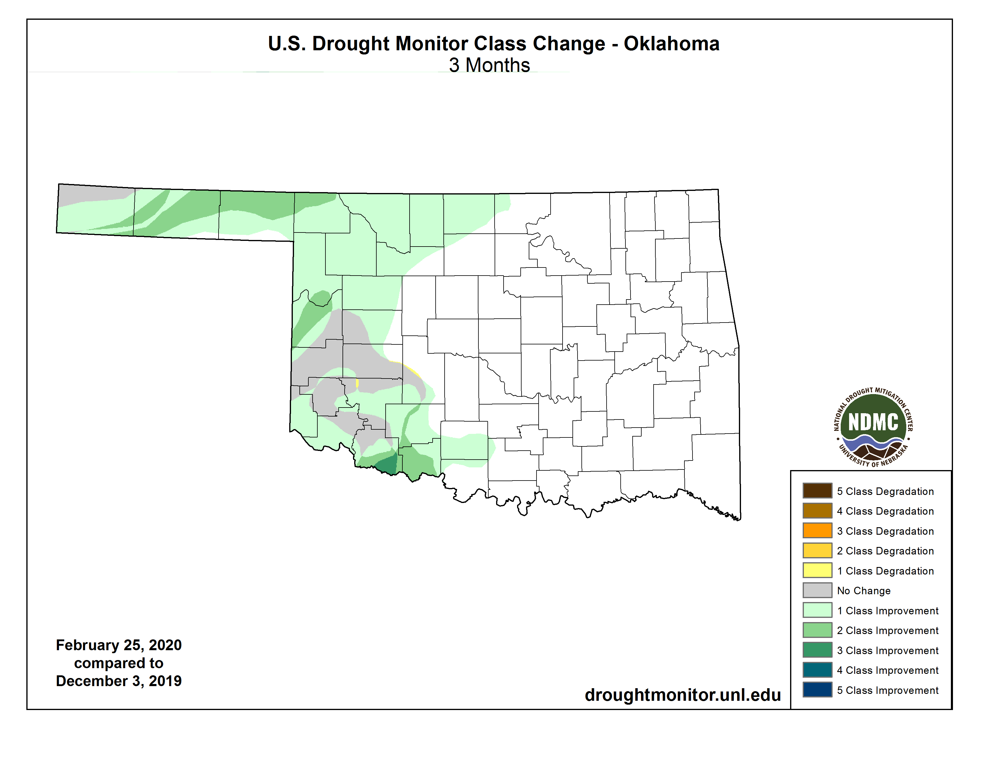
Oklahoma’s drought coverage was cut nearly in half through February according
to the U.S. Drought Monitor. The amount of drought stood at 8.03% at the end
of January, but had dropped to 4.66% by the end of February. An even larger
reduction occurred since the start of climatological winter on December 1, when
drought covered 14.27% of the state. All of the drought over the last three
months occurred across the western one-third of the state. The amount of the
state in at least “abnormally dry” conditions – areas in drought and additional
parts possibly headed towards drought – fell from 35% to 13% through winter.
The March temperature outlook from the Climate Prediction Center (CPC)
indicates increased odds for above normal temperatures across all of Oklahoma,
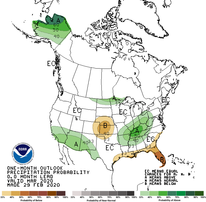
but those odds are greater in eastern Oklahoma. The precipitation outlook
shows enhanced chances of below normal precipitation across the northwestern
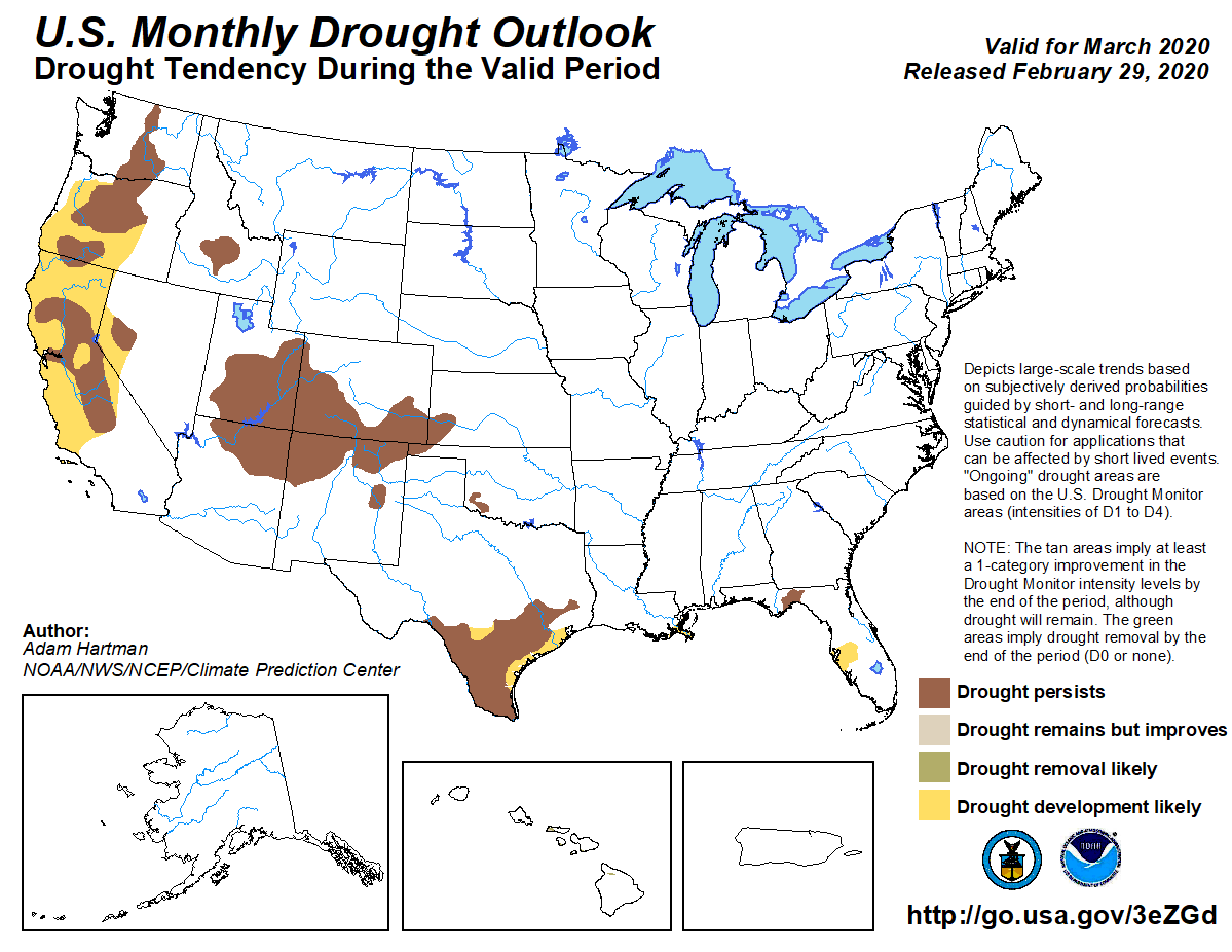
quarter of the state, but above normal across far eastern Oklahoma. CPC expects
the existing drought to persist in the state through March, but no new
development is anticipated.
Gary McManus
State Climatologist
Oklahoma Mesonet
Oklahoma Climatological Survey
(405) 325-2253
gmcmanus@mesonet.org
March 2 in Mesonet History
| Record | Value | Station | Year |
|---|---|---|---|
| Maximum Temperature | 85°F | WOOD | 2024 |
| Minimum Temperature | -2°F | BOIS | 2014 |
| Maximum Rainfall | 3.21 inches | HUGO | 2023 |
Mesonet records begin in 1994.
Search by Date
If you're a bit off, don't worry, because just like horseshoes, “almost” counts on the Ticker website!