Ticker for August 21, 2019
MESONET TICKER ... MESONET TICKER ... MESONET TICKER ... MESONET TICKER ...
August 21, 2019 August 21, 2019 August 21, 2019 August 21, 2019
Help is on the way?
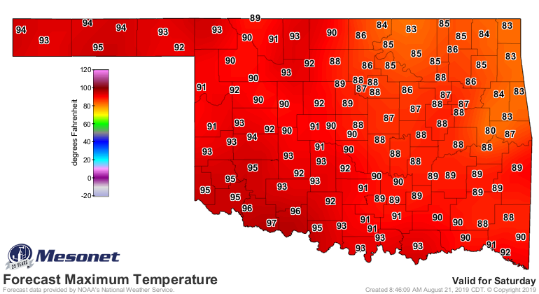
No no no. I'm not talking about the front scheduled to come through tomorrow into
the weekend. Yeah, that will help our current predicament, of course. But that
interlude from hell-summer to just plain summer will be brief, with a return to
hell-summer this weekend. Here you can see a nice Saturday, but by Sunday that
cooler air mass starts to pull off to the northeast from whence it came, leaving
us baking into early next week.

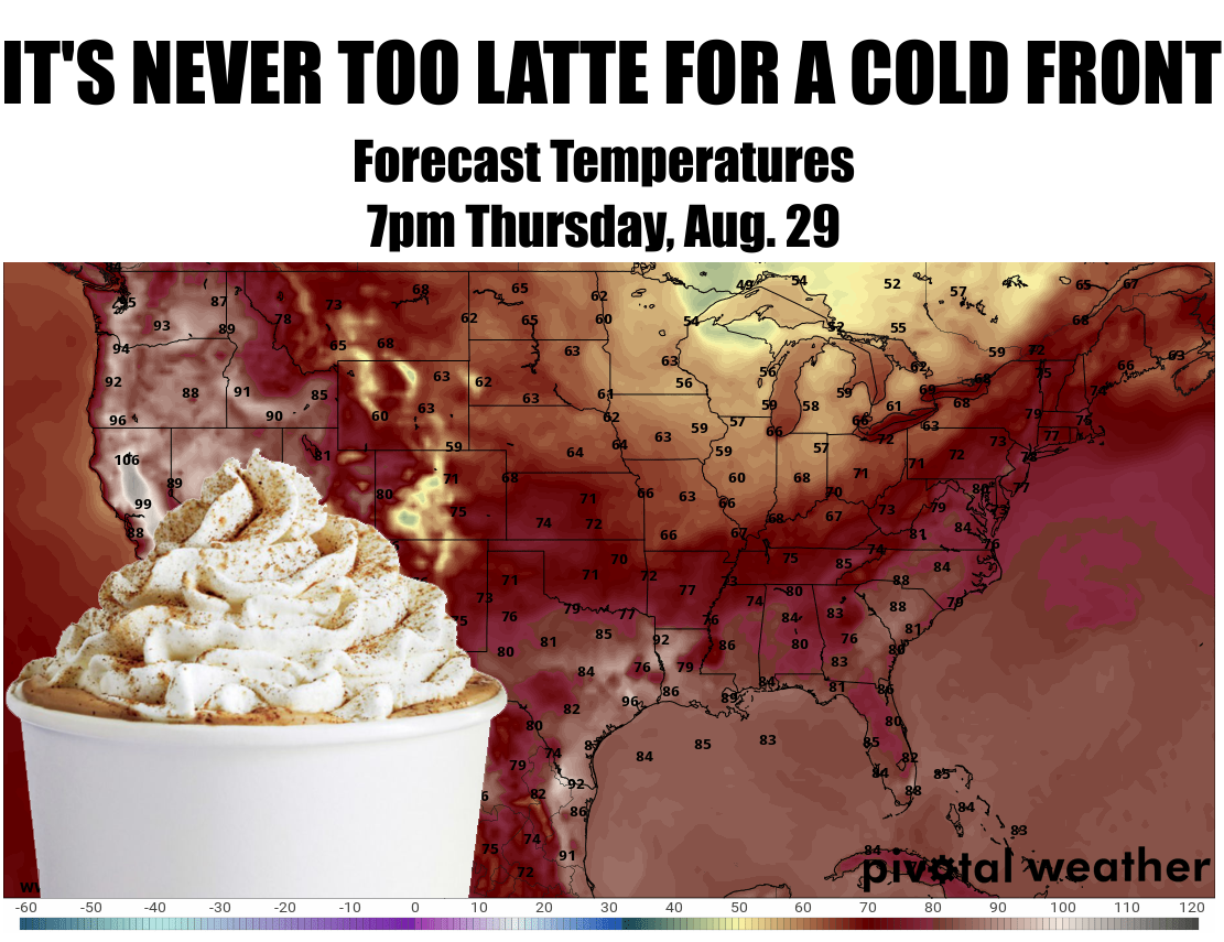
So we go back into the pressure oven next week and then, maybe...MAYBE...we get
a front in here mid-week that REALLY cools us down. I'm talking 50s for lows and
70s/80s for highs. I'm talking football weather (it's the South!). I'm talking
pumpkin spice lattes. I'm talking gagging and spitting pumpkin spice lattes out
because I can't stand pumpkin spice lattes. Why did you give me a pumpkin spice
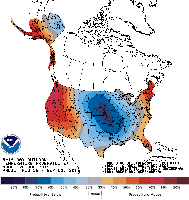
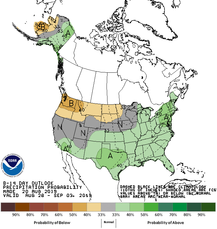
latte? You know I don't...wait, let's stay on track. Check out these 6-10 and 8-14
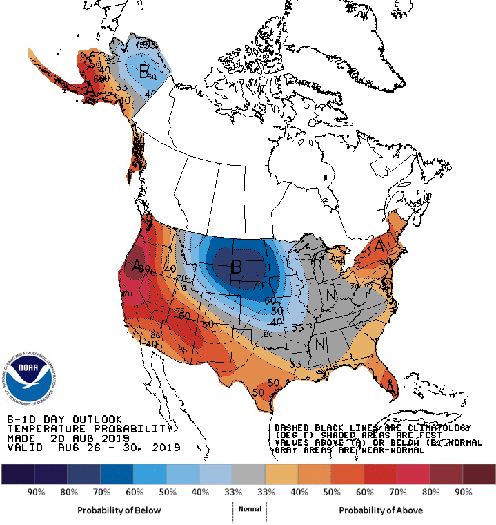
day outlooks from the Climate Prediction Center.
6-10 day outlooks
-----------------
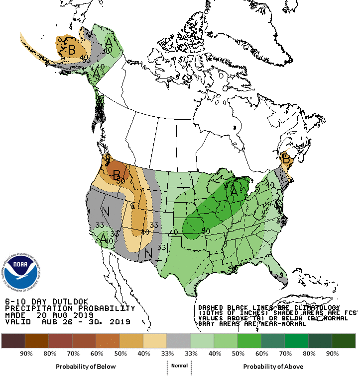
8-14 day outlooks
-----------------
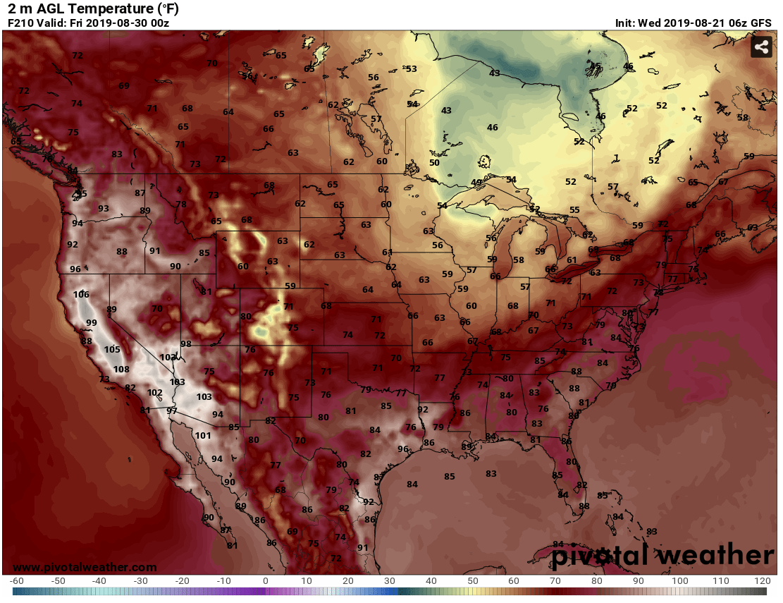
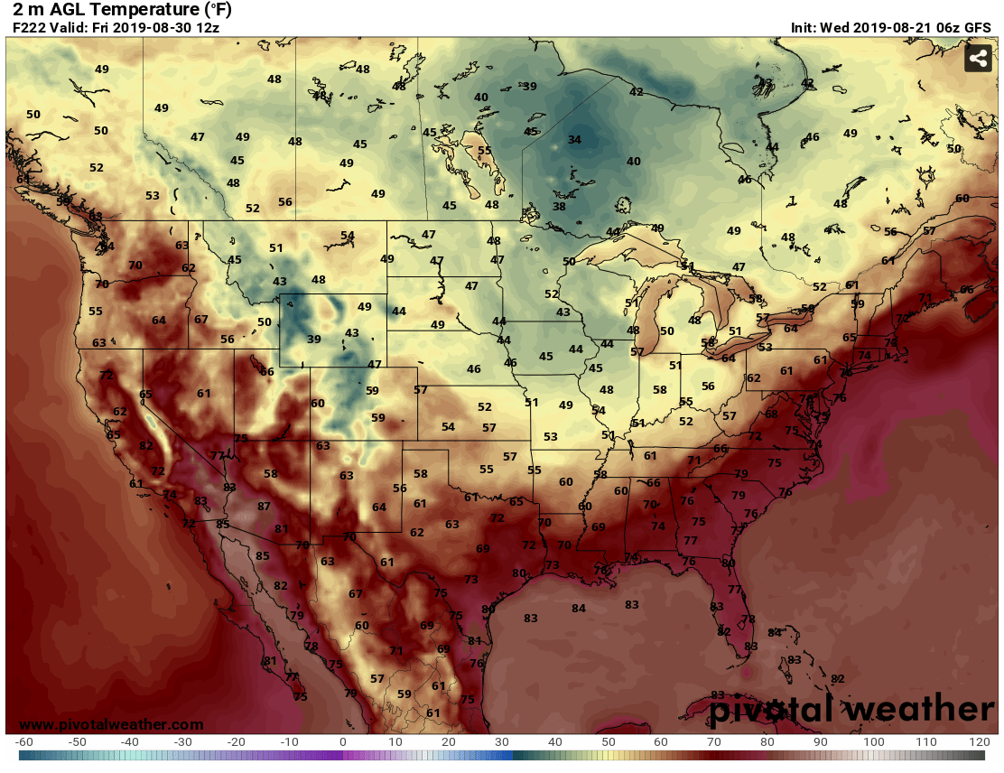
What would that look like, if these long-range outlooks come true? If the
weather just ends up in the vicinity of where the forecast models are taking
us some seven days down the road? Check it out. Swoon if you must. Send cash
if you will.
So we will be ready for this following one of the nastiest Augusts in state
history. It's not gonna be the hottest August; we still have 2011 to remember
unfondly. But it will be one of the stuffiest. The heat index has been running
ridiculously high since late July. You've seen the maps. Here's a graph showing
the departure from the Mesonet's long-term average (2004-18) statewide average
maximum heat index. This takes all regions of the state and averages them
together, so we're getting the drier parts of western Oklahoma AND the humid
areas of the east as well. This is for the entire climatological summer, June 1
through Aug. 31, so it's complete up to today.
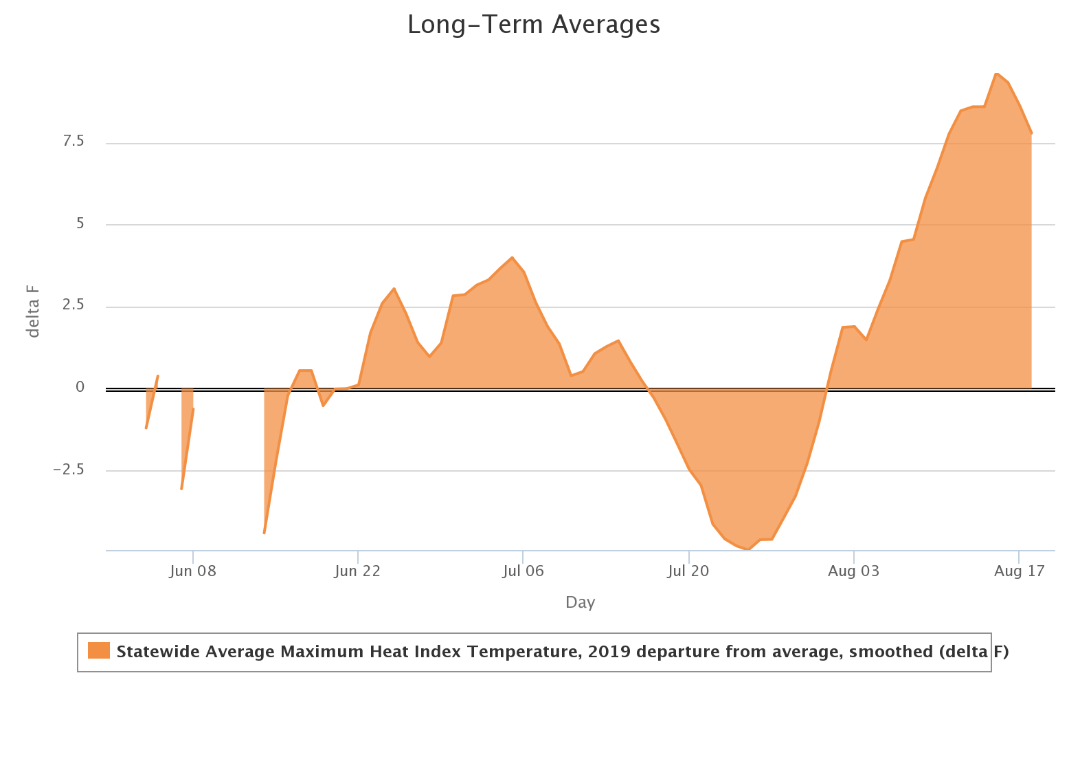
Nearly 10 degrees above normal for the heat index across the entire state
earlier this week. But you can also see the uptick in June directly after the
heavy rains stopped, then an interlude in the latter part of July.
What's this look like for the actual heat index and not the departure from
average? Just as ugly. We put it in blue this time to make you feel better.
Remember, this is averaged across the entire state, so it's gonna be worse in
the east than the west.
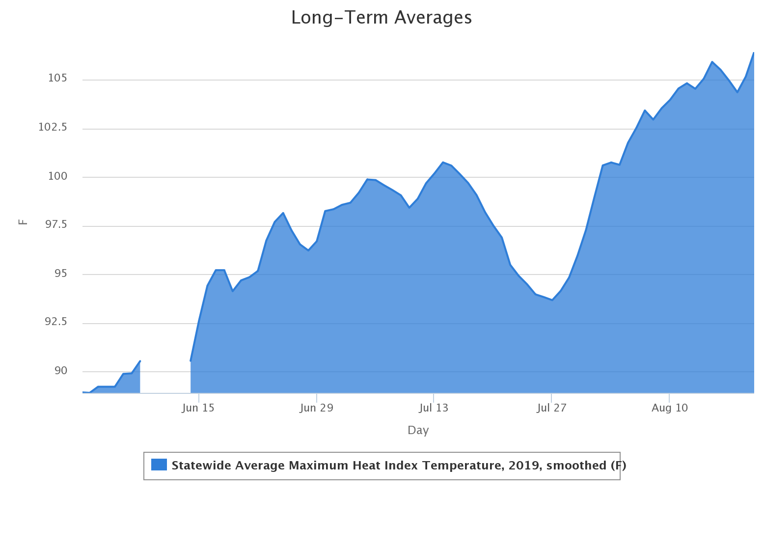
Above 105 degrees...not too shabby. Just thinking about it makes it hard to
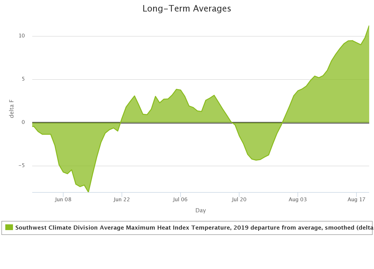
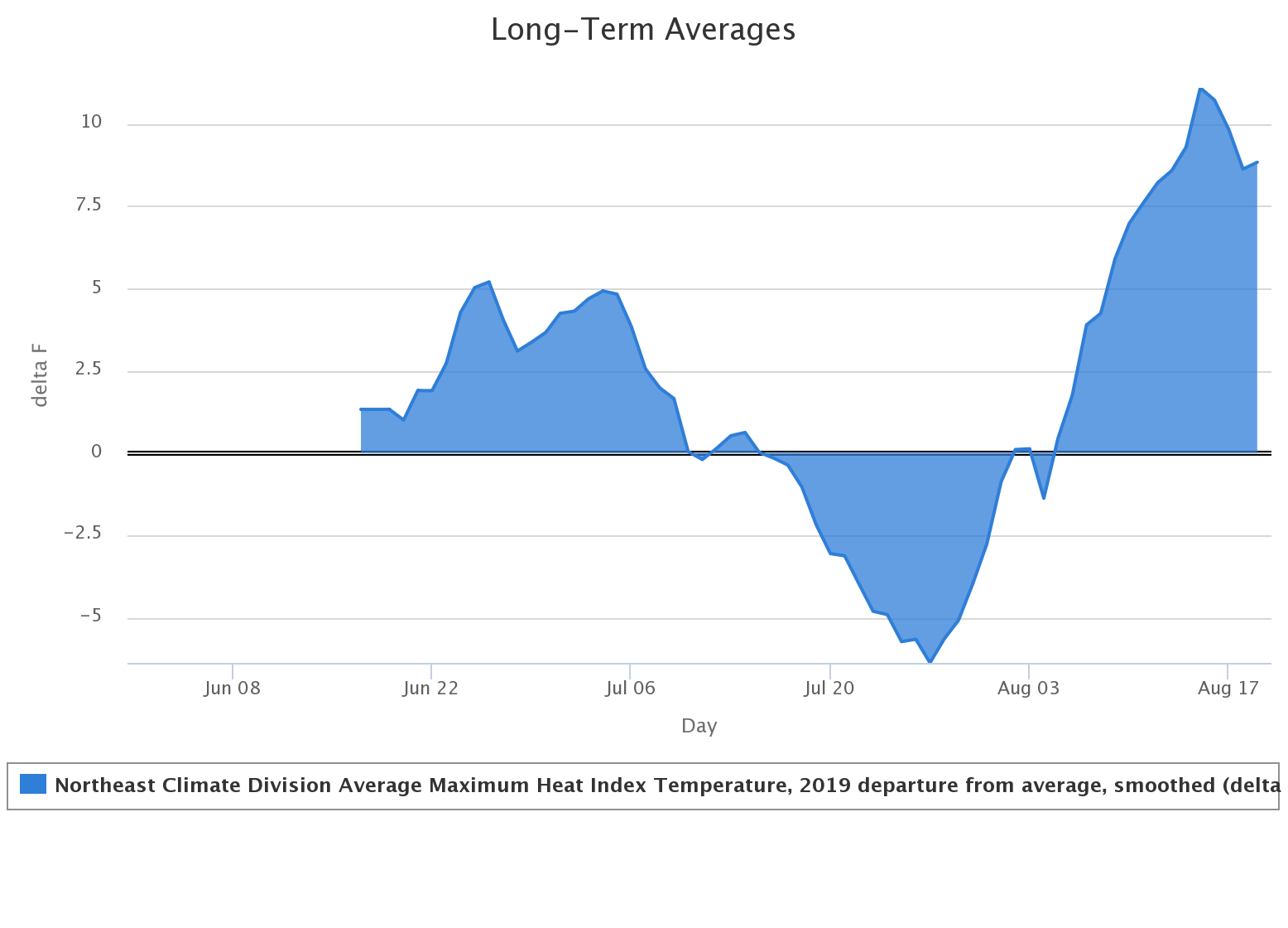
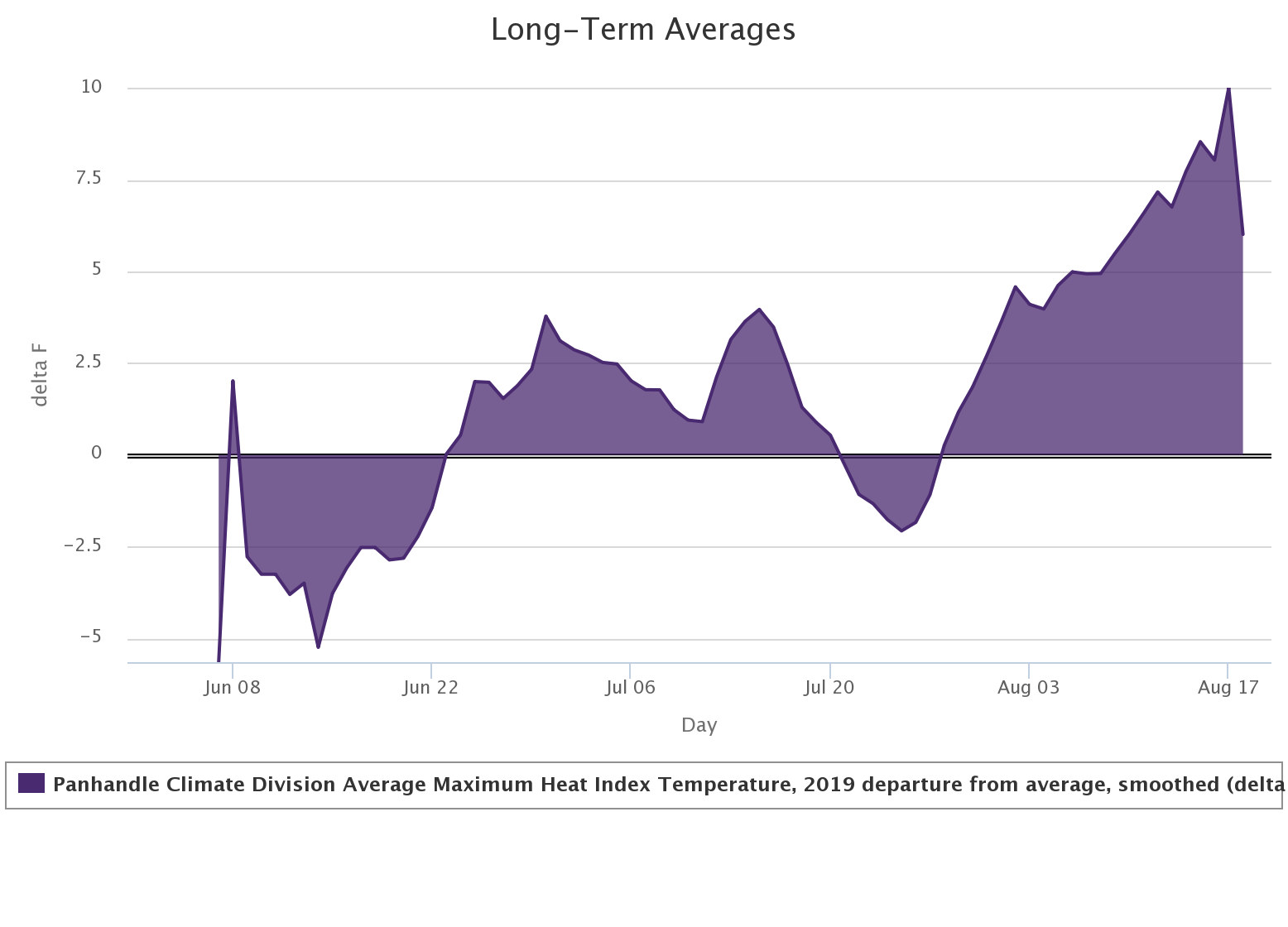
breathe. It's all relative though. If you look at individual climate divisions,
like the SW vs. the NE vs. the Panhandle, they're all running even higher than
that (so there are obviously moderating influences from other sections of the
state...I suspect SE and WC Oklahoma).
Regardless of the heat index, the actual air temperatures for August are
elevated as well, after a cooler first couple of months of summer. That's what
makes August so unbearable this year. We didn't get our slow ramp up to August
through June and July. We had "hey, this summer ain't so bad!" to "WHAT THE
HECK HAPPENED!!" From the Mesonet data thus far, I'm thinking August will end
up somewhere in the top-20 wettest since 1895. Maybe top 15.
But that heat index!
Gary McManus
State Climatologist
Oklahoma Mesonet
Oklahoma Climatological Survey
(405) 325-2253
gmcmanus@mesonet.org
August 21 in Mesonet History
| Record | Value | Station | Year |
|---|---|---|---|
| Maximum Temperature | 109°F | GRA2 | 2023 |
| Minimum Temperature | 48°F | EVAX | 2018 |
| Maximum Rainfall | 4.25 inches | RING | 2022 |
Mesonet records begin in 1994.
Search by Date
If you're a bit off, don't worry, because just like horseshoes, “almost” counts on the Ticker website!