Ticker for July 11, 2019
MESONET TICKER ... MESONET TICKER ... MESONET TICKER ... MESONET TICKER ...
July 11, 2019 July 11, 2019 July 11, 2019 July 11, 2019
DO NOT WANT
Yeah, do your magic Eleven. And bring help from Ten and Twelve if you need to. The
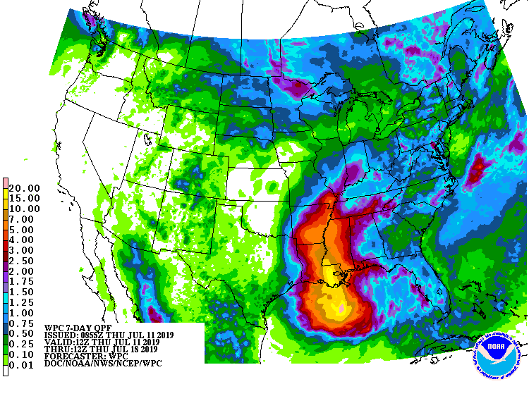
last thing we need is the 10-15 inches of rainfall forecast to move onto the
Louisiana coast over the weekend, let alone the 4-5 inches Arkansas looks poised
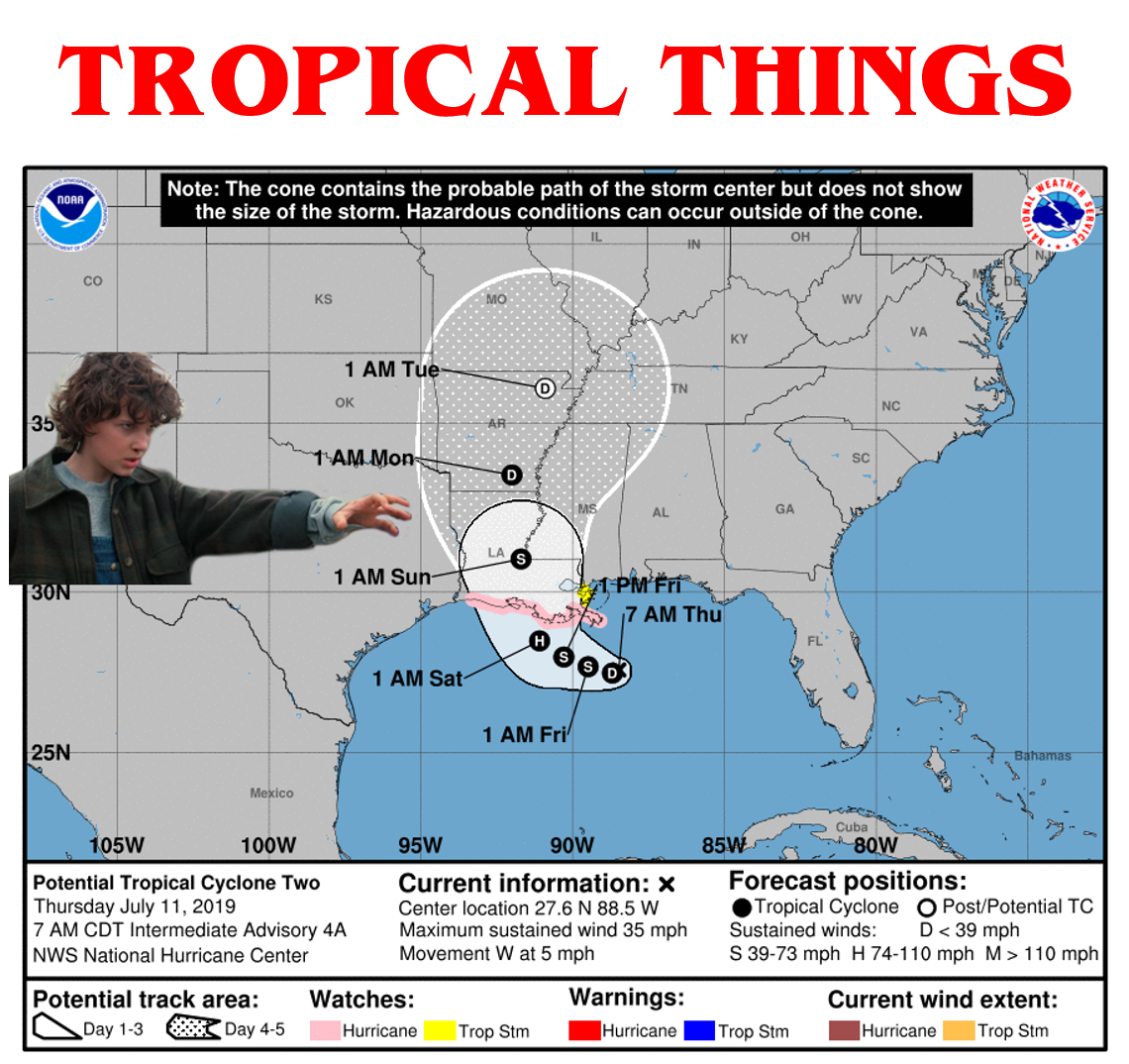
to get as "Potential Tropical Cyclone Two" transforms into Tropical Storm/Hurricane
Barry.
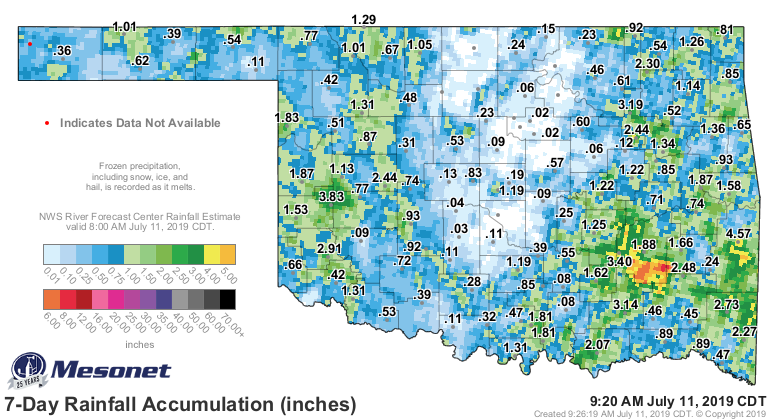
It's path will take it precariously close to eastern Oklahoma, where the worst
of our flooding occurred over the spring, but those far eastern counties will
still feel a bit of impact. And that area has already gotten a good dose of
rain over the last week or so (as has western Oklahoma).
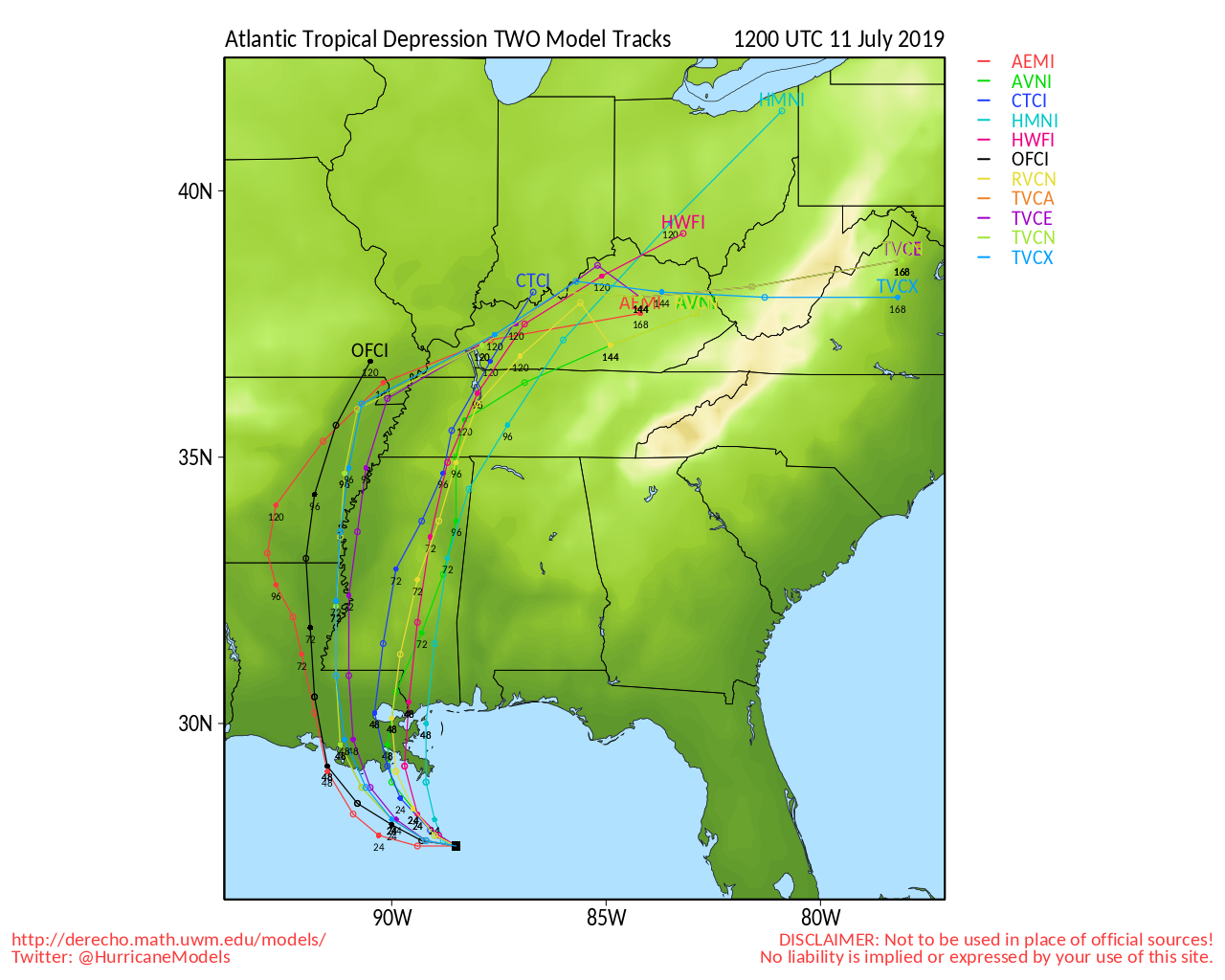
But, I think we're out of danger for the most part. There are no longer any
models pushing it up our way. They all keep it to the east thanks to the heat
dome over the West keeping it at bay.
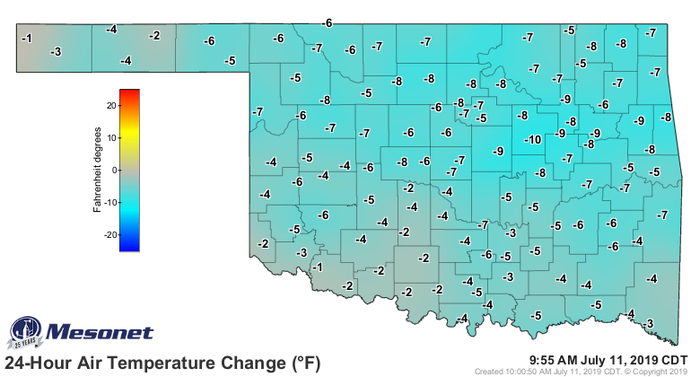
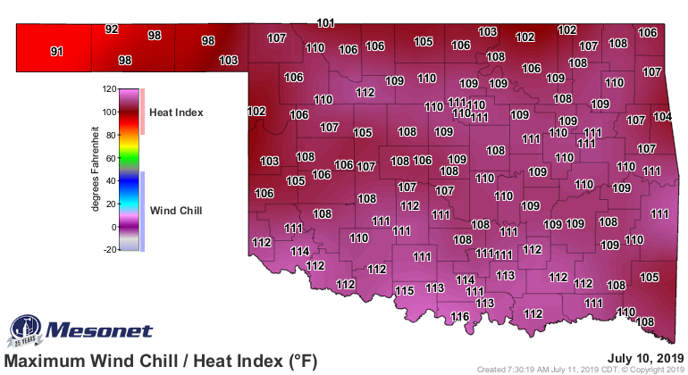
A much cooler day today, thanks to a nice cool front, so yesterday's blazing
temperatures should be about 10 degrees cooler, and the heat indices should
be about 20 degrees cooler.
Speaking of that heat dome, be prepared. It will be back. We ain't out of the
woods yet.
Get ready for the sequel..."Sweaty Things."
Gary McManus
State Climatologist
Oklahoma Mesonet
Oklahoma Climatological Survey
(405) 325-2253
gmcmanus@mesonet.org
July 11 in Mesonet History
| Record | Value | Station | Year |
|---|---|---|---|
| Maximum Temperature | 111°F | KIN2 | 2009 |
| Minimum Temperature | 52°F | GOOD | 1999 |
| Maximum Rainfall | 4.62 inches | SULP | 2023 |
Mesonet records begin in 1994.
Search by Date
If you're a bit off, don't worry, because just like horseshoes, “almost” counts on the Ticker website!