Ticker for June 21, 2019
MESONET TICKER ... MESONET TICKER ... MESONET TICKER ... MESONET TICKER ...
June 21, 2019 June 21, 2019 June 21, 2019 June 21, 2019
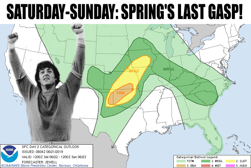
Spring's last gasp!
Welcome to Oklahoma where winter runs March 1-3, spring severe weather season
starts January 1 and ends December 31, and summer shows up whenever it darned
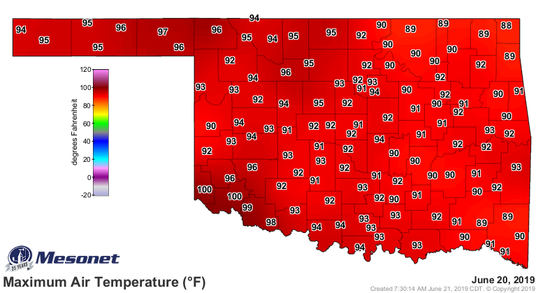
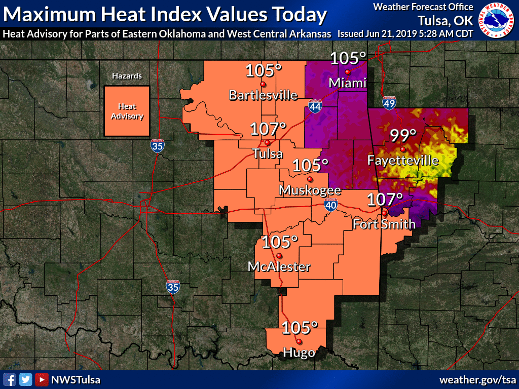
well feels like it. We've covered the heat now. Been there, done that. How about
our first 100s of the year, and a max heat index of 113 on the map?
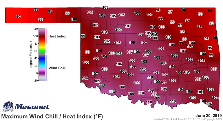
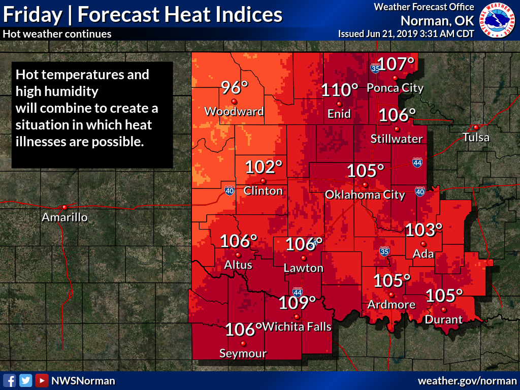
And more of the same today. Be ready, Mother Nature certainly is. I think these
values are an underestimate, but I hope I'm wrong.


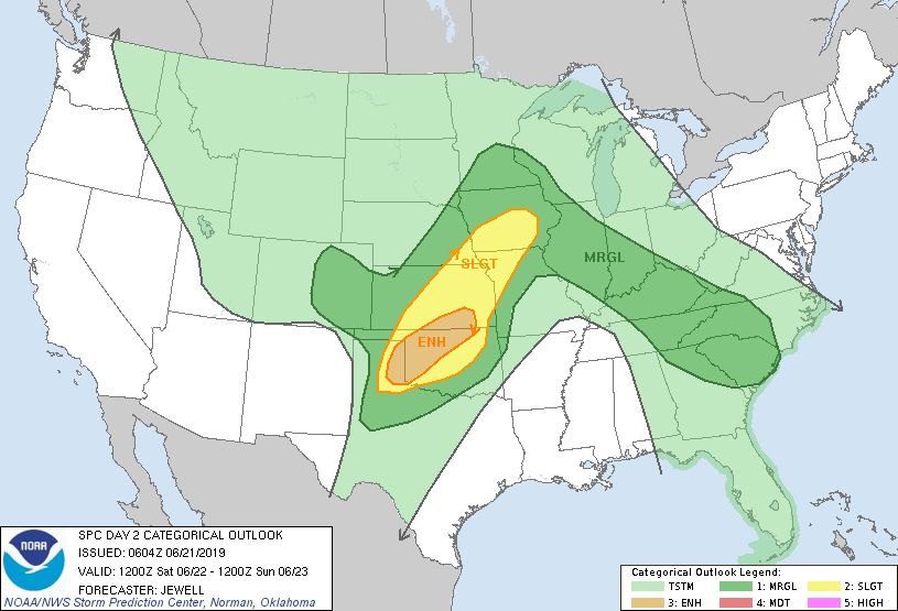
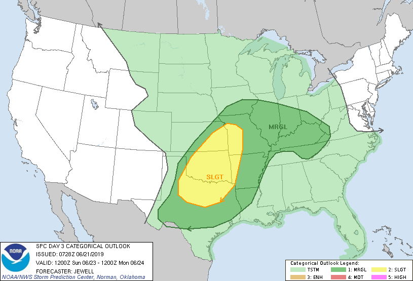
A bit of a cool down this weekend, but that's because of a trough of low
pressure, which will drag a cool front and a dryline into Oklahoma. And that,
of course, means storms and severe weather! Doesn't matter what the calendar
says. So here we go again. Watch out for the weather Saturday afternoon and
evening, and again overnight into Sunday AND then Sunday afternoon once again.
Looks like giant hail and widescale severe wind threat will be the most
likely, uhhhhh, threats (I hate when I do that), but tornadoes can't be ruled
out either. As we saw earlier this week, though, doesn't take a tornado to
ruin somebody's day.
And while our not-so-clever meme indicated this will be the end of our spring
severe weather season, will it REALLY be the end? Is Rocky celebrating to
early? He did lose that fight, ya know.
Mother Nature didn't hear no bell.
Gary McManus
State Climatologist
Oklahoma Mesonet
Oklahoma Climatological Survey
(405) 325-2253
gmcmanus@mesonet.org
June 21 in Mesonet History
| Record | Value | Station | Year |
|---|---|---|---|
| Maximum Temperature | 107°F | HOLL | 1998 |
| Minimum Temperature | 52°F | KENT | 2004 |
| Maximum Rainfall | 6.57 inches | COOK | 2000 |
Mesonet records begin in 1994.
Search by Date
If you're a bit off, don't worry, because just like horseshoes, “almost” counts on the Ticker website!