Ticker for June 6, 2019
MESONET TICKER ... MESONET TICKER ... MESONET TICKER ... MESONET TICKER ...
June 6, 2019       June 6, 2019       June 6, 2019       June 6, 2019


A little dab will do ya


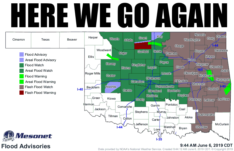
Oh, a flash flood watch and warnings, Flood advisory, flood warning, flood watch,
all on one map. Well pardon me all over the place. I thought we might actually
go a week sometime without FIVE DIFFERENT FLOOD ADVISORIES! I also thought I'd
need a comb at this point in my life (dreamed about a brush, but that was more
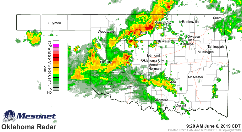
of a delusion). That upper-level low that has kept us thinking we were going to
flood all week has finally arrived, and the rain is now coming down.


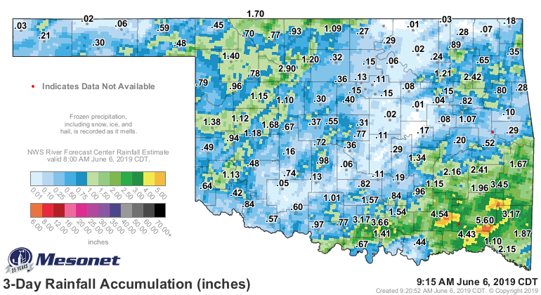
So this only adds to the rains over the last few days, and they have already
been substantial. And the ground is so saturated, it doesn't take much to cause
trouble.


Watch out for another 3-4 inches in areas where these slow moving storms just
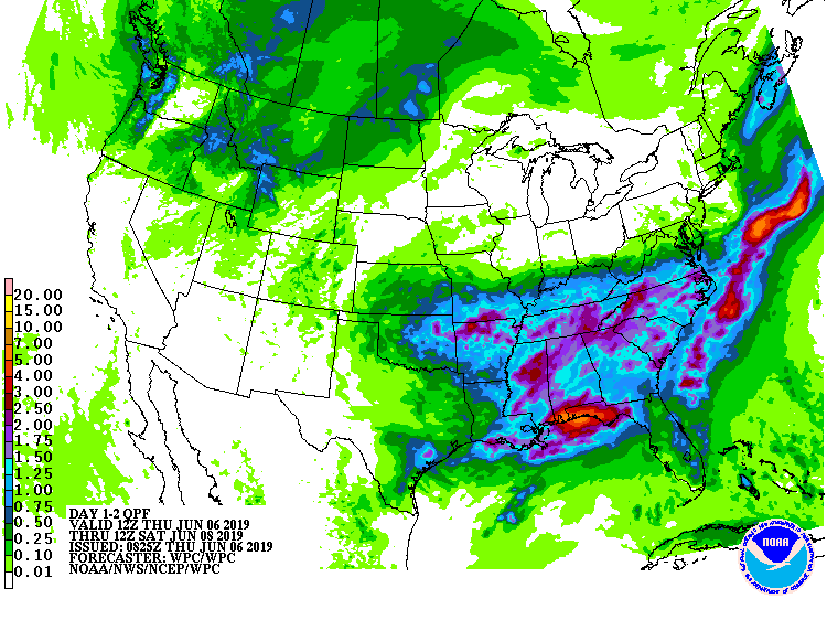
continue to develop and remain almost stationary over unlucky areas. Doesn't show
up on the forecast map as much, but the state's gonna got buckshot areas of very
heavy rains.


Prepare for an interlude Saturday, more rain Sunday (hopefully not too much),
then April-like temperatures. Then, another shot of rain later next week.

Turn around, don't drown, be safe, be smart, remain weather aware. You know the
drill.

Gary McManus
State Climatologist
Oklahoma Mesonet
Oklahoma Climatological Survey
(405) 325-2253
gmcmanus@mesonet.org
June 6 in Mesonet History
| Record | Value | Station | Year |
|---|---|---|---|
| Maximum Temperature | 104°F | CHER | 2011 |
| Minimum Temperature | 38°F | BOIS | 1998 |
| Maximum Rainfall | 4.75″ | TULN | 2019 |
Mesonet records begin in 1994.
Search by Date
If you're a bit off, don't worry, because just like horseshoes, “almost” counts on the Ticker website!