Ticker for January 16, 2019
MESONET TICKER ... MESONET TICKER ... MESONET TICKER ... MESONET TICKER ...
January 16, 2019 January 16, 2019 January 16, 2019 January 16, 2019
IT LIVES!
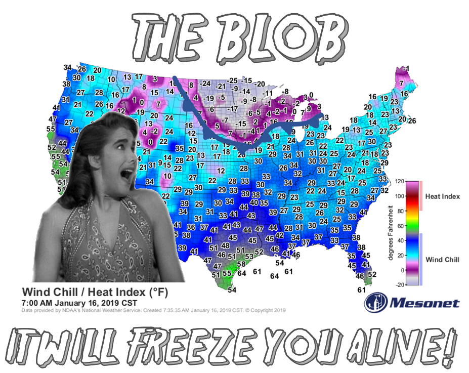
It's the story of the day, and yesterday, and tomorrow and Friday and...well, you
know the drill here. The inevitability of the mass of arctic air currently moving
south through the middle of the country, destined for the eastern half of the
U.S., is, well, inevitable. While we'll get a glancing blow, that glance will
turn you to ice much like a Medusa's glare did to Perseus' crew (highbrow Greek
literature reference, no extra charge!).
Again, I turn to our friends at the NWS to help us out with this weekend's
scenario (although again, a glance at the U.S. map above tells most of the frigid
story.
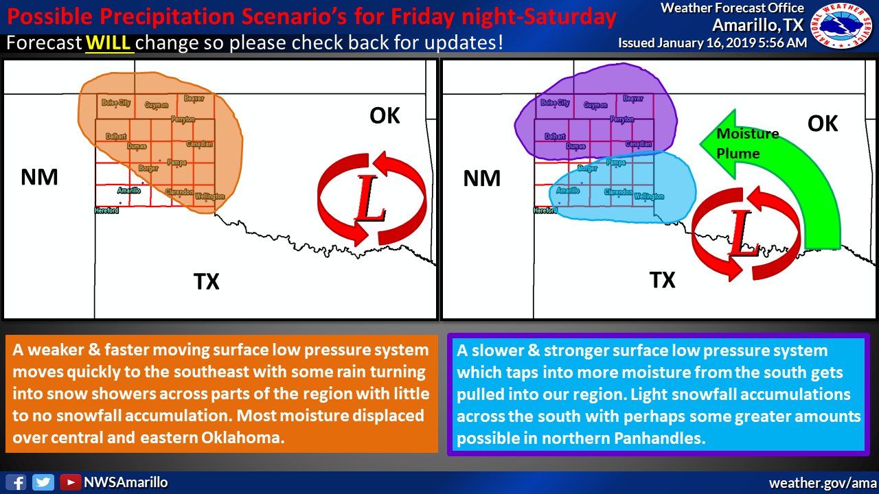

What do we know? It's gonna get COLD! Somebody's getting snow, somebody's not.
Some will probably have a thunderstorm before the front arrives Friday night.
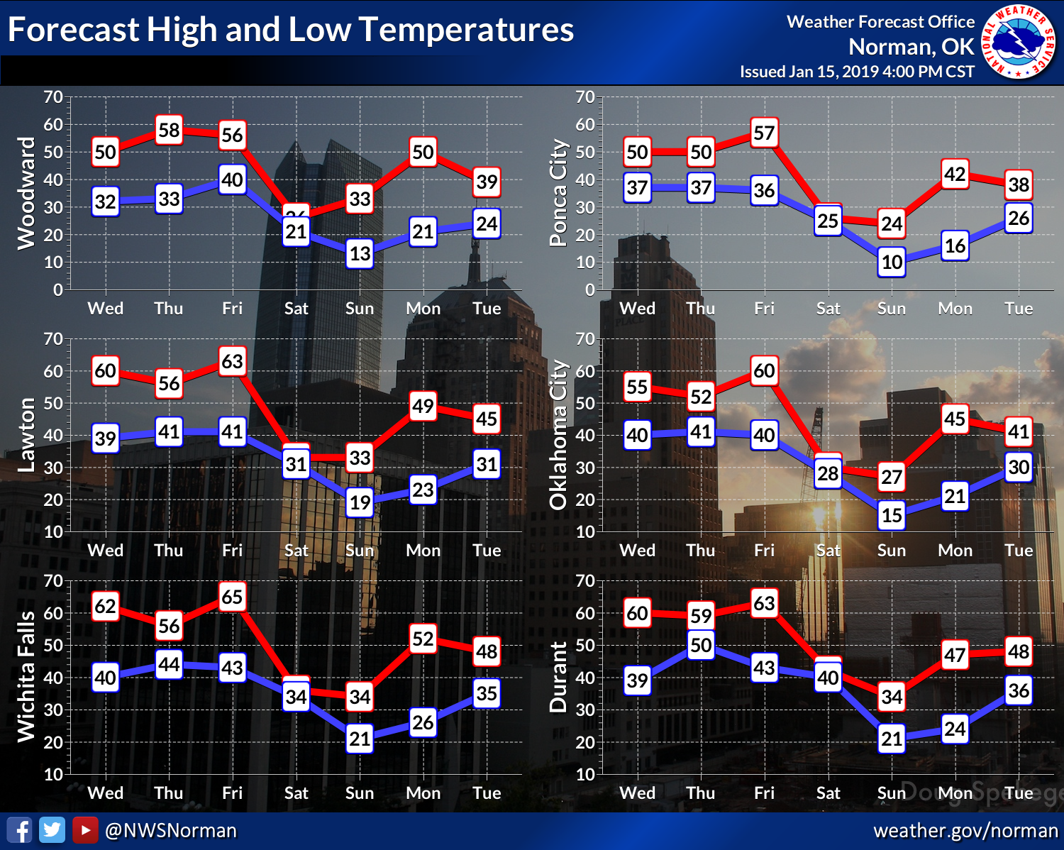
All in all, the coldest air of the season, and while it will move to the east
later in the weekend, the warmup we're seeing this week will be but a memory
as the air mass it leaves in place will still remain cooler than normal. At
least for this time of year.
Dangerous wind chills Friday night through Sunday, so be prepared!
Gary McManus
State Climatologist
Oklahoma Mesonet
Oklahoma Climatological Survey
(405) 325-2253
gmcmanus@mesonet.org
January 16 in Mesonet History
| Record | Value | Station | Year |
|---|---|---|---|
| Maximum Temperature | 79°F | MANG | 2012 |
| Minimum Temperature | -15°F | VINI | 2024 |
| Maximum Rainfall | 2.43 inches | ALTU | 2004 |
Mesonet records begin in 1994.
Search by Date
If you're a bit off, don't worry, because just like horseshoes, “almost” counts on the Ticker website!