Ticker for August 31, 2018
MESONET TICKER ... MESONET TICKER ... MESONET TICKER ... MESONET TICKER ...
August 31, 2018 August 31, 2018 August 31, 2018 August 31, 2018
Beat the heat!
Had enough of summer? Ha! This summer has been incredibly mild. Only now do we
realize how lucky we've been after most of August was spent in September
territory, climatologically (with a bit of October thrown in here and there). So
we have a day or two left of the current heatwave before we see relief once again.
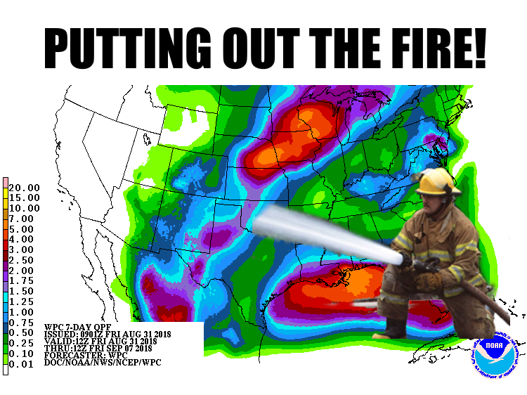
Then Mother Nature sends out here firefighters. In this case, the "fire" is the
heat we're having...not unusual for this time of the year, but the unusualness
of the cooler weather this year makes the heat unusual THIS YEAR!
Clear as mud? Well, let's hope there's lots of mud around next week and we're
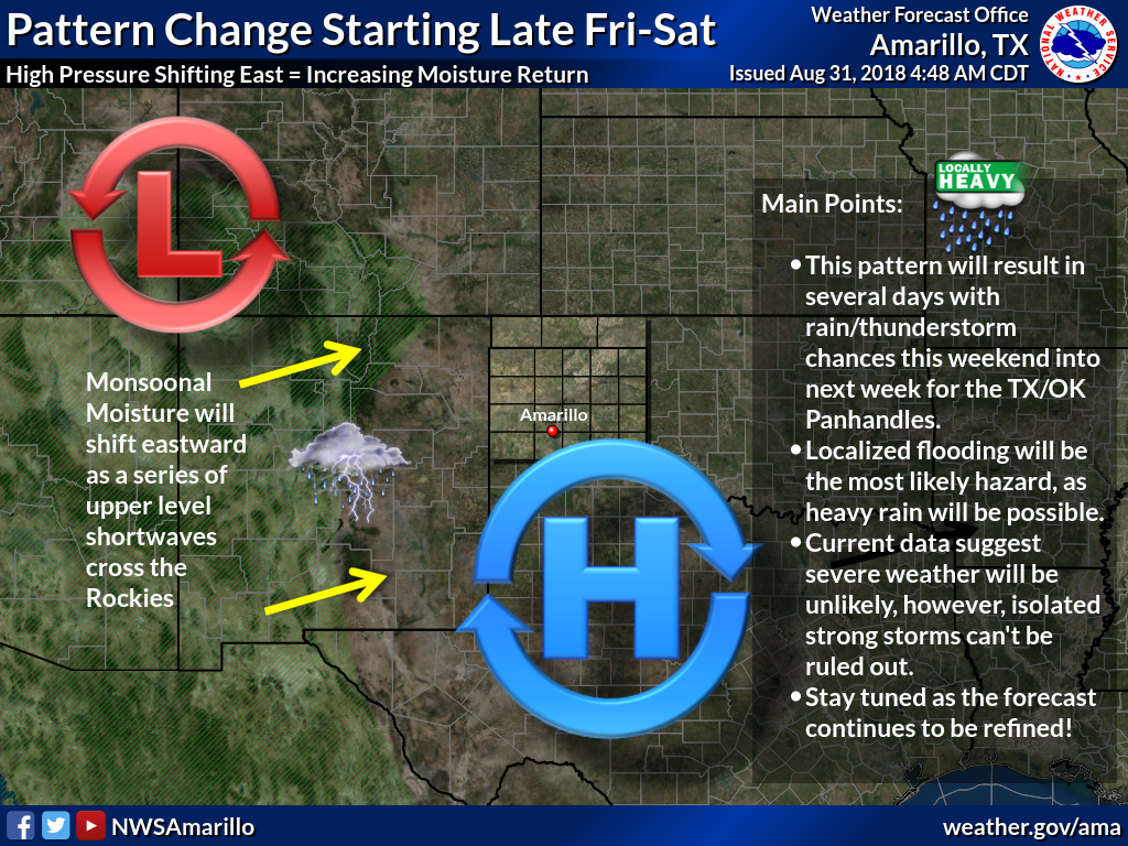
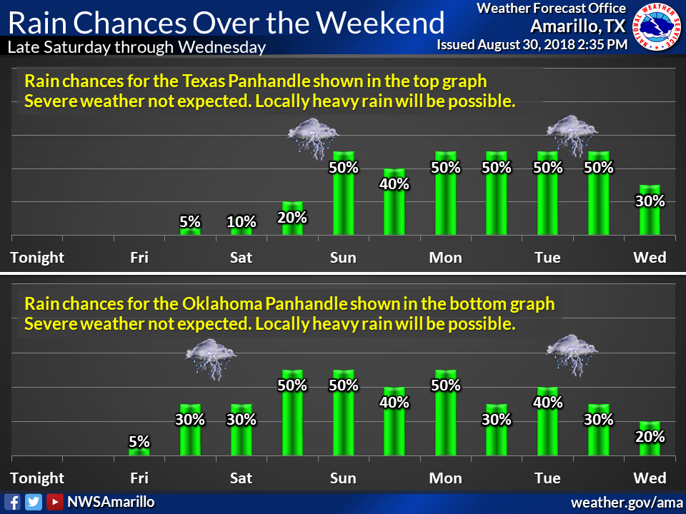
enjoying some rain. The Panhandle will see the best chance tonight and tomorrow
as they get a bit of scraps from the Southwest Monsoon, and then those chances
will spread into the rest of the state on Sunday into early next week.

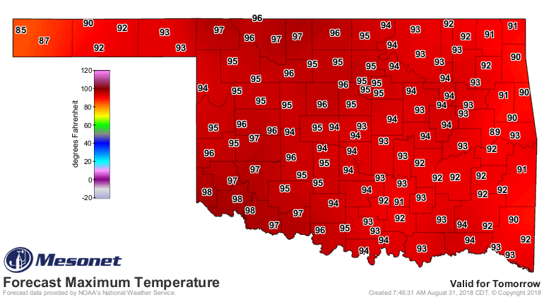
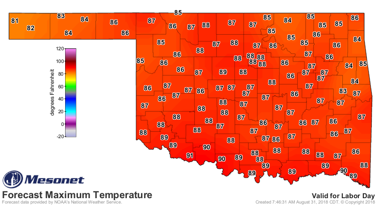
Before that, though, we're gonna have to beat the heat. Watch for highs in the
90s and 100s today, with heat index values 5-10 degrees above that, then a nice
cooldown as we get to Labor Day.

Fall's coming, I can smell it!
Wait, let me check the bottom of my shoe.
Nope, wait a minute. Fall's not here just yet.
Gary McManus
State Climatologist
Oklahoma Mesonet
Oklahoma Climatological Survey
(405) 325-2253
gmcmanus@mesonet.org
August 31 in Mesonet History
| Record | Value | Station | Year |
|---|---|---|---|
| Maximum Temperature | 111°F | FREE | 2011 |
| Minimum Temperature | 45°F | NOWA | 2009 |
| Maximum Rainfall | 5.29 inches | YUKO | 2020 |
Mesonet records begin in 1994.
Search by Date
If you're a bit off, don't worry, because just like horseshoes, “almost” counts on the Ticker website!