Ticker for May 8, 2018
MESONET TICKER ... MESONET TICKER ... MESONET TICKER ... MESONET TICKER ...
May 8, 2018 May 8, 2018 May 8, 2018 May 8, 2018
Greenless-Land
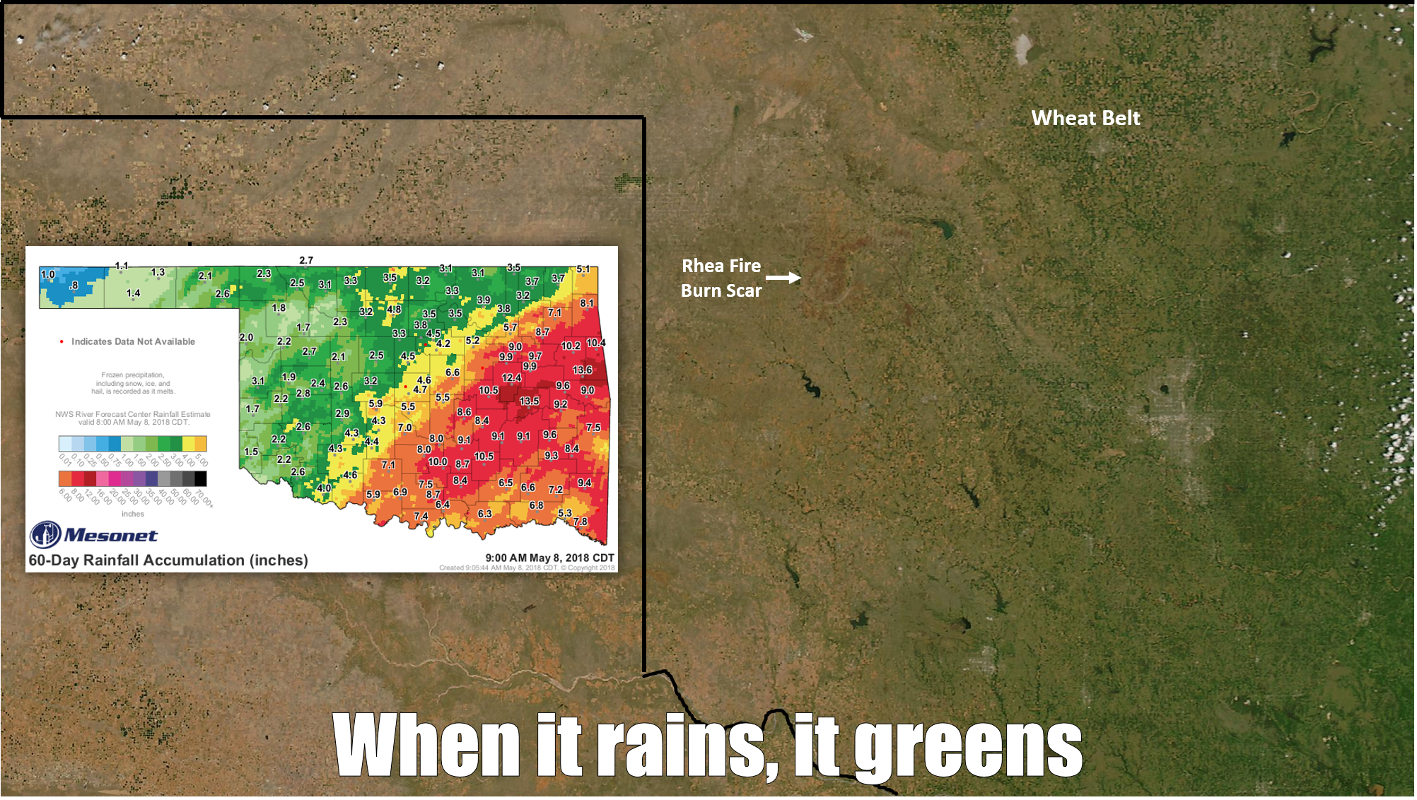
A simple image of Oklahoma, taken a couple of days ago on a mostly cloudless day,
by the MODIS instrument operating on the Aqua satellite. A 60-day rainfall map.
What do we see? Something plainly obvious. Now that it has warmed up, where it
has rained significantly over the last 2 months (let's say > 4 inches), it has
started to green up. Those are the areas that don't necessarily have to worry
about fire danger quite as much. As a reminder to those who have already forgotten
about fire danger and what it means, I've highlighted the Rhea Fire burn scar
across Dewey County.
Now it doesn't seem like we're in danger of wildfires here across much of the
southeastern half of the state, and we're probably not at the moment. As we've
noted many times, green vegetation is the mortal enemy of fire danger. As clearly
seen in the satellite image, however, that green (nor the more generous rainfall
totals) doesn't show up quite as much across western Oklahoma. That's where
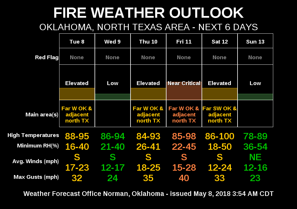
each windy, dry day brings fire worries. And they're in for a week or so of
worry as evidenced by the 7-day fire planner from the NWS office in Norman.
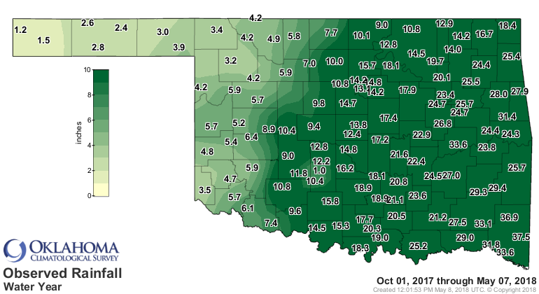
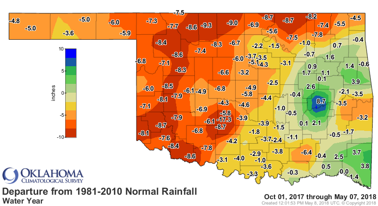
Now it may seem like a couple of inches of rain would be good for western
Oklahoma, and it was...but not enough to really kick that vegetation into high
gear. If you look back at the last 7 months, you can see the deficits they're
trying to overcome have not been conquered by 2 inches of rain.
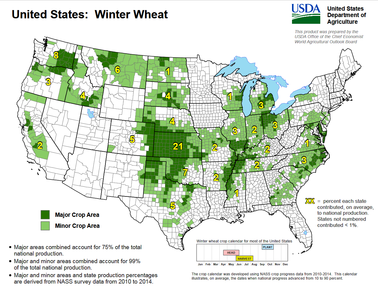
Another feature on the image that's plainly obvious...the greenness of the
Oklahoma Wheat Belt in the north. You can even pick out individual fields
up in the Alfalfa, Grant, Kay, Major counties area where those totals have
been 3-4 inches or more. The Oklahoma Wheat Belt is much larger than just that
area, however. It actually extends down into southwestern Oklahoma, and into the
Panhandle.
So the west is worried about fires, the wheat belt is screaming for rain, and
the rest of the state is greening up...for now. The solution is really, really
simple too. More cowbell? NO!
More rain. What's it looking like for the next 7 days? Well, it appears it
will remain hot (I'll show you today's forecast highs, then Saturday's...not
much difference from day to day).
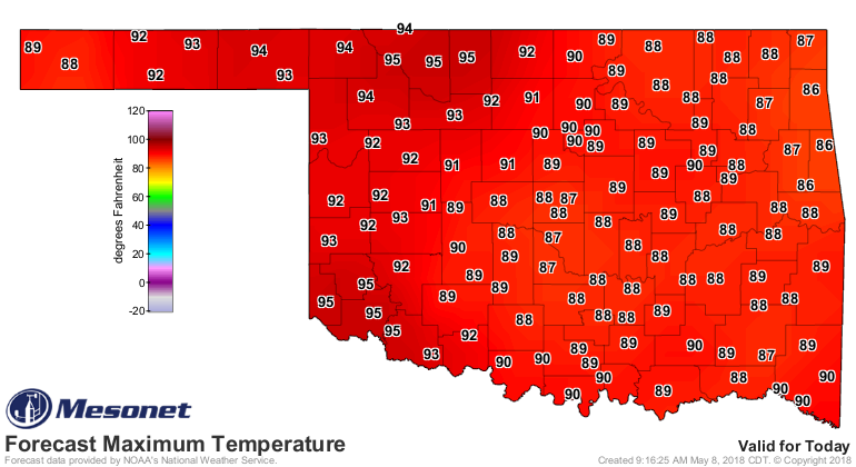

On Saturday's map, you can just catch a glimpse of Oklahoma's next front, with
highs only reaching into the 80s in the Panhandle. That will also bring our
next major chance of rain. There will be slighter chances on and off over the
next few days, but early next week looks like a better chance, at least as of
now. It's not looking like a massive rain, but as per usual, some will get
a lot, and others not so much, probably.

So there you have it, a request for Mother Nature for more cowbell. I mean RAIN!
Gary McManus
State Climatologist
Oklahoma Mesonet
Oklahoma Climatological Survey
(405) 325-2253
gmcmanus@mesonet.org
May 8 in Mesonet History
| Record | Value | Station | Year |
|---|---|---|---|
| Maximum Temperature | 108°F | ALTU | 2011 |
| Minimum Temperature | 34°F | CHER | 2010 |
| Maximum Rainfall | 5.86″ | FTCB | 2007 |
Mesonet records begin in 1994.
Search by Date
If you're a bit off, don't worry, because just like horseshoes, “almost” counts on the Ticker website!