Ticker for January 18, 2018
MESONET TICKER ... MESONET TICKER ... MESONET TICKER ... MESONET TICKER ...
January 18, 2018 January 18, 2018 January 18, 2018 January 18, 2018
And the dry get drier
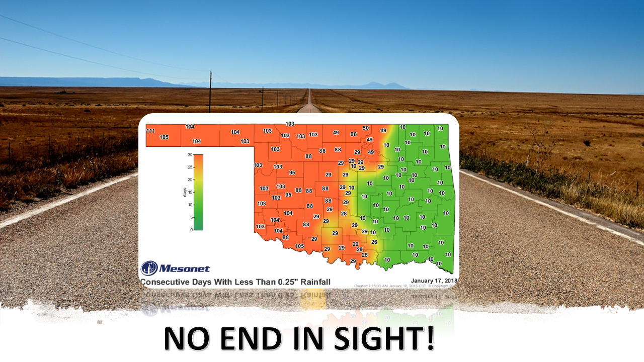
And the long road to drought relief continues as parts of western Oklahoma have
now gone (counting today...the map was created through yesterday) up to 112 days
without at least a quarter-inch of rain in a single day. That dates back to
early October, for those keeping score. Most of the western half falls between
88 and 105 days. And the stats aren't much better for days without at least
a tenth of an inch.

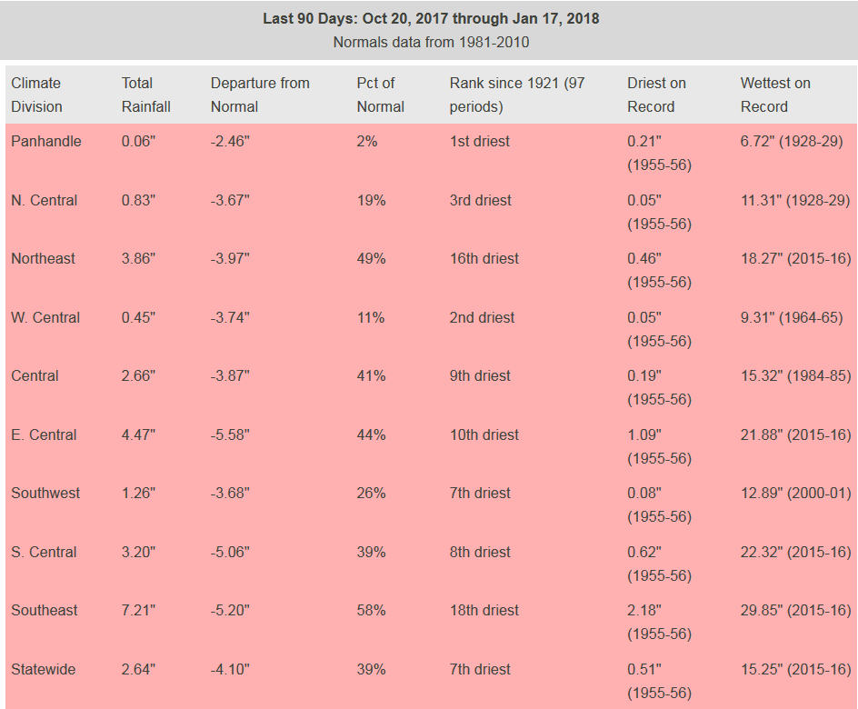
I'll just show you the 90-day rainfall maps. They're very similar to the 30- and
60-day maps. They all look equally horrible for the most part.
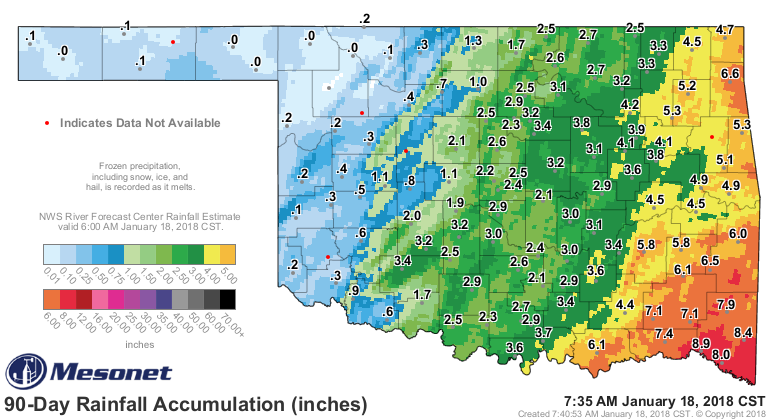
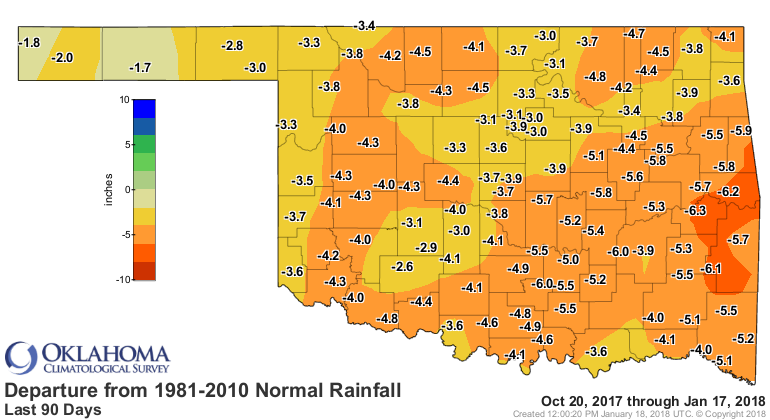
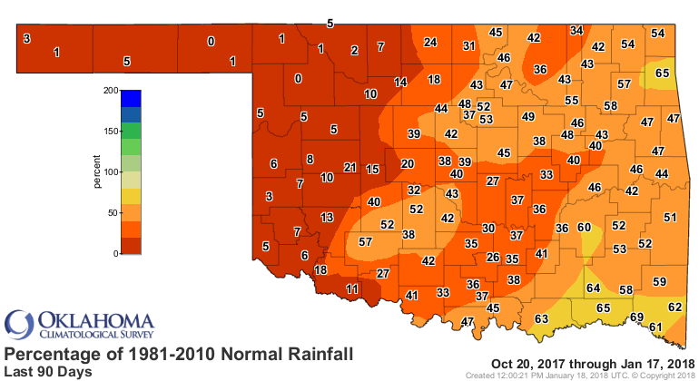
And for such a dry part of the state, for the last 90 days to be ranked as the
driest since at least 1921 imports the significance of that ranking.
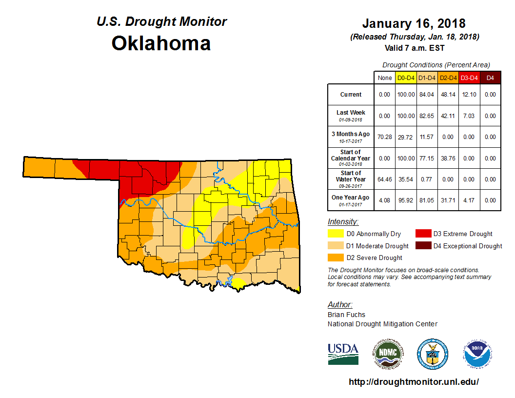
With reports of wheat crop troubles, desiccated soils, dry or flagging farm
ponds, and related impacts to the cattle industry, we have little choice but to
continue asking for increases in drought intensity on the U.S. Drought Monitor.
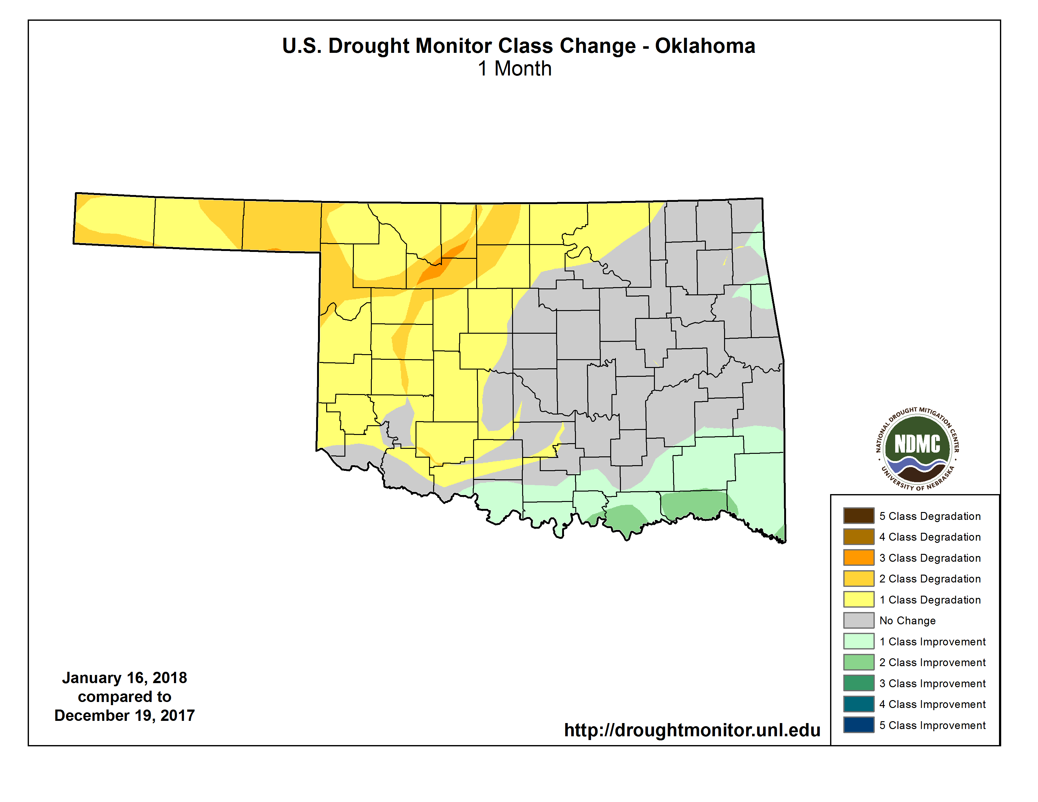
And the latest Drought Monitor map as well as the 4-week intensity change map
reflect those requested changes as we go without moisture (as well as catch up
with worsening impacts).
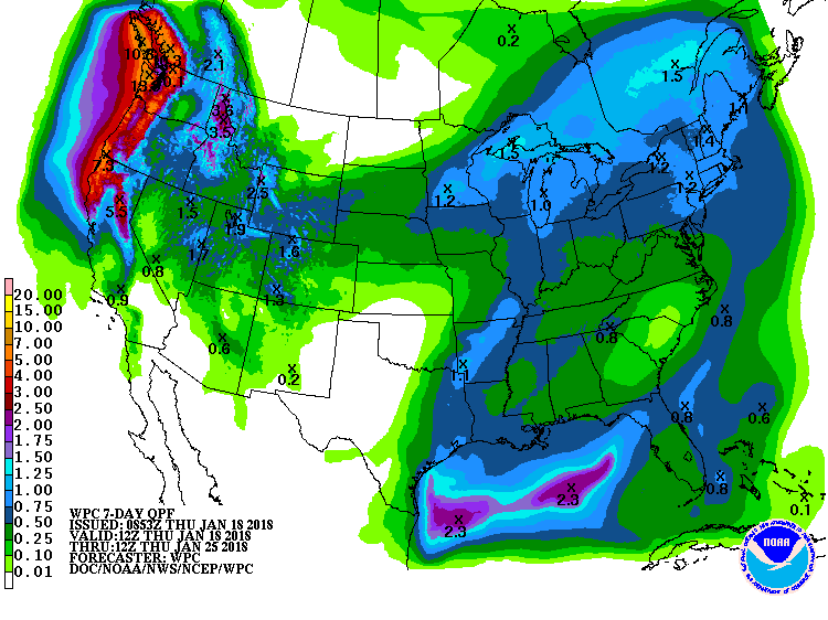
There doesn't appear to be much hope for relief over the next 7 days, at least
for western OK. Eastern OK once again appears the most likely part of the state
to see any significant moisture, but that also looks iffy.
Farther out? Your guess is not only as good as mine, it's probably better. The
Climate Prediction Center has no good news as we look out to both the February
and Feb-April three-month time frame. They see increased odds of above normal
temperatures and below normal precipitation for western OK.
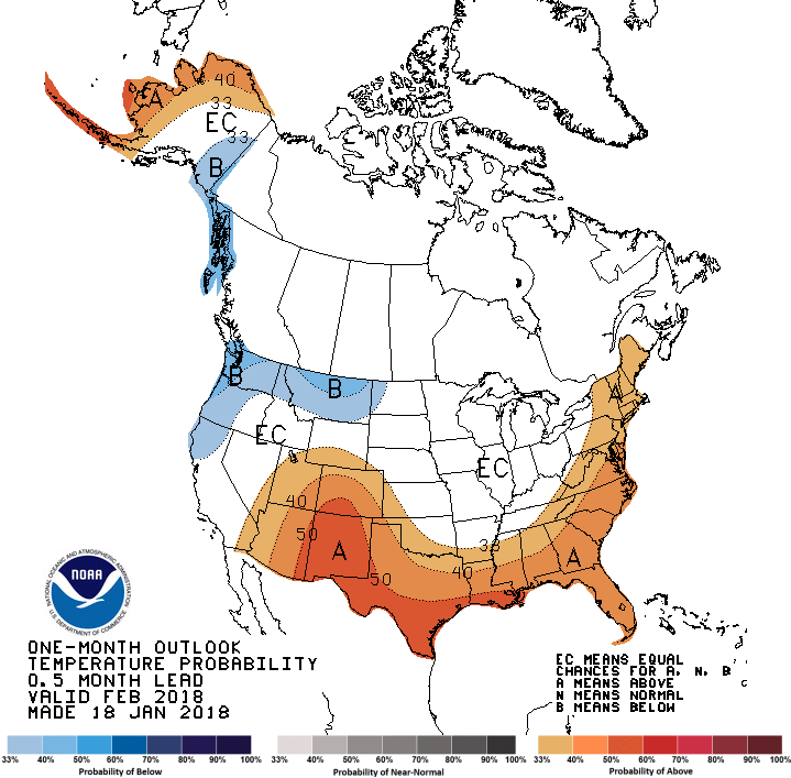

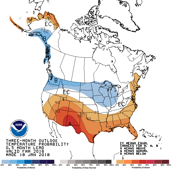
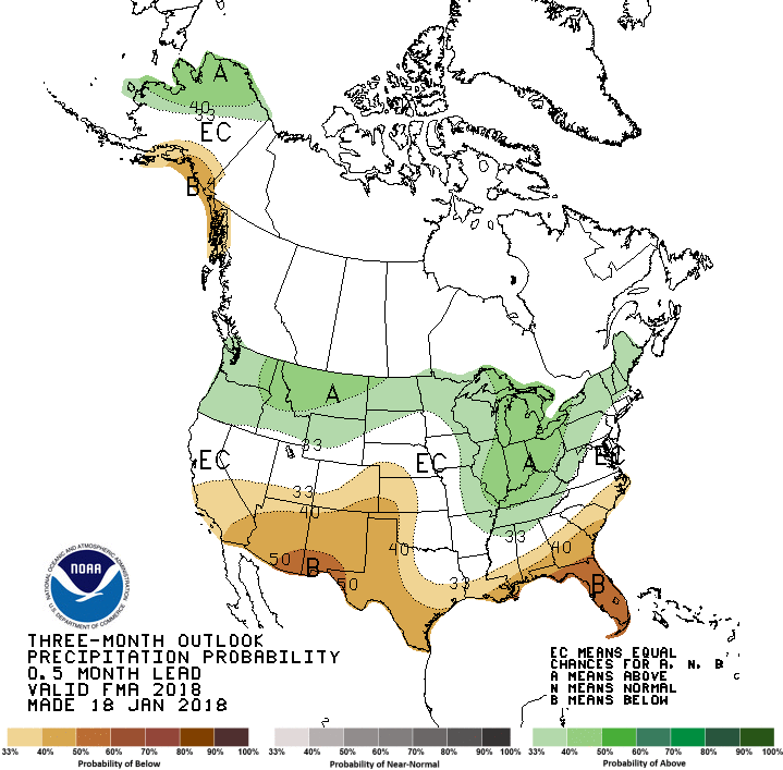
For the eastern half of the state, the dreaded "EC" for equal chances of above-,
below- and near-normal temperature and precipitation. Translate that into a
Feb-April Drought Outlook and you get all sorts of bad news.
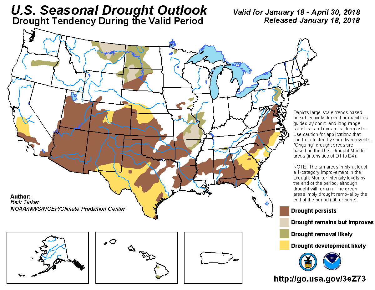
Translate that map into what's expected at the end of April and you get drought
either persisting or intensifying in the state, at least where it exists at
this point. Not good. But we don't see more development where we're just
abnormally dry? I'm a bit skeptical on that one. Time will tell.
Now my fear here, other than a comb or a hairbrush, is fire danger across
western OK. If we enter the early-to-mid spring with drought conditions in place
or intensifying, we will be primed for another bad fire season. From what I've
gathered from reports across western Oklahoma, it's one giant tinderbox. Lots of
vegetation growth thanks to a wet spring, mild summer and an extremely mild/wet
August has left lots of leftover fuel.
Spring should be a time of hope, however. The return of the rainy season. We'll
need a pattern shift...a nice slow-moving storm or two to sit over the Four
Corners region and pump moisture from the Gulf into the state.
Not too much to ask? We ask it every year...Mother Nature usually (sometimes)
comes through.
Gary McManus
State Climatologist
Oklahoma Mesonet
Oklahoma Climatological Survey
(405) 325-2253
gmcmanus@mesonet.org
January 18 in Mesonet History
| Record | Value | Station | Year |
|---|---|---|---|
| Maximum Temperature | 78°F | WAUR | 2022 |
| Minimum Temperature | 2°F | KENT | 2008 |
| Maximum Rainfall | 1.28 inches | HASK | 2023 |
Mesonet records begin in 1994.
Search by Date
If you're a bit off, don't worry, because just like horseshoes, “almost” counts on the Ticker website!