Ticker for December 1, 2017
MESONET TICKER ... MESONET TICKER ... MESONET TICKER ... MESONET TICKER ...
December 1, 2017 December 1, 2017 December 1, 2017 December 1, 2017
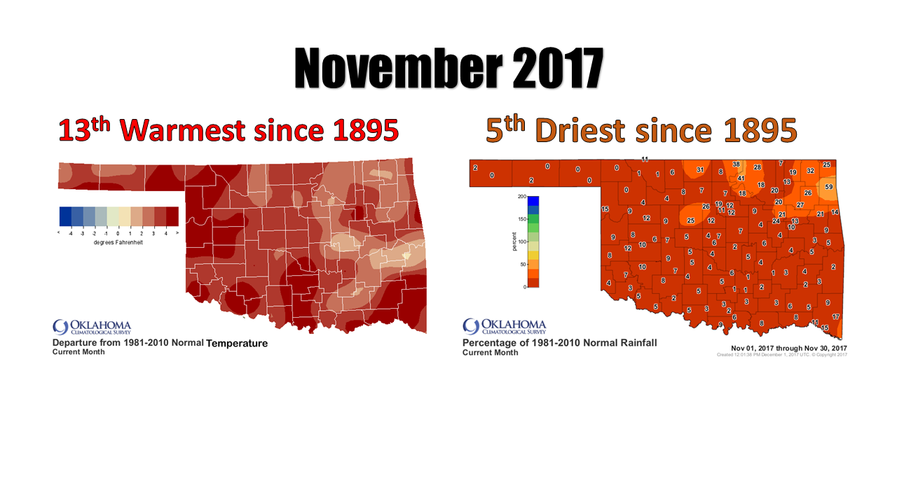
November another doozy!
What can I say? Here we are dealing with drought again, and also the approach of
more winter (temperature, not precipitation). We need a mighty good rain or
snow, but that doesn't look likely at this time.

The cold air DOES look likely, however. Too bad there's not going to be much
moisture to mix it with. Here are some graphics from our NWS friends to help
paint the mostly dry/cold picture.

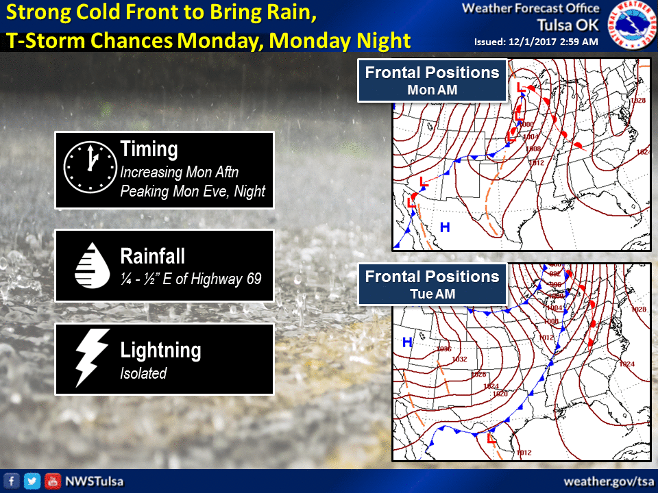
Even with that front next week and a possible pattern change, we're not talking
a plunge into the arctic. Just closer to where we should actually be this time
of year, if not a bit below. The difference this time is it will probably stick
around a bit longer. Again, the unfortunate news is...so will the dry weather.
HEY, speaking of dry weather, how about that November?
-------------------------------------------------------------------------------
Drought Expands During Dry November
Dec. 1, 2017
Drought flourished across Oklahoma over the past month, fed by one of the
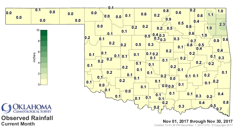
state?s driest and warmest Novembers on record. Six of the Oklahoma Mesonet?s
120 stations recorded no precipitation for the month, and another 77 recorded a
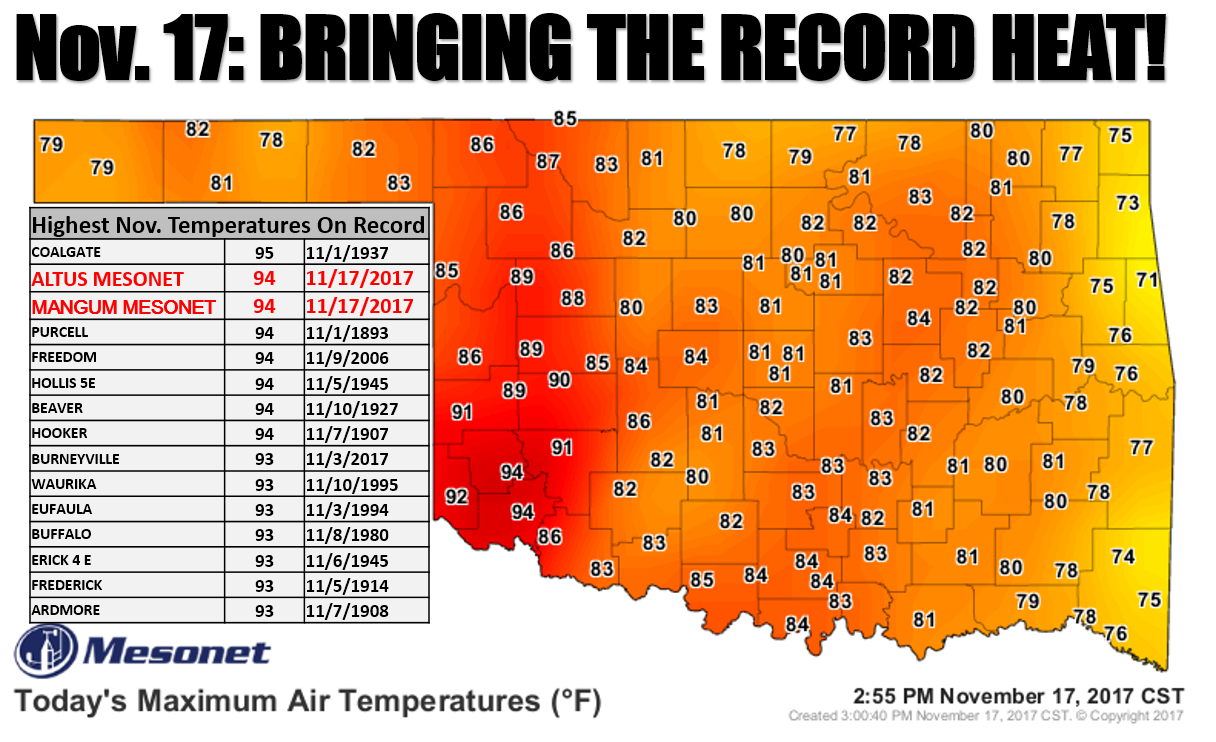
quarter of an inch or less. High temperatures rose into the 70s and 80s with
regularity. The temperature at the Altus and Mangum Mesonet sites soared to 94
degrees on the 17th, the second highest November temperature on record in
Oklahoma, dating back to 1892. It was also the highest temperature ever recorded
in the state that late in the calendar year.
The warm, dry weather took its toll. Reports of winter wheat stressed by the
dry conditions were common, especially in the wheat belt of western Oklahoma.
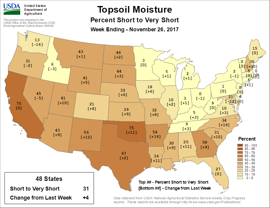
According to USDA officials, 75 percent of the state?s topsoil moisture was
rated as ?short to very short? by the end of November.
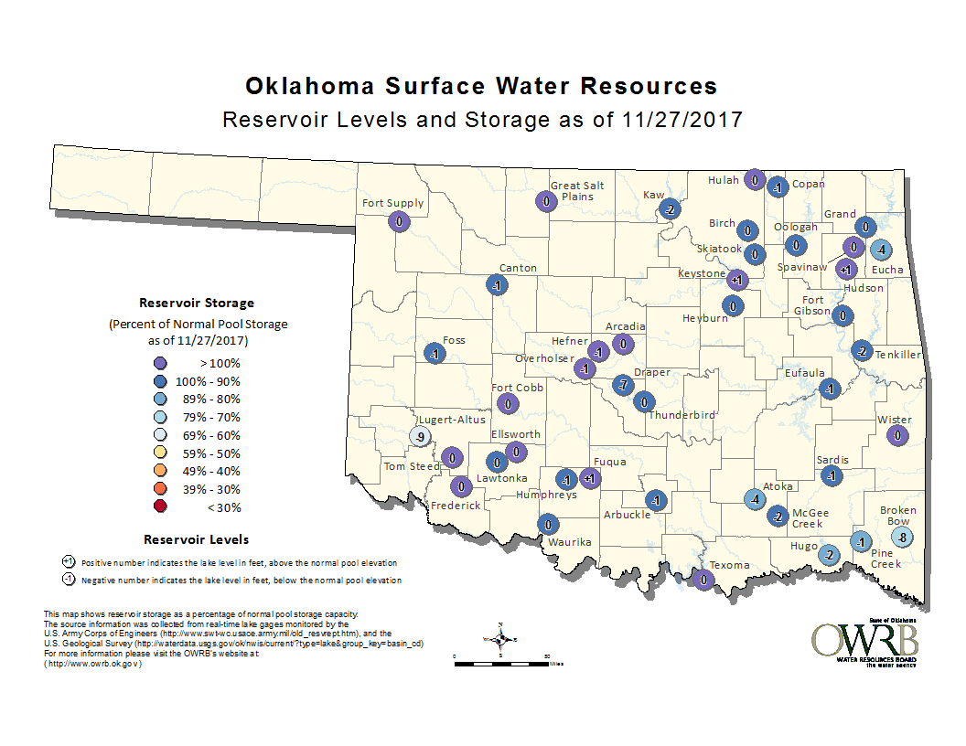
Reservoirs across southeastern Oklahoma were several feet below normal. Broken
Bow Lake fell 8 feet below its normal capacity.
Only a minor storm system late in the month prevented November from entering
the record books as the direst in state history. According to preliminary data
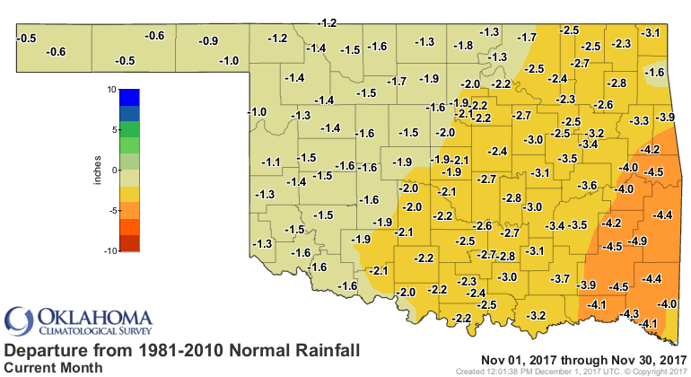
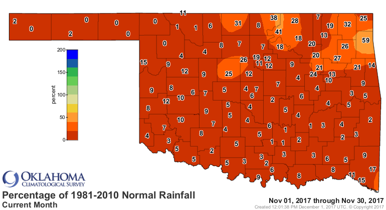
from the Oklahoma Mesonet, the statewide average precipitation total was 0.25
inches, 2.26 inches below normal and ranked as the fifth driest since records
began in 1895. The southeast experienced its driest November on record at more
than 4 inches below normal. Jay recorded 2.34 inches to lead the Mesonet.
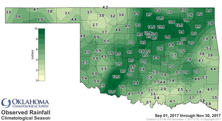
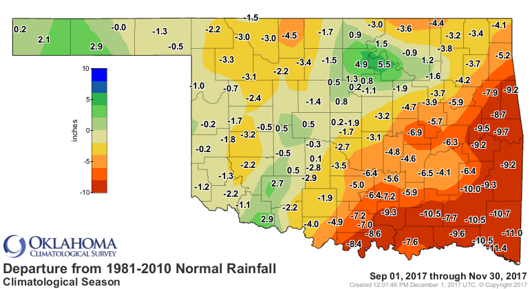
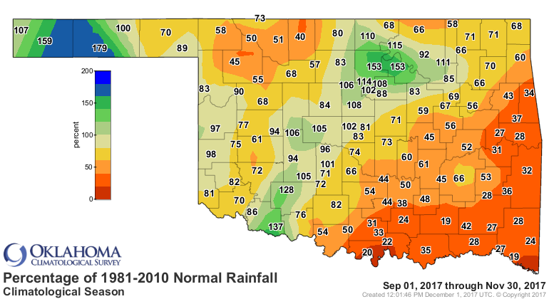
The climatological fall (August-November) precipitation pattern varied wildly
across the state, from the 13th wettest on record in the southwest to the 30th
driest in the southeast. The statewide average was 6.1 inches to rank as the
31st driest fall on record, nearly 3.5 inches below normal.
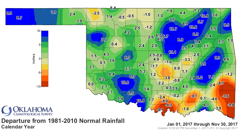
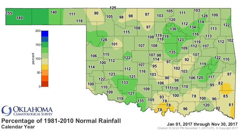
The January-November period was the 18th wettest on record, however, nearly 3
inches above normal.

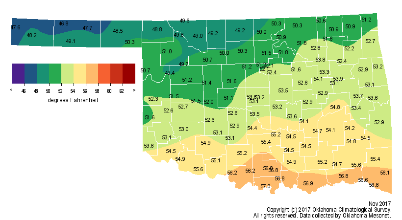
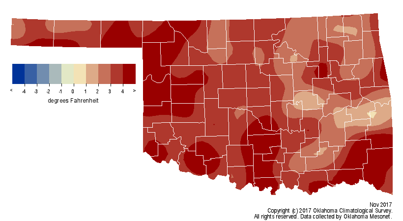
November finished as the 13th warmest on record with a statewide average
temperature of 52.5 degrees, 3.2 degrees above normal.
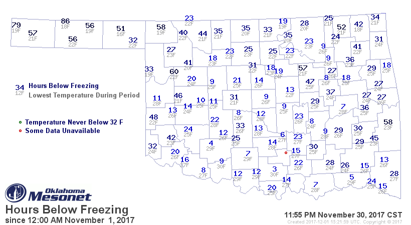
Outside of the Panhandle, freezing weather was uncommon. Many stations across
the southern half of the state spent less than 20 hours below freezing for the
month. Newport, located in Carter County, spent 3 hours at or below freezing.
Eva in northern Texas County led the state at 86 hours. Beaver recorded the
lowest November temperature with a reading of 16 degrees on the 19th.
The fall season finished decidedly warm with a statewide average of 62.6
degrees, 1.8 degrees above normal to rank as the 29th warmest on record. The
first 11 months of the year were the 11th warmest such period on record, nearly
2 degrees above normal.
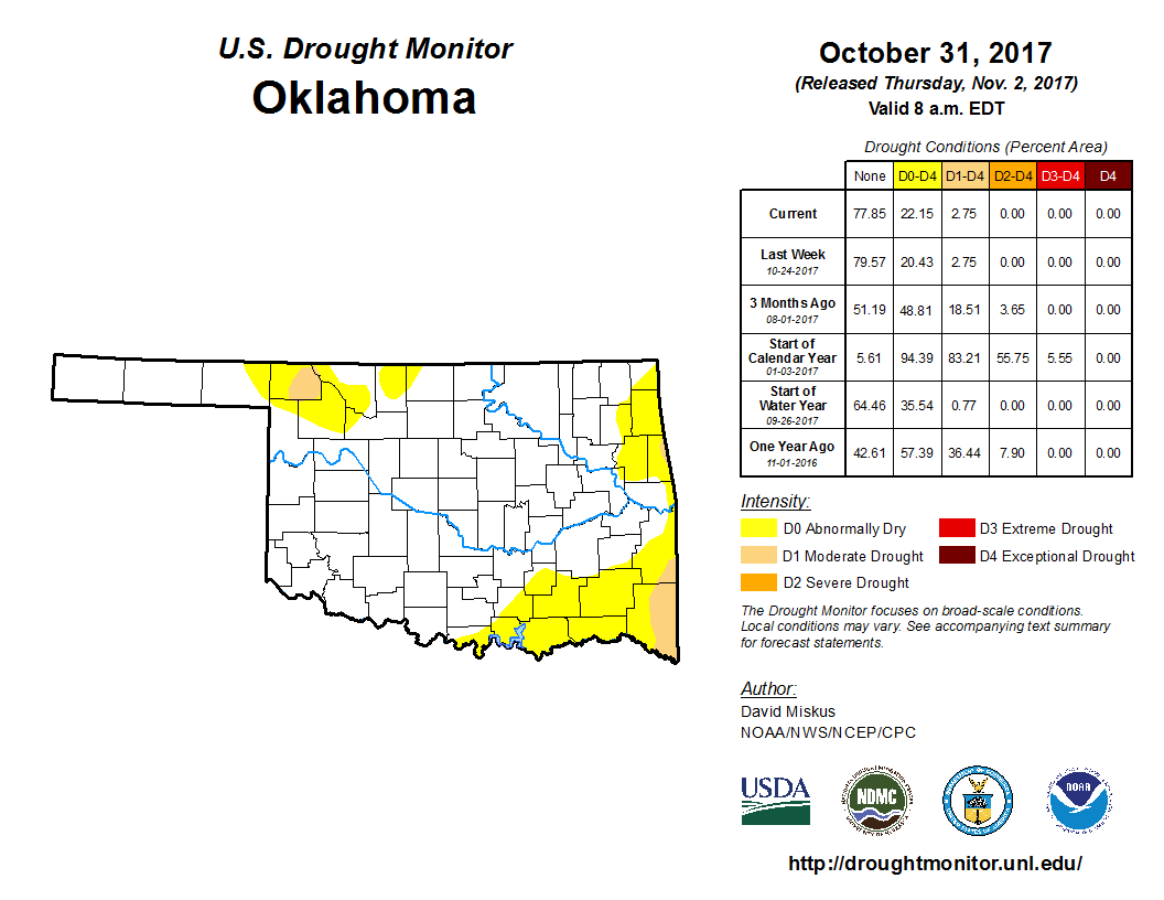
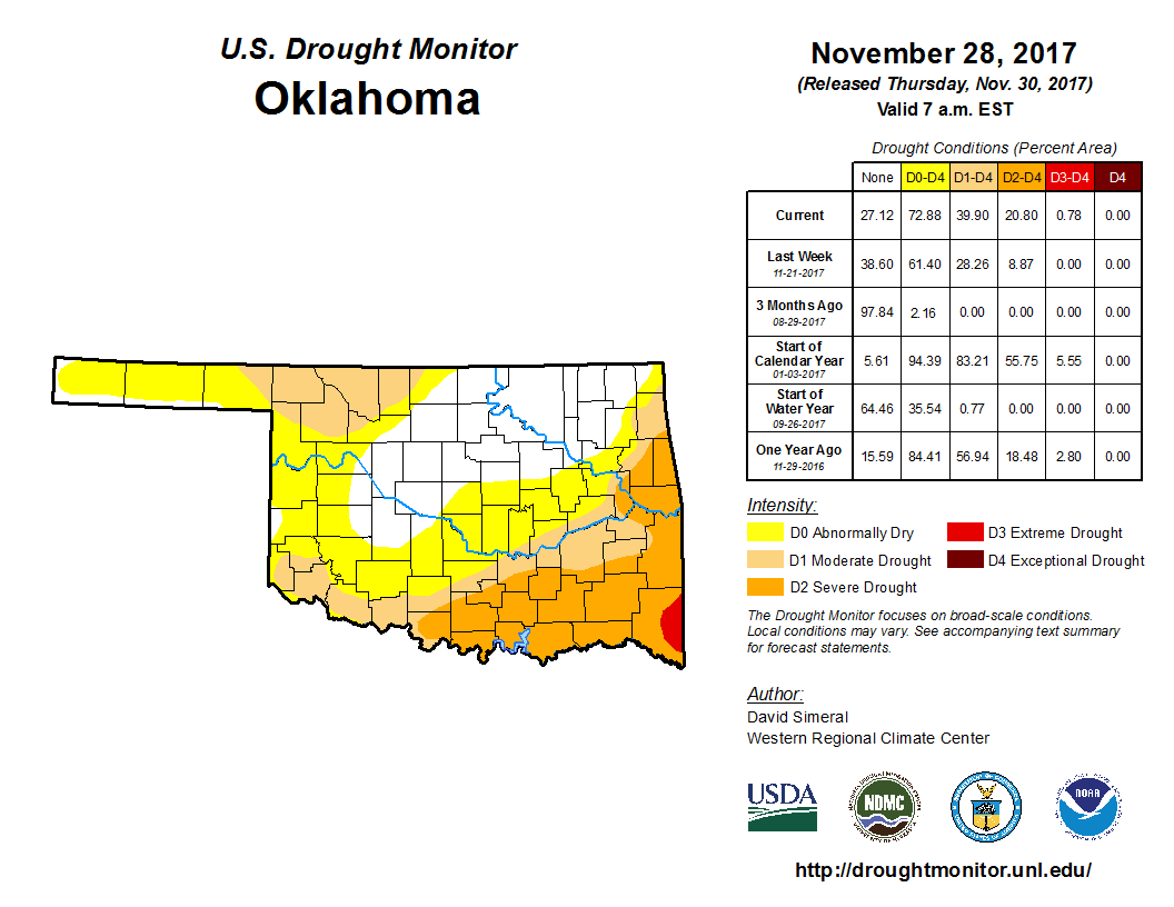
Drought increased dramatically across Oklahoma through the month. According to
the U.S. Drought Monitor, the area of the state in drought increased from 3
percent at the end of October to 40 percent at the end of November. Another 32
percent of the state was considered abnormally dry, a drought precursor. More
than 19 percent of the state?s drought coverage was considered moderate in
intensity, while another 20 percent was labeled as severe. About 1 percent was
in the extreme category. The Drought Monitor?s intensity scale slides from
moderate-severe-extreme-exceptional, with exceptional being the worst
classification.
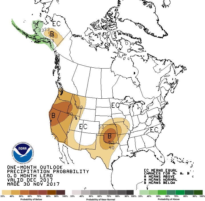
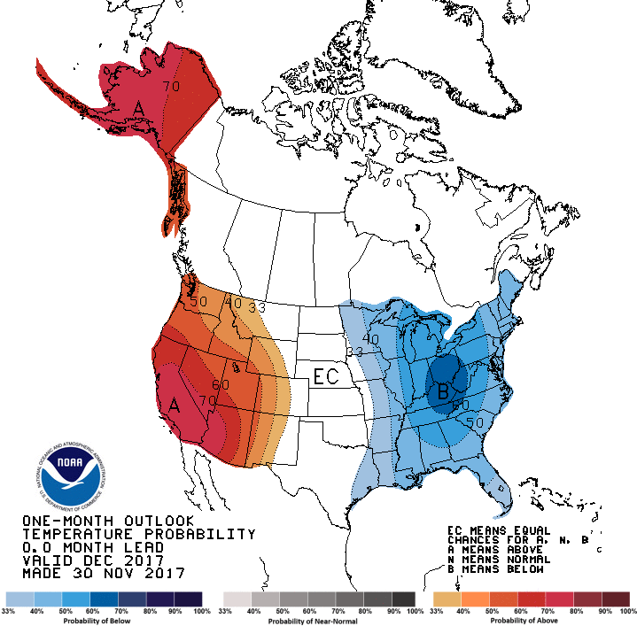
The December precipitation outlook from the Climate Prediction Center (CPC)
indicated a clear bullseye of increased odds for below normal precipitation
located directly over Oklahoma. There was no definite indication in the
temperature outlook.
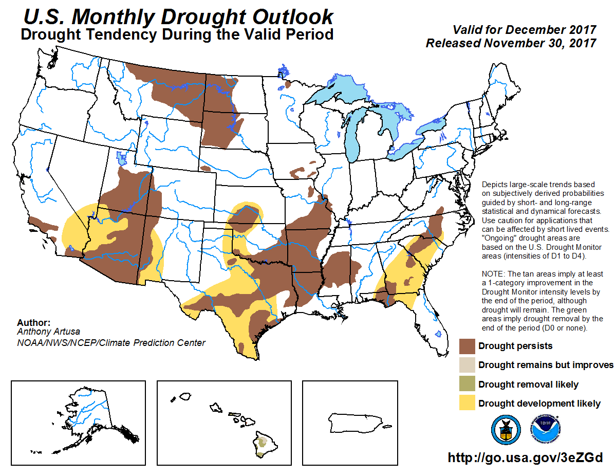
CPC?s December Drought Outlook showed drought persisting based on November?s
final Drought Monitor map, and developing across the western half of Oklahoma.
Gary McManus
State Climatologist
Oklahoma Mesonet
Oklahoma Climatological Survey
(405) 325-2253
gmcmanus@mesonet.org
December 1 in Mesonet History
| Record | Value | Station | Year |
|---|---|---|---|
| Maximum Temperature | 86°F | HOLL | 2012 |
| Minimum Temperature | 0°F | SEIL | 2006 |
| Maximum Rainfall | 0.75″ | WATO | 2015 |
Mesonet records begin in 1994.
Search by Date
If you're a bit off, don't worry, because just like horseshoes, “almost” counts on the Ticker website!