Ticker for October 23, 2017
MESONET TICKER ... MESONET TICKER ... MESONET TICKER ... MESONET TICKER ...
October 23, 2017   October 23, 2017   October 23, 2017   October 23, 2017


Gulp gulp


Well THAT was exciting, no? We knew the front was going to cool us down, bring
rain and a chance of severe weather. Who knew the Beach Boys would become the
Waterspout Boys, however (unless you've been living in a cave, I'm sure you
heard the Beach Boys concert at the Riverwind Casino west of Norman was
interrupted by a very unwelcome guest in the form of a tornado). Still no word
on the twister's intensity, but NWS personnel will no doubt have that info
shortly.

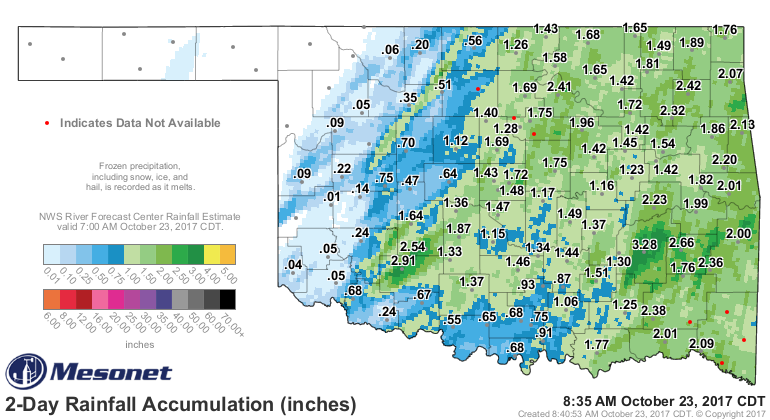
The good news was the mostly-statewide rain that fell with the storms, with
amounts ranging from 1-3 inches across a good portion of the southeastern two-
thirds of the state. Some a bit more, some a bit less, although the NW corner
went without.

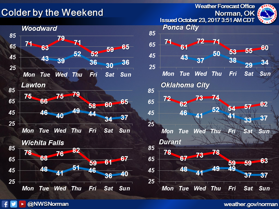
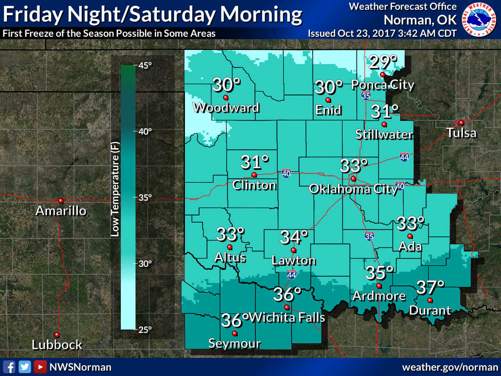
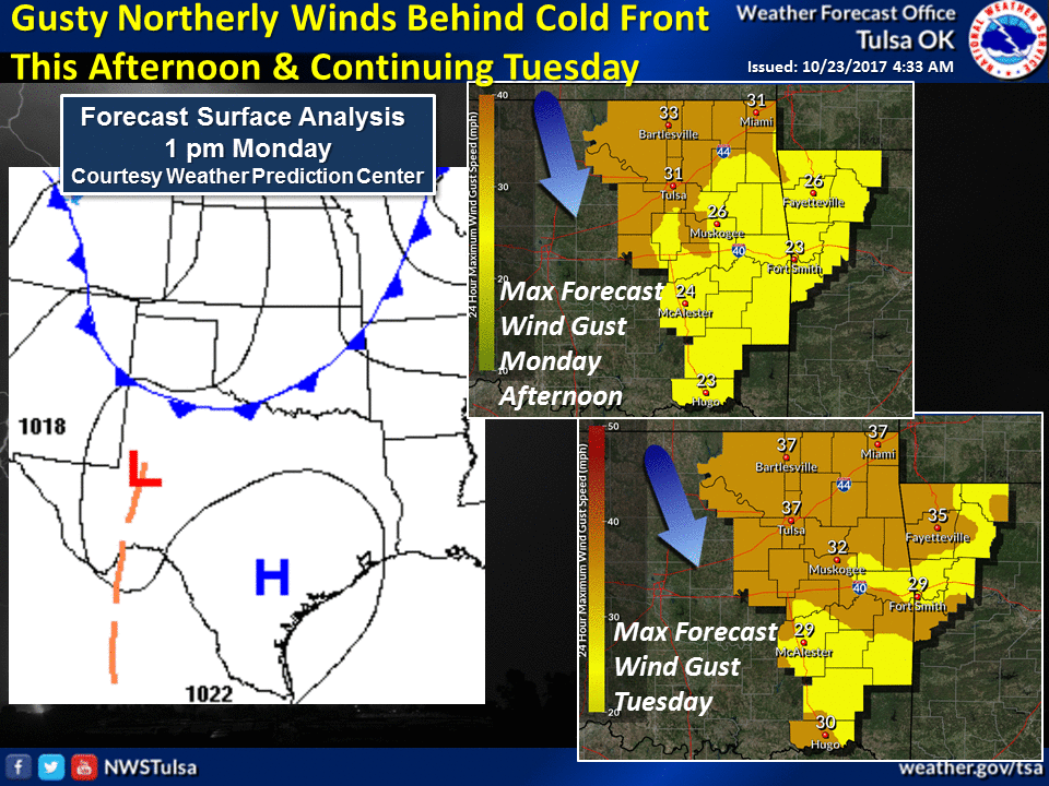
Now we're in for a roller coaster ride typical of fall with fronts, warm ups
and some dreaded/welcomed (pick your poison) flirtations with freezing weather...
all this week!

Our NWS friends will help us out here:


Step right up and get your fall roller coaster tickets!

It's not like you have a choice.

Gary McManus
State Climatologist
Oklahoma Mesonet
Oklahoma Climatological Survey
(405) 325-2253
October 23 in Mesonet History
| Record | Value | Station | Year |
|---|---|---|---|
| Maximum Temperature | 96°F | WAUR | 2024 |
| Minimum Temperature | 21°F | EVAX | 2020 |
| Maximum Rainfall | 4.31 inches | BROK | 2015 |
Mesonet records begin in 1994.
Search by Date
If you're a bit off, don't worry, because just like horseshoes, “almost” counts on the Ticker website!