Ticker for August 24, 2017
MESONET TICKER ... MESONET TICKER ... MESONET TICKER ... MESONET TICKER ...
August 24, 2017 August 24, 2017 August 24, 2017 August 24, 2017
Deadly forecast
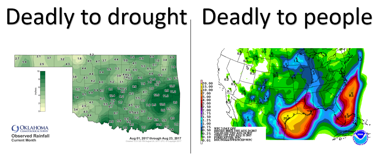
There are no ifs ands or buts here, if that rainfall forecast thanks to the
landfall of tropical storm Harvey comes to fruition, it will be DISASTROUSLY
deadly. Even while we are joyous (for the most part) about our August fortunes
that have killed the drought across Oklahoma, we worry for our neighbors to the
south and what's about to occur.
The moisture we have received allowed our drought picture to go from this
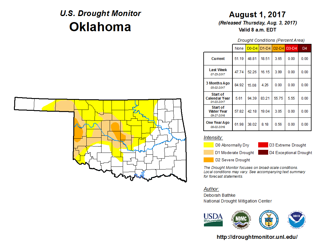
to this
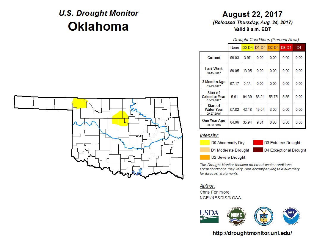
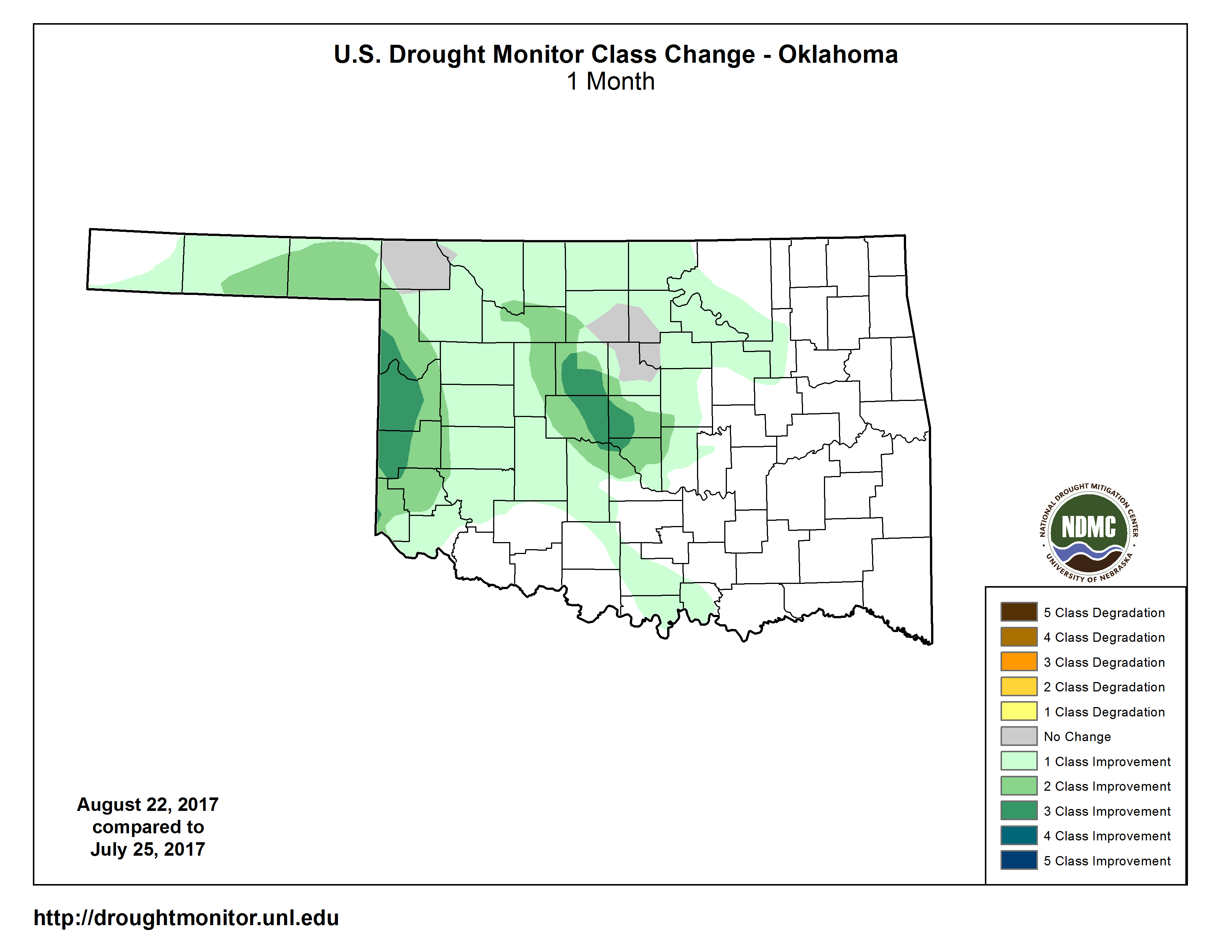
in the span of three weeks. Even more changes in the last 4 weeks, as illustrated
by this map.
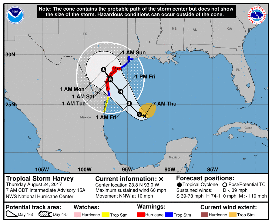
Tropical storm Harvey is expected to strengthen to a weak hurricane, make
landfall somewhere on the Gulf Coast to the south of Houston, and then just
meander around for a bit in the area, causing catastrophic flooding. There's
very little chance of direct impact on our area, at least according to the
latest model forecasts.

So what can we expect here? Well, we'll let our NWS friends give you the good
news. Fall is here, at least for the next week.
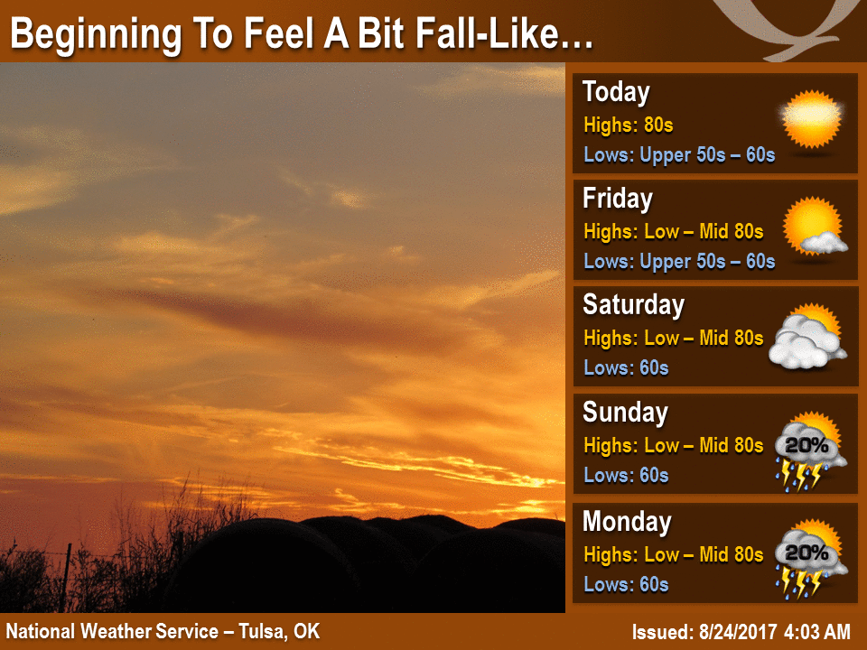
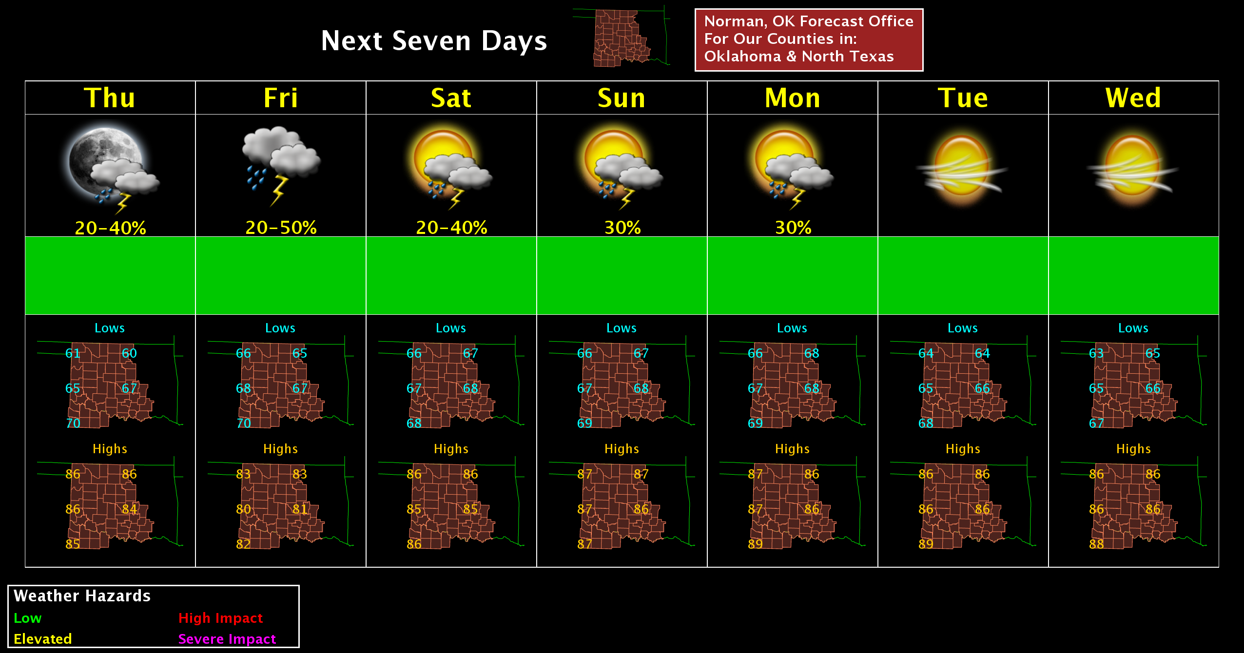
So things are looking grand for Oklahoma, unless that nasty fella Harvey messes
things up for us.
Gary McManus
State Climatologist
Oklahoma Mesonet
Oklahoma Climatological Survey
(405) 325-2253
gmcmanus@mesonet.org
August 24 in Mesonet History
| Record | Value | Station | Year |
|---|---|---|---|
| Maximum Temperature | 113°F | FREE | 2024 |
| Minimum Temperature | 52°F | EVAX | 2022 |
| Maximum Rainfall | 4.59 inches | SHAW | 2010 |
Mesonet records begin in 1994.
Search by Date
If you're a bit off, don't worry, because just like horseshoes, “almost” counts on the Ticker website!