Ticker for July 25, 2017
MESONET TICKER ... MESONET TICKER ... MESONET TICKER ... MESONET TICKER ...
July 25, 2017 July 25, 2017 July 25, 2017 July 25, 2017
Wait for it
What am I going to do, Tick at you about how it's going to be miserably hot for
the next few days? Why would I do that? You know it will be already. It's summer.
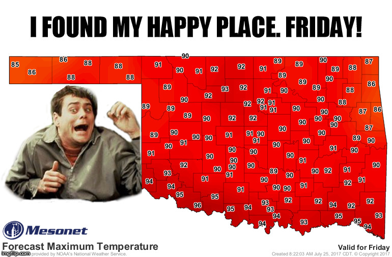
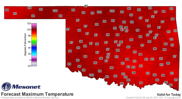
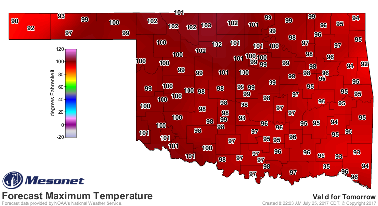
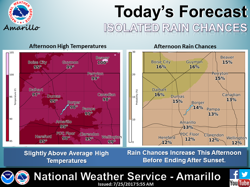
Just check out the forecast highs for the next few days.

Well, I guess I blew that one. BUT, did you see that high of 79 in the Panhandle
on Thursday? Surely that's good news, right? Indeed it is! As our friends at the
Tulsa NWS explain, it's a momentary (at least) shift of the heat dome away from
our area, allowing a cool front to slip through.
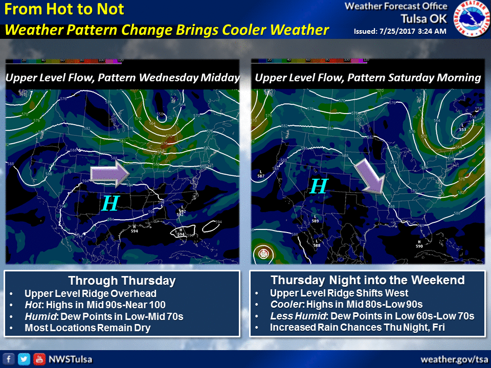
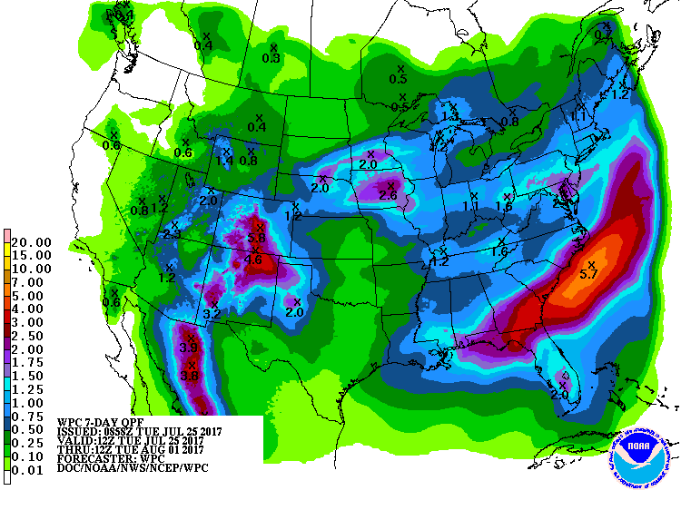
AND, not only will it be cooler, it will be less humid with a chance of rain early
on in the shift. Doesn't look like a drought buster, of course, but rain
means cool (until later on when the heat dome shifts back and it gets
evaporated and causes the heat index to explode...this news courtesy of Negative
Nancy).
Again, I'm not going to come in here and talk about how it's going to be hot
until then and blah blah blah. But it's going to be hot until then and blah
blah blah.

Let's keep it going!
Gary McManus
State Climatologist
Oklahoma Mesonet
Oklahoma Climatological Survey
(405) 325-2253
gmcmanus@mesonet.org
July 25 in Mesonet History
| Record | Value | Station | Year |
|---|---|---|---|
| Maximum Temperature | 110°F | GRA2 | 2011 |
| Minimum Temperature | 55°F | BOIS | 2004 |
| Maximum Rainfall | 3.16 inches | SHAW | 2016 |
Mesonet records begin in 1994.
Search by Date
If you're a bit off, don't worry, because just like horseshoes, “almost” counts on the Ticker website!