Ticker for February 23, 2017
MESONET TICKER ... MESONET TICKER ... MESONET TICKER ... MESONET TICKER ...
February 23, 2017 February 23, 2017 February 23, 2017 February 23, 2017
40s are cold!
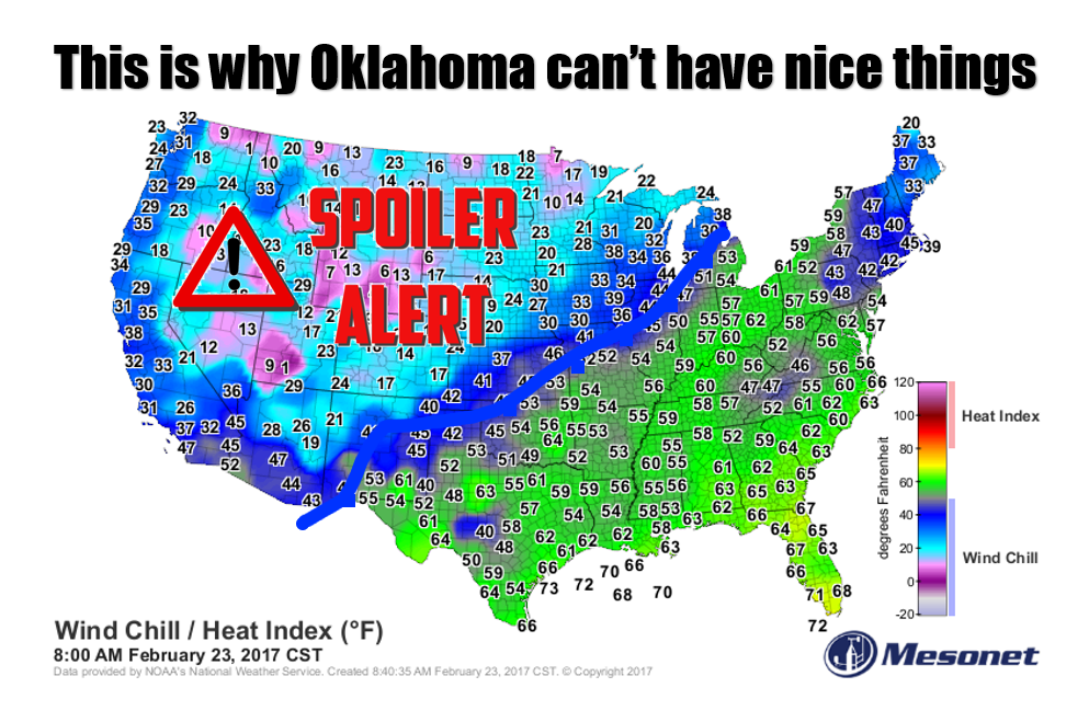
No no, I did the fire thing yesterday and not much has changed. Don't burn or
YOU will burn. Most of the state is under a Red Flag Fire warning, so my final
advice is to not burn anything. Not even your toast. Not even your friend with
a sharp jibe. Keep romance to a minimum...no sparks needed.
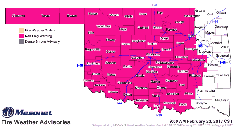
It's your classic setup...strong storm system, surface low up in the NW, dryline
extending south, strong winds, very low RH (hence no storms since the system has
little moisture to work with). Drought, still contributing (but getting better,
and I'm hearing word from all over of a greenening (new word, sounds better than
"greening up") of vegetation across the state thanks to the unusually warm
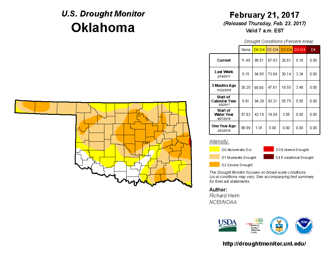
weather and moisture from the last 1.5 months or so. The newest drought monitor
does show substantial improvements, especially south of I40 where the best
moisture has fallen lately.
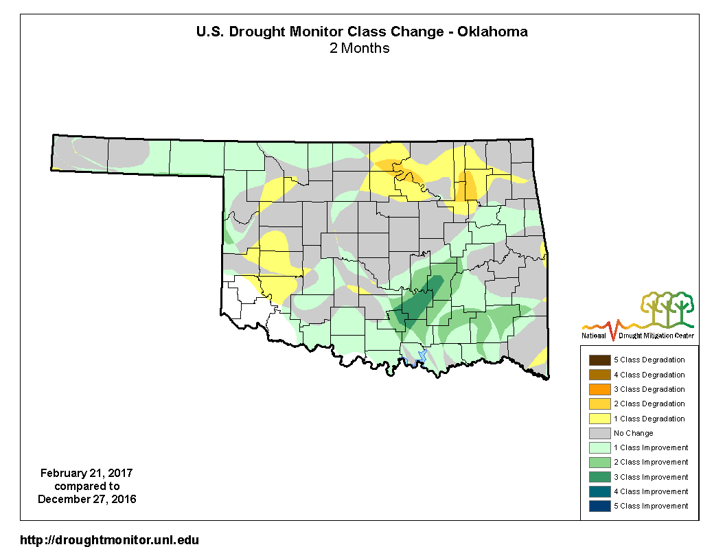
The Drought Monitor 8-week change map shows that substantial relief across
southern OK (last 2 storms) and NW OK (mid-January ice storm), but also
intensification across northern OK where they've mostly missed out. "Only" 68%
of the state is in drought, and that number has been on the decline.
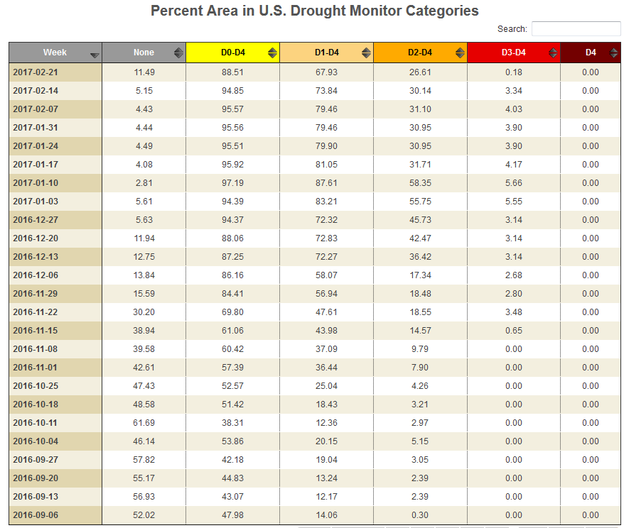
Click the "search" box in the upper right of that last image and you can check
the drought coverage for a specific date.
YOU DIDN'T ACTUALLY CLICK THAT DID YOU? That's just an image, you can't click
there! YOU JUST GOT BURNED!! Whoops, not supposed to do that. Delete all this.
Anyway, what I want to talk about is a return to winter...actually that should
be "winter" since it's not like we're headed to the single digits again. But,
we are going back to normal temperatures for late February after being 20-30
degrees above normal. It all starts late today as the front surges into the NW
and crosses through overnight. By Saturday morning, we'll see lows in the 20s
and 30s and highs in the 40s and 50s.
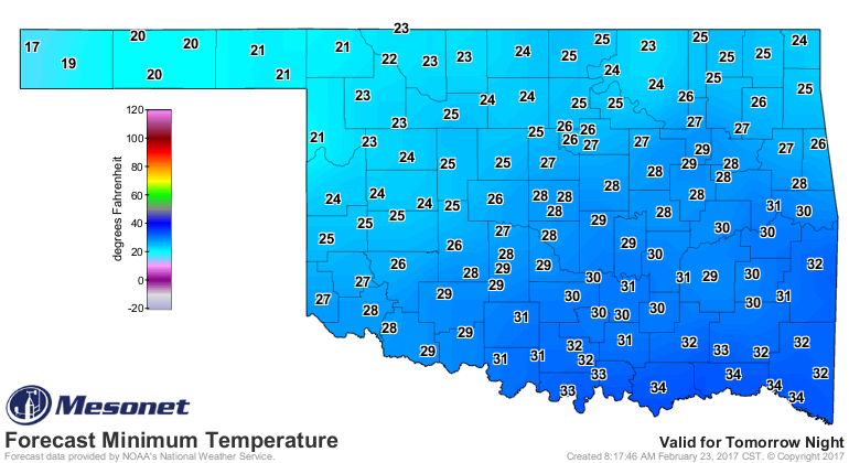
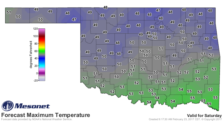
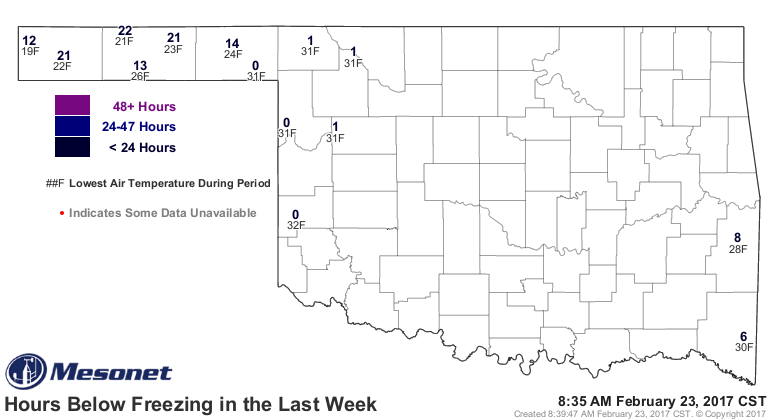
While not too bad, it's a shock back to winter. The number of hours below
freezing map from the Mesonet is a good indicator of that. Only 14 of the
Mesonet's 121 stations have hit the freezing mark during the last 7 days.
So enjoy the warmth today, if you're into that sort of thing. We'll probably
approach record highs in some areas.
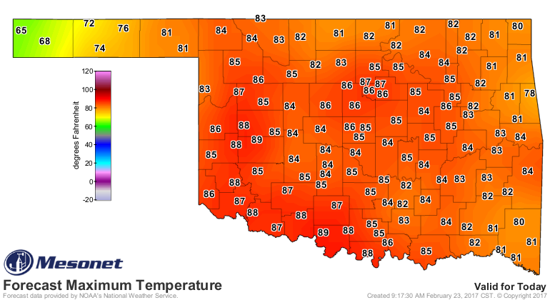
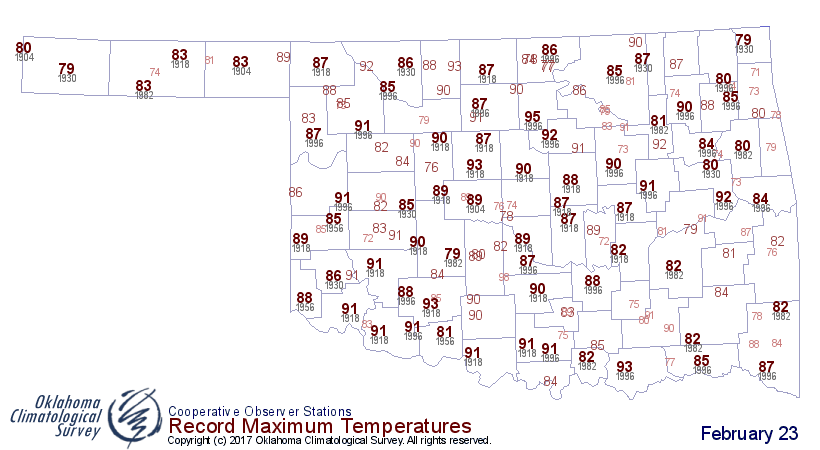
We're turning the corner. We'll see more days above 50 than below from here on
out until November or so. Fire danger will stick around, regardless of rain,
until we see a good green up. Chances of rain return next week.
Gary McManus
State Climatologist
Oklahoma Mesonet
Oklahoma Climatological Survey
(405) 325-2253
gmcmanus@mesonet.org
February 23 in Mesonet History
| Record | Value | Station | Year |
|---|---|---|---|
| Maximum Temperature | 91°F | WAUR | 2017 |
| Minimum Temperature | -2°F | BOIS | 2022 |
| Maximum Rainfall | 3.61″ | EUFA | 2018 |
Mesonet records begin in 1994.
Search by Date
If you're a bit off, don't worry, because just like horseshoes, “almost” counts on the Ticker website!