Ticker for January 26, 2017
MESONET TICKER ... MESONET TICKER ... MESONET TICKER ... MESONET TICKER ...
January 26, 2017 January 26, 2017 January 26, 2017 January 26, 2017
The Drier Limits
https://content.mesonet.org/ticker/archive/20170126/7day-drainfall-forecast.mp4
There is nothing wrong with your computer. Do not attempt to adjust the drought.
We are controlling rainfall.
Well, if you get that reference, you're either old, or as I like to call myself,
"not young." This is no way to get rid of a drought following a couple of weekends
of nice rains. First you had ICEMAGEDDONPOCALYPSE 2017 which provided the entire
state with beneficial (if not disastrous) moisture, then you had another nice
burst of rain in the northeast.
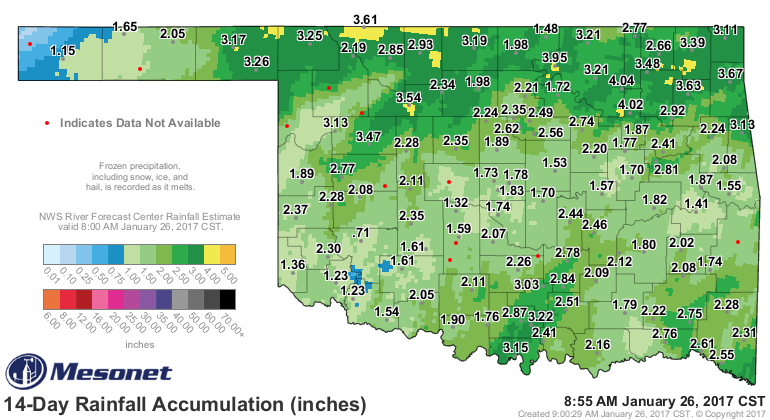
That's how you get rid of drought. Not with one good storm...that's the beginning
as you lessen the impacts. No, you need to follow up with more rain, maybe at
least once every week or every two weeks. That's the recipe for quick drought
removal. Unfortunately, that's not what we're seeing now (as depicted above in
the 7-day (d)rainfall forecast). Reports from the field indicate some
improvements, and we showed that last week, but also continued drought impacts,
including dry farm ponds and as we saw this week...increased wildfire danger.
Therefore, drought remains across Oklahoma.
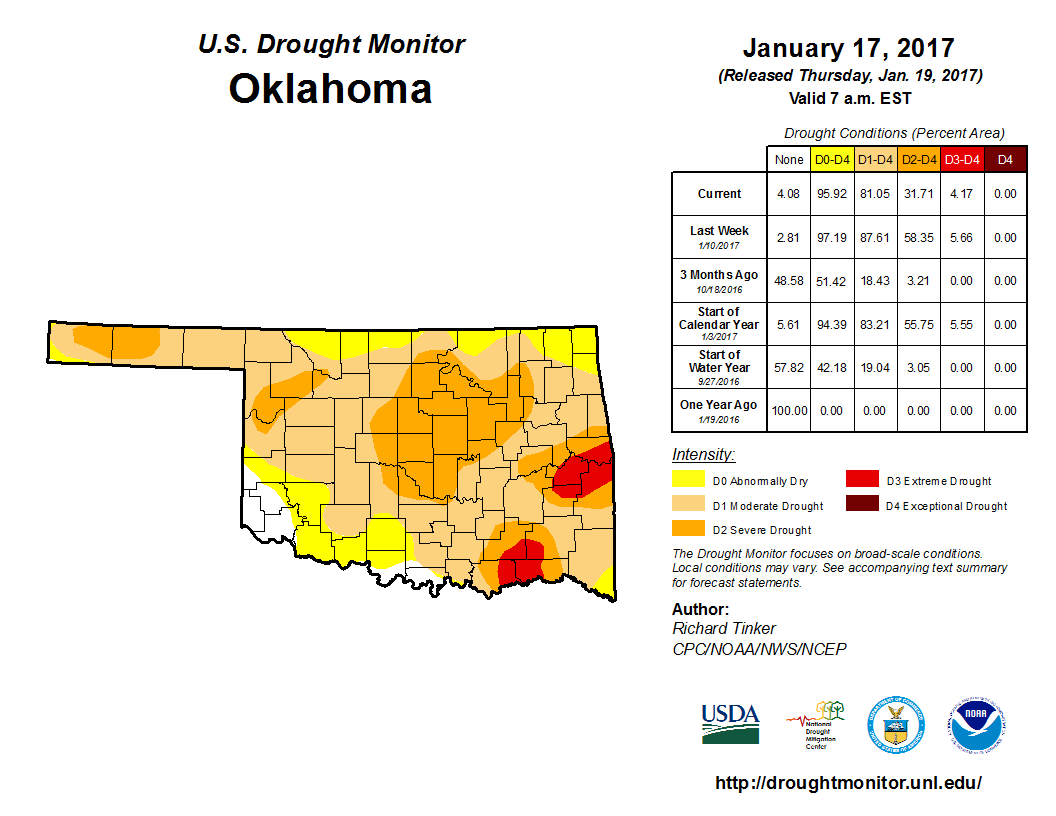
Still, we have had improvements as this 2-week drought monitor class change map
shows.
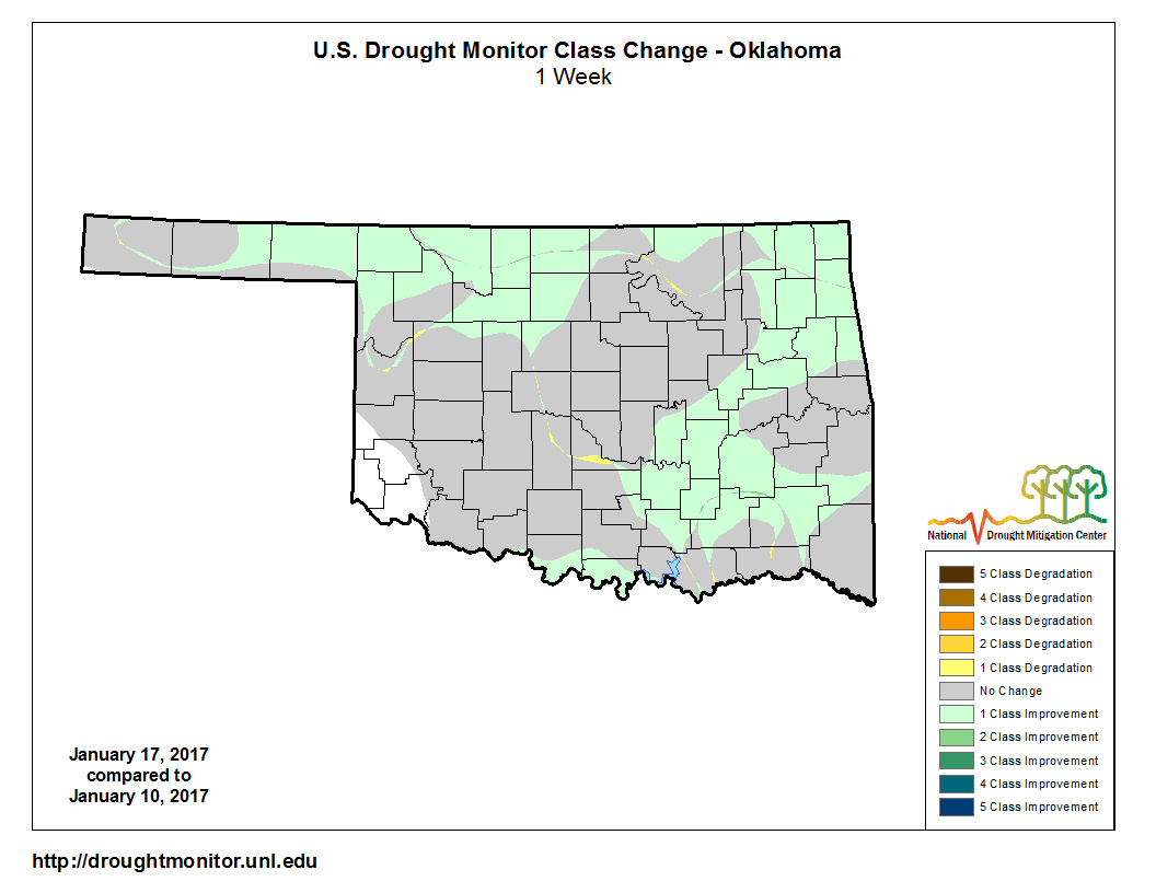
Some think it should show a lot more improvements. Some think we improved way
too much. And some thing we changed it juuuuuusssstttt right. They also thought
the porridge was at the right temperature, but that's a different subject.
Temperatures in the last week or so rising into the 60s and 70s (we even hit
80 at Walters on the 24th) to go along with the windy conditions did us no
favors. We've had three nice storm systems in the last two months, although
this last one and the one on Christmas Day were more regional in nature. So
maybe we change that to we've had ONE nice storm and two "okay" ones in the last
two months.
At any rate, we need reinforcing moisture. It's not showing up anytime soon, and
even as we get into next week it's looking dry and warm.
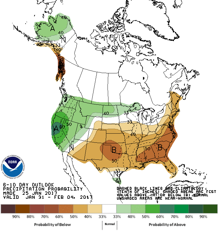
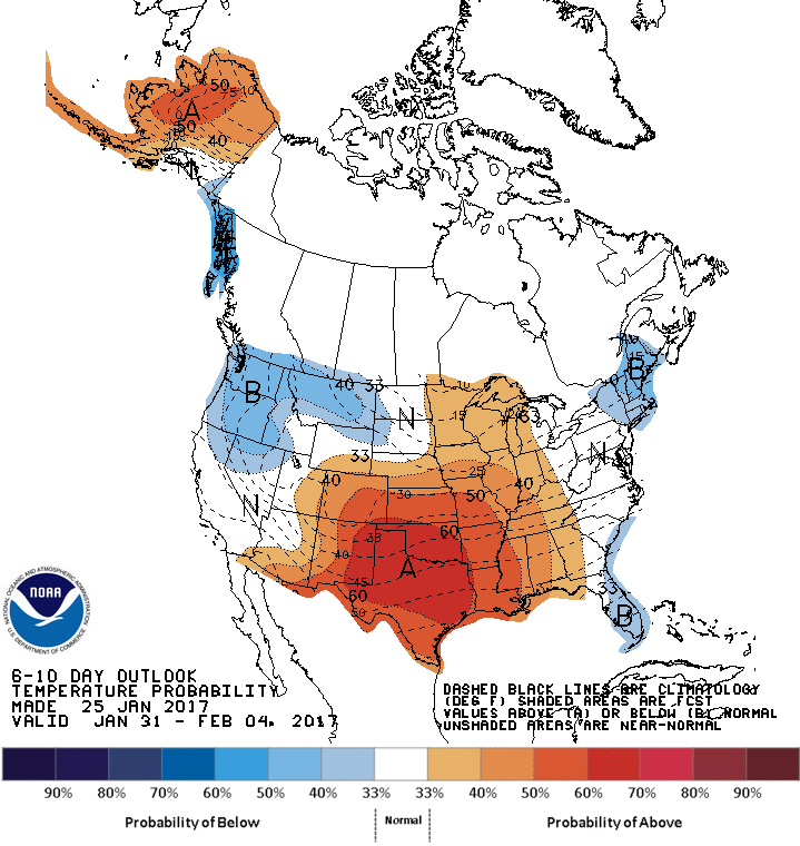
Go out even farther and the Canadian forecast model, depicting our odds of
accumulating at least an inch of precip between now and Feb. 10, has some grim
output.
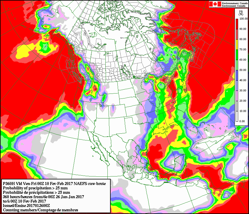
It's still the driest time of the year, and it's following that script. For now.
We now return control of your computer to you, until next week, at the same
time when the Drought Monitor will take you to... The Drier Limits.
Gary McManus
State Climatologist
Oklahoma Mesonet
Oklahoma Climatological Survey
(405) 325-2253
gmcmanus@mesonet.org
January 26 in Mesonet History
| Record | Value | Station | Year |
|---|---|---|---|
| Maximum Temperature | 81°F | MANG | 2015 |
| Minimum Temperature | 4°F | BUFF | 2004 |
| Maximum Rainfall | 3.45″ | CLAY | 1994 |
Mesonet records begin in 1994.
Search by Date
If you're a bit off, don't worry, because just like horseshoes, “almost” counts on the Ticker website!